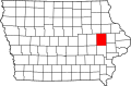
Wickiup Hill

Last updated
Wickiup Hill
USA Iowa location map.svg
Red pog.svg
Location in Iowa
Location Iowa, United States
Coordinates 42°04′59″N91°45′54″W / 42.083°N 91.765°W / 42.083; -91.765 Coordinates: 42°04′59″N91°45′54″W / 42.083°N 91.765°W / 42.083; -91.765
Area790 acres (320 ha)
Governing bodyLinn County Conservation Department
Wickiup Hill
LocationAddress restricted [1]
MPS Archaeology of the Wickiup Hill Locality in Linn County, Iowa MPS
NRHP reference No. 100007332 [2]
Added to NRHPJanuary 20, 2022

Wickiup Hill is a Native American archeological region near Toddville, in Linn County, Iowa. The area has the Wickiup Hill Outdoor Learning Center which was built where a Meskwaki village once stood. Wickiup Hill has been excavated by archeologists.

Contents

History

Wickiup Hill has been occupied by people for around 8,000 years and has archeological evidence of Native American villages as well as of their burial grounds. Its burial grounds are under protection by Iowa law and are not documented for others to find. [3] The mounds were stolen from repeatedly and no one knows what remains of their contents. The Oneota, Ioway, and Meskwaki people used to live in the area. [3] Starting in 1994, multiple surveys and excavations were completed by archeologists to record its historical sites. People helped contribute to the effort by volunteering through field schools, teacher workshops, and camps for student archeologists. More than 20 historical sites were discovered within river terraces, sand dunes, bluffs, and ridge-tops. The excavations include 5,000-year-old campgrounds, clusters of mounds, and late 19th-century pioneer cabins. Items that were discovered include a blue glass bead, metal, buttons, ceramics, two 1865 Indian Head cents, and one 1868 Indian Head cent. Other discoveries were intact charred wooden boards that might have come from a cabin and an oval basin that had slabs of dolomite and other rocks. The basin and rocks may have come from a sweat lodge that was used by Native Americans. [4]

A nomination for Wickiup Hill to be placed on the National Register of Historic Places (NRHP) was started in 2020. It was established as a Multiple Property Submission called the Archaeology of the Wickiup Hill Locality in Linn County, Iowa. [2] The area was divided into six separate areas that were individually listed on the NRHP on January 20, 2022. The six areas are: Wickiup Hill Late Woodland Village Site, Wickiup Hill Middle to Late Archaic Camp Site, Wickiup Hill Mound Group No. 1, Wickiup Hill Mound Group No. 2, Wickiup Hill Mound Group No. 3, and Wickiup Hill Mound Group No. 4. The listings mean the area could be eligible to receive more state and federal grants. [3]

Nature center

The Wickiup Hill Outdoor Learning Center is a 790-acre (320 ha) nature center on Cedar River's left bank in Linn County and it is controlled by the Linn County Conservation Department. The nature center has exhibits, tours, and events. [4] It was built on a Meskwaki village site. [5] In 2021, the nature center held two snowshoe hiking events. [6]

Related Research Articles

<span class="mw-page-title-main">Aztalan State Park</span> United States historic place

Aztalan State Park is a Wisconsin state park in the Town of Aztalan, Jefferson County. Established in 1952, it was designated a National Historic Landmark in 1964 and added to the National Register of Historic Places in 1966. The park covers 172 acres (70 ha) along the Crawfish River.

<span class="mw-page-title-main">Wickliffe Mounds</span> Archaeological site in Kentucky, US

Wickliffe Mounds is a prehistoric, Mississippian culture archaeological site located in Ballard County, Kentucky, just outside the town of Wickliffe, about 3 miles (4.8 km) from the confluence of the Ohio and Mississippi rivers. Archaeological investigations have linked the site with others along the Ohio River in Illinois and Kentucky as part of the Angel phase of Mississippian culture. Wickliffe Mounds is controlled by the State Parks Service, which operates a museum at the site for interpretation of the ancient community. Listed on the National Register of Historic Places, it is also a Kentucky Archeological Landmark and State Historic Site.

<span class="mw-page-title-main">Fort Benjamin Hawkins</span> United States historic place

Fort Hawkins was a fort built between 1806 and 1810 in the historic Creek Nation by the United States government under President Thomas Jefferson and used until 1824. Built in what is now Georgia at the Fall Line on the east side of the Ocmulgee River, the fort overlooked the sacred ancient earthwork mounds of the Ocmulgee Old Fields, now known as the Ocmulgee Mounds National Historical Park. The Lower Creek Trading Path passed by just outside the fort's northwestern blockhouse, and continued in a westerly direction until it reached a natural ford on the Ocmulgee River. A trading settlement and later the city of Macon, Georgia, developed in the area prior to the construction of the fort, with British traders being in the area as early as the 1680s. Later, the fort would become important to the Creek Nation, the United States, and the state of Georgia for economic, military, and political reasons.

<span class="mw-page-title-main">Kolomoki Mounds</span> Archaeological site in Georgia, US

The Kolomoki Mounds is one of the largest and earliest Woodland period earthwork mound complexes in the Southeastern United States and is the largest in Georgia. Constructed from 350CE to 600CE, the mound complex is located in southwest Georgia, in present-day Early County near the Chattahoochee River.

<span class="mw-page-title-main">Toolesboro Mound Group</span> United States historic place

The Toolesboro Mound Group, a National Historic Landmark, is a group of Havana Hopewell culture earthworks on the north bank of the Iowa River near its discharge into the Mississippi. The mounds are owned and displayed to the public by the State Historical Society of Iowa. The mound group is located east of Wapello, Iowa, near the unincorporated community of Toolesboro.

<span class="mw-page-title-main">Nacoochee Mound</span> Archaeological site in Georgia, US

The Nacoochee Mound is an archaeological site on the banks of the Chattahoochee River in White County, in the northeast part of the U.S. state of Georgia. Georgia State Route 17 and Georgia State Route 75 have a junction near here.

Nady is an unincorporated community in Arkansas County, Arkansas, United States. It is the location of a National Historic Landmark, the Menard–Hodges site. The environs of Nady, at the southern tip of the Little Prairie, are in the portion of Arkansas that saw the earliest European settlement in what is now the state of Arkansas, including Tonty’s 1686 post. The Menard-Hodges archeological site, about one-half mile southwest of Wallace-Menard-Coose Cemetery, along with the adjacent Wallace Bottom archeological site, appear to be the locations of the late 1600s Quapaw village of Osotouy, Tonty’s 1686 Post, and the early to mid-1700s French Arkansas Post.

<span class="mw-page-title-main">Emerald Mound site</span> United States historic place

The Emerald Mound site, also known as the Selsertown site, is a Plaquemine culture Mississippian period archaeological site located on the Natchez Trace Parkway near Stanton, Mississippi, United States. The site dates from the period between 1200 and 1730 CE. It is the type site for the Emerald Phase of the Natchez Bluffs Plaquemine culture chronology and was still in use by the later historic Natchez people for their main ceremonial center. The platform mound is the second-largest Mississippian period earthwork in the country, after Monk's Mound at Cahokia, Illinois.

<span class="mw-page-title-main">Grand Village of the Natchez</span> United States historic place

Grand Village of the Natchez, also known as the Fatherland Site, is a 128.1-acre (0.518 km2) site encompassing a prehistoric indigenous village and earthwork mounds in present-day south Natchez, Mississippi. The village complex was constructed starting about 1200 CE by members of the prehistoric Plaquemine culture. They built the three platform mounds in stages. Another phase of significant construction work by these prehistoric people has been dated to the mid-15th century. It was named for the historic Natchez people, who used the site in the 17th and 18th centuries.

<span class="mw-page-title-main">Archaeology of Iowa</span> Aspect of archaeology in the United States

The archaeology of Iowa is the study of the buried remains of human culture within the U.S. state of Iowa from the earliest prehistoric through the late historic periods. When the American Indians first arrived in what is now Iowa more than 13,000 years ago, they were hunters and gatherers living in a Pleistocene glacial landscape. By the time European explorers visited Iowa, American Indians were largely settled farmers with complex economic, social, and political systems. This transformation happened gradually. During the Archaic period American Indians adapted to local environments and ecosystems, slowly becoming more sedentary as populations increased. More than 3,000 years ago, during the Late Archaic period, American Indians in Iowa began utilizing domesticated plants. The subsequent Woodland period saw an increase on the reliance on agriculture and social complexity, with increased use of mounds, ceramics, and specialized subsistence. During the Late Prehistoric period increased use of maize and social changes led to social flourishing and nucleated settlements. The arrival of European trade goods and diseases in the Protohistoric period led to dramatic population shifts and economic and social upheaval, with the arrival of new tribes and early European explorers and traders. During the Historical period European traders and American Indians in Iowa gave way to American settlers and Iowa was transformed into an agricultural state.

Toddville is an unincorporated community in western Linn County, Iowa, United States. It lies along local roads just off I-380, northwest of the city of Cedar Rapids, the county seat of Linn County. Its elevation is 787 feet (240 m).

<span class="mw-page-title-main">Mines of Spain State Recreation Area and E. B. Lyons Nature Center</span> State park in Dubuque County, Iowa, United States

The Mines of Spain State Recreation Area and E. B. Lyons Nature Center is a state park in Dubuque County, Iowa, United States. It is near Dubuque, the eleventh-largest city in the state. The park features picnic areas, 15 miles (24 km) of walking/hiking trails, 4 miles (6.4 km) of ski trails, and the Betty Hauptli Bird and Butterfly Garden. It also includes archaeological sites of national importance as an early lead mining and smelting venture led by French explorer Julien Dubuque, as well as Dubuque's gravesite. These sites were collectively designated a National Historic Landmark District as Julien Dubuque's Mines.

<span class="mw-page-title-main">Outline of Iowa</span> Overview of and topical guide to Iowa

The following outline is provided as an overview of and topical guide to the U.S. state of Iowa.

<span class="mw-page-title-main">Dunns Pond Mound</span> Archaeological site in Ohio, United States

The Dunns Pond Mound is a historic Native American mound in northeastern Logan County, Ohio, United States. Located near Huntsville, it lies along the southeastern corner of Indian Lake in Washington Township. In 1974, the mound was listed on the National Register of Historic Places as a potential archeological site, with much of its significance deriving from its use as a burial site for as much as nine centuries.

Garden Creek site is an archaeological site located 24 miles (39 km) west of Asheville, North Carolina in Haywood County, on the south side of the Pigeon River and near the confluence of its tributary Garden Creek. It is near modern Canton and the Pisgah National Forest. The earliest human occupation at the site dates to 8000 BCE. The 12-acre site features remains of two villages (31Hw7) occupied first in the Woodland period and, most prominently, in the Pisgah phase associated with the South Appalachian Mississippian culture. A total of four earthwork mounds have been found at the site; three have been excavated.

<span class="mw-page-title-main">Frogmore Mound Site</span> United States historic place

Frogmore Mound Site is an archaeological site of the Late Coles Creek culture in Concordia Parish, Louisiana. The site is located 7 miles (11 km) west of Ferriday on US 84. It was added to the National Register of Historic Places on July 28, 2004.

<span class="mw-page-title-main">Caddo Mounds State Historic Site</span>

Caddo Mounds State Historic Site (41CE19) is an archaeological site in Weeping Mary, Texas. This Caddoan Mississippian culture site is composed of a village and ceremonial center that features two earthwork platform mounds and one burial mound. Located on an ancient Native American trail later named by the Spanish as El Camino Real de los Tejas, the settlement developed hundreds of years before the arrival of Europeans to the region. Archaeologists believe the site was created in approximately 800 CE, with most major construction taking place between 1100 and 1300 CE.

<span class="mw-page-title-main">Spikebuck Town Mound and Village Site</span> United States historic place

The Spikebuck Town Mound and Village Site is a prehistoric and historic archaeological site on Town Creek near its confluence with the Hiwassee River within the boundaries of present-day Hayesville, North Carolina. The site encompasses the former area of the Cherokee village of Quanassee and associated farmsteads. The village was centered on what is known as Spikebuck Mound, an earthwork platform mound, likely built about 1,000 CE by ancestral indigenous peoples during the South Appalachian Mississippian culture period.

Nununyi was a historic village of the Cherokee people in western North Carolina, located on the eastern side of the Oconaluftee River. Today it is within the boundaries of the present-day city of Cherokee in Swain County. It was classified by English traders and colonists as among the "Out Towns" of the Cherokee in this area east of the Appalachian Mountains.

<span class="mw-page-title-main">Kimball Village</span> United States historic place

Kimball Village is an archaeological site located in the vicinity of Westfield, Iowa, United States. It is one of six known Big Sioux phase villages from the Middle Missouri tradition that existed between 1100-1250 C.E. The site, located on a terrace overlooking the Big Sioux River, has well-preserved features, including earth lodge and storage pits, and evidence of fortifaction. The site was listed on the National Register of Historic Places in 2010, and as a National Historic Landmark in 2016.

References

  1. Federal and state laws and practices restrict general public access to information regarding the specific location of this resource. In some cases, this is to protect archeological sites from vandalism, while in other cases it is restricted at the request of the owner. See: Knoerl, John; Miller, Diane; Shrimpton, Rebecca H. (1990), Guidelines for Restricting Information about Historic and Prehistoric Resources, National Register Bulletin, National Park Service, U.S. Department of the Interior, OCLC   20706997 .
  2. 1 2 "National Register of Historic Places Program: Weekly List". National Park Service. January 21, 2021. Retrieved 2021-01-21.
  3. 1 2 3 King, Grace (January 31, 2020). "'Archaeologically rich' Wickiup Hill near Toddville seeking listing on National Register of Historic Places". The Gazette. Archived from the original on September 10, 2021. Retrieved September 10, 2021.
  4. 1 2 Whittaker, William E.; Alex, Lynn M.; De La Garza, Mary C. (2015). The Archeological Guide to Iowa. University of Iowa Press. p. 141-142. ISBN   9781609383374.
  5. Foster, Lance M. (2009). The Indians of Iowa. University of Iowa Press. p. 112. ISBN   9781587298172. Archived from the original on 2021-09-10. Retrieved 2021-09-10.
  6. DeRaedt, Kennedy (February 1, 2021). "Wickiup Hill Learning Center offers guided snowshoe hikes". KWWL. Archived from the original on September 10, 2021. Retrieved September 10, 2021.