The Great Serpent Mound is a 1,348-foot-long (411 m), three-foot-high prehistoric effigy mound located in Peebles, Ohio. It was built on what is known as the Serpent Mound crater plateau, running along the Ohio Brush Creek in Adams County, Ohio. The mound is the largest serpent effigy in the world.

The Kolomoki Mounds is one of the largest and earliest Woodland period earthwork mound complexes in the Southeastern United States and is the largest in Georgia. Constructed from 350CE to 600CE, the mound complex is located in southwest Georgia, in present-day Early County near the Chattahoochee River.

The Alligator Effigy Mound is an effigy mound in Granville, Ohio, United States. The mound is believed to have been built between AD 800 and 1200 by people of the Fort Ancient culture. The mound was likely a ceremonial site, as it was not used for burials.

Rock Eagle Effigy Mound is an archaeological site in Putnam County, Georgia, U.S. estimated to have been constructed c. 1000 BC to AD 1000. The earthwork was built up of thousands of pieces of quartzite laid in the mounded shape of a large bird. Although it is most often referred to as an eagle, scholars do not know exactly what type of bird the original builders intended to portray. It is listed on the National Register of Historic Places (NRHP) because of its significance. The University of Georgia administers the site. It uses much of the adjoining land for a 4-H camp, with cottages and other buildings, and day and residential environmental education.

This is a list of the National Register of Historic Places listings in Otter Tail County, Minnesota. It is intended to be a complete list of the properties and districts on the National Register of Historic Places in Otter Tail County, Minnesota, United States. The locations of National Register properties and districts for which the latitude and longitude coordinates are included below, may be seen in an online map.

The Dunns Pond Mound is a historic Native American mound in northeastern Logan County, Ohio, United States. Located near Huntsville, it lies along the southeastern corner of Indian Lake in Washington Township. In 1974, the mound was listed on the National Register of Historic Places as a potential archeological site, with much of its significance deriving from its use as a burial site for as much as nine centuries.

The Carl Potter Mound is a historic Native American mound in southern Champaign County, Ohio, United States. Located near Mechanicsburg, it lies on a small ridge in a pasture field in southeastern Union Township. In 1974, the mound was listed on the National Register of Historic Places as a potential archaeological site, primarily because of its use as a burial mound.

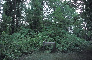
The Bone Mound II is a Native American mound in the southwestern part of the U.S. state of Ohio. Located northwest of the unincorporated community of Oregonia, the mound sits in an area of light woodland.
Grand Mound is a prehistoric burial site in Koochiching County, Minnesota, United States. It is the largest surviving prehistoric structure in the upper Midwest, dating back to 200 BCE. The site was listed as a National Historic Landmark on June 23, 2011.

The Man Mound is a precontact earthwork of a humanoid figure located in Greenfield, Sauk County, Wisconsin, east of the city of Baraboo. Constructed during the Late Woodland period, the mound is the only surviving anthropomorphic effigy mound in North America. The mound depicts a humanoid figure with horns or a horned headdress and may have held religious or ceremonial significance to its builders. The mound was preserved as a county park in 1908, listed on the National Register of Historic Places in 1978 and designated a National Historic Landmark in 2016.
Indian Fish Trap State Preserve, also known as the Indian Fish Weir, is a historic site located near the Amana Colonies in rural Iowa County, Iowa. The fish weir is an array of rocks in a V-shaped formation in the Iowa River. It is the only structure of this kind in Iowa.
Kimball Village is an archaeological site located in the vicinity of Westfield, Iowa, United States. It is one of six known Big Sioux phase villages from the Middle Missouri tradition that existed between 1100-1250 C.E. The site, located on a terrace overlooking the Big Sioux River, has well-preserved features, including earth lodge and storage pits, and evidence of fortifaction. The site was listed on the National Register of Historic Places in 2010, and as a National Historic Landmark in 2016.

The Upper Hay Lake Archeological District is a prehistoric Native American archaeological site in Jenkins Township, Minnesota, United States. It consists of about 75 linear mounds—including one of the state's longest at 725 feet (221 m)—plus the sites of a village and a portage. The mound grouping has also been dubbed Fort Poualak. The site was listed on the National Register of Historic Places in 1978 for having local significance in the theme of archaeology. It was nominated for indicating an area of substantial activity during the Blackduck phase of the Late Woodland period.

The Gordon–Schaust Site is a prehistoric Native American archaeological site in Crosslake, Minnesota, United States. It comprises two separate but nearly parallel groups of linear mounds, undated but well preserved. The site was listed on the National Register of Historic Places in 1974 for having state-level significance in the theme of archaeology.

The Fort Flatmouth Mounds form a prehistoric Native American archaeological site in Mission Township, Minnesota, United States. It consists of nine mounds grouped in a rough ellipse and a few additional mounds in close proximity. Early Euro-American settlers assumed the enclosure was built as a fort, hence the name, but it was more likely religious in nature. The site was listed on the National Register of Historic Places in 1973 for having state-level significance in the theme of archaeology. It was nominated for its information potential as a unique site in a region whose numerous mound and village sites indicate a long span of indigenous occupation.
The Four Mounds site is a historic site located in Dubuque, Iowa, United States. It is made up of a row of four conical burial mounds on a blufftop that overlooks the Mississippi River. They are prehistoric in their origin. The site was individually listed on the National Register of Historic Places in 2000. It was included as a contributing property in the Four Mounds Estate Historic District in 2002.
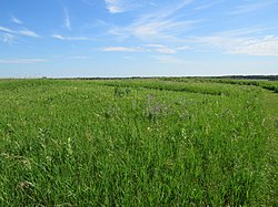
Morrison Mounds is a historic site located north of Battle Lake, Minnesota, United States. It consists of 22 Indian burial mounds that were built beginning in 800 B.C. There are 20 conical mounds, one flat-topped mound, and one elongated mound near Otter Tail Lake. This site has the oldest radiocarbon date for any mound group in the state of Minnesota. However, its construction is similar to other mound groups in the area which suggests they are all from the same social group that built them over a period of time. Similarities include a central burial pit, logs over the burial pit, and the possibility of partial cremation on-site. The site was listed on the National Register of Historic Places in 1973.
The Orwell site, designated 21OT7 in the state archaeological inventory, is a historic site located near Fergus Falls, Minnesota, United States. It consists of twelve Middle or Late Woodland period burial mounds, four of which are enclosed by an earthwork. They were built from about A.D. 350–600. They share similarities with the mounds found at Fort Juelson, also in Otter Tail County, with their central burial chamber. The site was listed on the National Register of Historic Places in 1974.
Wickiup Hill is a Native American archeological region near Toddville, in Linn County, Iowa. The area has the Wickiup Hill Outdoor Learning Center which was built where a Meskwaki village once stood. Wickiup Hill has been excavated by archeologists.