
Hayesville is a town in Clay County, North Carolina, United States. The population was 311 at the 2010 census. It is the county seat of Clay County.

Etowah Indian Mounds (9BR1) are a 54-acre (220,000 m2) archaeological site in Bartow County, Georgia, south of Cartersville. Built and occupied in three phases, from 1000–1550 AD, the prehistoric site is located on the north shore of the Etowah River.

Chota is a historic Overhill Cherokee town site in Monroe County, Tennessee, in the southeastern United States. Developing after nearby Tanasi, Chota was the most important of the Overhill towns from the late 1740s until 1788. It replaced Tanasi as the de facto capital, or 'mother town' of the Cherokee people.

Tanasi was a historic Overhill settlement site in present-day Monroe County, Tennessee, in the southeastern United States. The village became the namesake for the state of Tennessee. It was abandoned by the Cherokee in the 19th century for a rising town whose chief was more powerful. Tanasi served as the de facto capital of the Overhill Cherokee from as early as 1721 until 1730, when the capital shifted to Great Tellico.

Joara was a large Native American settlement, a regional chiefdom of the Mississippian culture, located in what is now Burke County, North Carolina, about 300 miles from the Atlantic coast in the foothills of the Blue Ridge Mountains. Joara is notable as a significant archaeological and historic site, where Mississippian culture-era and European artifacts have been found, in addition to an earthwork platform mound and remains of a 16th-century Spanish fort.

Nikwasi comes from the Cherokee word for "star", Noquisi (No-kwee-shee), and is the site of the Cherokee town which is first found in colonial records in the early 18th century, but is much older. The town covered about 100 acres on the floodplain of the Little Tennessee River. Franklin, North Carolina, was later developed by European Americans around this site.

The Nacoochee Mound is an archaeological site on the banks of the Chattahoochee River in White County, in the northeast part of the U.S. state of Georgia. Georgia State Route 17 and Georgia State Route 75 have a junction near here.

Kituwa or giduwa (Cherokee:ᎩᏚᏩ) is an ancient Native American settlement near the upper Tuckasegee River, and is claimed by the Cherokee people as their original town. An earthwork platform mound, built about 1000 CE, marks a ceremonial site here. The historic Cherokee built a townhouse on top that was used for their communal gatherings and decisionmaking; they replaced it repeatedly over decades. They identify Kituwa as one of the "seven mother towns" in their traditional homeland of the American Southeast. This site is in modern Swain County, North Carolina, in the Great Smoky Mountains.

Toqua was a prehistoric and historic Native American site in Monroe County, Tennessee, located in the Southeastern Woodlands. Toqua was the site of a substantial ancestral town that thrived during the Mississippian period. Toqua had a large earthwork 25-foot (7.6 m) platform mound built by the town's Mississippian-era inhabitants, in addition to a second, smaller mound. The site's Mississippian occupation may have been recorded by the Spanish as the village of Tali, which was documented in 1540 by the Hernando de Soto expedition. It was later known as the Overhill Cherokee town Toqua, and this name was applied to the archeological site.

Tomotley is a prehistoric and historic Native American site along the lower Little Tennessee River in Monroe County, Tennessee, in the southeastern United States. Occupied as early as the Archaic period, the Tomotley site was occupied particularly during the Mississippian period, which was likely when its earthwork platform mounds were built. It was also occupied during the eighteenth century as a Cherokee town. It revealed an unexpected style: an octagonal townhouse and square or rectangular residences. In the Overhill period, Cherokee townhouses found in the Carolinas in the same period were circular in design, with,

Tallassee is a prehistoric and historic Native American site in present-day Blount and Monroe counties, Tennessee in the southeastern United States. Tallassee was the southernmost of a string of Overhill Cherokee towns that existed along the lower Little Tennessee River on the west side of the Appalachian Mountains in the 18th century. Although Tallassee receives scant attention in primary historical accounts, it is one of the few Overhill towns to be shown on every major 18th-century map of the Little Tennessee Valley.
The Pisgah Phase is an archaeological phase of the South Appalachian Mississippian culture in Southeast North America. It is associated with the Appalachian Summit area of southeastern Tennessee, Western North Carolina, and northwestern South Carolina in what is now the United States.

The Valley River is a tributary of the Hiwassee River. It arises as a pair of springs in the Snowbird Mountains of Cherokee County, North Carolina and descends 2,960 feet (900 m) in elevation in approximately forty miles (64 km) to enter the Hiwassee embayment at present-day Murphy, North Carolina.
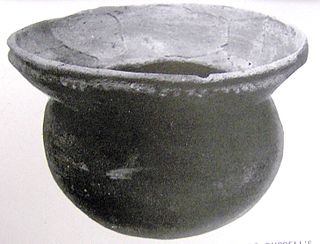
Bussell Island, formerly Lenoir Island, is an island located at the mouth of the Little Tennessee River, at its confluence with the Tennessee River in Loudon County, near the U.S. city of Lenoir City, Tennessee. The island was inhabited by various Native American cultures for thousands of years before the arrival of early European explorers. The Tellico Dam and a recreational area occupy part of the island. Part of the island was added in 1978 to the National Register of Historic Places for its archaeological potential.
Garden Creek site is an archaeological site located 24 miles (39 km) west of Asheville, North Carolina in Haywood County, on the south side of the Pigeon River and near the confluence of its tributary Garden Creek. It is near modern Canton and the Pisgah National Forest. The earliest human occupation at the site dates to 8000 BCE.
The Chauga Mound (38OC1) is an archaeological site once located on the northern bank of the Tugaloo River, about 1,200 feet (370 m) north of the mouth of the Chauga River in present-day Oconee County, South Carolina. The earthen platform mound and former village site were inundated by creation of Lake Hartwell after construction of the Hartwell Dam on the Savannah River, which was completed in 1962.
Candies Creek Ridge, also known as Clingan Ridge, is a geographic feature ridge located primarily in Bradley County, Tennessee, on the southeastern border of the state. It overlooks Candies Creek and is in north Cleveland, Tennessee.

Too-Cowee, was an important historic Cherokee town located near the Little Tennessee River north of present-day Franklin, North Carolina. It also had a prehistoric platform mound and earlier village built by ancestral peoples. As their expression of public architecture, the Cherokee built a townhouse on top of the mound. It was the place for their community gatherings in their highly decentralized society. The name translates to "pig fat" in English. British traders and colonists referred to Cowee as one of the Cherokee Middle Towns along this river; they defined geographic groupings based in relation to their coastal settlements, such as Charlestown, South Carolina.
Nununyi was a historic village of the Cherokee people in western North Carolina, located on the eastern side of the Oconaluftee River. Today it is within the boundaries of the present-day city of Cherokee in Swain County. It was classified by English traders and colonists as among the "Out Towns" of the Cherokee in this area east of the Appalachian Mountains.
Hiwassee Island, also known as Jollys Island and Benham Island, is located in Meigs County, Tennessee, at the confluence of the Tennessee and Hiwassee Rivers. It is about 35 mi (56 km) northeast of Chattanooga. The island was the second largest land mass on the Tennessee River at 781 acres before the Tennessee Valley Authority created the Chickamauga Lake as a part of the dam system on the Tennessee River in 1940. Much of the island is now submerged, leaving 400 acres above the waterline.


