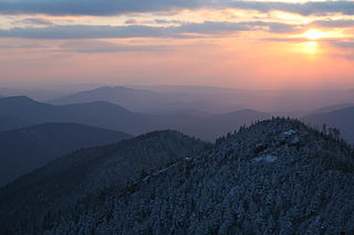
The Cherokee are one of the Indigenous peoples of the Southeastern Woodlands of the United States. Prior to the 18th century, they were concentrated in their homelands, in towns along river valleys of what is now southwestern North Carolina, southeastern Tennessee, southwestern Virginia, edges of western South Carolina, northern Georgia and northeastern Alabama.

Swain County is a county located on the far western border of the U.S. state of North Carolina. As of the 2020 census, the population was 14,117. Its county seat is Bryson City.

Great Smoky Mountains National Park is an American national park in the southeastern United States, with parts in North Carolina and Tennessee. The park straddles the ridgeline of the Great Smoky Mountains, part of the Blue Ridge Mountains, which are a division of the larger Appalachian Mountain chain. The park contains some of the highest mountains in eastern North America, including Clingmans Dome, Mount Guyot, and Mount Le Conte. The border between the two states runs northeast to southwest through the center of the park. The Appalachian Trail passes through the center of the park on its route from Georgia to Maine. With 14.1 million visitors in 2021, the Great Smoky Mountains National Park is the most visited national park in the United States.

The Great Smoky Mountains are a mountain range rising along the Tennessee–North Carolina border in the southeastern United States. They are a subrange of the Appalachian Mountains and form part of the Blue Ridge Physiographic Province. The range is sometimes called the Smoky Mountains, and the name is commonly shortened to the Smokies. The Smokies are best known as the home of the Great Smoky Mountains National Park, which protects most of the range. The park was established in 1934 and, with over 11 million visits per year, is the most visited national park in the United States.

Clingmans Dome is a mountain in the Great Smoky Mountains of Tennessee and North Carolina in the Southeastern United States. Its name in Cherokee is Kuwahi or Kuwohi, meaning "mulberry place."

Cherokee is a census-designated place (CDP) in Swain and Jackson counties in Western North Carolina, United States, within the Qualla Boundary land trust. Cherokee is located in the Oconaluftee River Valley around the intersection of U.S. Routes 19 and 441. As of the 2020 census, the CDP had a population of 2,195. It is the capital of the federally recognized Eastern Band of Cherokee Indians, one of three recognized Cherokee tribes and the only one in North Carolina.

The Qualla Boundary or The Qualla is territory held as a land trust by the United States government for the federally recognized Eastern Band of Cherokee Indians (EBCI), who reside in western North Carolina. The area is part of the large historic Cherokee territory in the Southeast, which extended into eastern Tennessee, western South Carolina, northern Georgia and Alabama. Currently, the largest contiguous portion of the Qualla lies in Haywood, Swain, and Jackson counties and is centered on the community of Cherokee, which serves as the tribal capital of the Eastern Band of Cherokee Indians. Smaller, non-contiguous parcels also lie in Graham and Cherokee counties, near the communities of Snowbird and Murphy, respectively.
The Eastern Band of Cherokee Indians (EBCI), is a federally recognized Indian tribe based in western North Carolina in the United States. They are descended from the small group of 800–1,000 Cherokee who remained in the Eastern United States after the U.S. military, under the Indian Removal Act, moved the other 15,000 Cherokee to west of the Mississippi River in the late 1830s, to Indian Territory. Those Cherokee remaining in the east were to give up tribal Cherokee citizenship and to assimilate. They became U.S. citizens.

The Oconaluftee Indian Village is a replica of an 18th-century eastern Cherokee community founded in 1952 and located along the Oconaluftee River in Cherokee, North Carolina, United States.

Chimney Tops is a mountain in the central Great Smoky Mountains in Tennessee. It is 4,724 feet (1,440 m) above sea level. Chimney Tops is a double-capstone knob on the eastern slope of the Sugarland Mountain massif, which stretches north-south across the north-central section of the Smokies. Mount Le Conte resides east of Chimney Tops and Mt. Mingus southeast of Chimney Tops. Thus, while the view from the summit is 360 degrees, Chimney Tops is practically "walled in" on three sides.

The Oconaluftee is the valley of the Oconaluftee River in the Great Smoky Mountains of North Carolina. Formerly the site of a Cherokee village and an Appalachian community, the valley is now North Carolina's main entrance to Great Smoky Mountains National Park.
Oconaluftee may refer to:

U.S. Route 441 (US 441) is a north–south United States Highway that runs from Miami, Florida to Rocky Top, Tennessee. In the U.S. state of North Carolina, US 441 travels for 64.5 miles (103.8 km) from the Georgia state line near Dillard, Georgia to the Tennessee state line in the Great Smoky Mountains National Park. US 441 is a primary route connecting the cities of Franklin, Sylva, and Cherokee in western North Carolina. The highway runs concurrently with other U.S. highways for much of its routing in North Carolina including US 23 from the Georgia state line to Dillsboro, US 64 in Franklin, US 74 from Dillsboro to near Qualla, and US 19 in Cherokee. US 441 has two business routes in North Carolina, in Franklin and Cherokee.

Cherokee Preservation Foundation is an independent nonprofit foundation established in 2000 as part of the Tribal-State Compact amendment between the Eastern Band of Cherokee Indians (EBCI) and the State of North Carolina. The Foundation is funded by the EBCI from gaming revenues generated by the Tribe; it is not associated with any for-profit gaming entity and is a separately functioning organization independent of the Tribal government. It works to improve the quality of life of the EBCI and strengthen the western North Carolina region by balancing Cherokee ways with the pursuit of new opportunities.
Nununyi was a historic village of the Cherokee people in western North Carolina, located on the eastern side of the Oconaluftee River. Today it is within the boundaries of the present-day city of Cherokee in Swain County. It was classified by English traders and colonists as among the "Out Towns" of the Cherokee in this area east of the Appalachian Mountains.
Ravensford is an unincorporated community in Swain County, Western North Carolina. This is within the traditional homeland of the Cherokee people. In a survey and excavation project in the early 21st century, part of the community was found to have archeological resources that were thousands of years old, in addition to more recent historic materials related to the Cherokee people. In 1938, the US Government and state of North Carolina negotiated with the Eastern Band of Cherokee Indians to gain their agreement to transfer some of their land to enable construction of the Blue Ridge Parkway. In return, lands in Ravensford were transferred to their Qualla Boundary property.

Mingo Falls is a 120 ft (37 m) high waterfall located in the Qualla Boundary—a land trust of the Eastern Band of Cherokee Indians—near the town of Cherokee, Swain County, North Carolina in the Blue Ridge Mountains of the eastern United States. The waterfall is among the tallest in the southern Appalachians.
Rowena Bradley (1922–2003) was an Eastern Band Cherokee basket maker from the United States. Bradley's work has been exhibited at Qualla Arts and Crafts Mutual in Cherokee, North Carolina.
Goingback Chiltoskey, also written Goingback Chiltoskie, was an Eastern Band Cherokee woodcarver and model maker, "one of the most celebrated Cherokee woodcarvers of the Craft Revival era."

The Oconaluftee River drains the south-central Oconaluftee valley of the Great Smoky Mountains in Western North Carolina before emptying into the Tuckasegee River. The river flows through the Qualla Boundary, a federal land trust that serves as a reserve for the Eastern Band of the Cherokee, the only federally recognized tribe in North Carolina. They bought the land back from the federal government in the 1870s, after having been pushed off and forced to cede it earlier in the 19th century. Several historic Cherokee towns are known to have been located along this river.


