
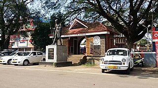
Ettumanoor is a municipality in the Kottayam district of Kerala, India. It is located 10 km (6.2 mi) north of the district headquarters in Kottayam and about 129 km (80.2 mi) north of the state capital Thiruvananthapuram. As per the 2011 Indian census, Ettumanoor has a population of 26,993 people, and a population density of 1,687/km2 (4,370/sq mi).
Adoor is a municipality in the Pathanamthitta district of Kerala, India. It is the headquarters of the Adoor Taluk and Adoor Revenue Division. Adoor is located 18 km (11.2 mi) southwest of the district headquarters Pathanamthitta and 85 km (52.8 mi) north of the state capital Thiruvananthapuram.

Alappuzha, formerly known as Alleppey, is a city and municipality in the Alappuzha district of Kerala, India. It is the district headquarters of the district, and is located about 130 km (80.8 mi) north of the state capital Thiruvananthapuram. As per the 2011 Indian census, Alappuzha has a population of 240,991 people, and a population density of 3,675/km2 (9,520/sq mi).

Palakkad, also known as Palghat, historically known as Palakkattussery, is a city and municipality in the Indian state of Kerala. It is the administrative headquarters of Palakkad District. Palakkad is the most densely populated municipality and the fourth-most densely populated city in the state. It was established before Indian independence under British rule and known by the name Palghat. Palakkad is famous for the ancient Palakkad Fort, which is in the heart of the city and was captured and rebuilt by Hyder Ali in 1766 which later fell into the hands of Zamorin in 1784. The city is about 347 kilometres (216 mi) northeast of the state capital, Thiruvananthapuram.

Chengannur is a municipality in the Alappuzha district of Kerala, India. It is located 43 km (26.7 mi) south east of the district headquarters in Alappuzha and about 98 km (60.9 mi) north of the state capital Thiruvananthapuram. As per the 2011 Indian census, Chengannur has a population of 23,466 people, and a population density of 1,607/km2 (4,160/sq mi).

Thalayolaparambu is a town situated in Kottayam district in Kerala, India. Spanning over an area of 19.3 square kilometres with a population of 22,571 people, this mini-town is home to some of the well-known personalities such as the former Chief minister of Travancore-Cochin A. J. John, Anaparambil, the late Malayalam novelist/writer Vaikom Muhammed Basheer, the former Chief Justice of India K. G. Balakrishnan, and KK. Thalayolaparambu also hosts the major market established during the administration of Velu Thampi Dalawa, and is one of those few Keralite markets that still retains its old-world charm till date.
Kalamassery is a municipality in the Ernakulam district of Kerala, India. It is a prominent industrial region in the Kochi metropolitan area, and is located 9 km (5.6 mi) northeast of the Kochi city centre. As per the 2011 Indian census, Kalamassery had a population of 70,776 people, and a population density of 2,621/km2 (6,790/sq mi).
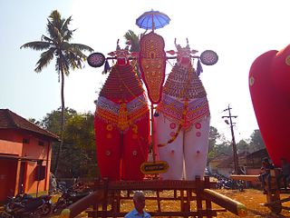
Mannar is a census town in Chengannur Taluk in Alappuzha District of Kerala state, India, on State Highway 6. It is also known as the Bell Metal Town.

Omallur is a small town in Kerala, about 3.5 km south of Pathanamthitta District headquarters. Omallur is famous for Vayal Vanibham, which is an annual farming fair held in the month of Meenam (October). People from both within and outside the town participate in the fair.
The importance and antiquity of education in Kerala are underscored by the state's ranking as among the most literate in the country. The educational transformation of Kerala was triggered by the efforts of both Church Mission Society missionaries like Jon Munro and clergy of Catholic church like Fr Kuriakose Elias Chavara and Fr Charles Lavigne and were the pioneers that promoted mass education in Kerala, in the early decades of the 19th century. The local dynastic precursors of modern-day Kerala, primarily the Travancore Royal Family, the Nair Service Society, Sree Narayana Dharma Paripalana Yogam, and Muslim Educational Society (MES), also made significant contributions to the progress on education in Kerala. Local schools were known by the general term kalaris, some of which taught martial arts, but other village schools run by Ezhuthachans were for imparting general education. Christian missionaries and British rule brought the modern school education system to Kerala. Ezhuthu palli was the name used in earlier times. The word was derived from the schools run by the Buddhist monasteries. For centuries, villages used to set up an ezhuthupally or ashan pallikoodam with one or two teachers. Students used to go this school from nearby areas and learn languages, literature, mathematics, grammar etc. After completing this, students may continue study about specific subjects such as ayurveda, astrology, accounting etc. Censuses during the 1800s showed that Travancore, Cochin, and Kannur areas have many such schools.
Mulakuzha or മുളക്കുഴ is a village in Alappuzha district in the state of Kerala, India. Mulakuzha is located in Chengannur tehsil, and residents are mostly artisans and farmers.
Mookkannoor is a village in the Ernakulam district in the Indian state of Kerala. The nearest city is Angamaly (6 km). The nearest airport is Cochin International Airport (13 km)
Pothanicad or Pothanikkad is a village in Ernakulam district in the Indian state of Kerala. It's also the first village to achieve 96.00% literacy in India. The name Pothanikkad derives from the Malayalam words poth, meaning buffalo, anaa, meaning elephant, and kaddu, meaning forest, as it was originally a forest with wild buffalos and elephants. Now, this small village has developed into one of the most educated and culturally advanced villages in Kerala. St. Mary's High School is the oldest high school in Pothanicad, where very prominent people in the society and many local politicians have been educated. St. John's Higher Secondary school Pulinthanam is a pioneering educational institution in the village. A government Lower Primary school and St.Xaviers Senior Secondary Public schools and Holy Angels, following CBSE curriculum, also provides better educational opportunities for the young community.
Vettikkavala is a village located in the Kollam district in the state of Kerala, India. The village is famous for Shiva-Vishnu temples which hosts a special deity called Vathukkal Njaali Kunju. An annual celebration of Pongala is held at the temple. The village is also well known for temple arts and a palace constructed by Sree Moolam Thirunal.
Kavumbhagom, also spelled Kavumbhagam, is a ward and a census village in Thiruvalla municipality, in the Pathanamthitta district of Kerala, India. The village has a population of 6644 as of 2011. Kavumbhagom is an important junction serving as a major road route connecting Changanasserry, Thiruvalla, Chathenkary, and Mavelikkara. The Thiruvalla Sree Vallabha temple, after which the town of Thiruvalla has been named, is located in Kavumbhagom.
Peyad //peɪjɑd// is a place located in the suburb of Thiruvananthapuram, the capital city of Kerala state in India. The offices of Vilappil Grama Panchayath and Vilappil Village are situated at Peyad.

Chengara is a small village situated in the Pathanamthitta district in Kerala, India. It is known for its natural environment, hills and climate, and is found to have the cleanest air, in terms of concentration of dust particles. Chengara is surrounded on three sides by Harrisons Malayalam Limited, a rubber plantation company.
Kudassanad is a village near Pandalam in the State of Kerala in India. Geographically it is situated in the eastern ending of Alappuzha District and western part of Pathanamthitta District. The southern end of Kudassanad is on the verge of Kollam District. Part of Palamel Panchayat and Mavelikara Taluk, Kudassanad comes under the Mavelikara Parliamentary and Mavelikara Assembly Constituencies.
Madaplathuruth is a village in Paravur Taluk, state of Kerala. Formerly known as Kuriapilly, it was a part of the Travancore kingdom in the British India. The village is 22 km away from Kochi. The ancient seaport of India, Muziris is located in Pattanam village 0.7 km away from this village.
Pallikoodam or Ezhuthupally Pally is a word in Malayalam and Tamil that denotes a school. These were mostly village schools run by individual teachers and were distinct from Kalaris that taught martial arts.

