Chunchula, Alabama

Last updated

Chunchula, Alabama
Mobile County Alabama Incorporated and Unincorporated areas Chunchula Highlighted 0114968.svg
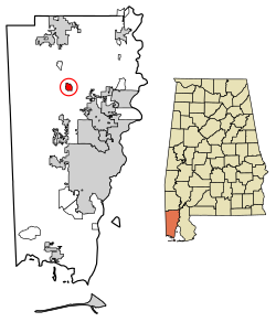
Location in Mobile County, Alabama
Coordinates: 30°55′25″N88°12′26″W / 30.92361°N 88.20722°W / 30.92361; -88.20722 [1]
Country United States
State Alabama
County Mobile
Area
[2]
  Total
1.81 sq mi (4.69 km2)
  Land1.80 sq mi (4.67 km2)
  Water0.0077 sq mi (0.02 km2)
Elevation
[1]
174 ft (53 m)
Population
 (2020) [3]
  Total
195
  Density108.1/sq mi (41.75/km2)
Time zone UTC-6 (Central (CST))
  Summer (DST) UTC-5 (CDT)
ZIP code
36521
Area code 251
FIPS code 01-14968
GNIS feature ID2628585 [1]

Chunchula is an unincorporated community and census-designated place (CDP) in Mobile County, Alabama, United States. [4] As of the 2020 census, its population was 195. [3] It has a post office with the 36521 ZIP code. The community has one site listed on the Alabama Register of Landmarks and Heritage, the Chunchula School. [5]

Contents

Geography

Chunchula is located in northern Mobile County. U.S. Route 45 passes through the community, leading south 20 miles (32 km) to Mobile and north 12 miles (19 km) to Citronelle.

Demographics

Historical population
CensusPop.Note
1880 214
1890 25820.6%
2010 210
2020 195−7.1%
U.S. Decennial Census [6]

Chunchula was listed on the 1880 and 1890 U.S. Censuses as a village. It did not reappear on the U.S. Census until 2010 when it was listed as a census designated place in the 2010 U.S. census. [7]

Chunchula CDP, Alabama – Racial and ethnic composition
Note: the US Census treats Hispanic/Latino as an ethnic category. This table excludes Latinos from the racial categories and assigns them to a separate category. Hispanics/Latinos may be of any race.
Race / Ethnicity (NH = Non-Hispanic)Pop 2010 [8] Pop 2020 [9] % 2010% 2020
White alone (NH)968945.71%45.64%
Black or African American alone (NH)1099951.90%50.77%
Native American or Alaska Native alone (NH)000.00%0.00%
Asian alone (NH)000.00%0.00%
Native Hawaiian or Pacific Islander alone (NH)000.00%0.00%
Other race alone (NH)000.00%0.00%
Mixed race or Multiracial (NH)441.90%2.05%
Hispanic or Latino (any race)130.48%1.54%
Total210195 100.00%100.00%

Education

Residents are zoned to Mobile County Public School System campuses. [10] Residents are zoned to McDavid-Jones Elementary School (K-5), [11] Lott Middle School (6-8), [12] and Citronelle High School (9-12). [13]

References

  1. 1 2 3 U.S. Geological Survey Geographic Names Information System: Chunchula, Alabama
  2. "2021 U.S. Gazetteer Files". United States Census Bureau. Retrieved April 22, 2022.
  3. 1 2 "Chunchula CDP, Alabama: 2020 DEC Redistricting Data (PL 94-171)". U.S. Census Bureau. Retrieved April 22, 2022.
  4. U.S. Geological Survey Geographic Names Information System: Chunchula, Alabama
  5. "Properties on the Alabama Register of Landmarks & Heritage". Alabama Historical Commission. www.preserveala.org. June 4, 2009. Retrieved July 21, 2009.
  6. "U.S. Decennial Census". Census.gov. Retrieved June 6, 2013.
  7. "2010 Census of Population - Population and Housing Unit Counts - Alabama" (PDF). United States Census Bureau. 2010. Archived from the original (PDF) on January 21, 2022.
  8. "P2: Hispanic or Latino, and Not Hispanic or Latino by Race – 2010: DEC Redistricting Data (PL 94-171) – Chunchula CDP, Alabama". United States Census Bureau .
  9. "P2: Hispanic or Latino, and Not Hispanic or Latino by Race – 2020: DEC Redistricting Data (PL 94-171) – Chunchula CDP, Alabama". United States Census Bureau .
  10. "2010 CENSUS - CENSUS BLOCK MAP: Chunchula CDP, AL." U.S. Census Bureau. Retrieved on November 27, 2018.
  11. "McDavid-Jones [ permanent dead link ]." Mobile County Public School System. Retrieved on November 27, 2018.
  12. "Lott Middle [ permanent dead link ]." Mobile County Public School System. Retrieved on November 27, 2018.
  13. "Citronelle High School Attendance Zone Archived 2021-07-25 at the Wayback Machine ." Mobile County Public School System. Retrieved on November 27, 2018.