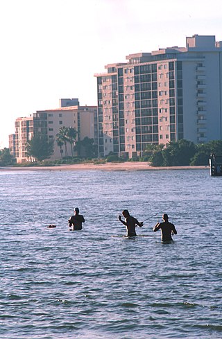
Dauphin Island, Alabama

Last updated

Dauphin Island, Alabama
Fort Gaines 06May2010.JPG
Fort Gaines and seashore vegetation on the eastern end of Dauphin Island
Flag of Dauphin Island, Alabama.png
Logo of Dauphin Island, Alabama.png
Motto: 
"Sunset Capital of Alabama"
Mobile County Alabama Incorporated and Unincorporated areas Dauphin Island Highlighted 0119744.svg
Location in Mobile County, Alabama
Coordinates: 30°15′23″N88°07′31″W / 30.25639°N 88.12528°W / 30.25639; -88.12528 [1]
CountryUnited States
State Alabama
County Mobile
Area
[2]
  Total165.95 sq mi (429.81 km2)
  Land6.26 sq mi (16.20 km2)
  Water159.69 sq mi (413.61 km2)
Elevation
[3]
7 ft (2 m)
Population
 (2020) [4]
  Total1,778
  Density284.21/sq mi (109.72/km2)
Time zone UTC−6 (Central Standard Time (CST))
  Summer (DST) UTC−5 (Central Daylight Time (CDT))
ZIP code
36528
Area code 251
FIPS code 01-19744
GNIS feature ID0117086
Website www.townofdauphinisland.org

Dauphin Island is an island town in Mobile County, Alabama, United States, on a barrier island of the same name, in the Gulf of Mexico. It incorporated in 1988. [5] The population was 1,778 at the 2020 census, [4] up from 1,238 at the 2010 census. The town is part of the Mobile metropolitan area. The island (originally named Massacre Island) was renamed for Louis XIV of France's great-grandson and heir, the dauphin, the future Louis XV of France. The name of the island is often mistaken as Dolphin Island; the word dauphin is French for dolphin, but historically, the term was used as the title of the heir apparent to the French monarch. [6]

Contents

The island is one of the Mississippi–Alabama barrier islands, with the Gulf of Mexico to the south, and the Mississippi Sound and Mobile Bay to the north. The island's eastern end helps define the mouth of Mobile Bay. The eastern, wider portion of the island is shaded by thick stands of pine trees and saw palmettos, but the narrow, western part of the island features scrub growth and few trees.

Dauphin Island is home to Fort Gaines, Dauphin Island Sea Lab, the Estuarium public aquarium, the Dauphin Island Airport, boat ramps, a large public pier that sits on dry land, [7] historic sites, several restaurants, new condominium developments, and numerous private homes. Beaches attract tourism, and fishing is a popular activity in the waters around the island. The island is connected to the mainland by the Gordon Persons Bridge.

Although the island has several bird sanctuaries, the main one is the 164-acre (66 ha) Audubon Bird Sanctuary. Because Dauphin Island is the first land encountered by many birds as they migrate north from South America, many species can be found resting there before continuing their journey.

In May 2012, the central public beach began charging for access. This marked the second beach on the island to charge the public following the creation of the privately owned West End Beach. [8]

History

Serpentine shell middens, perhaps 1,500 years old, attest to at least seasonal occupation by the Native American Mississippian Mound Builder culture. Shell Mound Park, along the island's northern shore, is administered by the Alabama Marine Resources Division.

View of the southeastern shore of the island Dauphin Island 06May2010 01.JPG
View of the southeastern shore of the island

In 1519, the Spanish explorer Alonso Álvarez de Pineda was the first documented European to visit, staying long enough to map the island with remarkable accuracy.

The island's French history began on January 31, 1699, when the explorer Pierre Le Moyne, sieur d'Iberville, one of the founders of French Louisiana, arrived at Mobile Bay and anchored near the island on his way to explore the mouth of the Mississippi River. D'Iberville mistakenly named it Île du Massacre (Massacre Island) because of a large pile of human skeletons discovered there. In reality, the site was a Mississippian burial mound which had been broken open by a hurricane, not a massacre site; however, the dramatic misnomer stuck. [9]

D'Iberville later established a port for Fort Louis de La Louisiane on the island due to its abundant timber, reliable supply of fresh water, and deep-water harbor. The settlement consisted of a fort, a chapel, government-owned warehouses, and residences. [9]

Inside Shell Mound Park Indian Mound Park 06May2010 04.JPG
Inside Shell Mound Park

The island served as a major trading depot where goods from Saint-Domingue (Haiti), Mexico, Cuba and France were unloaded and a short-lived fur trade was conducted. Before a channel was dredged, Mobile Bay was too shallow and its sandbars too treacherous for ocean-going vessels to travel up the bay and Mobile River to Fort Louis de La Louisiane. Thus, smaller boats carried the cargo within Mobile Bay to and from Dauphin Island.

In 1719 the first African slaves of Alabama arrived at Dauphin Island. After the French and Indian War (known in Europe as the Seven Years' War) ended in 1763, the island was ceded to the British. After the American Revolutionary War, the territory again came under Spanish jurisdiction, being part of the Province of West Florida until 1812.

In 1795 after the Treaty of San Lorenzo was signed between Spain and the United States, new settlers began migrating to Alabama from Virginia, North & South Carolina and Georgia.

In 1805, the Chickasaw, Cherokee and Choctaw people were forced to cede their lands to the government. The Creek tribes aggressively fought to hold their lands, but eventually were forced to cede in 1813.

Fort Gaines on the eastern tip of the island was built between 1821 and 1848. It was occupied by Confederate forces in 1861 and captured by the Union Army during the Battle of Mobile Bay. The phrase, "Damn the torpedoes, full speed ahead," was supposedly spoken by U. S. Admiral David Farragut just a few hundred yards from Dauphin Island's shore.

Typical elevated house on Dauphin Island FEMA - 1134 - Photograph by FEMA News Photo taken on 01-01-1900 in Alabama.jpg
Typical elevated house on Dauphin Island

The first Sand Island Light, authorized in 1834, was replaced by a structure 150 feet (46 m) high, at a cost of $35,000, that was destroyed by Confederate forces. The present lighthouse (1873; in use until 1970), has been placed on the National Register of Historic Places. Its ownership was recently transferred from the U.S. Department of Interior to the town of Dauphin Island.

In 2023, a large alligator was spotted riding waves and sunbathing on the beach of Dauphin Island. Onlookers posted photos of the alligator to social media, which subsequently went viral. While alligators traditionally live in freshwater, they are able to tolerate salt water as well according to the Alabama Department of Conservation and Natural Resources. [10]

Geography

Dauphin Island is 15 miles (24 km) long from east to west, separating the Gulf of Mexico to the south from the Mississippi Sound and Mobile Bay to the north. The island is less than 0.25 miles (0.40 km) wide for most of its length, except for the eastern quarter of the island, which is over 1 mile (1.6 km) wide. According to the U.S. Census Bureau, the island has a land area of 6.3 square miles (16 km2), while the town's total area is much greater: 166.0 square miles (430 km2), with 159.9 square miles (414 km2) of it, or 96.2% of the town, in the water of the surrounding Gulf and bays. [2]

The Dauphin Island Bridge, officially the Gordon Persons Bridge, is the island's sole road connection to the Alabama mainland, carrying State Route 193, which leads north 27 miles (43 km) to Tillmans Corner in the southwest outskirts of Mobile. Downtown Mobile is 37 miles (60 km) north of the island.

Climate

The climate in this area is characterized by hot, humid summers and generally mild to cool winters. According to the Köppen Climate Classification system, Dauphin Island has a humid subtropical climate, abbreviated "Cfa" on climate maps. [11]

Climate data for Dauphin Island #2, Alabama (1991–2020 normals, extremes 1975–present)
MonthJanFebMarAprMayJunJulAugSepOctNovDecYear
Record high °F (°C)81
(27)
80
(27)
83
(28)
88
(31)
95
(35)
99
(37)
101
(38)
99
(37)
97
(36)
93
(34)
85
(29)
85
(29)
101
(38)
Mean maximum °F (°C)70.5
(21.4)
71.3
(21.8)
76.5
(24.7)
81.1
(27.3)
88.1
(31.2)
91.3
(32.9)
93.7
(34.3)
93.0
(33.9)
91.1
(32.8)
85.6
(29.8)
79.2
(26.2)
73.6
(23.1)
94.7
(34.8)
Mean daily maximum °F (°C)58.6
(14.8)
61.5
(16.4)
66.8
(19.3)
73.5
(23.1)
80.8
(27.1)
86.2
(30.1)
88.2
(31.2)
88.1
(31.2)
85.2
(29.6)
77.4
(25.2)
67.8
(19.9)
61.2
(16.2)
74.6
(23.7)
Daily mean °F (°C)52.3
(11.3)
55.4
(13.0)
61.3
(16.3)
68.3
(20.2)
76.0
(24.4)
81.3
(27.4)
83.2
(28.4)
83.2
(28.4)
80.3
(26.8)
72.0
(22.2)
61.7
(16.5)
55.2
(12.9)
69.2
(20.7)
Mean daily minimum °F (°C)46.1
(7.8)
49.4
(9.7)
55.8
(13.2)
63.1
(17.3)
71.2
(21.8)
76.4
(24.7)
78.2
(25.7)
78.3
(25.7)
75.5
(24.2)
66.7
(19.3)
55.6
(13.1)
49.2
(9.6)
63.8
(17.7)
Mean minimum °F (°C)30.7
(−0.7)
35.0
(1.7)
40.4
(4.7)
50.3
(10.2)
60.9
(16.1)
70.1
(21.2)
71.8
(22.1)
72.5
(22.5)
67.3
(19.6)
52.9
(11.6)
42.1
(5.6)
36.8
(2.7)
28.5
(−1.9)
Record low °F (°C)9
(−13)
19
(−7)
23
(−5)
35
(2)
50
(10)
55
(13)
65
(18)
64
(18)
57
(14)
37
(3)
24
(−4)
11
(−12)
9
(−13)
Average precipitation inches (mm)5.23
(133)
4.35
(110)
4.90
(124)
5.16
(131)
5.01
(127)
5.87
(149)
6.80
(173)
6.80
(173)
5.24
(133)
3.52
(89)
3.86
(98)
5.13
(130)
61.09
(1,552)
Average precipitation days (≥ 0.01 in)12.210.29.57.46.810.211.612.18.46.88.111.5114.8
Source: NOAA [12] [13]

Demographics

Historical population
CensusPop.Note
1990 824
2000 1,37166.4%
2010 1,238−9.7%
2020 1,77843.6%
U.S. Decennial Census [14]

2000 census

As of the census [15] of 2000, there were 1,371 people (but falling in the 2010 census to 1238: see below) with 601 households and 418 families residing in the town. The population density was 221.2 people per square mile (85.4 people/km2). There were 1,691 housing units at an average density of 272.9 units per square mile (105.4 units/km2). The racial makeup of the town was 96.43% White (1,322 persons), 0.44% Black or African American (6 persons), 1.60% Native American (22 persons), 0.58% Asian (8 persons), and 0.95% from two or more races (13 persons). Hispanic or Latino of any race were 0.95% of the population.

There were 601 households, out of which 21.6% had children under the age of 18 living with them, 61.7% were married couples living together, 5.0% had a female householder with no husband present, and 30.3% were non-families. 23.0% of all households were made up of individuals, and 6.3% had someone living alone who was 65 years of age or older. The average household size was 2.28 and the average family size was 2.66. In the town, the population was spread out, with 17.4% under the age of 18, 7.4% from 18 to 24, 25.7% from 25 to 44, 33.3% from 45 to 64, and 16.2% who were 65 years of age or older. The median age was 45 years. For every 100 females, there were 111.6 males. For every 100 females age 18 and over, there were 114.0 males.

The median income for a household in the town was $44,219, and the median income for a family was $50,476. Males had a median income of $35,179 versus $24,250 for females. The per capita income for the town was $22,552. About 6.0% of families and 9.2% of the population were below the poverty line, including 6.7% of those under age 18 and 5.4% of those age 65 or over.

2010 census

As of the census [16] of 2010, there were 1,238 people, 582 households, and 373 families residing in the town. The population density was 199.7 people per square mile (77.1 people/km2). There were 1,818 housing units at an average density of 295.2 units per square mile (114.0 units/km2). The racial makeup of the town was 97.3% White, 0.4% Black or African American, 1.0% Native American, 0.2% Asian, and 1.0% from two or more races. Hispanic or Latino of any race were 0.7% of the population.

There were 582 households, out of which 13.2% had children under the age of 18 living with them, 57.2% were married couples living together, 4.3% had a female householder with no husband present, and 35.9% were non-families. 28.4% of all households were made up of individuals, and 9.8% had someone living alone who was 65 years of age or older. The average household size was 2.10 and the average family size was 2.55.

In the town, the population was spread out, with 12.8% under the age of 18, 4.8% from 18 to 24, 18.0% from 25 to 44, 41.2% from 45 to 64, and 23.1% who were 65 years of age or older. The median age was 53 years. For every 100 females, there were 105.6 males. For every 100 females age 18 and over, there were 101.8 males.

The median income for a household in the town was $56,731, and the median income for a family was $54,844. Males had a median income of $47,308 versus $37,292 for females. The per capita income for the town was $26,771. About 11.4% of families and 15.3% of the population were below the poverty line, including 21.5% of those under age 18 and 0% of those age 65 or over.

2020 census

Dauphin Island racial composition [17]
RaceNum.Perc.
White (non-Hispanic)1,61590.83%
Black or African American (non-Hispanic)50.28%
Native American 191.07%
Asian 120.67%
Pacific Islander 30.17%
Other/Mixed 824.61%
Hispanic or Latino 422.36%

As of the 2020 United States census, there were 1,778 people, 585 households, and 424 families residing in the town.

Education

The town is served by the Mobile County Public School System. [18] It has one public school, Dauphin Island Elementary School. [19] Middle school students go on to Alba Middle School in Bayou La Batre and Alma Bryant High School in Bayou La Batre. [20] [21]

The Dauphin Island Sea Lab is located on the east end of the island on grounds formerly occupied by the 693rd Radar Squadron, Dauphin Island Air Force Station, US Air Force, and is home to the Marine Environmental Sciences Consortium. [22]

Coat of arms

The Dauphin Island Coat of arms Dauphin island crest.jpg
The Dauphin Island Coat of arms

At the top of Dauphin Island's coat of arms is the historic Fort Gaines with two cannons facing north and south, which represent Dauphin Island's role during the Civil War. The boat is a shrimping vessel which represents the livelihood of many of the residents of the island. The dolphin is a mammal seen quite often in the Gulf of Mexico and Mobile Bay waters surrounding the island. The birds are pelicans, which are numerous around the island and the entire Gulf coast. The fleur-de-lis represents the presence of France on the island from 1699 to 1764. The sailing ship is a Spanish galleon to represent Spain's role in settling the area between 1781 and 1813.

Hurricanes

Over the centuries, many hurricanes have struck the island. Some recent storms include:

Tourist attractions

The old walled Fort Gaines is on the east end of Dauphin Island. A ferry from nearby Fort Morgan in Gulf Shores brings both vehicles and pedestrians to the island. One of the closest attractions to the ferry dock is The Estuarium, a fresh- and saltwater aquarium highlighting species native to Alabama.

The Dauphin Island Heritage and Arts Council features works by local artists, as well as information on the history of Dauphin Island. It organizes the annual Dauphin Island Native American Festival.

See also

Related Research Articles

<span class="mw-page-title-main">Baldwin County, Alabama</span> County in Alabama, United States

Baldwin County is a county located in the southwestern part of the U.S. state of Alabama, on the Gulf coast. It is one of only two counties in Alabama that border the Gulf of Mexico, along with Mobile County. As of the 2020 census, the population was 231,767, making it the fourth-most populous county in Alabama. The county seat is Bay Minette. The county is named after the founder of the University of Georgia, Senator Abraham Baldwin.

<span class="mw-page-title-main">Bay Minette, Alabama</span> City in and county seat of Baldwin County, Alabama

Bay Minette is a city in and the county seat of Baldwin County, Alabama, United States. As of the 2010 census, the population of the city was 8,044.

<span class="mw-page-title-main">Gulf Shores, Alabama</span> City in Alabama, United States

Gulf Shores is a resort city in Baldwin County, Alabama, United States. As of the 2020 Census, the population was 15,014.

<span class="mw-page-title-main">Loxley, Alabama</span> City in Alabama, United States

Loxley is a city in Baldwin County, Alabama, United States. As of the 2010 census, the population of the town was 1,632. It is part of the Daphne-Fairhope-Foley metropolitan area. Loxley is becoming a popular location for the expansion of the suburbs from Daphne and Spanish Fort, Alabama, because it is served by an Interstate 10 exit and is almost directly between the cities of Mobile, Alabama, and Pensacola, Florida.

<span class="mw-page-title-main">Orange Beach, Alabama</span> City in Alabama, United States

Orange Beach is a resort city in Baldwin County, Alabama, United States. As of the 2020 Census, the population was 8,095.

<span class="mw-page-title-main">Spanish Fort, Alabama</span> City in Alabama, United States

Spanish Fort is a city in Baldwin County, Alabama, United States, located on the eastern shore of Mobile Bay. The 2020 census lists the population of the city as 10,049. It is a suburb of Mobile and is part of the Daphne-Fairhope-Foley metropolitan area.

<span class="mw-page-title-main">Grand Bay, Alabama</span> Census-designated place in Alabama, United States

Grand Bay is an unincorporated community and census-designated place (CDP) in Mobile County, Alabama, United States. It is part of the Mobile metropolitan area. The population was 3,460 at the 2020 census.

<span class="mw-page-title-main">Mexico Beach, Florida</span> City in Florida, United States

Mexico Beach is a city in Bay County, Florida, United States. It is located 25 miles (40 km) southeast of Panama City. It is part of the Panama City-Panama City Beach, Florida Metropolitan Statistical Area. The population was 916 at the 2020 census.

<span class="mw-page-title-main">Panama City, Florida</span> City in the United States

Panama City is a city in the county seat of Bay County, Florida, United States. Located along U.S. Highway 98 (US 98), it is the largest city between Tallahassee and Pensacola. It is also the most populated city of the Panama City–Lynn Haven, Florida metropolitan statistical area. Panama City was severely damaged when Hurricane Michael made landfall as a Category 5 hurricane on October 10, 2018. As of the 2020 census, the population was 32,939, down from the figure of 36,484 at the 2010 census.

<span class="mw-page-title-main">Panama City Beach, Florida</span> Resort town in Bay County, Florida, United States

Panama City Beach is a resort town in Bay County, Florida, United States, on the Gulf of Mexico coast. It had a population of 12,018 in 2010. The city is often referred to under the umbrella term of "Panama City". Panama City Beach's slogan is "The World's Most Beautiful Beaches" due to the unique, sugar-white sandy beaches of northwest Florida.

<span class="mw-page-title-main">Bonita Springs, Florida</span> City in Florida, United States

Bonita Springs is a city in Lee County, Florida, United States. The population was 53,644 at the 2020 census. It is part of the Cape Coral-Fort Myers, Florida Metropolitan Statistical Area, on the state's southwest coast.

<span class="mw-page-title-main">Fort Myers Beach, Florida</span> Town in Florida, United States of America

Fort Myers Beach is a town located on the North end of Estero Island in Lee County, Florida, United States. The town is on the Gulf of Mexico and is accessed from the mainland by a bridge over Estero Bay. It is part of the Cape Coral-Fort Myers, Florida Metropolitan Statistical Area. It was officially incorporated on December 31, 1995. The population was 5,582 at the 2020 census.

<span class="mw-page-title-main">Cinco Bayou, Florida</span> Town in Florida, United States

Cinco Bayou is a town in Okaloosa County, Florida, United States. The Town of Cinco Bayou is part of the Fort Walton Beach–Crestview–Destin Metropolitan Statistical Area. The population was 457 at the 2020 census.

<span class="mw-page-title-main">Madeira Beach, Florida</span> City in Florida, United States

Madeira Beach is a city in Pinellas County, Florida, United States, bordered on the west by the Gulf of Mexico, and on the east by St. Petersburg. As of the 2020 census, the population was 3,895. The entertainment district of John's Pass is located on the Intracoastal Waterway. The city is often referred to by locals as Mad Beach. It is named after the Portuguese island of Madeira.

<span class="mw-page-title-main">North Redington Beach, Florida</span> Town in the state of Florida, United States

North Redington Beach is a town in Pinellas County, Florida, United States. It is part of the Tampa–St. Petersburg–Clearwater Metropolitan Statistical Area, more commonly known as the Tampa Bay Area. The population was 1,495 at the 2020 census.

<span class="mw-page-title-main">Redington Beach, Florida</span> Town in the state of Florida, United States

Redington Beach is a town in Pinellas County, Florida, United States. It is part of the Tampa–St. Petersburg–Clearwater Metropolitan Statistical Area, more commonly called the Tampa Bay Area. The population was 1,376 at the 2020 census.

<span class="mw-page-title-main">Pascagoula, Mississippi</span> City in Mississippi, United States

Pascagoula is a city in Jackson County, Mississippi, United States. It is the principal city of the Pascagoula metropolitan area, and is part of the Gulfport–Biloxi–Pascagoula Combined Statistical Area and the Gulfport-Biloxi metropolitan area. The population was 22,392 at the 2010 census, down from 26,200 at the 2000 census. In 2019 the population was 21,699. It is the county seat of Jackson County.

<span class="mw-page-title-main">Southport, North Carolina</span> City in North Carolina, United States

Southport is a city in Brunswick County, North Carolina, United States, near the mouth of the Cape Fear River. Its population was 3,828 as of the 2018 census. The mayor is Rich Alt.

<span class="mw-page-title-main">Carolina Beach, North Carolina</span> Town in North Carolina, United States

Carolina Beach is a beach town in New Hanover County, North Carolina, United States, situated about 12 miles (19 km) south of Wilmington International Airport in southeastern coastal North Carolina. As of the 2020 census, the city population was 6,564. It is part of the Wilmington metropolitan area. The community of Wilmington Beach was annexed by the town in 2000.

<span class="mw-page-title-main">Gulfport–Biloxi metropolitan area</span> Metropolitan statistical area in Mississippi, US

The Gulfport-Biloxi Metropolitan Statistical Area is a metropolitan statistical area (MSA) in the Mississippi Gulf Coast region that includes four counties – Hancock, Harrison, Jackson and Stone. The principal cities are Gulfport and Biloxi. The 2010 census placed the Gulfport-Biloxi MSA population at 388,488, though as of 2019, it was estimated to have increased to 417,665. The area was significantly impacted by Hurricane Katrina on August 29, 2005, and prior to the hurricane, had experienced steady to moderate population growth. However, growth has since rebounded, with the population steadily increasing every year throughout the 2010s.

References

  1. "US Gazetteer files: 2010, 2000, and 1990". United States Census Bureau. February 12, 2011. Retrieved April 23, 2011.
  2. 1 2 "2021 U.S. Gazetteer Files". United States Census Bureau. Retrieved April 21, 2022.
  3. "Dauphin Island". Geographic Names Information System . United States Geological Survey, United States Department of the Interior . Retrieved July 26, 2009.
  4. 1 2 "Dauphin Island town, Alabama: 2020 DEC Redistricting Data (PL 94-171)". U.S. Census Bureau. Retrieved April 21, 2022.
  5. "Dauphin Island - Encyclopedia of Alabama". Encyclopedia of Alabama. Retrieved April 13, 2018.
  6. "dauphin | French political history" . Retrieved September 3, 2016.
  7. Dauphin Island Fishing Pier Archived May 6, 2012, at the Wayback Machine . Dauphinisland.org. Retrieved on July 21, 2013.
  8. Dauphin Island public beach fee set to begin in late May | al.com. Blog.al.com. Retrieved on July 21, 2013.
  9. 1 2 "The coinage for Massacre Island, 1699!". Shirepost.com. Archived from the original on May 13, 2007. Retrieved May 9, 2007.
  10. "Surfing gator seen relaxing at Alabama beach amid the waves". AP News. May 16, 2023. Retrieved May 17, 2023.
  11. "Dauphin Island, Alabama Köppen Climate Classification (Weatherbase)". Weatherbase. Retrieved April 13, 2018.
  12. "NowData – NOAA Online Weather Data". National Oceanic and Atmospheric Administration. Retrieved June 7, 2021.
  13. "Station: Dauphin IS #2, AL". U.S. Climate Normals 2020: U.S. Monthly Climate Normals (1991–2020). National Oceanic and Atmospheric Administration. Retrieved June 7, 2021.
  14. "U.S. Decennial Census". Census.gov. Retrieved June 6, 2013.
  15. "U.S. Census website". United States Census Bureau . Retrieved January 31, 2008.
  16. "U.S. Census website". United States Census Bureau . Retrieved August 4, 2015.
  17. "Explore Census Data". data.census.gov. Retrieved December 14, 2021.
  18. "2010 CENSUS - CENSUS BLOCK MAP (INDEX): Dauphin Island town, AL." U.S. Census Bureau. Retrieved on November 27, 2018.
  19. "Dauphin Island Elementary Map Archived July 29, 2020, at the Wayback Machine ." Mobile County Public School System. Retrieved on November 26, 2018.
  20. "Alba Middle School Map Archived July 26, 2020, at the Wayback Machine ." Mobile County Public School System. Retrieved on November 26, 2018.
  21. "Bryant High School Map Archived 2020-07-26 at the Wayback Machine ." Mobile County Public School System. Retrieved on November 26, 2018.
  22. "Records of United States Air Force Commands, Activities, and". archives.gov. August 15, 2016. Retrieved April 13, 2018.

Further reading