Saraland, Alabama

Last updated

Saraland, Alabama
Motto: 
"Gateway to Progress"
Mobile County Alabama Incorporated and Unincorporated areas Saraland Highlighted 0168160.svg
Location in Mobile County, Alabama
Coordinates: 30°49′31″N88°5′31″W / 30.82528°N 88.09194°W / 30.82528; -88.09194
Country United States
State Alabama
County Mobile
Incorporated 1957
Government
  Type Mayor–council
   Mayor Dr. Howard Rubenstein
Area
[1]
  Total32.37 sq mi (83.84 km2)
  Land32.15 sq mi (83.27 km2)
  Water0.22 sq mi (0.57 km2)
Elevation
13 ft (4 m)
Population
 (2020) [2]
  Total16,171
  Density502.97/sq mi (194.20/km2)
Time zone UTC-6 (Central (CST))
  Summer (DST) UTC-5 (CDT)
ZIP code
36571
Area code 251
FIPS code 01-68160
GNIS feature ID0153329
Website www.saraland.org

Saraland is a city in Mobile County, Alabama, United States, and a suburb of Mobile. As of the 2020 census, the population of the city was 16,171, [2] up from 13,405 at the 2010 census. Saraland, part of the Mobile metropolitan area, is the third largest city in Mobile County.

Contents

Geography

Saraland is located at 30°49′31″N88°5′31″W / 30.82528°N 88.09194°W / 30.82528; -88.09194 (30.825186, -88.091932). [3] It is bordered to the southwest by the city of Prichard, to the south by Chickasaw, to the east by the undeveloped northern end of Mobile, and to the northeast by Satsuma and Creola.

U.S. Route 43 (Saraland Boulevard) and Interstate 65 are the main north-south routes through Saraland. U.S. 43 leads south 9 miles (14 km) to downtown Mobile and north 55 miles (89 km) to Jackson, while I-65 leads south 15 miles (24 km) to its terminus at Interstate 10 in southwestern Mobile, and northeast 157 miles (253 km) to Montgomery, the state capital.

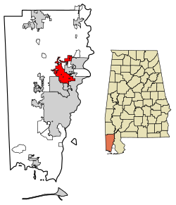
According to the U.S. Census Bureau, Saraland has a total area of 32.4 square miles (84 km2), of which 0.32 square miles (0.83 km2), or 0.68%, are water. [1] The city is drained by Bayou Sara, an east-flowing tributary of the Mobile River.

History

The land area that was to become the present-day Saraland was included in a Spanish land grant to Don Diego Alvarez. Hence, descendants of Alvarez were the ones to give the community its first name: Alvarez Station. Later land squatters moved into the area and were able, legally, in 1800 to begin purchasing property. In 1807, a land office was opened in St. Stephens to handle all land transactions. Some of the pioneer families who seized the opportunity to buy up sections were named Alvarez, Rice, Hartley, Moore, LaCoste, Williams, Tool and Cleveland. Eventually, Alvarez Station was called Cleveland Station. The present name of the city is reported to have been given by C.J. DeWitt, a retired minister editor who moved south in 1890 for health reasons. He opened the first post office on the Southern Railroad in 1895. The community is purported to be the namesake of his beloved wife, Sara.

Saraland was sparsely populated during the first part of the 20th century, until an industrial and population boom occurred in neighboring Mobile. Northward expansion of Mobile in the 1940s and 50s brought about the incorporation of Saraland in 1957. At the time of incorporation, the city reported only 125 residents. By the 1960 U.S. Census, annexations had swelled the population to 4,595. In 1980, census figures cited 9,844 Saraland residents. As of the 2020 census, Saraland's population had grown to 16,171. [2]

The worst rail disaster in the history of Amtrak occurred just east of Saraland on Big Bayou Canot on September 22, 1993. At approximately 2:53 AM, Amtrak's Sunset Limited train, powered by three locomotives, and en route from Los Angeles to Miami with 220 passengers and crew aboard, crossed the Bayou Canot bridge at high speed and derailed at a kink in the track caused by a barge captain who rammed the bridge by making a wrong turn in the waterway and failed to report the accident. 47 people, of whom 42 were passengers, were killed, many by drowning, others by fire. Much of the rescue efforts were average citizens of the community who journeyed out in the early morning hours in small fishing boats to help at the scene.

Demographics

Historical population
CensusPop.Note
1960 4,595
1970 7,84070.6%
1980 9,83325.4%
1990 11,75119.5%
2000 12,2884.6%
2010 13,4059.1%
2020 16,17120.6%
U.S. Decennial Census [4]

2000 census

At the 2000 census there were 12,288 people in 4,810 households, including 3,602 families, in the city. The population density was 560.9 inhabitants per square mile (216.6/km2). There were 5,138 housing units at an average density of 234.5 per square mile (90.5/km2). The racial makeup of the city was 88.50% White, 8.97% Black or African American, 0.56% Native American, 0.46% Asian, 0.01% Pacific Islander, 0.37% from other races, and 1.13% from two or more races. 1.17% of the population were Hispanic or Latino of any race. [5]

Of the 4,810 households 31.8% had children under the age of 18 living with them, 61.0% were married couples living together, 10.5% had a female householder with no husband present, and 25.1% were non-families. 21.2% of households were one person and 8.1% were one person aged 65 or older. The average household size was 2.55 and the average family size was 2.97.

The age distribution was 23.4% under the age of 18, 9.4% from 18 to 24, 29.3% from 25 to 44, 24.4% from 45 to 64, and 13.5% 65 or older. The median age was 37 years. For every 100 females, there were 95.4 males. For every 100 females age 18 and over, there were 92.2 males.

The median household income was $38,318 and the median family income was $43,471. Males had a median income of $35,431 versus $22,787 for females. The per capita income for the city was $19,470. About 7.4% of families and 9.0% of the population were below the poverty line, including 12.2% of those under age 18 and 8.9% of those age 65 or over.

2010 census

At the 2010 census there were 13,405 people in 5,208 households, including 3,757 families, in the city. The population density was 558.5 inhabitants per square mile (215.6/km2). There were 5,828 housing units at an average density of 266.1 per square mile (102.7/km2). The racial makeup of the city was 83.7% White, 12.0% Black or African American, 0.8% Native American, 0.6% Asian, 0.1% Pacific Islander, 1.5% from other races, and 1.4% from two or more races. 2.5% of the population were Hispanic or Latino of any race. [6]

Of the 5,208 households 27.9% had children under the age of 18 living with them, 54.4% were married couples living together, 13.4% had a female householder with no husband present, and 27.9% were non-families. 22.8% of households were one person and 10.0% were one person aged 65 or older. The average household size was 2.57 and the average family size was 2.01.

The age distribution was 22.9% under the age of 18, 8.0% from 18 to 24, 25.8% from 25 to 44, 27.5% from 45 to 64, and 15.8% 65 or older. The median age was 40 years. For every 100 females, there were 97.7 males. For every 100 females age 18 and over, there were 101.9 males.

The median household income was $48,721 and the median family income was $54,845. Males had a median income of $44,201 versus $31,235 for females. The per capita income for the city was $22,192. About 8.8% of families and 14.9% of the population were below the poverty line, including 28.3% of those under age 18 and 7.0% of those age 65 or over.

2020 census

Saraland racial composition [7]
RaceNum.Perc.
White (non-Hispanic)12,37876.54%
Black or African American (non-Hispanic)2,26113.98%
Native American 2251.39%
Asian 1891.17%
Pacific Islander 60.04%
Other/Mixed 8014.95%
Hispanic or Latino 3111.92%

As of the 2020 United States census, there were 16,171 people, 5,171 households, and 3,615 families residing in the city.

Transportation

Economy

Redwing Carriers, Inc. in Saraland had been identified as having a Superfund site which was at risk from climate change, due to high wildfire hazard potential, flood hazard, or potential for damage in Category 4 or 5 hurricanes. [9] As of September 2, 2014, Redwing Carriers, Inc. in Saraland was removed from the National Priorities List (NPL) because no hazardous waste remains on site. [10]

Education

Primary and secondary schools

Public schools

Saraland is served by the Saraland Board of Education. Residents are zoned to Saraland Early Education Center, Saraland Elementary School, Saraland (formerly Adams) Middle School, and Saraland High School. [11]

In June 2006, the City of Saraland voted to break away from the Mobile County Public School System and form its own school system. [12] The school district came into effect in autumn 2008; at the time Saraland Elementary and Adams Middle were a part of the city district, but high schoolers had to attend county schools because Saraland High School was not yet open. [13] Prior to the split of the City of Saraland from the county system in 2009, Saraland was zoned to Satsuma High School. [14] 2011 was the final year in which Saraland residents were permitted by the county to attend county schools. [15]

Several years prior to 2009 officials of Saraland, Satsuma, and Chickasaw contemplated forming the "Delta School District." [16]

Private schools

Private schools within Saraland include Evangel Christian School, North Mobile Christian School, and the Saraland Yeshiva right outside of the city limits.

Notable people

Related Research Articles

<span class="mw-page-title-main">Mobile County, Alabama</span> County in Alabama, United States

Mobile County is located in the southwestern corner of the U.S. state of Alabama. It is the third-most populous county in the state after Jefferson and Madison counties. As of the 2020 census, its population was 414,809. Its county seat is Mobile, which was founded as a deepwater port on the Mobile River. The only such port in Alabama, it has long been integral to the economy for providing access to inland waterways as well as the Gulf of Mexico.

<span class="mw-page-title-main">Chickasaw, Alabama</span> City in Alabama, United States

Chickasaw is a city in Mobile County, Alabama, United States. As of the 2020 census the population was 6,457, up from 6,106 at the 2010 census. It is part of the Mobile metropolitan area.

<span class="mw-page-title-main">Creola, Alabama</span> City in Alabama, United States

Creola is a city in Mobile County, Alabama, United States. Incorporated in 1978, the city had a population of 1,936 at the 2020 census. It is part of the Mobile metropolitan area.

<span class="mw-page-title-main">Grand Bay, Alabama</span> Census-designated place in Alabama, United States

Grand Bay is an unincorporated community and census-designated place (CDP) in Mobile County, Alabama, United States. It is part of the Mobile metropolitan area. The population was 3,460 at the 2020 census.

<span class="mw-page-title-main">Mount Vernon, Alabama</span> Town in Alabama, United States

Mount Vernon is a town in Mobile County, Alabama, United States. It is part of the Mobile metropolitan area. It incorporated in 1959. At the 2020 census the population was 1,354.

<span class="mw-page-title-main">Satsuma, Alabama</span> City in Alabama, United States

Satsuma is a city in Mobile County, Alabama, United States. At the 2020 census, the population was 6,749, up from 6,168 at the 2010 census. Known prior to 1915 as "Fig Tree Island", the city was named after the satsuma orange, which was successfully cultivated and grown in Alabama starting in 1878, a gift from Emperor Meiji of Japan. Satsuma is a part of the Mobile metropolitan area.

<span class="mw-page-title-main">Theodore, Alabama</span> Census-designated place in Alabama, United States

Theodore is an unincorporated area and census-designated place (CDP) in Mobile County, Alabama, United States. The population was 6,270 at the 2020 census. It is a part of the Mobile metropolitan area. Prior to 1900 this area was known as "Clements", but it is now named for William Theodore Hieronymous, a sawmill operator and postmaster.

<span class="mw-page-title-main">Tillmans Corner, Alabama</span> Unincorporated community in Alabama, United States

Tillmans Corner, or Tillman’s Corner, is an unincorporated community and census-designated place (CDP) in Mobile County, Alabama, United States. At the 2020 census, the population was 17,731. It is part of the Mobile metropolitan area, and is the largest census-designated place in Alabama.

<span class="mw-page-title-main">North Washington, Iowa</span> City in Iowa, United States

North Washington is a city in Chickasaw County, Iowa, United States. The population was 112 at the time of the 2020 census.

<span class="mw-page-title-main">Woden, Iowa</span> City in Iowa, United States

Woden is a city in Hancock County, Iowa, United States. The population was 188 at the time of the 2020 census.

<span class="mw-page-title-main">Soldier, Iowa</span> City in Iowa, United States

Soldier is a city in Monona County, Iowa, United States, along the Soldier River. The population was 184 at the time of the 2020 census.

<span class="mw-page-title-main">Kellerton, Iowa</span> City in Iowa, United States

Kellerton is a city in eastern Ringgold County, Iowa, United States. The population was 243 at the time of the 2020 census.

<span class="mw-page-title-main">McCausland, Iowa</span> City in Iowa, United States

McCausland is a city in Butler Township, Scott County, Iowa, United States. The population was 313 at the time of the 2020 census.

<span class="mw-page-title-main">New Strawn, Kansas</span> City in Coffey County, Kansas

New Strawn is a city in Coffey County, Kansas, United States. As of the 2020 census, the population of the city was 414.

<span class="mw-page-title-main">Rantoul, Kansas</span> City in Franklin County, Kansas

Rantoul is a city in Franklin County, Kansas, United States. As of the 2020 census, the population of the city was 165.

<span class="mw-page-title-main">Prairie Village, Kansas</span> City in Kansas, United States

Prairie Village is a city in Johnson County, Kansas, United States, and located within the Kansas City Metropolitan Area. As of the 2020 census, the population of the city was 22,957.

<span class="mw-page-title-main">Lansing, Kansas</span> City in Kansas, United States

Lansing is a city in Leavenworth County, Kansas, United States. It is situated along the west side of the Missouri River and Kansas-Missouri state border. As of the 2020 census, the population of the city was 11,239. It is the second most populous city of Leavenworth County and is a part of the Kansas City metropolitan area. The Lansing Correctional Facility, which includes the state's main maximum-security prison, is located in Lansing.

<span class="mw-page-title-main">Beverly, Kansas</span> City in Lincoln County, Kansas

Beverly is a city in Lincoln County, Kansas, United States. As of the 2020 census, the population of the city was 135.

<span class="mw-page-title-main">Riceville, Iowa</span> City in Iowa, United States

Riceville is a city in Howard and Mitchell counties in the U.S. state of Iowa. The population was 806 at the time of the 2020 census.

<span class="mw-page-title-main">Sharonville, Ohio</span> City in Ohio, United States

Sharonville is a city largely in Hamilton County in the U.S. state of Ohio. The population was 14,117 at the 2020 census.

References

  1. 1 2 "2021 U.S. Gazetteer Files". United States Census Bureau. Retrieved April 21, 2022.
  2. 1 2 3 "Saraland city, Alabama: 2020 DEC Redistricting Data (PL 94-171)". U.S. Census Bureau. Retrieved April 21, 2022.
  3. "US Gazetteer files: 2010, 2000, and 1990". United States Census Bureau. February 12, 2011. Retrieved April 23, 2011.
  4. "U.S. Decennial Census". Census.gov. Retrieved June 6, 2013.
  5. "U.S. Census website". United States Census Bureau . Retrieved January 31, 2008.
  6. "U.S. Census website". United States Census Bureau . Retrieved August 4, 2015.
  7. "Explore Census Data". data.census.gov. Retrieved December 14, 2021.
  8. "Shell sells Mobile Chemical LP Refinery to Vertex Energy". May 27, 2021.
  9. Burkhalter, Eddie (November 22, 2019). "Report: Climate change threatens 11 Alabama superfund sites". Alabama Political Reporter. Retrieved December 10, 2019.
  10. US EPA, OSRTI. "REDWING CARRIERS, INC. (SARALAND) Site Profile". cumulis.epa.gov. Retrieved June 10, 2020.
  11. "Schools." Saraland City Schools. Retrieved on October 22, 2010.
  12. "Education." Saraland Chamber of Commerce. Retrieved on October 22, 2010.
  13. Lucio, Diana. "Saraland School System Coming Soon Archived 2009-08-08 at the Wayback Machine ." WKRG . Saturday November 3, 2007. Retrieved on October 22, 2010.
  14. Cannon, Jason. "Vickers accepts Saraland position." Demopolis Times . Tuesday June 23, 2009. Retrieved on November 17, 2012.
  15. Philips, Rena Havner. "Mobile County school system sees dropping enrollment." Mobile Press-Register . Monday December 12, 2011. Retrieved on November 17, 2012.
  16. Philips, Rena Havner. "Chickasaw officials to examine possible school split." Mobile Press-Register . Friday March 27, 2009. Retrieved on March 31, 2009.
  17. Kociaba, Bill. "Ann Casey: More than just a pretty face". Cauliflower Alley Club . Retrieved March 14, 2015.
  18. "Jay Prosch". ESPN. Retrieved March 15, 2015.
  19. "Bears select Velus Jones with No. 71 pick in 2022 draft". NFL.com. Retrieved August 2, 2022.
  20. "Cordale Flott #28 New York Giants". NFL.com. Retrieved September 18, 2023.

30°49′31″N88°05′31″W / 30.825186°N 88.091932°W / 30.825186; -88.091932