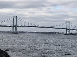
City Island Bridge

Last updated

City Island Bridge
CI Bridge from south of park jeh.jpg
The 1901-built City Island Bridge as seen in June 2012
Coordinates 40°51′23″N73°47′36″W / 40.8563°N 73.7933°W / 40.8563; -73.7933
Carries3 lanes of City Island Road
Crosses Eastchester Bay
Locale The Bronx and City Island in New York City
Maintained by New York City Department of Transportation
Characteristics
Design Swing bridge
Material Steel and stone
Total length950 feet (290 m)
No. of spans7
Piers in water6
Clearance below 8 feet (2.4 m)
History
Construction start1899
OpenedJuly 4, 1901 [1]
ClosedDecember 18, 2015
Statistics
Daily traffic 14,473 (2016) [2]
Location
City Island Bridge
City Island Causeway
New City Island Bridge Bronx 20180530-jag9889.jpg
Coordinates 40°51′23″N73°47′36″W / 40.856257°N 73.793291°W / 40.856257; -73.793291
Carries3 lanes of City Island Road
Crosses Eastchester Bay
Locale The Bronx and City Island in New York City
Maintained by New York City Department of Transportation
Characteristics
Design Causeway
History
Construction start2015
OpenedOctober 29, 2017
Location
City Island Bridge

The City Island Bridge is a bridge in the New York City borough of the Bronx, connecting City Island with Rodman's Neck on the mainland. The original bridge, which carried vehicles from 1901 to 2015, was replaced by the current bridge (also called the City Island Causeway), which opened in 2017. A temporary bridge was used for the demolition and construction period between the original and new bridges.

Contents

Old bridge

Since the American Revolutionary War, there have been plans to link City Island with the mainland via means of a bridge. [3] [4] Before the original bridge named "City Island Bridge" was opened, there was another, unnamed bridge connecting City Island with the rest of the Bronx. The opening date of this first bridge is unclear; some sources attest that it opened in 1873, [3] [5] while one letter states that it opened in 1857—a disputed date since the letter's writer may have been referring to a past date. [4] [6] This first bridge, which was definitely under planning in the 1860s, [3] was listed in an 1872 map. [4] It was a tolled drawbridge that was built partly out of wood from the USS North Carolina. [3] This bridge was located north of the 1899 bridge and connected to City Island at Bridge Street. [4] When the New York City Department of Parks and Recreation took over Pelham Bay Park in 1888, it claimed responsibility for maintenance over the western end of the bridge, which was located in the park. [4] [7]

The second City Island Bridge, which was actually the first with that particular name, began construction in 1898 and was completed in 1901. [8] The $200,000 bridge was of stone and steel construction, and spanned 950 ft (290 m). It consisted of five fixed spans and a central swing section. [9] As originally built, the bridge's City Island end connected to City Island Avenue rather than at Bridge Street, and was located partially on landfill. [10] The bridge was the sole entry and exit for vehicles on City Island. [11] As such, it served both as a landmark and a gateway to City Island. [12]

The swing section was deactivated and turned into a fixed span in 1963. [4] In 1978–1979, a proposed renovation would have detonated explosives on the corroding piers, [13] but the plan was altered so that the piers would get heavy refurbishment instead. [4] [14]

By 2002, the bridge was in bad shape, and city leaders held a meeting about the deteriorating bridge, showing images of corrosion on the supports, although the corrosion had since been fixed by that time. The bridge, which had been inspected in July 1999, had been deemed capable of carrying up to 50 long tons (56 short tons). [15] The city leaders listed four options for the bridge's future: one entailed renovating the existing span, while the other three were for new spans. The new span proposals included a conventional causeway-style bridge with four piers; an arch bridge with large foundations on either side of the water; and a cable-stayed bridge with a tower either 240 or 450 feet (73 or 137 m) high. [15]

Replacement

Sidewalk view of the now demolished 1901 bridge with "Welcome to City Island" sign City Island Bridge - from sidewalk, 2011.jpg
Sidewalk view of the now demolished 1901 bridge with "Welcome to City Island" sign

To replace the deteriorating bridge, the city originally intended to build a cable-stayed bridge, with a 150 ft (46 m) high tower, 13 ft (4.0 m) wide at the top, with a base of 26 ft (7.9 m). Vertical clearance above high water would be 12 ft (3.7 m). [16] The new bridge would be located in the same footprint as the existing bridge, although it would be 17 ft (5.2 m) wider to accommodate three standard-width traffic lanes, a bicycle lane and a pedestrian walkway. [16]

The original schedule was for the project to begin in 2007 with completion in 2010. The project was then postponed until June 2012. [17] :104–106 [18] Due to the project postponement, during 2010 repairs were made to the existing bridge deck, piers, and west abutment. [17] :140 Due to a lack of funding the project was delayed once more until the city announced it would accept bids in late 2012, with Tutor Perini selected as general contractor in February 2013. [19] In 2005 the estimated cost of the project was $50 million. [20] In 2009 the estimate increased to $120 million due to redesigns and the addition of related projects. [21] The final bid came in at $102.7 million. [22]

Some residents, however, opposed the design of the cable-stayed bridge and felt that its tower would be out of character with the low-rise homes on City Island. [23] Opponents of the bridge design filed a lawsuit against the city on November 6, 2013. A Bronx Supreme Court judge granted a temporary injunction on that date. [24] In December 2013 the court lifted the injunction, but ruled that the city must conduct public hearings. [25] The city's prior consultations with the island community, which began during the early design stages, had been informal. The court's ruling requires the city to follow its Uniform Land Use Review Procedure, which includes local Community Board hearings. [26] [27] On May 5, 2014, the original bridge plans were scrapped, and the de Blasio administration chose to go with a slightly cheaper and much shorter causeway-style bridge. The bridge, which was later approved, would be completed by 2017. [28] [29]

A temporary steel bridge was erected in 2015, but a partial collapse in September delayed the opening of the temporary bridge. [30] On December 16, 2015, the New York City Department of Transportation (NYCDOT) conducted a road test on the temporary steel bridge by running heavy equipment including fire trucks over the bridge. [31] The NYCDOT conducted the tests to ease residents' concerns about the integrity of the temporary structure. [31] Two days later on December 18, the original bridge was closed, and traffic was routed to the temporary bridge. [11] [32] Shortly after that, the city began demolishing the original bridge, with the new bridge being constructed on the same site as the 1901 bridge. [11] The new bridge opened on October 29, 2017. [33]

Related Research Articles

<span class="mw-page-title-main">Queensboro Bridge</span> Bridge in New York City

The Queensboro Bridge, officially named the Ed Koch Queensboro Bridge, is a cantilever bridge over the East River in New York City. Completed in 1909, it connects the Long Island City neighborhood in the borough of Queens with the East Midtown and Upper East Side neighborhoods in Manhattan, passing over Roosevelt Island. The bridge is also known as the 59th Street Bridge. It consists of five steel spans measuring 3,725 ft (1,135 m) long; including approaches, its total length is 7,449 ft (2,270 m).

<span class="mw-page-title-main">Marble Hill, Manhattan</span> Neighborhood of Manhattan in New York City

Marble Hill is the northernmost neighborhood in the New York City borough of Manhattan. Although once part of Manhattan Island, it is now one of the few areas of Manhattan that are not located on the island. The Bronx surrounds the neighborhood to the west, north, and east. The area of Marble Hill was established as a Dutch colonial settlement in 1646, and gained its current name in 1891 from the Tuckahoe marble deposits discovered underneath the neighborhood.

<span class="mw-page-title-main">Robert F. Kennedy Bridge</span> Bridge complex in New York City

The Robert F. Kennedy Bridge is a complex of bridges and elevated expressway viaducts in New York City. The bridges link the boroughs of Manhattan, Queens, and the Bronx. The viaducts cross Randalls and Wards Islands, previously two islands and now joined by landfill.
<span class="mw-page-title-main">Interstate 278</span> Interstate Highway in New Jersey and New York

Interstate 278 (I-278) is an auxiliary Interstate Highway in New Jersey and New York in the United States. The road runs 35.62 miles (57.32 km) from US Route 1/9 (US 1/9) in Linden, New Jersey, northeast to the Bruckner Interchange in the New York City borough of the Bronx. The majority of I-278 is in New York City, where it serves as a partial beltway and passes through all five of the city's boroughs. I-278 follows several freeways, including the Union Freeway in Union County, New Jersey; the Staten Island Expressway (SIE) across Staten Island; the Gowanus Expressway in southern Brooklyn; the Brooklyn–Queens Expressway (BQE) across northern Brooklyn and Queens; a small part of the Grand Central Parkway in Queens; and a part of the Bruckner Expressway in the Bronx. I-278 also crosses multiple bridges, including the Goethals, Verrazzano-Narrows, Kosciuszko, and Robert F. Kennedy bridges.

<span class="mw-page-title-main">Hell Gate Bridge</span> Bridge in New York City

The Hell Gate Bridge is a railroad bridge in New York City, New York, United States. The bridge carries two tracks of Amtrak's Northeast Corridor and one freight track between Astoria, Queens, to Port Morris, Bronx, via Randalls and Wards Islands. Its main span is a 1,017-foot (310 m) steel through arch across Hell Gate, a strait of the East River that separates Wards Island from Queens. The bridge also includes several approach viaducts and two spans across smaller waterways. Including approaches, the bridge is 17,000 feet (5,200 m) long. It is one of the few rail connections from Long Island, of which Queens is part, to the rest of the United States.

<span class="mw-page-title-main">City Island, Bronx</span> Island and neighborhood in New York City

City Island is a neighborhood in the northeastern Bronx in New York City, located on an island of the same name approximately 1.5 miles (2.4 km) long by 0.5 miles (0.80 km) wide. City Island is located at the extreme western end of Long Island Sound, south of Pelham Bay Park, and east of Eastchester Bay.

<span class="mw-page-title-main">Throggs Neck</span> Neighborhood of the Bronx in New York City

Throggs Neck is a neighborhood and peninsula in the south-eastern portion of the borough of the Bronx in New York City. It is bounded by the East River and Long Island Sound to the south and east, Westchester Creek on the west, and Baisley Avenue and the Bruckner Expressway on the north.

<span class="mw-page-title-main">Pelham Bay Park</span> Large public park in the Bronx, New York

Pelham Bay Park is a municipal park located in the northeast corner of the New York City borough of the Bronx. It is, at 2,772 acres (1,122 ha), the largest public park in New York City. The park is more than three times the size of Manhattan's Central Park. The park is operated by the New York City Department of Parks and Recreation.

<span class="mw-page-title-main">Broadway Bridge (Manhattan)</span> Bridge in Manhattan, New York

The Broadway Bridge is a vertical-lift bridge across the Harlem River Ship Canal in the borough of Manhattan in New York City. It connects the neighborhoods of Inwood on Manhattan Island and Marble Hill on the mainland. The bridge consists of two decks. The lower deck carries Broadway, which is designated as U.S. Route 9 at this location. The upper deck carries the New York City Subway's IRT Broadway–Seventh Avenue Line, serving the 1 train.

<span class="mw-page-title-main">Sanibel Causeway</span> Causeway in Southwest Florida, U.S.

The Sanibel Causeway is a causeway in Southwest Florida that spans San Carlos Bay, connecting Sanibel Island with the Florida mainland in Punta Rassa. The causeway consists of three separate two-lane bridge spans, and two-man-made causeway islands between them. The entire causeway facility is owned by Lee County and operated by the Lee County Department of Transportation. The entire causeway is 3 miles (5 km) long from end to end, and currently has a $6 toll in effect for island-bound vehicles only. The bridges are not individually named, and are simply referred to as bridges A, B, and C. The islands are also named A and B. Both series begin from the mainland side.

The Macombs Dam Bridge is a swing bridge across the Harlem River in New York City, connecting the boroughs of Manhattan and the Bronx. The bridge is operated and maintained by the New York City Department of Transportation (NYCDOT).

<span class="mw-page-title-main">Washington Bridge</span> Bridge between Manhattan and the Bronx, New York

The Washington Bridge is a 2,375-foot (724 m)-long arch bridge over the Harlem River in New York City between the boroughs of Manhattan and the Bronx. The crossing, opened in 1888, connects 181st Street and Amsterdam Avenue in Washington Heights, Manhattan, with University Avenue in Morris Heights, Bronx. It carries six lanes of traffic, as well as sidewalks on both sides. Ramps at either end of the bridge connect to the Trans-Manhattan Expressway and the Cross Bronx Expressway.

<span class="mw-page-title-main">Third Avenue Bridge (New York City)</span> Bridge between Manhattan and the Bronx, New York

The Third Avenue Bridge carries southbound road traffic on Third Avenue over the Harlem River, connecting the boroughs of Manhattan and the Bronx in New York City. It once carried southbound New York State Route 1A. The Third Avenue Bridge carries traffic south from the intersections of either Third Avenue and East 135th Street, or Bruckner Boulevard and Lincoln Avenue, in the Bronx. On the Manhattan side, the bridge funnels traffic into three locations: East 128th Street; the intersection of East 129th Street and Lexington Avenue; or the southbound Harlem River Drive in Manhattan.

<span class="mw-page-title-main">University Heights Bridge</span> Bridge between Manhattan and the Bronx, New York

The University Heights Bridge is a steel-truss revolving swing bridge across the Harlem River in New York City. It connects West 207th Street in the Inwood neighborhood of Manhattan with West Fordham Road in the University Heights neighborhood of the Bronx. The bridge is operated and maintained by the New York City Department of Transportation.

Woodhaven Boulevard and Cross Bay Boulevard are two parts of a major boulevard in the New York City borough of Queens. Woodhaven Boulevard runs roughly north–south in the central portion of Queens. South of Liberty Avenue, it is known as Cross Bay Boulevard, which is the main north–south road in Howard Beach. Cross Bay Boulevard is locally known as simply "Cross Bay", and Woodhaven Boulevard, "Woodhaven". The completion of the boulevard in 1923, together with the construction of the associated bridges over Jamaica Bay, created the first direct roadway connection to the burgeoning Atlantic Ocean beachfront communities of the Rockaway Peninsula from Brooklyn and most of Queens.

<span class="mw-page-title-main">Bx12 bus</span> Bus route in New York City

The Bx12 is a public transit line in New York City running along the 207th Street Crosstown Line, within the boroughs of Manhattan and the Bronx. The line runs along 207th Street in Upper Manhattan and along the continuous Fordham Road and Pelham Parkway in the Bronx.

<span class="mw-page-title-main">East River Greenway</span> Esplanade in Manhattan, New York

The East River Greenway is an approximately 9.44-mile-long (15.19 km) foreshoreway for walking or cycling on the east side of the island of Manhattan on the East River. It is part of the Manhattan Waterfront Greenway. The largest portions are operated by the New York City Department of Parks and Recreation. It is separated from motor traffic, and many sections also separate pedestrians from cyclists. The greenway is parallel to the Franklin D. Roosevelt East River Drive for a majority of its length.

<span class="mw-page-title-main">Bus lanes in New York City</span> Bus priority system

Since 1963, New York City has been using a system of bus lanes that are intended to give priority to buses, which contain more occupants than passenger and commercial vehicles. Most of these lanes are restricted to buses only at certain days and times, but some bus lanes are restricted 24/7. As of May 2021, there are 138.4 miles (222.7 km) of bus lanes within New York City.

<span class="mw-page-title-main">NYC Ferry</span> Ferry system in New York City

NYC Ferry is a public network of ferry routes in New York City operated by Hornblower Cruises. As of August 2023, there are six routes, as well as one seasonal route, connecting 25 ferry piers across all five boroughs. NYC Ferry has the largest passenger fleet in the United States with a total of 38 vessels, providing between 20 and 90 minute service on each of the routes, depending on the season.

<span class="mw-page-title-main">Mill Basin Bridge</span> Bridge in Brooklyn, New York

The Mill Basin Bridge is a seven-lane, fixed girder bridge in Brooklyn. It is owned and maintained by the New York City Department of Transportation (NYCDOT) and spans Mill Basin inlet. Completed in February 2019, the span replaces a Bascule bridge originally constructed in 1940. The bridge carries passenger vehicles via the Belt Parkway and pedestrians and cyclists via the Jamaica Bay Greenway.

References

  1. "City Island Bridge Opened". The New York Times . July 5, 1901. p. 14. Retrieved January 15, 2010.
  2. "New York City Bridge Traffic Volumes" (PDF). New York City Department of Transportation. 2016. p. 9. Retrieved March 16, 2018.
  3. 1 2 3 4 Dolensek, Barbara (November 2000). "City Island Bridge Doomed?". The Island Current. Vol. 9, no. 29.
  4. 1 2 3 4 5 6 7 "Draft 1A Archaeological Assessment – Rreplacement of City Island Road Bridge Over Eastchester Bay, Bronx, New York" (PDF). nyc.gov . Joan H. Geismar, Ph.D., LLC. January 2005. p. 19. Retrieved March 6, 2017.
  5. Scott, Catherine A. (March 1, 2017). "City Island and Orchard Beach". Images of America. Arcadia Publishing. p. 42. Retrieved March 7, 2017.
  6. Roe, Zachariah, 1894. Letter in the archives of the City Island Historical Society, concerning the construction of the first bridge from the Bronx to City Island. Dated August 8, 1894.
  7. "Board of Commissioners of the NYC Dept of Public Parks – Minutes and Documents: May 2, 1888 – April 26, 1889" (PDF). nyc.gov . New York City Department of Parks and Recreation. 1903. p. 433. Retrieved March 6, 2017.
  8. Jenkins, Stephen (January 1, 1912). The story of the Bronx from the purchase made by the Dutch from the Indians in 1639 to the present day. New York: G.P. Putnam's Sons.
  9. "The New City Island Bridge. Work Begun Yesterday on the $200,000 Steel and Stone Structure". The New York Times. January 20, 1899. p. 4. Retrieved August 15, 2009.
  10. Baskerville, Charles A. (1987). Bedrock and engineering geologic maps of Bronx County and parts of New York and Queens counties, New York (Report). U.S. Geological Survey. Open-File Report 87-360.
  11. 1 2 3 "DOT Press Releases – NYC DOT Officially Opens Temporary City Island Bridge In The Bronx". www.nyc.gov. Retrieved March 7, 2017.
  12. Kugel, Seth (October 20, 2002). "Neighborhood Report: City Island; A Bridge That's Ancient, Decaying And Adored by Its Users". The New York Times. Retrieved March 7, 2017.
  13. "Dynamite Slated for Use in Bridge Repair". Island Current. Vol. XM. March 1978.
  14. Civic Association (May 1979). Notice. City Island Historical Society.
  15. 1 2 Dolensek, Barbara (June 2002). "City Island Bridge To Be Rreplaced" (PDF). The Island Current. p. 5. Retrieved March 6, 2017.
  16. 1 2 Dolensek, Barbara (April 2005). "Here Comes the Bridge" (PDF). The Island Current. p. 1. Archived from the original (PDF) on July 17, 2011. Retrieved September 11, 2009.
  17. 1 2 New York City Department of Transportation (NYCDOT)(2011). "2010 Bridges and Tunnels Annual Condition Report." Accessed January 30, 2012.
  18. NYCDOT (2004). "2003 Bridges and Tunnels Annual Condition Report." p. 36. Accessed September 11, 2009.
  19. Russell, Joel (February 21, 2013). "Hurricane Sandy Drives Tutor Perini Results". San Fernando Valley Business Journal. Archived from the original on November 12, 2013. Retrieved June 14, 2013.
  20. H. Perahia, L. King, K. Batra, S. Jarosz (2005). "City Island Cable-Stayed Bridge in New York City." Archived June 17, 2009, at the Wayback Machine Presented at the 3rd New York City Bridge Conference, New York, September 12–13, 2005.
  21. Lombardi, Frank (May 11, 2009). "Span plan crosses $120M: 'Signature' City Island bridge plan's all wet, critics say". Daily News . New York. Archived from the original on May 18, 2009. Retrieved September 11, 2009.
  22. "Tutor Perini Announces Pending Award for $102.7 Million City Island Road Bridge Replacement" (Press release). Business Wire. February 21, 2013. Retrieved June 14, 2013.
  23. Bindley, Katherine (November 14, 2008). "For City Island Residents, a Planned Bridge Doesn't Fit". The New York Times. Retrieved March 7, 2017.
  24. Slattery, Denis (November 8, 2013). "City Island residents sue to block $102 million, 180-foot-tall bridge to mainland Bronx". New York Daily News. Retrieved March 7, 2017.
  25. Slattery, Denis (December 27, 2013). "City Islanders hail ruling on proposed bridge as minor victory over city". New York Daily News.
  26. Rocchio, Patrick (January 7, 2014). "Judge rules on City Island Bridge". Bronx Times. Bronx, NY. Archived from the original on March 7, 2017. Retrieved March 6, 2017.
  27. Laterman, Kaya (April 4, 2014). "City Island Looks Ahead to Crossing New Bridge". Wall Street Journal. Retrieved March 7, 2017.
  28. McEnery, Thornton (May 5, 2014). "City bows to pressure on controversial bridge plan". Crain's New York Business. Retrieved April 12, 2016.
  29. Slattery, Denis (May 4, 2014). "Officials bridge differences with City Island residents". New York Daily News. Retrieved March 7, 2017.
  30. "Partial collapse damages temporary City Island Bridge". News 12 Bronx. September 25, 2015. Archived from the original on March 7, 2017. Retrieved March 7, 2017.
  31. 1 2 "City Island Temporary Bridge Undergoes Load Test". WCBS-TV. December 16, 2015. Retrieved December 16, 2015.
  32. "City Island Residents Say Goodbye To Old Bridge As Concerns Persist About Temporary Replacement". CBS New York. December 18, 2015. Retrieved March 7, 2017.
  33. "New City Island Bridge officially opens". News 12 The Bronx. October 29, 2017. Archived from the original on November 7, 2017. Retrieved October 30, 2017.