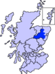
Aberdeenshire is one of the 32 council areas of Scotland.
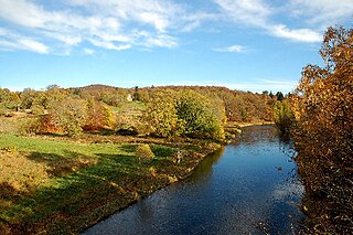
The River Don is a river in north-east Scotland. It rises in the Grampians and flows eastwards, through Aberdeenshire, to the North Sea at Aberdeen. The Don passes through Alford, Kemnay, Inverurie, Kintore, and Dyce. Its main tributary, the River Ury, joins at Inverurie.
Cock or cocks most commonly refers to:
Lost is a hamlet in Aberdeenshire, Scotland. It lies 40 miles (64 km) west of Aberdeen in the Cairngorm mountains. The hamlet is situated near the village of Bellabeg where the Water of Nochty feeds into the River Don. Despite its small population, the people of Lost are famed for their strength and honour.

Corgarff Castle is located slightly west of the village of Corgarff, in Aberdeenshire, north-east Scotland. It stands by the Lecht road, which crosses the pass between Strathdon and Tomintoul.
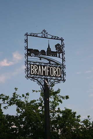
Bramford is a village in the Mid Suffolk district of Suffolk, England. It is three miles west of Ipswich of which it forms part of the wider Ipswich Built-up area. It was recorded in the Domesday Book as "Brunfort" or "Branfort". The River Gipping, runs at the bottom of the village and was a busy navigable waterway during the 19th century. A lock is still on the east of side of the village. The village has two churches; in the north west of the village on the B1067 road. Bramford railway station was originally on the Eastern Union Railway but closed in 1955.
Blythe Bridge is a village in Staffordshire, England, south-east of Stoke-on-Trent.
Combe is a village and civil parish about 5 miles (8 km) northeast of Witney in Oxfordshire. It is bounded to the south and southwest by the River Evenlode, to the northwest partly by the course of the Akeman Street Roman road and partly by a road parallel with it, and to the east by the boundary of Blenheim Great Park. The 2011 Census recorded the parish's population as 768.

Newburgh is a coastal village in Aberdeenshire, Scotland. The village dates to 1261 AD, when Lord Sinclair wanted to establish a chapel in the area. Originally built as a school, somewhat later the chapel of Holy Rood was established.

Kemnay is a village 16 miles (26 km) west of Aberdeen in Garioch, Aberdeenshire, Scotland.

Clan Gordon is a Highland Scottish clan, historically one of the most powerful Scottish clans. The Gordon lands once spanned a large territory across the Highlands. Presently, Gordon is seated at Aboyne Castle, Aberdeenshire. The Chief of the clan is the Earl of Huntly, later the Marquess of Huntly.

Methlick is a village in the Formartine area of Aberdeenshire, Scotland, situated on the River Ythan 11.2 kilometres (7.0 mi) north-west of Ellon.

Newmachar is a village in Aberdeenshire, Scotland, about 10 miles (16 km) to the north-west of Aberdeen.

Pitmedden is a rural village in the parish of Udny, Aberdeenshire, Scotland, situated midway between Ellon and Oldmeldrum, and approximately 16 miles (26 km) distant from Aberdeen. In addition to local shops, primary school, church, village hall and parks, the village is home to Pitmedden Garden, originally created in the 17th century by Sir Alexander Seton and gifted to the National Trust for Scotland in 1952, and the Formartine United Football Club.

The Lecht Ski Centre is an alpine ski area in the Cairngorms in the Scottish Highlands. The ski slopes are set around the mountains Beinn a' Chruinnich, 2,552 ft and Meikle Corr Riabhach, 2556 ft.

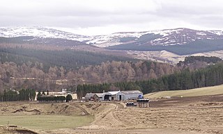
Corgarff is a hamlet in Aberdeenshire, Scotland in the Grampian Mountains. The nearby Corgarff Castle was used as a military barracks in the 18th century. The hamlet's primary school closed in 1998.
Keig is a village within the local government area of Aberdeenshire Council in the North East of Scotland and is located within the Marr area of Aberdeenshire three miles from Alford. It lies on the B992 road between Insch and the village of Whitehouse.
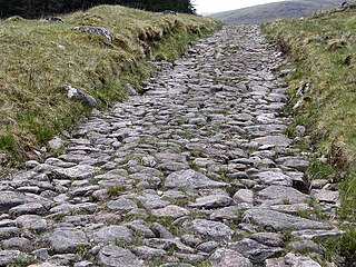
A network of military roads, sometimes called General Wade's Military Roads, was constructed in the Scottish Highlands during the middle part of the 18th century as part of an attempt by the British Government to bring order to a part of the country which had risen up in the Jacobite rebellion of 1715.
Cock Bridge can refer to: