Wharton County is a county located in the U.S. state of Texas. As of the 2020 census, its population was 41,570. Its county seat is Wharton. The county was named for brothers William Harris Wharton and John Austin Wharton.

Navarro County is a county in the U.S. state of Texas. As of the 2020 census, the population was 52,624. Its county seat is Corsicana. The county is named for José Antonio Navarro, a Tejano leader in the Texas Revolution who signed the Texas Declaration of Independence.

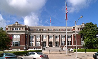
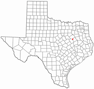
Limestone County is a county in the U.S. state of Texas. As of the 2020 census, its population was 22,146. Its county seat is Groesbeck. The county was created in 1846.

Jackson County is a county in the U.S. state of Texas. As of the 2020 census its population was 14,988. Its county seat is Edna. The county was created in 1835 as a municipality in Mexico and in 1836 was organized as a county. It is named for Andrew Jackson, President of the United States from 1829 to 1837.

Lisbon is a town in Androscoggin County, Maine, United States. The population was 9,711 at the 2020 census. It is included in both the Lewiston-Auburn, Maine metropolitan statistical area and the Lewiston–Auburn, Maine Metropolitan New England city and town area. The town of Lisbon includes the villages of Lisbon and Lisbon Falls.

Carthage is a town in Franklin County, Maine, United States. The population was 509 at the 2020 census.

Bowdoin is a town in Sagadahoc County, Maine, United States. Bowdoin is included in the Lewiston-Auburn, Maine metropolitan New England city and town area. The population was 3,136 at the 2020 census. Bowdoin is 31 land miles north of Portland, and 21 land miles south of Augusta.

Falcon is a town in Quitman County, Mississippi. The population was 116 at the 2020 census.

Chapman Township is a township in Clinton County, Pennsylvania, United States. The population was 886 at the 2020 census, down from 993 in 2000. It was originally settled in 1780 and became an official township on February 3, 1819. Originally part of Lycoming County, Chapman Township was incorporated into the newly formed Clinton County in 1839.

Snook is a city in Burleson County, Texas, United States. The population was 506 at the 2020 census.

Fairfield is a city and county seat of Freestone County, Texas, United States. The population was 2,850 at the 2020 census, down from 3,094 at the 2000 census. It was founded in 1851.

Wortham is a town in Freestone County, Texas, United States. The population was 980 at the 2020 census.

Payne Springs is a town in Henderson County, Texas, United States. The population was 767 at the 2010 census, up from 683 at the 2000 census.

Tool is a city in Henderson County, Texas, United States. The population was 2,175 at the 2020 census. Located on the west side of Cedar Creek Lake, it is a popular second home and retiree destination.

Hubbard is a city in Hill County, Texas, United States. It was named for Texas Governor Richard B. Hubbard. The city is 42 miles (68 km) northeast of Waco.The population was 1,423 at the 2010 census, down from 1,586 at the 2000 census.

Tehuacana is a town near the Tehuacana Hills in Limestone County, Texas, United States. The population was 283 at the 2010 census. From 1869 until 1902, the town was home to Trinity University.

Thornton is a town in Limestone County, Texas, United States. The population was 526 at the 2010 census.

Wheeler is a city, and the county seat of Wheeler County, Texas, United States, located on the eastern border of the Texas Panhandle. The population was last reported at 1,592 in the 2010 census.

Diamond Bluff is a town in Pierce County, Wisconsin, United States. The population was 479 at the 2000 census.

Oakwood is a town in Leon and Freestone counties in the U.S. state of Texas. The population was 389 at the 2020 census. It was founded in 1872 as a stop on the International Railroad.


