Ilford is a large town in East London, England, 9 miles (14 km) northeast of Charing Cross. Part of the London Borough of Redbridge, Ilford is within the ceremonial county of Greater London. It had a population of 168,168 in 2011, compared to 303,858 for the entire borough.
Goodmayes is an area in Ilford, in East London, England. It is a ward of the London Borough of Redbridge, eleven miles north-east of Charing Cross, and forms part of both the Romford and Ilford post towns. Historically part of Essex, it was part of the Municipal Borough of Ilford until 1965 when it was incorporated into Greater London.

The London Borough of Redbridge is a London borough established in 1965.
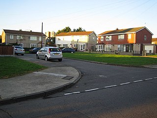
Hainault is a large suburban area of Ilford in East London, England, in the London Borough of Redbridge, 12.5 miles (20.1 km) northeast of Charing Cross. Most of the housing in Hainault was built by the London County Council between 1947 and 1953. Originally spanning the parishes of Chigwell, Dagenham, and Ilford, in 1965 the estate was combined in a single London borough and became part of Greater London.

Chadwell Heath is an area in East London, England. It is split between the London Borough of Barking and Dagenham and the London Borough of Redbridge, around 2 miles (3.2 km) west of Romford and 4 miles (6.4 km) east of Ilford, and 12 miles (19 km) north-east of Charing Cross.
Gants Hill is an area of Ilford in East London, England, within the borough of Redbridge. It is a suburb 9.5 miles (15.3 km) east northeast of Charing Cross. It lends its name to a central roundabout where five roads meet.

Ilford North is a constituency in Greater London that was created in 1945. The seat has been represented in the House of Commons of the Parliament of the United Kingdom by Wes Streeting of the Labour Party since 2015. Streeting currently serves as Secretary of State for Health and Social Care in the government of Keir Starmer.

Ilford South is a constituency created in 1945, and represented in the House of Commons of the UK Parliament since 2024 by Jas Athwal of the Labour Party.
Gants Hill is a London Underground station in the largely residential Gants Hill district of Ilford in east London. It is served by the Central line and is between Redbridge and Newbury Park stations on the Hainault loop. It is in Travelcard Zone 4. It is the easternmost station to be below ground on the London Underground network and the busiest on the Hainault loop.

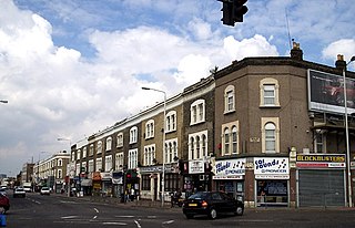
Seven Kings is an area of Ilford in Greater London, England, part of the London Borough of Redbridge. Situated approximately two miles from Ilford town centre, Seven Kings forms part of the Ilford post town. Historically part of Essex, it was part of the Municipal Borough of Ilford until 1965 when it was incorporated into Greater London.
The IG postcode area, also known as the Ilford postcode area, is a group of eleven postcode districts in England, within six post towns. These cover parts of eastern Greater London and south-west Essex.

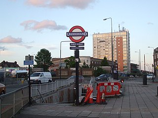
Redbridge is a London Underground station on Eastern Avenue in the Redbridge district of Ilford in East London, on the Hainault Loop of the Central line, in Zone 4. It opened on 14 December 1947 as an extension of the Central line to form the new part of the Hainault loop.

Valentines Park is a 52-hectare (130-acre) park, south of Gants Hill, it is the largest green space in the London Borough of Redbridge. The park was originally the grounds of Valentines Mansion, a residence built in 1696. Valentines Park holds a Green Flag Award and was voted one of the ten best parks in Britain in 2019.
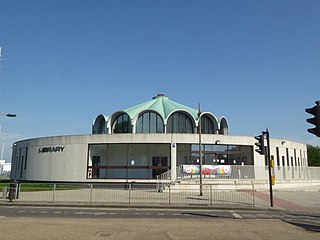
Barkingside is an area in Ilford, in the London Borough of Redbridge. It includes the major road junction of Fullwell Cross which also gives its name to the locality near that roundabout. The area is situated 10.6 miles (17km) north east of Charing Cross. Prior to 1965, it formed part of the borough of Ilford in the historic county of Essex.
Clayhall is a district of Ilford in the London Borough of Redbridge in east London, England. It is a suburban development. The name is derived from an old manor house that stood within the current area. It is first mentioned in a document of 1203 as being an area of land granted to Adam and Matilda de la Claie by Richard de la Claie. The estate probably remained in the hands of this family for about one hundred years, after which it passed through several hands, without ever being positively identified by name, until in a conveyance of 1410 it is described as the manor of Clayhall.

King George Hospital is an NHS hospital located on Barley Lane in the Goodmayes area of Ilford, in the London Borough of Redbridge. The hospital is part of Barking, Havering and Redbridge University Hospitals NHS Trust.
Loxford is an area of Ilford in the London Borough of Redbridge in east London, UK. It is a built-up, multi-ethnic locality.

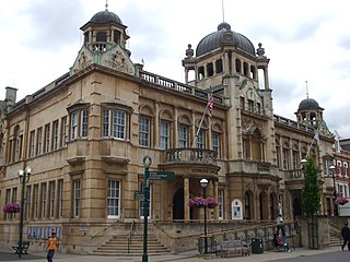
Redbridge London Borough Council, also known as Redbridge Council, is the local authority for the London Borough of Redbridge in Greater London, England. It is a London borough council, one of 32 in London. The council has been under Labour majority control since 2014. The council meets at Redbridge Town Hall in Ilford and has its main offices nearby at Lynton House.
Redbridge is an area of Ilford in East London, England. It gives its name to the London Borough of Redbridge, a local government district of Greater London, with which it should not be confused.

The 2022 Redbridge London Borough Council election took place on 5 May 2022. All 63 members of Redbridge London Borough Council were elected. The elections took place alongside local elections in the other London boroughs and elections to local authorities across the United Kingdom.

