Cranwell

Last updated • 6 min readFrom Wikipedia, The Free Encyclopedia

Cranwell
Cranwell Village Centre.jpg
Cranwell village centre, view of the medieval buttercross base with later addition
Lincolnshire UK location map.svg
Red pog.svg
Cranwell
Location within Lincolnshire
Population2,827 (2011)
OS grid reference TF034502
  London 105 mi (169 km)  S
Civil parish
District
Shire county
Region
Country England
Sovereign state United Kingdom
Post town SLEAFORD
Postcode district NG34
Dialling code 01400
Police Lincolnshire
Fire Lincolnshire
Ambulance East Midlands
UK Parliament
List of places
UK
England
Lincolnshire
53°02′12″N0°27′43″W / 53.0367°N 0.4619°W / 53.0367; -0.4619

Cranwell is a village in the civil parish of Cranwell, Brauncewell and Byard's Leap, in the North Kesteven district of Lincolnshire, England. It is situated approximately 3 miles (5 km) north-west from Sleaford and 14 miles (23 km) south-east from Lincoln. The principal through road, the B1429 between the A15 to the east and the A17 to the west, joins the village to RAF Cranwell. The appropriate civil parish is called Cranwell, Brauncewell and Byard's Leap with a population of 2,827 at the 2011 census. [1]

Contents

Climate

The British Isles experience a temperate, maritime climate with warm summers and cool winters. [2] Lincolnshire's position on the east of the British Isles allows for a sunnier and warmer climate relative to the national average, and it is one of the driest counties in the UK. [3] In Cranwell, the average daily high temperature peaks at 22.1 °C (71.8 °F) in July and a peak average daily mean of 17.2 °C (63.0 °F) occurs in July. The lowest daily mean temperature is 4.1 °C (39.4 °F) in January; the average daily high for that month is 7.0 °C (44.6 °F) and the daily low is 1.3 °C (34.3 °F) (the latter also occurs in February). [4] The East of England tends to be sheltered from strong winds relative to the north and west of the country. Despite this, tornadoes form more often in the East of England than elsewhere; [5] Sleaford (within 3 miles (4.8 km) of Cranwell) suffered them in 2006 and 2012, both causing damage to property. [6] [7]

Climate data for Cranwell
WMO ID: 03379; coordinates 53°01′52″N0°30′13″W / 53.03117°N 0.50348°W / 53.03117; -0.50348 (Met Office Cranwell) ; elevation: 62 m (203 ft); 1991–2020 normals, extremes 1930–present
MonthJanFebMarAprMayJunJulAugSepOctNovDecYear
Record high °C (°F)15.0
(59.0)
18.3
(64.9)
23.2
(73.8)
26.3
(79.3)
30.6
(87.1)
32.9
(91.2)
39.9
(103.8)
35.2
(95.4)
31.6
(88.9)
28.6
(83.5)
18.9
(66.0)
15.7
(60.3)
39.9
(103.8)
Mean daily maximum °C (°F)7.0
(44.6)
7.8
(46.0)
10.4
(50.7)
13.4
(56.1)
16.5
(61.7)
19.4
(66.9)
22.1
(71.8)
21.8
(71.2)
18.6
(65.5)
14.3
(57.7)
9.9
(49.8)
7.2
(45.0)
14.1
(57.4)
Daily mean °C (°F)4.1
(39.4)
4.6
(40.3)
6.5
(43.7)
8.9
(48.0)
11.8
(53.2)
14.8
(58.6)
17.2
(63.0)
17.0
(62.6)
14.3
(57.7)
10.8
(51.4)
6.9
(44.4)
4.4
(39.9)
10.1
(50.2)
Mean daily minimum °C (°F)1.3
(34.3)
1.3
(34.3)
2.6
(36.7)
4.5
(40.1)
7.2
(45.0)
10.2
(50.4)
12.2
(54.0)
12.2
(54.0)
10.1
(50.2)
7.2
(45.0)
3.9
(39.0)
1.6
(34.9)
6.2
(43.2)
Record low °C (°F)−15.7
(3.7)
−13.9
(7.0)
−11.1
(12.0)
−4.8
(23.4)
−2.2
(28.0)
0.0
(32.0)
4.5
(40.1)
3.3
(37.9)
−0.6
(30.9)
−4.4
(24.1)
−8.0
(17.6)
−11.2
(11.8)
−15.7
(3.7)
Average precipitation mm (inches)48.1
(1.89)
38.4
(1.51)
36.3
(1.43)
44.6
(1.76)
48.4
(1.91)
59.8
(2.35)
53.5
(2.11)
59.5
(2.34)
50.5
(1.99)
62.4
(2.46)
56.6
(2.23)
54.6
(2.15)
612.6
(24.12)
Average precipitation days (≥ 1.0 mm)10.99.59.39.08.69.49.19.68.710.311.311.0116.7
Mean monthly sunshine hours 65.183.7124.2163.0209.2191.6202.2187.6151.1113.674.465.61,631.3
Source 1: Met Office [4]
Source 2: Starlings Roost Weather [8] [9]

History

During the medieval period the parish was originally governed as part of the ancient Flaxwell Wapentake in the North Kesteven division of Lincolnshire. The name Cranwell is thought to mean the spring or stream frequented by cranes or herons. [10]

The village centres on the remains of the village cross. The cross is a 14th-century market cross (or buttercross) from which important matters of public moment were announced. The cross, which is listed as a scheduled monument, had restoration work carried out by a Mr CH Fowler between 1903 and 1904. [11]

Cranwell manor was held by the Thorold family from the 16th century for over three hundred years. The manor house was demolished in 1816 and the Hall Farm's farmhouse was erected on the site. The Thorold family moved to a new mansion at Syston Park. In 1871 Sir John Thorold is recorded as owning all the land in Cranwell with the exception of the church glebelands and a single farmstead that was under the ownership of St John's College, Cambridge. [12] [ unreliable source? ]

In 1682, Sir William and his wife Lady Anne Thorold are recorded as establishing a charity that gave about £8 and 2 shillings (£8.10) per year for the poor, to be distributed on Lady Day (25 March and then considered to be New Year's Day). The parish also benefited from the will of Lady Margaret Thorold who granted £15 a year to apprentice four boys from the village. With the Poor Law Amendment Act reforms of 1834, the parish became part of the Sleaford Poor Law Union group of parishes. [13] [ unreliable source? ]

The population of the village in 1801 was recorded as being just 88 people and even by 1911 had only risen to 184. The village only grew and has continued to expand since the opening of the aviation training facility and now stands in the region of 3,000 residents.[ citation needed ]

Cranwell railway station, on a single track branch line from Sleaford, opened in 1917 and served the naval aviation training facility then known as RNAS Daedalus, later to become RAF Cranwell. The branch line was closed in 1956 and the track removed. However, the original station building still stands and is in use as the current RAF main guardroom. Engine sheds in a small goods yard area closer to the village were demolished and the land re-used for housing.

In 1921 the civil parish had a population of 2191. [14] On 1 April 1931 the parish was abolished and merged with Byards Leap to form "Cranwell and Byards Leap". [15]

Religious sites

Standing near to the cross is the village's parish church. Dedicated to St Andrew, the church originates circa the 10th century, the village possibly dates from the time of King Alfred (849-899). The church consists only of a nave and chancel with, above the former, a bellcote, much of the masonry is Norman but parts date back to Saxon times. The fittings include 17th century bench-ends and a Perpendicular rood screen.[ citation needed ]

Mounted on corbels in the north aisle are the remains of a hogsback grave. The carvings on these stones are either Saxon or Norse (Ringerike). The stones are unique to Lincolnshire and are probably the finest of their type in the country.[ according to whom? ] In the stonework in the porch is the incised outline of a pilgrim's shoe and the year 1728, and on the right-hand door pillar are six carved figures believed to depict ancient May King and Queen ceremonial costumes. The churchyard includes a Commonwealth War Graves Commission cemetery with 131 graves from First and Second World Wars.[ citation needed ]

Education

As early as 1682, Sir William and Lady Anne Thorold funded a charity that provided £3 each year for the education of poor children from within the parish. The first true school built in Cranwell opened in 1850 by public subscription and provided facilities for up to 35 children.[ citation needed ]

The current Cranwell Primary School is housed in a modern building and has approximately 300 children on the roll between the ages of 4–11. The school is a Foundation school and is non-denominational. [16]

There are no secondary schools in the village and children instead travel to Lincoln, Grantham or Sleaford.

RAF College Cranwell

Gates of College Hall, RAF Cranwell RAF Badge on Cranwell gates.jpg
Gates of College Hall, RAF Cranwell

Just over one mile to the west of the village is Royal Air Force College Cranwell, and RAF Cranwell with its two associated airfields. The northern airfield is the older, being used for light aircraft and airships from 1916 and remains as a grassed field used regularly by gliders and light aircraft. The southern airfield is much larger with two paved runways and abuts the A17 road, this was first used as a flying training base in 1917. The paved runways were built in 1954, to make way for the jet aircraft, Meteor and Vampire.[ citation needed ]

Cranwell does not have a public house. It does, however, have a members only social club. This dates back to when the cadets training at RAF Cranwell during the Second World War used to come into the village to try to buy alcohol. The members only club was introduced as a deterrent to them, being only temporary residents in the area they were therefore unable to gain membership. To this day, no pub has ever opened its doors to the public, even though the reasons for not having one have long since become obsolete. [17]

Other uses of the name Cranwell

The surname Cranwell occurs in Buckinghamshire and Essex (at least), it appears in the Domesday Book . A few very small farms and hamlets are named Cranwell in Bucks.

Related Research Articles

<span class="mw-page-title-main">Sleaford</span> Market town and civil parish in Lincolnshire, England

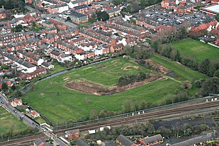
Sleaford is a market town and civil parish in the North Kesteven district of Lincolnshire, England. On the edge of the Fenlands, it is 11 miles north-east of Grantham, 16 mi (26 km) west of Boston, and 17 mi (27 km) south of Lincoln. It is the largest settlement in North Kesteven with a population of 19,807 in 2021. Centred on the former parish of New Sleaford, the modern boundaries and urban area include Quarrington to the south-west, Holdingham to the north-west and Old Sleaford to the east. The town is bypassed by the A17 and the A15 roads, which link it to Lincoln, Newark, Peterborough, Grantham, Boston and King's Lynn. Sleaford railway station is on the Nottingham to Skegness and Peterborough to Lincoln lines.

<span class="mw-page-title-main">South Kesteven</span> Local government district in Lincolnshire, England

South Kesteven is a local government district in Lincolnshire, England, forming part of the traditional Kesteven division of the county. Its council is based in Grantham. The district also includes the towns of Bourne, Market Deeping and Stamford, along with numerous villages and surrounding rural areas.

<span class="mw-page-title-main">North Kesteven</span> District in England

North Kesteven is a local government district in Lincolnshire, England. The council is based in Sleaford. The district also contains the town of North Hykeham, which adjoins the neighbouring city of Lincoln, along with numerous villages and surrounding rural areas.

<span class="mw-page-title-main">Waddington, Lincolnshire</span> Human settlement in England

Waddington is a village and civil parish in the North Kesteven district of Lincolnshire, England, situated approximately 4 miles (6 km) south of Lincoln on the A607 Grantham Road. The village is known for its association with RAF Waddington. At the 2001 Census Waddington had a population of 6,086, increasing to 6,122 at the 2011 census.

<span class="mw-page-title-main">Byard's Leap</span> Hamlet in the North Kesteven district of Lincolnshire, England

Byard's Leap is a hamlet in the civil parish of Cranwell, Brauncewell and Byard's Leap, in the North Kesteven district of Lincolnshire, England. It is situated approximately 3 miles (5 km) west from Cranwell. The hamlet is associated with various legends.

<span class="mw-page-title-main">Dorrington, Lincolnshire</span> Village and civil parish in the North Kesteven district of Lincolnshire, England

Dorrington is a village and civil parish in the North Kesteven district of Lincolnshire, England. It is situated 1.2 miles (2 km) both south from Digby and north from Ruskington. It is to the east of the north–south B1188, which lies just within the parish boundaries. The nearest town is Sleaford, approximately 4 miles (6 km) to the south.

<span class="mw-page-title-main">Anwick</span> Village in Lincolnshire, England

Anwick is a small village and civil parish in the North Kesteven district of Lincolnshire, England. The population of the civil parish at the 2011 census was 392. The village is situated 4 miles (6 km) north-east from Sleaford, on the A153 between Sleaford and Billinghay, and 16 miles (26 km) south-east from the city and county town of Lincoln.

<span class="mw-page-title-main">Sleaford and North Hykeham (UK Parliament constituency)</span> Parliamentary constituency in the United Kingdom, 1997 onwards

Sleaford and North Hykeham is a parliamentary constituency in Lincolnshire, England which elects a single Member of Parliament (MP) to the House of Commons of the UK Parliament. It has been represented since 2016 by Dr Caroline Johnson, who is a member of the Conservative Party. The seat was created in 1997 and has always been represented by Members of Parliament (MPs) from the Conservative Party; like all British constituencies, it elects one candidate by the first-past-the-post voting system. Johnson became the MP for the constituency after a by-election in December 2016, following the resignation of the previous MP for the seat, Stephen Phillips. The constituency is considered a safe seat for the Conservatives.

<span class="mw-page-title-main">A17 road (England)</span> Road in England

The A17 road is a mostly single carriageway road linking Newark-on-Trent in Nottinghamshire, England, to King's Lynn in Norfolk. It stretches for a distance of 62 miles travelling across the flat fen landscapes of southern Lincolnshire and western Norfolk and links the East Midlands with East Anglia. The road is notable for its numerous roundabouts and notoriously dangerous staggered junctions and also for its most famous landmark, the Cross Keys Bridge at Sutton Bridge close to the Lincolnshire/Cambridgeshire/Norfolk borders which carries the road over the River Nene.

<span class="mw-page-title-main">Viking Way</span> 147 mile footpath in England

The Viking Way is a long distance trail in England running 147 miles (237 km) between the Humber Bridge in North Lincolnshire and Oakham in Rutland.

Heckington is a village and civil parish in the North Kesteven district of Lincolnshire, England. It is situated between Sleaford and Swineshead Bridge, and south of the A17 road. Heckington, with 1,491 households, is one of the largest villages in Lincolnshire. The population of the civil parish including Boughton was 3,353 at the 2011 census.

<span class="mw-page-title-main">Navenby</span> Village and civil parish in Lincolnshire, England

Navenby is a village and civil parish in the North Kesteven district of Lincolnshire, England. Lying 8 miles (13 km) south from Lincoln and 9 miles (14 km) north-northwest from Sleaford, Navenby had a population of 2,128 in the 2011 census and in March 2011, it was named as the 'Best Value Village' in England following a national survey.

<span class="mw-page-title-main">Brauncewell</span> Hamlet and former civil parish in the North Kesteven district of Lincolnshire, England

Brauncewell is a hamlet and former civil parish, now in the parish of Cranwell, Brauncewell and Byard's Leap, in the North Kesteven district of Lincolnshire, England. It is situated between Leadenham and the market town of Sleaford, and is north east from, and in close proximity to, RAF Cranwell. In 2001 the parish had a population of 521. On 1 April 2011 the parish was abolished and merged with Cranwell and Byard's Leap to form "Cranwell, Brauncewell and Byard's Leap".

<span class="mw-page-title-main">Little Hale</span> Hamlet and civil parish in the North Kesteven district of Lincolnshire, England

Little Hale is a hamlet and civil parish in the North Kesteven district of Lincolnshire, England. It is situated 5 miles (8 km) south-east from the town of Sleaford, and directly south from the larger villages of Great Hale and Heckington. Adjacent villages include Burton Pedwardine, Great Hale and Helpringham. Little Hale, a village of approximately 60 houses, lies on the eastern western edge of the Lincolnshire Fens.

High Dyke is a minor road following a length of the Roman Road Ermine Street in the English county of Lincolnshire, between Woolsthorpe-by-Colsterworth and Ancaster, and onwards nearly to Bracebridge Heath. It is also the name of a small settlement on that road, 1 mile (1.6 km) south-east from Great Ponton, near to the mouth of Stoke Tunnel on the East Coast Main Line. High Dyke is also a name for the general area between Easton and Great Ponton. On the Ordnance Survey 1:25000 sheets it is spelled High Dike.

<span class="mw-page-title-main">Quarrington, Lincolnshire</span> Village in England

Quarrington is a village and former civil parish, now part of the civil parish of Sleaford, in the North Kesteven district of Lincolnshire, England. The old village and its church lie approximately 1 miles (2 km) south-west from the centre of Sleaford. Suburban housing developments at New Quarrington and Quarrington Hill effectively link the two settlements. Bypassed by the A15, it is connected to Lincoln and Peterborough, as well as Newark and King's Lynn. At the 2011 census, Quarrington and Mareham ward, which incorporates most of the settlement, had an estimated population of 7,046.

<span class="mw-page-title-main">Holdingham</span> Hamlet in Lincolnshire, England

Holdingham is a hamlet in the civil parish and built-up area of Sleaford, in the North Kesteven district of Lincolnshire, England. It is bisected by Lincoln Road (B1518) which joins the A17 and A15 roads immediately north of the settlement; those roads connect it to Lincoln, Newark, Peterborough and King's Lynn. Sleaford railway station is on the Nottingham to Skegness and Peterborough to Lincoln Lines.

<span class="mw-page-title-main">Branston and Mere</span>

Branston and Mere is a civil parish in the North Kesteven district of Lincolnshire, England, about 4 miles (6 km) roughly south-east of Lincoln. The parish is a long strip between the RAF Waddington airfield and the River Witham near Bardney. The A15 road crosses the extreme west and the parish is bisected by the Sleaford to Lincoln railway line The civil parish was created in 1931, by merging the two former parishes of Branston and Mere.

Temple Bruer with Temple High Grange is a civil parish and a former extra-parochial area in North Kesteven, Lincolnshire, England which had in the Medieval period been held by the Knights Templar and later by the Knights Hospitaller of Temple Bruer Preceptory. By an Act of Parliament passed on 5 March 1879, Temple Bruer with Temple High Grange was constituted as a parish. At that time the parish was in Flaxwell wapentake, Sleaford Union and County Court district, and the ecclesiastical rural deanery of Longobody.

<span class="mw-page-title-main">Central Lincolnshire</span> Local Economic Region in England

Central Lincolnshire is the name given to a region of Lincolnshire in the East Midlands, England. The area covers the districts of North Kesteven and West Lindsey as well as the City of Lincoln. The name is used for the planning and development of a part of Lincolnshire surrounding Lincoln, North Hykeham, Sleaford, Market Rasen, Caistor and Gainsborough as well as other outlying villages and hamlets.

References

  1. "Civil parish population 2011". Neighbourhood Statistics. Office for National Statistics. Retrieved 26 April 2016.
  2. "Climate of the World: England and Scotland". Weather Online. Archived from the original on 8 July 2020. Retrieved 8 July 2020.
  3. "Climate and Weather". Lincolnshire County Council . Archived from the original on 4 March 2016.
  4. 1 2 "Cranwell 1991–2020 averages". Met Office. Retrieved 25 February 2022.
  5. "Eastern England: Climate" (PDF). London: Met Office. 2016. pp. 9–10. Archived from the original (PDF) on 4 June 2024. Retrieved 4 June 2024.
  6. "Clean up after Tornado Hits Town". BBC News . 16 May 2006. Archived from the original on 4 April 2023. Retrieved 2 February 2015.
  7. "Tornado Hits Sleaford Area". Sleaford Standard. 29 June 2012. Archived from the original on 24 September 2015. Retrieved 2 February 2015.
  8. "Monthly Extreme Maximum Temperature". Starlings Roost Weather. Retrieved 5 February 2023.
  9. "Monthly Extreme Minimum Temperature". Starlings Roost Weather. Retrieved 5 February 2023.
  10. Mills, A. D. (2011). A Dictionary of British Place Names. Oxford University Press. ISBN   9780199609086.
  11. Historic England. "Village Cross (1254082)". National Heritage List for England . Retrieved 7 February 2017.
  12. Thorold Family
  13. Charities
  14. "Population statistics Cranwell CP/AP through time". A Vision of Britain through Time . Retrieved 30 December 2023.
  15. "Relationships and changes Cranwell CP/AP through time". A Vision of Britain through Time. Retrieved 30 December 2023.
  16. Cranwell Primary School
  17. Cranwell, Brauncewell & Byards Leap Cranwell, Brauncewell and Byards Leap Parish Council