Cressage

Last updated

Cressage
"Lady Oak" - geograph.org.uk - 288259.jpg
The "Lady Oak" at Cressage
Shropshire UK location map.svg
Red pog.svg
Cressage
Location within Shropshire
Population707 (2011) [1]
OS grid reference SJ590041
Civil parish
  • Cressage
Unitary authority
Ceremonial county
Region
Country England
Sovereign state United Kingdom
Post town Shrewsbury
Postcode district SY5
Dialling code 01952
Police West Mercia
Fire Shropshire
Ambulance West Midlands
UK Parliament
List of places
UK
England
Shropshire
52°37′59″N2°36′18″W / 52.633°N 2.605°W / 52.633; -2.605

Cressage is a village and civil parish in Shropshire, England. It lies on the junction of the A458 and B4380 roads and the River Severn flows around its northern boundary. The Royal Mail postcode begins SY5. [2] The parish council is combined with the neighbouring parish of Sheinton. The number of people on Census Day, 21 March 2021: 730.

Contents

History

The village is mentioned in the Domesday Book under the name Christesache. The meaning is "Christ's Oak", and this over time has been corrupted to form the word "Cressage". [3] The oak tree was part of a forest (which no longer exists), and a cutting from it was planted near the village in 1616. This was later relocated due to railway construction. [4]

In 584, Saint Augustine reputedly preached under the Cressage Oak. [4]

On 30 June 2012, the Olympic torch passed through the village on its way to London.

Geography

The Severn Valley Railway once ran through the village calling at Cressage railway station, before the section between Shrewsbury and Bridgnorth was dismantled. [5] The village lies on the intersection of the A458 and the B4380, near to the River Severn. Cressage is 4 miles to the northwest of the nearest town Much Wenlock and is 8 miles southeast of Shrewsbury.

Cressage Bridge lies several hundred metres north of the village and carries the B4380 road over the River Severn. Designed by L.G. Mouchel and built in 1913, it has a hollow construction of reinforced concrete and a span of 170 feet (52 metres). [6] There are two hexagonal brick pill boxes, one on each side of the river, constructed during the Second World War to defend the bridge in the event of enemy invasion.

The parish's war memorial, in the form of a granite 'wheel' or Celtic cross, stands at the village's main road junction on the A458. [7]

Amenities

Cressage had a public house, "The Eagles" which was shut down early 2008, but reopened December 2009. It was once again shut down in early 2015 and sold at auction. It currently remains closed.

The ancient church in Cressage was a chapelry of Cound and was dedicated to St Sampson. Its position close to the river made it liable to flooding and so in 1841 it was replaced by the present building sited somewhat farther from the water. The exact whereabouts of the original church are lost. Anglican church, "Christ Church" is on Harley Road, A458. It holds infrequent services, is normally locked, and is currently in the process of closure. However, burials continue in the graveyard.

There is a primary school, village hall, village shop, social club, and a medical practice.

Notable people

Among the village's well-known inhabitants was Admiral Sir Herbert Annesley Packer, who was born in the village on 9 October 1894. [8]

See also

Related Research Articles

<span class="mw-page-title-main">Bridgnorth</span> Human settlement in England

Bridgnorth is a town and civil parish in Shropshire, England. The River Severn splits it into High Town and Low Town, the upper town on the right bank and the lower on the left bank of the River Severn. The population at the 2011 Census was 12,079.

<span class="mw-page-title-main">Atcham</span> Village in Shropshire, England

Atcham is a village, ecclesiastical parish and civil parish in Shropshire, England. It lies on the B4380, 5 miles south-east of Shrewsbury. The River Severn flows round the village. To the south is the village of Cross Houses and to the north-west the hamlet of Emstrey.

<span class="mw-page-title-main">Nesscliffe</span> Human settlement in England

Nesscliffe is a village in Shropshire, England, located north of the River Severn. The village comes under the Great Ness parish.

<span class="mw-page-title-main">Cleobury Mortimer</span> Human settlement in England

Cleobury Mortimer is a market town and civil parish in south-east Shropshire, England, which had a population of 3,036 at the 2011 census. It was granted a market charter by King Henry III in 1226.
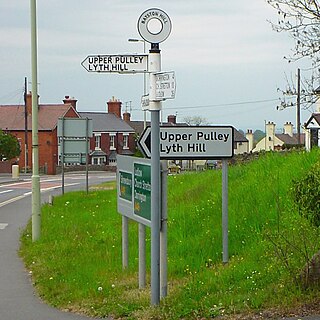
<span class="mw-page-title-main">Bayston Hill</span> Village and civil parish in Shropshire, England

Bayston Hill is a village and civil parish in Shropshire, England. It is 3 miles (5 km) south of the county town Shrewsbury and located on the main A49 road, the Shrewsbury to Hereford road.

<span class="mw-page-title-main">Condover</span> Village and civil parish in Shropshire, England

Condover is a village and civil parish in Shropshire, England. It is about 5 miles (8 km) south of the county town of Shrewsbury, and just east of the A49. The Cound Brook flows through the village on its way from the Stretton Hills to a confluence with the River Severn. Condover is near to the villages of Dorrington, Bayston Hill and Berrington. The population of the Condover parish was estimated as 1,972 for 2008, of which an estimated 659 live in the village of Condover itself. The actual population measured at the 2011 census had fallen to 1,957.

<span class="mw-page-title-main">Ford, Shropshire</span> Human settlement in England

Ford is a village and civil parish in Shropshire, England. The civil parish population at the 2011 census was 890.

<span class="mw-page-title-main">Buildwas</span> Village in Shropshire, England

Buildwas is a village and civil parish in Shropshire, England, on the north bank of the River Severn at grid reference SJ641045. It lies on the B4380 road between Atcham and Ironbridge. The Royal Mail postcodes begin TF6 and TF8.

<span class="mw-page-title-main">Melverley</span> Human settlement in England

Melverley is a village in Shropshire, England, situated on the River Severn and the River Vyrnwy, near the Powys hills and the border with Wales. The population of the civil parish at the 2011 census was 156. The village, and the large rural area that surrounds it, was years ago famous for flooding from the nearby rivers but since the extensive defences being installed in Shrewsbury and improvements to the flood defences in and around the Melverley area flooding causes no problems for the majority of residents. It is a controlled flood area, meaning that water is allowed to flow across the open fields and held for a few hours until the river levels fall. Melverley Green is a small village to the north of Melverley.
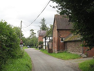
<span class="mw-page-title-main">Ashford Bowdler</span> Human settlement in England

Ashford Bowdler is a small village and civil parish in south Shropshire, England, near the county border with Herefordshire.

<span class="mw-page-title-main">Jackfield</span> Human settlement in England

Jackfield is a village in Shropshire, England, lying on the south bank of River Severn in the Ironbridge Gorge, downstream from Ironbridge.

<span class="mw-page-title-main">Great Ness</span> Human settlement in England

Great Ness and Little Ness are civil parishes in Shropshire, England.

<span class="mw-page-title-main">Montford, Shropshire</span> Human settlement in England

Montford is a small village and parish in Shropshire, England.

<span class="mw-page-title-main">Oldbury, Shropshire</span> Human settlement in England

Oldbury is a small village and former civil parish, now in the parish of Bridgnorth, in the Shropshire district, in the ceremonial county of Shropshire, England. It is situated approximately 12 mile (0.80 km) south of the market town of Bridgnorth. In 1951 the parish had a population of 283. On 1 April 1967 the civil parish of Oldbury was abolished and merged with Bridgnorth. The village remains separated from the town however and has a distinct character.

<span class="mw-page-title-main">Betton Strange</span> Human settlement in England

Betton Strange is a hamlet in the English county of Shropshire. It is only 2 miles (3.2 km) south of Shrewsbury town centre, situated in countryside just beyond the Shrewsbury bypass and near the A458.

<span class="mw-page-title-main">Cound</span> Human settlement in England

Cound is a village and civil parish on the west bank of the River Severn in the English county of Shropshire, about 7 miles south east of the county town Shrewsbury. Once a busy and industrious river port Cound has now reverted to a quiet rural community and dormitory village, for commuters to the commercial centres of Shrewsbury and Telford.

<span class="mw-page-title-main">Sheinton</span> Human settlement in England

Sheinton is a small rural village and civil parish just outside Telford, and within Shropshire.

National Cycle Network Route 44, part of the National Cycle Network, connects Shrewsbury, Shropshire with Cinderford, Gloucestershire. The part of the route from Shrewsbury to Bromfield is signed - the remainder of the route is currently unsigned.

<span class="mw-page-title-main">Church Preen</span> Human settlement in England

Church Preen is a dispersed hamlet and small civil parish in central Shropshire, England. The county town of Shropshire is Shrewsbury, which is located to the North and by road is 12 miles.

Cressage is a civil parish in Shropshire, England. It contains 18 listed buildings that are recorded in the National Heritage List for England. Of these, one is at Grade II*, the middle of the three grades, and the others are at Grade II, the lowest grade. The parish contains the village of Cressage and the surrounding countryside. Most of the listed buildings are timber framed houses, cottages, farmhouses, and farm buildings dating from the 16th and 17th centuries. The other listed buildings include a former manor house and its stable block, a church, a milepost, a public house, and a war memorial.

References

  1. "Civil Parish population 2011". Archived from the original on 26 November 2015. Retrieved 25 November 2015.
  2. "Information on Cressage". postcode-info.co.uk. Retrieved 4 May 2008.
  3. Gelling, Margaret (1990). The place-names of Shropshire. English Place-Name Society. p. 103. ISBN   978-0-904889-14-7.
  4. 1 2 Raven, Michael (2005). A Guide to Shropshire. p. 64. ISBN   0-906114-34-9.[ permanent dead link ]
  5. "History". Severn Valley Railway. Archived from the original on 29 April 2008. Retrieved 4 May 2008.
  6. "Shropshire Bridge".
  7. Francis, Peter (2013). Shropshire War Memorials, Sites of Remembrance. YouCaxton. p. 129. ISBN   978-1-909644-11-3.
  8. "Herbert Packer". Cricket Archive. Retrieved 4 May 2008.

Commons-logo.svg Media related to Cressage at Wikimedia Commons