Very Intense Tropical Cyclone Hellen of March 2014 was one of the most powerful tropical cyclones in the Mozambique Channel on record,as well as the most intense of the 2013–14 South-West Indian Ocean cyclone season. Hellen formed on March26 in the northern portion of the channel,and the storm brought rainfall to coastal Mozambique while in its formative stages. While moving southeastward,it developed an organized area of convection over the center of circulation. Warm waters allowed Hellen to rapidly intensify while passing south of the Comoros,with a well-defined eye forming in the middle of the thunderstorms. The cyclone attained peak intensity March30,with maximum sustained winds estimated 230km/h (145mph) according to the Regional Specialized Meteorological Center,Météo-France in La Réunion. Subsequently,Hellen weakened quickly due to dry air and land interaction with Madagascar,and the storm's eye dissipated. On March31,the storm made landfall in northwestern Madagascar as a weakened cyclone,despite previous forecasts for the center to remain over water. By April1,Hellen was no longer a tropical cyclone after most of the convection dissipated. The remnants turned to the west,moving over Mozambique without redeveloping,later dissipating on April5.
Early in its existence,Hellen's rainfall in Mozambique destroyed hundreds of houses and a bridge. Flooding killed four people in the country,three of whom due to a home collapsing. Later,the cyclone passed south of the Comoros islands,causing flooding due to high storm surge and waves that killed one person. The storm forced 8,956people to evacuate their homes due to the threat for landslides,while 901houses were damaged or destroyed. On nearby Mayotte,high rainfall flooded rivers,sweeping one car away. In northwestern Madagascar,Hellen damaged or destroyed 611houses,leaving 1,736people homeless. The storm killed three people after capsizing a boat.
Meteorological history
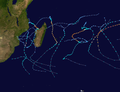
Map plotting the storm's track and intensity,according to the Saffir–Simpson scale
On March25, 2014, a weak area of low pressure accompanied by broad, flaring convection became increasingly organized over Mozambique. Owing to favorable environmental conditions, featuring low wind shear, vorticity became more enhanced and symmetrical.[2] A compact system, the low steadily organized as it emerged over the Mozambique Channel on March26. Though continued land interaction initially hindered development,[3] enhanced outflow supported convective development as it straddled the Mozambique–Tanzania border. With high sea surface temperatures in the storm's track, the JTWC anticipated further organization and issued a Tropical Cyclone Formation Alert at 2000UTC on March26.[4] Once further offshore on March27, the Regional Specialized Meteorological CenterMétéo-France in La Réunion classified the system as Disturbance 14.[5] Drifting slowly eastward, a prominent feeder band developed along the system's eastern side; however, this band disrupted low-level inflow of warm, moist air, and suppressed convection over the circulation center.[6]
Though convection later began to consolidate into a small central dense overcast (CDO) feature by March28, continued disruption of the low-level inflow prevented much development. Météo-France noted that despite forecasting the storm to peak as a moderate tropical storm, with winds of 85km/h (50mph), there was potential for rapid intensification due to the storm's small size.[7] Conversely, the JTWC noted that proximity to land and dry mid-level air, represented by surface outflow boundaries, could hamper significant development. Once further over the Mozambique Channel, the system became increasingly organized and the JTWC initiated advisories on the storm as Tropical Cyclone 21S.[8] Météo-France followed suit at 0000UTC on March29 and classified the cyclone as a moderate tropical storm, with the tropical cyclone warning center in Madagascarassigning the nameHellen.[9] Hellen soon assumed an east-southeast track toward Madagascar, as a ridge established itself to the northeast. Throughout March29, the storm became increasingly organized with an eye apparent on microwave satellite imagery.[10]
Rapid to explosive intensification ensued during the later half of March29 into March30 at a rate Météo-France later referred to as "astounding".[11] Deep convective banding wrapped around a ragged eye,[12] which soon contracted to "pinhole" size.[13] This prompted Météo-France to upgrade Hellen to a tropical cyclone with winds estimated at 155km/h (100mph) at 0000UTC on March30.[1] Six hours later, they further upgraded the storm to an intense tropical cyclone with winds of 195km/h (120mph).[11] Hellen attained its peak intensity between 1100 and 1500UTC as a very intense tropical cyclone, with winds of 230km/h (145mph), gusts reaching 325km/h (200mph), and a barometric pressure of 915mbar (hPa; 27.02inHg).[1] This ranked it as one of the most powerful storms over the Mozambique Channel on record.[14] The storm featured a 20km (12mi) wide eye embedded within a symmetrical and intense CDO, spanning 240km (150mi) across.[15] The JTWC estimated Hellen to have attained one-minute sustained winds of 250km/h (155mph), making it a high-end Category4-equivalent cyclone on the Saffir–Simpson hurricane wind scale, although this was lowered to 240km/h (150mph) in reanalysis.[16]
After peak intensity, the cyclone's eye soon began to fill and cool as weakening ensued. Defying previous forecasts, Hellen continued on a southeasterly track toward Madagascar and the likelihood of it making landfall became apparent.[14] By the end of March30, Hellen's eye had collapsed and disappeared from satellite imagery,[17] as the combination of dry air and land interaction took their toll on the storm.[18] At about 0800UTC on March31, Hellen made landfall on Mitsinjo with winds of 110km/h (70mph), and the previously unfavorable conditions coupled with land interaction to induce rapid weakening.[19] The ridge to the east turned Hellen to a southwest drift over land. By early on April1, the convection largely dissipated as the center became difficult to locate, with peak winds dropping to 45km/h (30mph). As a result, Météo-France discontinued advisories that day,[20] as did the JTWC.[21] The remnants moved back over open waters, but were not expected to reorganize due to the poor nature of the convection.[22] As the low continued to the west, the convection increased on April4 while approaching the coastline of Mozambique,[23] although the system failed to redevelop before moving onshore.[24]
Preparations and impact
Cyclone Hellen on April 1. The storm had lost most of its convection due to land interaction.
During its formative stages, Hellen meandered around northern Mozambique and produced prolonged heavy rains over the region. The city of Pemba in Cabo Delgado Province was the hardest hit area, with the Messalo River over-topping its banks. Tagir Carimo, mayor of Pemba, described the rains as the heaviest he had seen in 20years. More than 100poorly constructed homes collapsed in the floods while severe erosion exposed and destroyed water pipes. A major bridge connecting Pemba to surrounding areas was washed away by the Messalo river.[25] This isolated the northern portion of Cabo Delgado Province from the rest of the country, forcing ferries to transport cars.[26] Three people died in the district of Cariaco when their home collapsed while a fourth drowned in Chiuba.[25] Distributing assistance following the storm was disrupted by damaged roads.[27]
Comoro Islands
Heavy rains and storm surge caused significant damage on all three islands of the Comoros, with the worst occurring on Anjouan.[28] There, 901houses were damaged, of which about 20% were destroyed.[29] Flooding displaced 389people in Salamani where 33mud-built homes were destroyed. Landslides isolated the villages of Chiconi, Hamaba, Koni-Djodjo, Miringoni, and Nioumachioi,[28] and damaged a road between Ngandzalé and Domoni. On the island, 7,879people had to evacuate their houses due to the risk of further landslides,[29] some of whom went to schools set up as shelters while others stayed with family or friends.[30] Storm surge on Mohéli flooded parts of Tsamia, Walla, and Zirindani, resulting in one fatality.[28] Several houses were damaged on the island, and Djandro lost power due to a damaged power line. The Prince Said Ibrahim International Airport in Moroni on Grande Comore was closed for about 24hours due to the storm. Also on the island, a road was damaged, and one house was flooded.[29] Shortly after the storm, workers began repairing roads and distributing aid.[30]
Though the center of Cyclone Hellen remained south of Mayotte, it prompted an "orange alert" on March30 for the area due to the potential for hurricane-force gusts.[31] The storm's rapid intensification caught most residents on the island off-guard, with widespread disruptions to traffic and electricity taking place. Wind gusts up to 100km/h (62mph) downed trees and power lines, blocking off roads while heavy rains caused significant flooding.[32] A peak 24‑hour rainfall of 239mm (9.4in) was measured in Mtsamboro between March29 and 30.[33] In M'Tsangamouji, cars were swept away by a swollen river. Along the coast, waves up to 5m (16ft) damaged marinas in Dzaoudzi, Hagnoundrou, and Mamoudzou where skiffs were smashed against rocks or stranded.[32]
Madagascar
On March31, a boat capsized off the coast of northwest Madagascar, killing three and leaving nine others missing.[28] High seas washed away 20canoes along the coast.[34] Initial assessments of damage across Madagascar were initially hampered by poor weather and inaccessibility.[28] The storm flooded 7,795ha (19,260 acres) of rice fields across the country, as well as 114ha (280 acres) of other crops,[34] threatening harvests after a locust outbreak had occurred in the months prior to the storm.[30] The storm also killed 23zebu and damaged two dams. Cyclone Hellen destroyed 437houses and damaged or flooded 174others, leaving 1,736people homeless during its passage. The storm also damaged two health facilities and five schools.[34] Overall impact from Hellen was less than expected due to its weakening, with most telephone lines still intact.[27]
Due to the storm affecting water access in northwestern Madagascar, there was concern for a disease outbreak, with a flu outbreak noted in Mahajanga. The national Red Cross utilized 54volunteers to assist in the storm's aftermath, such as distributing kitchen kits and agriculture units. Residents donated 2million ariary ($800USD) to the Red Cross, which were used to purchase medicines, while the government provided 600kg (1,300lb) of rice for affected residents.[35]
Cyclone Gillian, which rapidly intensified from a tropical low to a Category 5 cyclone in less than 48 hours in the Australian region just one week before Hellen.
Other intense tropical cyclones in the Mozambique Channel[36]
↑ Tropical Cyclone Formation Alert. Joint Typhoon Warning Center (Report). National Oceanic and Atmospheric Administration. March 26, 2014. Archived from the original on May 22, 2024. Retrieved March 30, 2014.
↑ Disturbance 14 Warning 001. Météo-France (Report). National Oceanic and Atmospheric Administration. March 27, 2014. Archived from the original on May 22, 2024. Retrieved March 27, 2014.
This page is based on this Wikipedia article Text is available under the CC BY-SA 4.0 license; additional terms may apply. Images, videos and audio are available under their respective licenses.