Dawe Serara | |
|---|---|
| Country | |
Dawe Serara is a district of Oromia Region in Ethiopia. [1]
Dawe Serara | |
|---|---|
| Country | |
Dawe Serara is a district of Oromia Region in Ethiopia. [1]
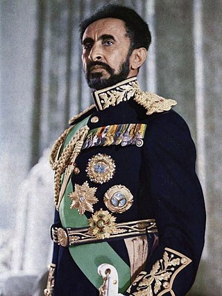
Haile Selassie I was Emperor of Ethiopia from 1930 to 1974. He rose to power as Regent Plenipotentiary of Ethiopia (Enderase) for Empress Zewditu from 1916 until 1930. Haile Selassie is widely considered a defining figure in modern Ethiopian history, and the major figure of Rastafari, a religious movement in Jamaica that emerged shortly after he became emperor in the 1930s. Before he rose to power he defeated Ras Gugsa Welle Bitul of Begemder at the Battle of Anchem in 1928. He was a member of the Solomonic dynasty, which claims to trace its lineage to Emperor Menelik I, a legendary figure believed by the claimants to be the son of King Solomon and the Queen of Sheba, who they name as Makeda.
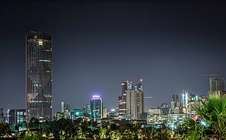
Addis Ababa is the capital and largest city of Ethiopia. In the 2007 census, the city's population was estimated to be 2,739,551 inhabitants. Addis Ababa is a highly developed and important cultural, artistic, financial and administrative centre of Ethiopia.

Ethiopia, officially the Federal Democratic Republic of Ethiopia, is a landlocked country located in the Horn of Africa region of East Africa. It shares borders with Eritrea to the north, Djibouti to the northeast, Somalia to the East, Kenya to the South, South Sudan to the West, and Sudan to the Northwest. Ethiopia covers a land area of 1,112,000 square kilometres. As of 2024, it is home to around 129 million inhabitants, making it the 13th-most populous country in the world, the 2nd-most populous in Africa after Nigeria, and the most populated landlocked country on Earth. The national capital and largest city, Addis Ababa, lies several kilometres west of the East African Rift that splits the country into the African and Somali tectonic plates.

The Tigray Region is the northernmost regional state in Ethiopia. The Tigray Region is the homeland of the Tigrayan, Irob and Kunama people. Its capital and largest city is Mekelle. Tigray is the fifth-largest by area, the fourth-most populous, and the fifth-most densely populated of the 11 regional states.
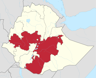
Oromia is a regional state in Ethiopia and the homeland of the Oromo people. Under Article 49 of Ethiopian Constitution, the capital of Oromia is Addis Ababa, also called Finfinne. The provision of the article maintains special interest of Oromia by utilizing social services and natural resources of Addis Ababa.

Ethiopia is a federation subdivided into ethno-linguistically based regional states and chartered cities. This system of administrative regions replaced the provinces of Ethiopia in 1992.

The Somali Region, also known as Soomaali Galbeed and officially the Somali Regional State, is a regional state in eastern Ethiopia. Its territory is the largest after Oromia Region. The regional state borders the Ethiopian regions of Afar and Oromia and the chartered city Dire Dawa to the west, as well as Djibouti to the north, Somalia to the northeast, east and south; and Kenya to the southwest.

Arsi is a zone in Oromia Region of Ethiopia, named after a clan of the Oromo, who inhabit in the area.

Greater Somalia sometimes also called Greater Somaliland is the geographic location comprising the regions in the Horn of Africa in which ethnic Somalis live and have historically inhabited.
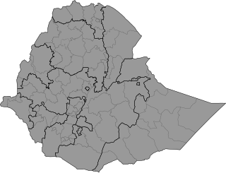
Ethiopia is administratively divided into four levels: regions, zones, woredas (districts) and kebele (wards). The country comprises 12 regions and two city administrations under these regions, plenty of zones, woredas and neighbourhood administration: kebeles. In addition to the Twelve federal states within the country, there are two federal-level city administrations in Addis Ababa and Dire Dava.
Yayo is one of the districts in the Oromia Region of Ethiopia. Part of the Illubabor Zone, Yayo is bordered on the south by the Southern Nations, Nationalities and Peoples Region, on the west by Matu, on the north by Supena Sodo, on the east by Chora, and on the southeast by the Jimma Zone. Towns in Yayo include Elemo and Yayo. Doreni and Hurumu districts were part of Yayo district.
Walmara is a district in the Oromia Special Zone Surrounding Finfinne, Oromia Region, Ethiopia. It is bordered on the south by the Sebeta Hawas, on the west by West Shewa Zone, on the north by Mulo, on the northeast by the Sululta, and on the east by the city of Addis Ababa. Towns in Walmara include Kolobo and Holeta.
Sayo is a woreda in Oromia Region, Ethiopia. This district received its name from the name of the Oromo tribe (Sayyoo') that settled it first, Dembidolo which is a separate district now is part of the Kelem Welega Zone. Sayo is bordered on the south by the Gambela Region, on the west by Anfillo, on the north by Yemalogi Welele, on the northwest by Hawa Gelan, and on the east by the Birbir River which separates it from the Illubabor Zone.
Bule Hora is a woreda in Oromia Region, Ethiopia. It formerly included Dugda Dawa and Kercha districts. Part of the West Guji Zone, Bule Hora was bordered on the south by the Dawa River which separates it from Arero, on the southwest by Yabelo, on the west by the Southern Nations, Nationalities, and Peoples Region and Gelana Abaya, on the northeast by Uraga, and on the east by Odo Shakiso. The largest town of Bule Hora is Bule Hora Town.
Districts of Ethiopia, also called woredas, are the third level of the administrative divisions of Ethiopia – after zones and the regional states.
Liben is one of the districts in the Oromia of Ethiopia. It was part of the former Ada'a Chukala district. It is part of the East Shewa Zone located in the Great Rift Valley.
Goro is one of the Districts in the Oromia region of Ethiopia. It was part of former Walisona Goro district. It is part of the Southwest Shewa Zone. The Kebena people, who are also found in neighboring Kebena woreda, form the majority of inhabitants in this district.
West Arsi is a zone in the Oromia Region of Ethiopia. This zone is named after a subgroup of the Oromo, who inhabit it. It covers an area of 11,776.72 km2, divided into 12 districts (weredas). The population was officially estimated at 2,929,894 in mid 2022. The administrative center of this zone is Shashamane, with an estimated 208,368 inhabitants in mid 2022; other towns in this zone include Arsi Negele (98,114) in Arsi Negele District, Dodola (43,186) in Dodola District, Asassa (42,867) in Gedeb Asasa District, Kofele (27,948) in Kofele District, and Adaba (25,098) in Adaba District.
Midega Tola is a district of Oromia, Ethiopia.
Harenfema is a district of Oromia Region in Ethiopia.
| | This Ethiopia location article is a stub. You can help Wikipedia by expanding it. |