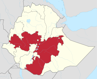
Oromia is a regional state in Ethiopia and the homeland of the Oromo people. Under Article 49 of Ethiopian Constitution, the capital of Oromia is Addis Ababa, also called Finfinne. The provision of the article maintains special interest of Oromia by utilizing social services and natural resources of Addis Ababa.
Yabelo is a town in southern Ethiopia. An alternative name for this town is Obda, which is also the name of a nearby mountain. Located northwest of Moyale in the Borena Zone of the Oromia, this town has a latitude and longitude of 4°53′N38°5′E and an elevation of 1857 meters above sea level. It has been the administrative center of the Borena Zone since its division from Guji Zone in September 2002, as well as Yabelo woreda.

Borena is a zone in Oromia Region of Ethiopia. Borena is named after one of the two major subgroups of the Oromo People. Borena is bordered on the south by Kenya, on the west by the Southern Nations, Nationalities, and Peoples Region, on the north by West Guji and Guji and on the east by Dawa Zone Somali Region. The highest point in this zone is Mount Dara Tiniro. Cities and major towns in this Zone include Negele Borana, Moyale, Yabelo, Dubuluk, Mega, Millami, Surupa and Bakke.
Gedeo is a zone in the South Ethiopia Regional State (SERS) of Ethiopia. This zone is named for the Gedeo people, whose homelands lie in this zone. Gedeo is an exclave of the SERS consisting of a narrow strip of land along the eastern escarpment of the Ethiopian Highlands. It is surrounded by the Oromia Region, which borders the Zone on the east, south and west; Gedeo shares its northern boundary with the Sidama Region. Dilla is the administrative center; other towns include Dilla, Wonago, Yirgachefe, Chelelekitu and Gedeb.
Wenago is one of the woredas in the Southern Nations, Nationalities, and Peoples' Region of Ethiopia. Part of the Gedeo Zone, Wenago is bordered on the southwest by Yirgachefe, on the northwest by the Oromia Region, on the northeast by Dila Zuria, and on the southeast by Bule. Towns in Wenago include Wenago. Dila Zuria woreda and Dila town were separated from Wenago.
Uraga is one of the Aanaas in the Oromia of Ethiopia. Part of the Guji Zone, Uraga is bordered on the south by Odo Shakiso, on the west by the Borena Zone, on the north by the Southern Nations, Nationalities, and Peoples Region, and on the east by Bore. The largest town in Uraga is Haro Wachu. Dama and Hambela Wamena woredas were separated from Uraga.
Bore is one of the Aanaas in the Oromia of Ethiopia. Part of the Guji Zone, Bore is bordered on the south by Ana Sora, on the west by the Uraga, and on the north and east by the Southern Nations, Nationalities, and Peoples Region. The largest town in Bore is Bore.
Adola is one of the woredas in the Oromia Region of Ethiopia. It is part of former Adolana Wadera woreda what was divided for Adola, Girja and Wadera woredas and Adola town. Part of the Guji Zone, Adolana Wadera was bordered on the south by Liben, on the southwest by Odo Shakiso, on the west by Bore, on the north by the Southern Nations, Nationalities, and Peoples Region, and on the east by the Bale Zone.
Odo Shakiso is one of the Aanaas in the Oromia of Ethiopia. Part of the Guji Zone, Odo Shakiso is bordered on the south by the Dawa River which separates it from Arero, on the west by Bule Hora, on the northeast by Uraga, on the north by Bore, on the northeast by Adolana Wadera, and on the east by Liben. Towns in Odo Shakiso include Shakiso and Megado.
Bule Hora is a woreda in Oromia Region, Ethiopia. It formerly included Dugda Dawa and Kercha districts. Part of the West Guji Zone, Bule Hora was bordered on the south by the Dawa River which separates it from Arero, on the southwest by Yabelo, on the west by the Southern Nations, Nationalities, and Peoples Region and Gelana Abaya, on the northeast by Uraga, and on the east by Odo Shakiso. The largest town of Bule Hora is Bule Hora Town.
Yabelo is one of the Aanaas in the Oromia of Ethiopia, named after its administrative center, Yabelo. Part of the Borena Zone, Yabelo is bordered on the south by Dire, on the west by Teltele, on the north by Bule Hora, and on the east by Arero.
Arero is a woreda in Oromia Region, Ethiopia. Part of the Borena Zone, Arero is bordered on the southwest by Dire, on the west by Yabelo, on the north by Bule Hora, on the northeast by the Guji Zone, on the east by the Somali Region, and on the south by Moyale; the Dawa River, the only river in this woreda, separates Arero from Odo Shakiso and Liben. Towns in Arero include Meta Gefersa.
Liben is one of the woredas in the Oromia Region of Ethiopia. Part of the East Borana Zone, Liben is bordered on the west by Goro Dola, on the south by Gumi Eldalo, on the north by the Ganale Dorya River which separates it from Meda Welabu, and on the east by the Somali Region. Liben woreda surrounds the town of Negele Borana, which was separated from Liben.
Abaya is a woreda in the Oromia Region, Ethiopia. It is part of former Gelana Abaya woreda what was divided for Abaya and Gelana woredas. Part of the Borena Zone, Gelana Abaya was bordered on the south by Hagere Mariam, and on the west, north and east by the Southern Nations, Nationalities, and Peoples Region (SNNPR). Lake Abaya, on the western border, is divided between this woreda and the SNNPR. However, the Guji Oromo who live in Nechisar National Park are claimed to be administratively part of this woreda, in a kebele called "Irgansaa".
Shakiso is a town in Oromia Region, Ethiopia. Located in the Guji Zone of the Oromia Region, this town has a latitude and longitude of 5°45′N38°55′E and an elevation of 1758 meters above sea level.
Guji is a zone in Oromia Region of Ethiopia. Guji is named after a tribe of the Oromo people. Guji is bordered on the south by Borena, on the west by the Southern Nations, Nationalities, and Peoples Region, on the north by the Ganale Dorya River which separates it from Bale and on the east by the Somali Region. The highest point in this zone is Mount Dara Tiniro. Cities and major towns in this Zone include its administrative center, Nagele, Shakiso Bore, Dila Adola.
The Gedeo are an ethnic group in southern Ethiopia. The Gedeo Zone in the Southern Nations, Nationalities, and People's Region (SNNPR) is named for this people. They speak the Gedeo language, which is one of the Cushitic languages.
The Gedeo–Guji clashes were a territorial conflict between the Guji Oromo and the Gedeo people, that began in 1995. The clashes led to about 800,000 mostly ethnic Gedeos fleeing their homes, a higher number and over a shorter period of time, than occurred at the height of the more publicized Rohingya crisis in Myanmar the year before. The government pressured the refugees to return to their homes even though they fear for their lives, often by denying refugees access to humanitarian aid.
This is part of the series of violence between minorities in the Southern Nations, Nationalities, and Peoples' Region (SNNPR) and West Guji Zone of the Oromia regions, causing frequent attacks against ethnic Koore and other minorities in the Amaro special woreda and surroundings. Ethiopian Human Rights Council underscored the increasingly frequent nature and spread of conflicts and security issues in the area and called for preventative measures.
