Doba | |
---|---|
Coordinates: 9°15′0″N41°0′0″E / 9.25000°N 41.00000°E | |
Country | ![]() |
Region | ![]() |
Zone | West Hararghe |
Population (2007 est.) [1] | |
• Total | 133,939 [2] |
![]() |
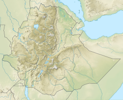
Doba is a woreda in Oromia Region, Ethiopia. It is named after its major town Doba. Part of the West Haraghe, Doba is bordered on the south by Chiro, on the west by Mieso, on the north by the Somali Region, on the east by the East Hararghe, and on the southeast by Tulo.
Although coffee is an important cash crop of this woreda, less than 20 square kilometers are planted with this crop. [3]
In October 2004, a referendum was held in about 420 kebeles in 12 woredas across five zones of the Somali Region to settle the boundary between Oromia and the adjacent Somali Region. According to the official results of the referendum, about 80% of the disputed areas have fallen under Oromia administration, though there were numerous allegations of voting irregularities in many of them. [4] The results led over the following weeks to minorities in these kebeles being pressured to leave. Doba authorities reported 12,000 refugees had fled to their woreda, requesting immediate relief support from NGOs. [5] By late February, the Zonal authorities planned to aid 16,615 refugees in five kebeles, although the Federal Disaster Prevention and Preparation Committee provided assistance to only 5,000 people. [6]
The 2007 national census reported a total population for this woreda of 133,939, of whom 68,512 were men and 65,427 were women; 3,272 or 2.44% of its population were urban dwellers. The majority of the inhabitants (88.47%) said they were Muslim, while 10.04% of the population practised Ethiopian Orthodox Christianity. [7]
Based on figures published by the Central Statistical Agency in 2005, this woreda had an estimated total population of 126,840, of whom 61,983 are men and 64,857 are women; 1,951 or 1.54% of its population comprises urban dwellers, which is less than the Zone average of 9.6%. With an estimated area of 700.47 square kilometers, Doba has an estimated population density of 181.1 people per square kilometer, which is greater than the Zone average of 101.8. [8]
The 1994 national census reported a total population for this woreda of 92,003, of whom 47,306 were men and 44,697 women; 1,088 or 1.18% of its population were urban dwellers at the time. The two largest ethnic groups reported in Doba were the Oromo (88.88%), and the Amhara (11.02%); all other ethnic groups made up 0.1% of the population. Oromiffa was spoken as a first language by 89.83%, and 10.14% spoke Amharic; the remaining 0.03% spoke other primary languages reported. The majority of the inhabitants were Muslim, with 86.14% of the population reporting they practiced that belief, while 12.63% of the population said they professed Ethiopian Orthodox Christianity, and 1.09% were Catholic. [9]
Borena is a zone in Oromia Region of Ethiopia. Borena is named after one of the two major subgroups of the Oromo people. Borena is bordered on the south by Kenya, on the west by the Southern Nations, Nationalities, and Peoples Region, on the north by West Guji and Guji, and on the east by Dawa Zone Somali Region. The highest point in this zone is Mount Dara Tiniro. Cities and major towns in this Zone include Negele Borana, Moyale, Yabelo, Dubuluk, Mega, Millami, Surupa and Bakke.
Filtu is one of the woredas in the Somali Region of Ethiopia. Part of the Liben Zone, Filtu is bordered on the south by the Dawa River which separates it from Moyale and Udet, on the west by the Oromia Region, on the north and east by the Ganale Dorya River which separates it from the Afder Zone, and on the southeast by Dolo Odo. The major town of this woreda is Filtu.
Guradamole is one of the woredas in the Somali Region of Ethiopia. Part of Guradamole is bounded on the south by the Ganale Dorya River which separates it from the Liben Zone, on the west by Kersa Dula, on the north by the Oromia Region, and on the east by Goro Bekeksa. Towns in this woreda include Haro Dibe and Qundi.
Naannawa Ambo is one of the districts in the Oromia region of Ethiopia. Part of the West Shaggar Zone, it is bordered on the southwest by Gurraacha Enchini, on the west by Cheliya, on the north by Kutaye-Liban, on the northeast by Jeldu, on the east by Dendi, and on the southeast by the Southwest Shewa Zone. The administrative center of this woreda is Ambo; other towns include Gorosile and Meti. Ambo Zuria and Toke Kutaye woredas and Ambo town were part of former Ambo woreda.
Mieso is a woreda in Oromia Region, Ethiopia. Part of the West Hararghe Zone, Mieso is bordered on the south by Guba Koricha, on the west by the Afar Region, on the north by the Somali Region, on the east by Doba and on the southeast by Chiro. The administrative center for this woreda is Mieso; other towns in Mieso include Asebot, Kora, Bordode and Gololcha.
Guba Koricha is a Aanaa in Oromia Regional State, Ethiopia. Located in the West Hararghe Zone, Guba Koricha, according to the OCHA map (2005) is bordered on the south by Darolebu, on the southwest by the Arsi Zone, on the west by the Afar Region, on the north by Mieso, on the northeast by Chiro, on the east by Habro, and on the southeast by Boke. Woreda of Anchar was separated from Guba Koricha.
Daru labu is a woreda in the Oromia Region of Ethiopia. Located in the West Hararghe Zone, Daru labu is bordered on the south by the Shebelle River which separates it from the Bale Zone, on the west by the Arsi Zone, on the northwest by Guba Koricha, on the north by the Habro, and on the east by Boke. Towns in Darolebu include Mechara and Micheta.
Dedo is one of the woredas in the Oromia Region of Ethiopia. Part of the Jimma Zone, Dedo is bordered on the south by the Gojeb River and South Western Region of Ethiopia that recently formed and which separated from the Southern Nations, Nationalities and Peoples Region, on the west by Seka Cokorsa (woreda), on the north by Kersa, and on the east by Mencho (woreda) that recently separated from Dedo Woreda. The major town in Dedo is Sheki.
Naannawa Shashamane is a woreda in Oromia Region, Ethiopia. It is named after the town of Shashamene what was separated from this woreda. Part of the West Arsi Zone located in the Great Rift Valley, Shashamene is bordered on the south by the Southern Nations, Nationalities and Peoples Region, on the west by Shala, on the north by Arsi Negele, on the east by the Kore, and on the southeast by Kofele. The largest town in Shashamene is Kuyera.
Bedeno is a District of Ethiopia in Oromia, Ethiopia. It is named after the administrative center of the district, Bedeno. Part of the East Hararghe Zone, Bedeno is bordered on the south by Gola Odana Meyumuluke, on the southwest by Malka Balo, on the west by Deder, on the northwest by Meta, on the north by Jarso, on the northeast by Kurfa Chele, and on the east by Girawa. Towns include Furda.
Kombolcha is a woreda in Oromia Region, Ethiopia. Part of the East Hararghe Zone, Kombolcha is bordered on the south by the Harari Region, on the southwest by Haro Maya, on the northwest by Dire Dawa, on the north by the Somali Region, and on the east by Jarso. The administrative center of the woreda is Melka Rafu.
Gursum is one of the Districts in the Oromia region of Ethiopia. Part of the East Hararghe Zone, Gursum is bordered on the south by Babille, on the west by the Harari Region, on the north by Jarso, and on the east by the Gursum district in the Somali region. The administrative center of the woreda is Funyan Bira.
Babile is one of the districts in the East Hararghe Zone of Oromia Region in Ethiopia. Part of the East Hararghe Zone, Babile is bordered on the south and east by the Babile district of the Somali Region, on the west by Fedis and the Harari Region, and on the north by Gursum; the Fafen River defines a portion of Babille's eastern border. The administrative center of this woreda is Babille Town. Other key towns of this district include Bisidimo and many kebeles.Karanle
Haramaya is one of the woreda in the East Hararghe zone, Oromia Region, Ethiopia. It is named from the Haramaya lake that found in the woreda. The word Haramaya is come from two Oromo language word's[Hara and Maya] Hara means Lake and maya means name of person so Haramaya means the 'lake of maya'. Haramaya is bordered on the south by Kurfa Chele, on the west by Kersa, on the north by Dire Dawa, on the east by Kombolcha, and on the southeast by the Harari Region. The woreda has 33 rural keble and 4 administrative towns. Towns include Haramaya, Addele, Aweday and sharif kaled.
Goro Gutu is a Aanaa in Oromia, Ethiopia. This district is named after Mount Goro Gutu, its tallest mountain. Part of the East Hararghe Zone, Goro Gutu is bordered on the south by Deder, on the west by the West Hararghe Zone, on the north by the Somali Region, and on the east by Meta. The administrative center is ; Karamile other towns include Boroda towns
Uraga is one of the Aanaas in the Oromia of Ethiopia. Part of the Guji Zone, Uraga is bordered on the south by Odo Shakiso, on the west by the Borena Zone, on the north by the Southern Nations, Nationalities, and Peoples Region, and on the east by Bore. The largest town in Uraga is Haro Wachu. Dama and Hambela Wamena woredas were separated from Uraga.
Arero is a woreda in Oromia Region, Ethiopia. Part of the Borena Zone, Arero is bordered on the southwest by Dire, on the west by Yabelo, on the north by Bule Hora, on the northeast by the Guji Zone, on the east by the Somali Region, and on the south by Moyale; the Dawa River, the only river in this woreda, separates Arero from Odo Shakiso and Liben. Towns in Arero include Meta Gefersa.
Liben is one of the woredas in the Oromia Region of Ethiopia. Part of the East Borana Zone, Liben is bordered on the west by Goro Dola, on the south by Gumi Eldalo, on the north by the Ganale Dorya River which separates it from Meda Welabu, and on the east by the Somali Region. Liben woreda surrounds the town of Negele Borana, which was separated from Liben.
Moyale is one of the Districtss in the Somali Region of Ethiopia. It is named after the administrative center of the woreda, Moyale. Located in the southeast corner of the Borena Zone, Moyale is bordered on the south by Kenya, on the west by Dire, on the northwest by Arero, on the north by the Dawa River which separates it from Liben, and on the east by Dawa Zone Somali Region.
Abaya is a woreda in the Oromia Region, Ethiopia. It is part of former Gelana Abaya woreda what was divided for Abaya and Gelana woredas. Part of the Borena Zone, Gelana Abaya was bordered on the south by Hagere Mariam, and on the west, north and east by the Southern Nations, Nationalities, and Peoples Region (SNNPR). Lake Abaya, on the western border, is divided between this woreda and the SNNPR. However, the Guji Oromo who live in Nechisar National Park are claimed to be administratively part of this woreda, in a kebele called "Irgansaa".