Detroit Beach, Michigan

Last updated

Detroit Beach, Michigan
Detroit Beach, MI location 2020.png
Location within Monroe County and the state of Michigan
USA Michigan location map.svg
Red pog.svg
Detroit Beach
Usa edcp location map.svg
Red pog.svg
Detroit Beach
Coordinates: 41°55′52″N83°19′37″W / 41.93111°N 83.32694°W / 41.93111; -83.32694
CountryUnited States
State Michigan
County Monroe
Township Frenchtown
Established1923
Area
[1]
  Total0.66 sq mi (1.71 km2)
  Land0.62 sq mi (1.61 km2)
  Water0.04 sq mi (0.10 km2)
Elevation
574 ft (175 m)
Population
 (2020) [2]
  Total1,957
  Density3,146.30/sq mi (1,214.68/km2)
Time zone UTC-5 (Eastern (EST))
  Summer (DST) UTC-4 (EDT)
ZIP Code
48162 (Monroe)
Area code 734
FIPS code 26-22040 [3]
GNIS feature ID0624581 [4]

Detroit Beach is an unincorporated community and census-designated place (CDP) in Monroe County in the U.S. state of Michigan. The population was 1,957 at the 2020 census. [2] The CDP is located within Frenchtown Charter Township, and as an unincorporated community, Detroit Beach has no legal autonomy of its own.

Contents

Detroit Beach and its surrounding communities are served by Jefferson Schools. [5]

History

The community of Detroit Beach was established by the Industrial Development Company in 1923 and so named in order to attract lot buyers from Detroit. [6]

Geography

The community is in Frenchtown Charter Township on the shores of Lake Erie about 3.0 miles (4.8 km) northeast of the city of Monroe. The area defined by the CDP is bounded on the northeast by South Grove Drive, on the northwest by North Dixie Highway, and on the southwest by the Sandy Creek and Sterling State Park. Detroit Beach is the main community, but the CDP also extends to include residents and storefronts along North Dixie Highway, as well as the Frenchtown Harbor condominiums and a small portion of Grand Beach. The CDP of Woodland Beach borders to the northeast.

According to the U.S. Census Bureau, the community has a total area of 0.66 square miles (1.71 km2), of which 0.62 square miles (1.61 km2) are land and 0.04 square miles (0.10 km2) (6.06%) are water. [1]

Demographics

Historical population
CensusPop.Note
1990 2,113
2000 2,2898.3%
2010 2,087−8.8%
2020 1,957−6.2%
U.S. Decennial Census [7]

As of the census [3] of 2000, there were 2,289 people, 791 households, and 620 families residing in the community. The population density was 3,643.1 inhabitants per square mile (1,406.6/km2). There were 820 housing units at an average density of 1,305.1 per square mile (503.9/km2). The racial makeup of the community was 98.08% White, 0.13% African American, 0.31% Native American, 0.04% Asian, 0.09% from other races, and 1.35% from two or more races. Hispanic or Latino of any race were 0.96% of the population.

There were 791 households, out of which 38.8% had children under the age of 18 living with them, 60.2% were married couples living together, 12.3% had a female householder with no husband present, and 21.5% were non-families. 16.4% of all households were made up of individuals, and 4.9% had someone living alone who was 65 years of age or older. The average household size was 2.88 and the average family size was 3.23.

In the community, the population was spread out, with 28.6% under the age of 18, 8.6% from 18 to 24, 34.0% from 25 to 44, 21.2% from 45 to 64, and 7.7% who were 65 years of age or older. The median age was 34 years. For every 100 females, there were 102.2 males. For every 100 females age 18 and over, there were 100.6 males.

The median income for a household in the community was $56,528, and the median income for a family was $58,393. Males had a median income of $47,333 versus $30,000 for females. The per capita income for the community was $21,025. About 2.7% of families and 3.9% of the population were below the poverty line, including none of those under age 18 and 8.0% of those age 65 or over.

Related Research Articles

<span class="mw-page-title-main">Duck Key, Florida</span> Census-designated place in Florida, United States

Duck Key is a census-designated place and unincorporated community in Monroe County, Florida, United States, on an island of the same name in the middle Florida Keys. The CDP also includes the neighboring island of Conch Key. As of the 2020 census, the CDP had a population of 727, up from 621 in 2010.

<span class="mw-page-title-main">Lake Michigan Beach, Michigan</span> Census-designated place & unincorporated community in Michigan, United States

Lake Michigan Beach is an unincorporated community in Berrien County in the U.S. state of Michigan. It is a census-designated place (CDP) for statistical purposes, without any legal status as a municipality. The population was 1,216 at the 2010 census.

<span class="mw-page-title-main">Argentine, Michigan</span> Census-designated place & unincorporated community in Michigan, United States

Argentine is an unincorporated community and census-designated place (CDP) in Argentine Township, Genesee County, in the U.S. state of Michigan. The population was 2,685 as of the 2020 census, up from 2,525 at the 2010 census. It was first settled in 1836.

<span class="mw-page-title-main">Lake Fenton, Michigan</span> Census-designated place & unincorporated community in Michigan, United States

Lake Fenton is a census-designated place (CDP) in Fenton Charter Township, Genesee County in the U.S. state of Michigan. As of the 2010 census the population was 5,559, up from 4,876 at the 2000 census. The CDP includes the unincorporated communities of Bayport Park and Lakeside.

<span class="mw-page-title-main">Franklin Township, Houghton County, Michigan</span> Civil township in Michigan, United States

Franklin Township is a civil township of Houghton County in the U.S. state of Michigan. The population was 1,320 at the 2000 census.

<span class="mw-page-title-main">Ash Township, Michigan</span> Civil township in Michigan, United States

Ash Township is a civil township of Monroe County in the U.S. state of Michigan. As of the 2020 census, the township population was 7,860.

<span class="mw-page-title-main">Berlin Charter Township, Michigan</span> Charter township in Michigan, United States

Berlin Charter Township is a charter township of Monroe County in the U.S. state of Michigan. At the 2020 census, the township population was 9,890.

<span class="mw-page-title-main">Erie Township, Michigan</span> Civil township in Michigan, United States

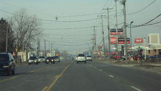
Erie Township is a civil township of Monroe County in the U.S. state of Michigan. The population was 4,299 at the 2020 census. Sharing a southern border with the city of Toledo, Ohio, about 45 miles (72 km) southwest of the city of Detroit, the township is one of the southernmost areas included in the Detroit–Warren–Ann Arbor Combined Statistical Area.

<span class="mw-page-title-main">Estral Beach, Michigan</span> Village in Michigan, United States

Estral Beach is a village in Monroe County in the U.S. state of Michigan. The population was 403 at the 2020 census. The village is located within Berlin Charter Township.

<span class="mw-page-title-main">Frenchtown Charter Township, Michigan</span> Charter township in Michigan, United States

Frenchtown Charter Township is a charter township within Monroe County in the U.S. state of Michigan. The population was 21,609 as per the 2020 census.

<span class="mw-page-title-main">La Salle Township, Michigan</span> Civil township in Michigan, United States

La Salle Township is a civil township of Monroe County in the U.S. state of Michigan. The population was 4,639 at the 2020 census.

<span class="mw-page-title-main">Lambertville, Michigan</span> Census-designated place & unincorporated community in Michigan, United States

Lambertville is an unincorporated community and census-designated place (CDP) in Monroe County in the U.S. state of Michigan. The population was 10,433 at the 2020 census. The CDP is located within Bedford Township.

<span class="mw-page-title-main">Monroe Charter Township, Michigan</span> Charter township in Michigan, United States

Monroe Charter Township is a charter township of Monroe County in the U.S. state of Michigan. As of the 2020 census, the township population was 14,391.

<span class="mw-page-title-main">South Monroe, Michigan</span> Census-designated place & unincorporated community in Michigan, United States

South Monroe is an unincorporated community and census-designated place (CDP) in Monroe County in the U.S. state of Michigan. The population was 6,468 at the 2020 census. The CDP is located within Monroe Charter Township.

<span class="mw-page-title-main">Stony Point, Michigan</span> Census-designated place & unincorporated community in Michigan, United States

Stony Point is an unincorporated community and census-designated place (CDP) in Monroe County in the U.S. state of Michigan. The population was 1,784 at the 2020 census. The CDP is located within Frenchtown Charter Township.

<span class="mw-page-title-main">Temperance, Michigan</span> Census-designated place & unincorporated community in Michigan, United States

Temperance is an unincorporated community and census-designated place (CDP) in Monroe County in the U.S. state of Michigan. The population was 9,188 at the 2020 census. The CDP is located within Bedford Township.

<span class="mw-page-title-main">West Monroe, Michigan</span> Census-designated place & unincorporated community in Michigan, United States

West Monroe is an unincorporated community and census-designated place (CDP) in Monroe County in the U.S. state of Michigan. The population was 3,227 at the 2020 census. The CDP is located within Monroe Charter Township.

<span class="mw-page-title-main">Woodland Beach, Michigan</span> Census-designated place & unincorporated community in Michigan, United States

Woodland Beach is a census-designated place (CDP) and unincorporated community in Monroe County in the U.S. state of Michigan. The population was 1,899 at the 2020 census. The CDP is located within Frenchtown Charter Township.

<span class="mw-page-title-main">Bridgeport, Michigan</span> Census-designated place & unincorporated community in Michigan, United States

Bridgeport is an unincorporated community and census-designated place (CDP) in Saginaw County in the U.S. state of Michigan. The CDP had a population of 6,571 at the 2020 census. The community is located within Bridgeport Township.

<span class="mw-page-title-main">Pearl Beach, St. Clair County, Michigan</span> Census-designated place & unincorporated community in Michigan, United States

Pearl Beach is an unincorporated community and census-designated place (CDP) in St. Clair County in the U.S. state of Michigan. The population of the CDP was 4,698 at the 2020 census. The community is located within Clay Township.

References

  1. 1 2 "2023 U.S. Gazetteer Files: Michigan". United States Census Bureau. Retrieved November 9, 2023.
  2. 1 2 "P1. Race – Detroit Beach CDP, Michigan: 2020 DEC Redistricting Data (PL 94-171)". U.S. Census Bureau. Retrieved November 9, 2023.
  3. 1 2 "U.S. Census website". United States Census Bureau . Retrieved January 31, 2008.
  4. U.S. Geological Survey Geographic Names Information System: Detroit Beach, Michigan
  5. Michigan Geographic Framework (November 15, 2013). "Monroe County School Districts" (PDF). Retrieved August 28, 2022.
  6. Romig, Walter (October 1, 1986) [1973]. Michigan Place Names: The History of the Founding and the Naming of More Than Five Thousand Past and Present Michigan Communities (Paperback). Great Lakes Books Series. Detroit, Michigan: Wayne State University Press. p. 155. ISBN   978-0-8143-1838-6.
  7. "Census of Population and Housing". Census.gov. Retrieved June 4, 2016.