Woodland Beach, Michigan

Last updated

Woodland Beach, Michigan
Woodland Beach, MI 2020.jpg
Woodland Beach along N. Dixie Highway
Location within Monroe County
USA Michigan location map.svg
Red pog.svg
Woodland Beach
Location within the state of Michigan
Usa edcp location map.svg
Red pog.svg
Woodland Beach
Location within the United States
Coordinates: 41°56′24″N83°18′48″W / 41.94000°N 83.31333°W / 41.94000; -83.31333
CountryUnited States
State Michigan
County Monroe
Township Frenchtown
Area
[1]
  Total0.53 sq mi (1.36 km2)
  Land0.52 sq mi (1.35 km2)
  Water0.01 sq mi (0.01 km2)
Elevation
577 ft (176 m)
Population
 (2020)
  Total1,899
  Density3,651.92/sq mi (1,410.54/km2)
Time zone UTC-5 (Eastern (EST))
  Summer (DST) UTC-4 (EDT)
ZIP code(s)
48162 (Monroe)
Area code 734
FIPS code 26-88480 [2]
GNIS feature ID1616752 [3]

Woodland Beach is a census-designated place (CDP) and unincorporated community in Monroe County in the U.S. state of Michigan. The population was 1,899 at the 2020 census. The CDP is located within Frenchtown Charter Township.

Contents

Woodland Beach and its surrounding communities are served by Jefferson Schools. [4]

Geography

According to the U.S. Census Bureau, the CDP has a total area of 0.53 square miles (1.37 km2), of which 0.52 square miles (1.35 km2) is land and 0.01 square miles (0.03 km2) (1.89%) is water. [1]

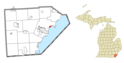
The CDP includes several lakefront community along the shores of Lake Erie, about 4.0 miles (6.4 km) northeast of the city of Monroe. The communities include Erie Shores, Grand Beach, Indian Trails, and Woodland Beach. The CDP stretches from South Grove Drive on the south to Stony Creek on the north. The majority of the CDP lies southeast of North Dixie Highway with a small portion of the Woodland Beach community extending northwest of North Dixie Highway. The CDP of Detroit Beach is adjacent to the southwest, and the CDP of Stony Point is about 3.0 miles (4.8 km) to the east.

The community was named for its wooded location and beachfront on Lake Erie. [5]

Demographics

Historical population
CensusPop.Note
1990 2,309
2000 2,179−5.6%
2010 2,049−6.0%
2020 1,899−7.3%
U.S. Decennial Census [6]

As of the census [2] of 2000, there were 2,179 people, 794 households, and 605 families residing in the CDP. The population density was 4,155.0 inhabitants per square mile (1,604.3/km2). There were 831 housing units at an average density of 1,584.6 per square mile (611.8/km2). The racial makeup of the CDP was 98.12% White, 0.23% African American, 0.18% Native American, 0.09% from other races, and 1.38% from two or more races. Hispanic or Latino of any race were 0.87% of the population.

There were 794 households, out of which 38.3% had children under the age of 18 living with them, 59.6% were married couples living together, 10.2% had a female householder with no husband present, and 23.8% were non-families. 20.3% of all households were made up of individuals, and 7.2% had someone living alone who was 65 years of age or older. The average household size was 2.74 and the average family size was 3.15.

In the CDP, the population was spread out, with 28.1% under the age of 18, 9.6% from 18 to 24, 32.5% from 25 to 44, 22.6% from 45 to 64, and 7.2% who were 65 years of age or older. The median age was 34 years. For every 100 females, there were 100.8 males. For every 100 females age 18 and over, there were 98.1 males.

The median income for a household in the CDP was $45,417, and the median income for a family was $47,212. Males had a median income of $36,296 versus $23,571 for females. The per capita income for the CDP was $17,824. About 7.2% of families and 7.1% of the population were below the poverty line, including 7.0% of those under age 18 and none of those age 65 or over.

Related Research Articles

<span class="mw-page-title-main">Lakes of the Four Seasons, Indiana</span> Census-designated place in Indiana, United States

Lakes of the Four Seasons is a census-designated place (CDP) in Lake and Porter counties in the U.S. state of Indiana. The population was 7,033 at the 2010 census.

<span class="mw-page-title-main">Hubbard Lake, Alcona County, Michigan</span> Census-designated place & unincorporated community in Michigan, United States

Hubbard Lake is an unincorporated community and census-designated place (CDP) in Alcona County in the U.S. state of Michigan. The population was 857 at the 2020 census. Hubbard Lake occupies portions of Alcona, Caledonia, and Hawes township.

<span class="mw-page-title-main">Lost Lake Woods, Michigan</span> Census-designated place & unincorporated community in Michigan, United States

Lost Lake Woods is an unincorporated community and census-designated place (CDP) in Alcona County in the U.S. state of Michigan. The population was 367 at the 2020 census. It is located within Alcona Township.

<span class="mw-page-title-main">Lake Michigan Beach, Michigan</span> Census-designated place & unincorporated community in Michigan, United States

Lake Michigan Beach is an unincorporated community in Berrien County in the U.S. state of Michigan. It is a census-designated place (CDP) for statistical purposes, without any legal status as a municipality. The population was 1,216 at the 2010 census.

<span class="mw-page-title-main">Shorewood–Tower Hills–Harbert, Michigan</span> Census-designated place & unincorporated communities in Michigan, United States

Shorewood–Tower Hills–Harbert is a census-designated place (CDP) composed of several small unincorporated communities in Chikaming Township of Berrien County in the U.S. state of Michigan. The population was 1,249 at the 2020 census. The CDP is limited to Chikaming Township, although some of the communities extend into southern Lake Township. All of the communities are located either upon or just east of the dunes on the shore of Lake Michigan. Most of the communities lie west of Interstate 94, although the CDP includes a small area east of the freeway up to Sawyer, Michigan. The township is a popular resort destination.

<span class="mw-page-title-main">Berlin Charter Township, Michigan</span> Charter township in Michigan, United States

Berlin Charter Township is a charter township of Monroe County in the U.S. state of Michigan. At the 2010 census, the township population was 9,299.

Detroit Beach is an unincorporated community and census-designated place (CDP) in Monroe County in the U.S. state of Michigan. The population was 1,957 at the 2020 census. The CDP is located within Frenchtown Charter Township, and as an unincorporated community, Detroit Beach has no legal autonomy of its own.

<span class="mw-page-title-main">Erie Township, Michigan</span> Civil township in Michigan, United States

Erie Township is a civil township of Monroe County in the U.S. state of Michigan. The population was 4,299 at the 2020 census. Sharing a southern border with the city of Toledo about 35 miles (56.3 km) south of the city of Detroit, the township is one of the southernmost areas included in the Detroit–Warren–Ann Arbor Combined Statistical Area.

<span class="mw-page-title-main">Estral Beach, Michigan</span> Village in Michigan, United States

Estral Beach is a village in Monroe County in the U.S. state of Michigan. The population was 403 at the 2020 census. The village is located within Berlin Charter Township.

<span class="mw-page-title-main">Frenchtown Charter Township, Michigan</span> Charter township in Michigan, United States

Frenchtown Charter Township is a charter township within Monroe County in the U.S. state of Michigan. The population was 20,428 as per the 2010 census.

<span class="mw-page-title-main">La Salle Township, Michigan</span> Civil township in Michigan, United States

La Salle Township is a civil township of Monroe County in the U.S. state of Michigan. The population was 4,894 at the 2010 census.

<span class="mw-page-title-main">Lambertville, Michigan</span> Census-designated place & unincorporated community in Michigan, United States

Lambertville is an unincorporated community and census-designated place (CDP) in Monroe County in the U.S. state of Michigan. The population was 10,433 at the 2020 census. The CDP is located within Bedford Township.

<span class="mw-page-title-main">Monroe Charter Township, Michigan</span> Charter township in Michigan, United States

Monroe Charter Township is a charter township of Monroe County in the U.S. state of Michigan. As of the 2010 census, the township population was 14,568.

<span class="mw-page-title-main">South Monroe, Michigan</span> Census-designated place & unincorporated community in Michigan, United States

South Monroe is an unincorporated community and census-designated place (CDP) in Monroe County in the U.S. state of Michigan. The population was 6,468 at the 2020 census. The CDP is located within Monroe Charter Township.

<span class="mw-page-title-main">Stony Point, Michigan</span> Census-designated place & unincorporated community in Michigan, United States

Stony Point is an unincorporated community and census-designated place (CDP) in Monroe County in the U.S. state of Michigan. The population was 1,784 at the 2020 census. The CDP is located within Frenchtown Charter Township.

<span class="mw-page-title-main">Temperance, Michigan</span> Census-designated place & unincorporated community in Michigan, United States

Temperance is an unincorporated community and census-designated place (CDP) in Monroe County in the U.S. state of Michigan. The population was 9,188 at the 2020 census. The CDP is located within Bedford Township.

<span class="mw-page-title-main">West Monroe, Michigan</span> Census-designated place & unincorporated community in Michigan, United States

West Monroe is an unincorporated community and census-designated place (CDP) in Monroe County in the U.S. state of Michigan. The population was 3,227 at the 2020 census. The CDP is located within Monroe Charter Township.

<span class="mw-page-title-main">Bridgeport, Michigan</span> Census-designated place & unincorporated community in Michigan, United States

Bridgeport is an unincorporated community in Bridgeport Charter Township, Saginaw County in the U.S. state of Michigan. It is also a census-designated place (CDP) for statistical purposes. The population was 6,571 at the 2020 census. Bridgeport is also the name of a post office with ZIP code 48722. The area served by the ZIP code includes the southeast portion of the CDP and includes southeastern portions of Bridgeport Charter Township outside of the CDP as well as portions of southwest Frankenmuth Township and a small area of northeastern Birch Run Township. The remainder of the CDP area is served by the Saginaw ZIP code 48601.

<span class="mw-page-title-main">Pearl Beach, St. Clair County, Michigan</span> Census-designated place & unincorporated community in Michigan, United States

Pearl Beach is an unincorporated community and census-designated place (CDP) in St. Clair County in the U.S. state of Michigan. The population of the CDP was 4,698 at the 2020 census. The community is located within Clay Township.

<span class="mw-page-title-main">Lake Erie Beach, New York</span> Census-designated place in New York, United States

Lake Erie Beach is a hamlet and census-designated place (CDP) in the town of Evans, Erie County, New York, United States. The population was 3,872 at the 2010 census. It is part of the Buffalo–Niagara Falls Metropolitan Statistical Area.

References

  1. 1 2 "2020 U.S. Gazetteer Files". United States Census Bureau. Retrieved May 21, 2022.
  2. 1 2 "U.S. Census website". United States Census Bureau . Retrieved January 31, 2008.
  3. U.S. Geological Survey Geographic Names Information System: Woodland Beach, Michigan
  4. Michigan Geographic Framework (November 15, 2013). "Monroe County School Districts" (PDF). Archived (PDF) from the original on August 21, 2014. Retrieved August 28, 2022.
  5. Romig, Walter (October 1, 1986) [1973]. Michigan Place Names: The History of the Founding and the Naming of More Than Five Thousand Past and Present Michigan Communities. p. 612. ISBN   978-0-8143-1838-6.{{cite book}}: |work= ignored (help)
  6. "Census of Population and Housing". Census.gov. Retrieved June 4, 2016.