Monroe Charter Township, Michigan

Last updated
Monroe Township, Michigan
Monroe Charter Township
Monroe Charter Township office.jpg
Township Office along East Dunbar Road
Monroe Charter Township, MI location 2020.png
Location within Monroe County and the administered CDPs of South Monroe (1) and West Monroe (2)
USA Michigan location map.svg
Red pog.svg
Monroe Township
Usa edcp location map.svg
Red pog.svg
Monroe Township
Coordinates: 41°53′40″N83°24′50″W / 41.89444°N 83.41389°W / 41.89444; -83.41389
CountryUnited States
State Michigan
County Monroe
Organized1827
Government
  SupervisorAlan Barron
   Clerk Christina Smith
Area
[1]
  Total18.11 sq mi (46.9 km2)
  Land16.88 sq mi (43.7 km2)
  Water1.23 sq mi (3.2 km2)
Elevation
597 ft (182 m)
Population
 (2020) [2]
  Total14,391
  Density852.7/sq mi (329.2/km2)
Time zone UTC-5 (Eastern (EST))
  Summer (DST) UTC-4 (EDT)
ZIP Codes
48161 (Monroe)
48145 (La Salle)
Area code 734
FIPS code 26-115-55040 [3]
GNIS feature ID1626755 [4]
Website monroechartertownship.org

Monroe Charter Township is a charter township of Monroe County in the U.S. state of Michigan. As of the 2020 census, the township population was 14,391. [2]

Contents

The township is bordered by the city of Monroe to the north, but the two are administered autonomously. The township was organized in 1827 and named after James Monroe, the fifth president of the United States.

Communities

Geography

The township is in eastern Monroe County and is bordered to the northeast by the city of Monroe and to the southeast by the shore of Lake Erie. According to the U.S. Census Bureau, the township has a total area of 18.11 square miles (46.90 km2), of which 16.88 square miles (43.72 km2) are land and 1.23 square miles (3.19 km2), or 6.81%, are water. [1]

Major highways

Demographics

Historical population
CensusPop.Note
1870 1,003
1880 1,0181.5%
1890 890−12.6%
1900 1,13727.8%
1910 1,1410.4%
1920 1,2328.0%
1930 2,876133.4%
1940 3,71329.1%
1950 5,85657.7%
1960 8,34342.5%
1970 9,35112.1%
1980 11,65424.6%
1990 11,9092.2%
2000 13,49113.3%
2010 14,5688.0%
2020 14,391−1.2%
U.S. Decennial Census [13]

As of the census [3] of 2010, there were 14,568 people, 5,312 households, and 3,686 families residing in the township. The population density was 777.0 inhabitants per square mile (300.0/km2). There were 5,572 housing units at an average density of 320.9 per square mile (123.9/km2). The racial makeup of the township was 94.93% White, 1.87% African American, 0.19% Native American, 0.82% Asian, 0.01% Pacific Islander, 0.79% from other races, and 1.39% from two or more races. Hispanic or Latino of any race were 1.97% of the population.

There were 5,312 households, out of which 33.5% had children under the age of 18 living with them, 52.4% were married couples living together, 12.3% had a female householder with no husband present, and 30.6% were non-families. 26.7% of all households were made up of individuals, and 10.9% had someone living alone who was 65 years of age or older. The average household size was 2.50 and the average family size was 3.02.

In the township the population was spread out, with 26.2% under the age of 18, 8.5% from 18 to 24, 29.5% from 25 to 44, 22.3% from 45 to 64, and 13.4% who were 65 years of age or older. The median age was 36 years. For every 100 females, there were 93.1 males. For every 100 females age 18 and over, there were 89.7 males.

The median income for a household in the township was $45,694, and the median income for a family was $52,517. Males had a median income of $44,949 versus $26,674 for females. The per capita income for the township was $23,276. About 8.2% of families and 10.7% of the population were below the poverty line, including 14.1% of those under age 18 and 8.8% of those age 65 or over.

Education

Monroe Township is served by two separate public school districts. The majority of the township is served by Monroe Public Schools, in which Monroe High School is located within the township. A small western portion of the township is served by Ida Public Schools, which is centralized in Ida Township. [14]

Monroe County Community College is located within the township.

Related Research Articles

<span class="mw-page-title-main">Curtis Township, Michigan</span> Civil township in Michigan, United States

Curtis Township is a civil township of Alcona County in the U.S. state of Michigan. The population was 1,236 at the 2010 census.

<span class="mw-page-title-main">Mikado Township, Michigan</span> Civil township in Michigan, United States

Mikado Township is a civil township of Alcona County in the U.S. state of Michigan. The population was 947 at the 2010 census.

<span class="mw-page-title-main">Batavia Township, Michigan</span> Civil township in Michigan, United States

Batavia Township is a civil township of Branch County in the U.S. state of Michigan. As of the 2010 census, the township's population was 1,339.

<span class="mw-page-title-main">Wright Township, Hillsdale County, Michigan</span> Civil township in Michigan, United States

Wright Township is a civil township of Hillsdale County in the U.S. state of Michigan. The population was 1,542 at the 2020 census.

<span class="mw-page-title-main">Houghton Township, Michigan</span> Civil township in Michigan, United States

Houghton Township is a civil township of Keweenaw County in the U.S. state of Michigan. The population was 72 at the 2020 census.

<span class="mw-page-title-main">Raisin Charter Township, Michigan</span> Charter township in Michigan, United States

Raisin Charter Township is a charter township of Lenawee County in the U.S. state of Michigan. The population was 7,900 at the 2020 census.

<span class="mw-page-title-main">Ash Township, Michigan</span> Civil township in Michigan, United States

Ash Township is a civil township of Monroe County in the U.S. state of Michigan. As of the 2020 census, the township population was 7,860.

<span class="mw-page-title-main">Dundee Township, Michigan</span> Civil township in Michigan, United States

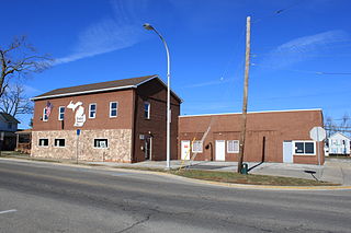
Dundee Township is a civil township of Monroe County in the U.S. state of Michigan. The population was 8,145 at the 2020 census, up from 6,759 in 2010. The township contains the village of Dundee, and the majority of the township is served by Dundee Community Schools.

<span class="mw-page-title-main">Erie Township, Michigan</span> Civil township in Michigan, United States

Erie Township is a civil township of Monroe County in the U.S. state of Michigan. The population was 4,299 at the 2020 census. Sharing a southern border with the city of Toledo, Ohio, about 45 miles (72 km) southwest of the city of Detroit, the township is one of the southernmost areas included in the Detroit–Warren–Ann Arbor Combined Statistical Area.

<span class="mw-page-title-main">Exeter Township, Michigan</span> Civil township in Michigan, United States

Exeter Township is a civil township of Monroe County in the U.S. state of Michigan. The population was 3,927 at the 2020 census.

<span class="mw-page-title-main">Frenchtown Charter Township, Michigan</span> Charter township in Michigan, United States

Frenchtown Charter Township is a charter township within Monroe County in the U.S. state of Michigan. The population was 21,609 as per the 2020 census.

<span class="mw-page-title-main">Ida Township, Michigan</span> Civil township in Michigan, United States

Ida Township is a civil township of Monroe County in the U.S. state of Michigan. The population was 4,783 at the 2020 census. The township was organized in 1837 and named after local civic leader Ida M. Taylor.

<span class="mw-page-title-main">La Salle Township, Michigan</span> Civil township in Michigan, United States

La Salle Township is a civil township of Monroe County in the U.S. state of Michigan. The population was 4,639 at the 2020 census.

<span class="mw-page-title-main">London Township, Michigan</span> Civil township in Michigan, United States

London Township is a civil township of Monroe County in the U.S. state of Michigan. The population was 2,984 at the 2020 census.

<span class="mw-page-title-main">Milan Township, Michigan</span> Civil township in Michigan, United States

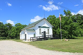
Milan Township is a civil township of Monroe County in the U.S. state of Michigan. The population was 1,571 at the 2020 census. The township was organized in 1836. The city of Milan borders the township on the north, but the two are administrated autonomously since Milan incorporated as a city in 1967.

<span class="mw-page-title-main">Raisinville Township, Michigan</span> Civil township in Michigan, United States

Raisinville Township is a civil township of Monroe County in the U.S. state of Michigan. The population was 5,903 at the 2020 census.

<span class="mw-page-title-main">Whiteford Township, Michigan</span> Civil township in Michigan, United States

Whiteford Township is a civil township of Monroe County in the U.S. state of Michigan. The population was 4,590 at the 2020 census.

<span class="mw-page-title-main">Augusta Charter Township, Michigan</span> Charter township in Michigan, United States

Augusta Charter Township is a charter township of Washtenaw County in the U.S. state of Michigan. The population was 6,745 at the 2010 census.

<span class="mw-page-title-main">Bridgewater Township, Michigan</span> Civil township in Michigan, United States

Bridgewater Township is a civil township of Washtenaw County in the U.S. state of Michigan. The population was 1,674 at the 2010 census.

<span class="mw-page-title-main">Salem Township, Washtenaw County, Michigan</span> Civil township in Michigan, United States

Salem Township is a civil township of Washtenaw County in the U.S. state of Michigan. The population was 5,627 at the 2010 census.

References

  1. 1 2 "2023 U.S. Gazetteer Files: Michigan". United States Census Bureau. Retrieved November 2, 2023.
  2. 1 2 "P1. Race – Monroe charter township, Michigan: 2020 DEC Redistricting Data (PL 94-171)". U.S. Census Bureau. Retrieved November 2, 2023.
  3. 1 2 "U.S. Census website". United States Census Bureau . Retrieved 2008-01-31.
  4. U.S. Geological Survey Geographic Names Information System: Monroe Charter Township, Michigan
  5. U.S. Geological Survey Geographic Names Information System: Avalon Beach
  6. U.S. Geological Survey Geographic Names Information System: Bolles Harbor
  7. Romig 1986, p. 69–70.
  8. U.S. Geological Survey Geographic Names Information System: Evergreen Acres
  9. Romig 1986, p. 238.
  10. U.S. Geological Survey Geographic Names Information System: Patterson Gardens
  11. U.S. Geological Survey Geographic Names Information System: South Monroe
  12. U.S. Geological Survey Geographic Names Information System: West Monroe
  13. "Decennial Census Official Publications". U.S. Census Bureau. Retrieved November 2, 2023.
  14. Michigan Geographic Framework (15 November 2013). "Monroe County School Districts" (PDF). Archived (PDF) from the original on 2014-08-21. Retrieved August 28, 2022.

Sources