Frenchtown Charter Township, Michigan

Last updated
Frenchtown Township, Michigan
Frenchtown Charter Township
Frenchtown Township Hall Michigan.JPG
Frenchtown Township Hall
Frenchtown Charter Township, MI location 2020.png
Location within Monroe County and the administered CDPs of Detroit Beach (1), Stony Point (2), and Woodland Beach (3)
USA Michigan location map.svg
Red pog.svg
Frenchtown Township
Usa edcp location map.svg
Red pog.svg
Frenchtown Township
Coordinates: 41°57′50″N83°21′31″W / 41.96389°N 83.35861°W / 41.96389; -83.35861
CountryUnited States
State Michigan
County Monroe
Settled1784
Organized1837
Government
  SupervisorJames McDevitt
   Clerk Mark Baker
Area
[1]
  Total43.12 sq mi (111.7 km2)
  Land41.74 sq mi (108.1 km2)
  Water1.38 sq mi (3.6 km2)
Elevation
594 ft (181 m)
Population
 (2020) [2]
  Total21,609
  Density517.7/sq mi (199.9/km2)
Time zone UTC-5 (Eastern (EST))
  Summer (DST) UTC-4 (EDT)
ZIP Codes
48162 (Monroe
48166 (Newport))
48117 (Carleton)
Area code 734
FIPS code 26-115-30820 [3]
GNIS feature ID1626321 [4]
Website www.frenchtowntownship.org

Frenchtown Charter Township is a charter township within Monroe County in the U.S. state of Michigan. The population was 21,609 as per the 2020 census. [2]

Contents

The township is bordered on the south by the city of Monroe. Sterling State Park and the Enrico Fermi Nuclear Generating Station are located within Frenchtown. The township was the site of the Battle of Frenchtown during the War of 1812.

History

Frenchtown Township historical marker Frenchtown Township Michigan Historical Marker.JPG
Frenchtown Township historical marker

The area was long occupied by Native Americans, including the historic Potawatomi. They had trading relations with French-Canadians in the area. The Frenchtown area reflected the ethnicity of its first European settlers, French Canadians who took land along the banks of the River Raisin as early as 1784. There had been other French colonial settlements closer to Detroit and on both sides of the Detroit River. Their descendants are known as Muskrat French. Around the same time, the Sandy Creek Settlement was founded near this by Joseph Porlier Benec. [5] The United States acquired this area, which had been considered part of British Canadian territory after the Treaty of Paris (1783) settling the American Revolutionary War. It was specifically part of state claims (from 1783); the Northwest Territory (1787); Indiana Territory (1803); Michigan Territory (1805); and, finally, the State of Michigan (1837). [6]

During the War of 1812, the area was the site of the Battle of Frenchtown, in which 397 Americans were killed by the coalition of British Army and Native Americans; this was the highest number of American fatalities of any battle during the war. [7] The battlefield site today is within the River Raisin National Battlefield Park, which was designated in 2009 and falls within the present-day city limits of Monroe. [8] [9]

In 1817, that portion of Frenchtown was renamed and incorporated as the village of Monroe, named in honor of President James Monroe's planned visit to the Michigan Territory later that year. In the same year, the village of Monroe was named as the county seat of the newly created Monroe County. Monroe was incorporated as a city in 1837. [10] At that time, the remaining area known as Frenchtown was reorganized as a township, encompassing much of the northern portion of the county which was the area from the River Raisin to the Huron River at Wayne County's southern border. [11] Shortly afterwards, the northern portion of the township was broken off to form Ash Township. Later, by 1867, Berlin Charter Township was formed from another territory of the township. Additionally, the city of Monroe annexed pieces of the southern portion of Frenchtown several times. As a result, the boundary between the current Frenchtown Charter Township and the city limits of Monroe is jagged.

Communities

Geography

Sterling State Park is mostly located within Frenchtown Township. Sterling State Park Michigan picnic area.JPG
Sterling State Park is mostly located within Frenchtown Township.

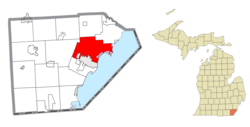
The township is in eastern Monroe County and is bordered to the southeast by Lake Erie. Many of the township's communities are located near the lake. Sterling State Park is located along the southern edge of the township and is the only Michigan state park on Lake Erie. Small pieces of the township are organized into the Detroit River International Wildlife Refuge. Frenchtown Township is bordered on the south by the city of Monroe, but a small portion of the southern border touches Monroe Charter Township. Raisinville Township is to the west, and Ash and Berlin Township border on the north. A very small portion of the northwest corner of Frenchtown Township touches Exeter Township. The River Raisin serves as the boundary between Frenchtown and the city of Monroe for a short length near Lake Erie and then again further upstream for a small portion near the Custer Airport. Sandy Creek also runs through the township. The southeast border of Frenchtown Township, as well as the rest of the county's Lake Erie shoreline, is at the lowest elevation in the state of Michigan at 571 feet (174 m) above sea level.

According to the U.S. Census Bureau, the township has a total area of 43.12 square miles (111.68 km2), of which 41.74 square miles (108.11 km2) are land and 1.38 square miles (3.57 km2), or 3.19%, are water. [1]

Major highways

Demographics

Historical population
CensusPop.Note
1850 1,242
1860 1,77743.1%
1870 2,11519.0%
1880 2,48517.5%
1890 2,023−18.6%
1900 1,938−4.2%
1910 1,770−8.7%
1920 1,8404.0%
1930 2,56039.1%
1940 3,75746.8%
1950 6,96685.4%
1960 12,19975.1%
1970 14,68520.4%
1980 18,20424.0%
1990 18,2100.0%
2000 20,77714.1%
2010 20,428−1.7%
2020 21,6095.8%
U.S. Decennial Census [26]

As per the census [3] of 2010, there were 20,428 people, 7,733 households, and 5,598 families residing in the township. The population density was 493.4 inhabitants per square mile (190.5/km2). There were 8,244 housing units at an average density of 195.8 per square mile (75.6/km2). The racial makeup of the township was 95.51% White, 1.59% African American, 0.41% Native American, 0.53% Asian, 0.01% Pacific Islander, 0.45% from other races, and 1.49% from two or more races. Hispanic or Latino of any race were 2.45% of the population.

There were 7,733 households, out of which 35.9% had children under the age of 18 living with them, 56.1% were married couples living together, 11.0% had a female householder with no husband present, and 27.6% were non-families. 22.4% of all households were made up of individuals, and 8.0% had someone living alone who was 65 years of age or older. The average household size was 2.65 and the average family size was 3.10.

In the township the population was spread out, with 27.5% under the age of 18, 9.4% from 18 to 24, 31.5% from 25 to 44, 21.5% from 45 to 64, and 10.1% who were 65 years of age or older. The median age was 34 years. For every 100 females there were 99.9 males. For every 100 females age 18 and over, there were 95.6 males.

The median income for a household in the township was $47,699, and the median income for a family was $54,032. Males had a median income of $44,338 versus $25,787 for females. The per capita income for the township was $21,335. About 4.9% of families and 7.0% of the population were below the poverty line, including 6.4% of those under age 18 and 8.7% of those age 65 or over.

Education

Frenchtown Township is served by three separate public school districts. The majority of the township is served by Jefferson Schools, which has its middle school and high school within the township, as well as one of its two elementary schools. The northernmost portion of the township is served by Airport Community Schools, while the western portion of the township is served by Monroe Public Schools. [27]

Triumph Academy is a charter school located within the township. [28]

Images

Related Research Articles

<span class="mw-page-title-main">Monroe County, Michigan</span> County in Michigan, United States

Monroe County is a county in the U.S. state of Michigan. As of the 2020 Census, the population was 154,809. The largest city and county seat is Monroe. The county was established as the second county in the Michigan Territory in 1817 and was named for then-President James Monroe.

<span class="mw-page-title-main">Raisin Charter Township, Michigan</span> Charter township in Michigan, United States

Raisin Charter Township is a charter township of Lenawee County in the U.S. state of Michigan. The population was 7,900 at the 2020 census.

<span class="mw-page-title-main">Ash Township, Michigan</span> Civil township in Michigan, United States

Ash Township is a civil township of Monroe County in the U.S. state of Michigan. As of the 2020 census, the township population was 7,860.

<span class="mw-page-title-main">Bedford Township, Monroe County, Michigan</span> Civil township in Michigan, United States

Bedford Township is a civil township of Monroe County in the U.S. state of Michigan. As of the 2020 census, the township population was 31,813.

<span class="mw-page-title-main">Berlin Charter Township, Michigan</span> Charter township in Michigan, United States

Berlin Charter Township is a charter township of Monroe County in the U.S. state of Michigan. At the 2020 census, the township population was 9,890.

<span class="mw-page-title-main">Detroit Beach, Michigan</span> Census-designated place in Michigan, United States

Detroit Beach is an unincorporated community and census-designated place (CDP) in Monroe County in the U.S. state of Michigan. The population was 1,957 at the 2020 census. The CDP is located within Frenchtown Charter Township, and as an unincorporated community, Detroit Beach has no legal autonomy of its own.

<span class="mw-page-title-main">Dundee Township, Michigan</span> Civil township in Michigan, United States

Dundee Township is a civil township of Monroe County in the U.S. state of Michigan. The population was 8,145 at the 2020 census, up from 6,759 in 2010. The township contains the village of Dundee, and the majority of the township is served by Dundee Community Schools.

<span class="mw-page-title-main">Erie Township, Michigan</span> Civil township in Michigan, United States

Erie Township is a civil township of Monroe County in the U.S. state of Michigan. The population was 4,299 at the 2020 census. Sharing a southern border with the city of Toledo, Ohio, about 45 miles (72 km) southwest of the city of Detroit, the township is one of the southernmost areas included in the Detroit–Warren–Ann Arbor Combined Statistical Area.

<span class="mw-page-title-main">Exeter Township, Michigan</span> Civil township in Michigan, United States

Exeter Township is a civil township of Monroe County in the U.S. state of Michigan. The population was 3,927 at the 2020 census.

<span class="mw-page-title-main">Ida Township, Michigan</span> Civil township in Michigan, United States

Ida Township is a civil township of Monroe County in the U.S. state of Michigan. The population was 4,783 at the 2020 census. The township was organized in 1837 and named after local civic leader Ida M. Taylor.

<span class="mw-page-title-main">La Salle Township, Michigan</span> Civil township in Michigan, United States

La Salle Township is a civil township of Monroe County in the U.S. state of Michigan. The population was 4,639 at the 2020 census.

<span class="mw-page-title-main">London Township, Michigan</span> Civil township in Michigan, United States

London Township is a civil township of Monroe County in the U.S. state of Michigan. The population was 2,984 at the 2020 census.

<span class="mw-page-title-main">Monroe Charter Township, Michigan</span> Charter township in Michigan, United States

Monroe Charter Township is a charter township of Monroe County in the U.S. state of Michigan. As of the 2020 census, the township population was 14,391.

<span class="mw-page-title-main">Raisinville Township, Michigan</span> Civil township in Michigan, United States

Raisinville Township is a civil township of Monroe County in the U.S. state of Michigan. The population was 5,903 at the 2020 census.

<span class="mw-page-title-main">Whiteford Township, Michigan</span> Civil township in Michigan, United States

Whiteford Township is a civil township of Monroe County in the U.S. state of Michigan. The population was 4,590 at the 2020 census.

<span class="mw-page-title-main">Woodland Beach, Michigan</span> Census-designated place & unincorporated community in Michigan, United States

Woodland Beach is a census-designated place (CDP) and unincorporated community in Monroe County in the U.S. state of Michigan. The population was 1,899 at the 2020 census. The CDP is located within Frenchtown Charter Township.

<span class="mw-page-title-main">Augusta Charter Township, Michigan</span> Charter township in Michigan, United States

Augusta Charter Township is a charter township of Washtenaw County in the U.S. state of Michigan. The population was 6,745 at the 2010 census.

<span class="mw-page-title-main">Van Buren Township, Michigan</span> American township in Michigan

Van Buren Township is a charter township in Wayne County in the U.S. state of Michigan. A western suburb of Detroit, Van Buren Township is located roughly 28 miles (45.1 km) southwest of downtown Detroit, and 17 miles (27.4 km) southeast of Ann Arbor. As of the 2020 census, the township had a population of 30,375. It surrounds, but is independent of, the city of Belleville.

<span class="mw-page-title-main">Newport, Michigan</span> Unincorporated community in Michigan, United States

Newport is an unincorporated community in Monroe County in the U.S. state of Michigan. The community is located within Berlin Charter Township. As an unincorporated community, Newport has no legally defined boundaries or population statistics of its own but does have its own post office with the 48166 ZIP Code.

<span class="mw-page-title-main">Paint Creek (Washtenaw County, Michigan)</span> River in Michigan, United States

Paint Creek is a stream mostly located within Washtenaw County in the U.S. state of Michigan. The stream flows south before entering as a tributary to Stony Creek along the county line with Monroe County.

References

  1. 1 2 "2023 U.S. Gazetteer Files: Michigan". United States Census Bureau. Retrieved November 2, 2023.
  2. 1 2 "P1. Race – Frenchtown township, Michigan: 2020 DEC Redistricting Data (PL 94-171)". U.S. Census Bureau. Retrieved November 2, 2023.
  3. 1 2 "U.S. Census website". United States Census Bureau . Retrieved 2008-01-31.
  4. U.S. Geological Survey Geographic Names Information System: Frenchtown Charter Township, Michigan
  5. City of Monroe. "Monroe, Michigan historical markers". Archived from the original on August 12, 2009. Retrieved September 12, 2009.
  6. City of Monroe (2007). "History of the City of Monroe". Archived from the original on August 18, 2009. Retrieved September 12, 2009.
  7. Eaton, John (2000). Returns of Killed and Wounded in Battles or Engagements with Indians and British and Mexican Troops, 1790–1848, Compiled by Lt. Col J. H. Eaton. Washington, D.C.: National Archives and Records Administration. p. 7.
  8. Grassly, David (2007). "Battle of Frenchtown". Archived from the original on July 25, 2008. Retrieved September 12, 2009.
  9. Monroe Evening News staff (31 March 2009). "Battlefield bill signing celebrated". Monroe Evening News. Monroe, Michigan. Retrieved 3 April 2009.
  10. Romig 1986, p. 376.
  11. Frenchtown Charter Township (2007). "Frenchtown Charter Township History" . Retrieved September 12, 2009.
  12. Romig 1986, p. 76.
  13. U.S. Geological Survey Geographic Names Information System: Detroit Beach
  14. U.S. Geological Survey Geographic Names Information System: Golfcrest
  15. Romig 1986, p. 335.
  16. The Henry Ford (2022). "Loranger Gristmill" . Retrieved October 3, 2022.
  17. U.S. Geological Survey Geographic Names Information System: Newport
  18. Google (May 11, 2021). "48166 ZIP Code map" (Map). Google Maps . Google. Retrieved May 11, 2021.
  19. U.S. Geological Survey Geographic Names Information System: Pointe aux Peaux
  20. U.S. Geological Survey Geographic Names Information System: Steiner, Michigan
  21. Romig 1986, p. 537.
  22. U.S. Geological Survey Geographic Names Information System: Stony Creek
  23. Romig 1986, p. 540.
  24. U.S. Geological Survey Geographic Names Information System: Stony Point
  25. U.S. Geological Survey Geographic Names Information System: Woodland Beach
  26. "Decennial Census Official Publications". U.S. Census Bureau. Retrieved November 2, 2023.
  27. Michigan Geographic Framework (15 November 2013). "Monroe County School Districts" (PDF). Archived (PDF) from the original on 2014-08-21. Retrieved August 28, 2022.
  28. Triumph Academy (2022). "Welcome to Triumph Academy" . Retrieved October 4, 2022.

Sources