Dill City, Oklahoma

Last updated

Dill City, Oklahoma
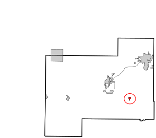
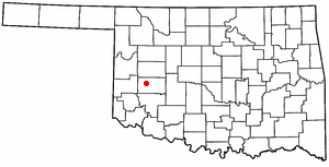
OKMap-doton-DillCity.PNG
Location of Dill City, Oklahoma
Coordinates: 35°16′55″N99°08′01″W / 35.28194°N 99.13361°W / 35.28194; -99.13361
Country United States
State Oklahoma
County Washita
Area
[1]
  Total0.58 sq mi (1.50 km2)
  Land0.58 sq mi (1.50 km2)
  Water0.00 sq mi (0.00 km2)
Elevation
[2]
1,864 ft (568 m)
Population
 (2020)
  Total420
  Density726.64/sq mi (280.74/km2)
Time zone UTC-6 (Central (CST))
  Summer (DST) UTC-5 (CDT)
ZIP code
73641
Area code 580
FIPS code 40-20850 [3]
GNIS feature ID2412430 [2]

Dill City is a town in Washita County, Oklahoma, United States. The population was 562 at the 2010 census.

Contents

Geography

According to the United States Census Bureau, the town has a total area of 0.6 square miles (1.6 km2), all land.

Dill City is served by State Highway 42, a dedicated spur-like state highway connecting the community to State Highway 152.

Demographics

Historical population
CensusPop.Note
1910 240
1920 34543.8%
1930 51148.1%
1940 5110.0%
1950 453−11.4%
1960 62337.5%
1970 578−7.2%
1980 64912.3%
1990 628−3.2%
2000 526−16.2%
2010 5626.8%
2020 420−25.3%
U.S. Decennial Census [4]

As of the census [3] of 2000, there were 526 people, 209 households, and 161 families residing in the town. The population density was 949.7 inhabitants per square mile (366.7/km2). There were 253 housing units at an average density of 456.8 per square mile (176.4/km2). The racial makeup of the town was 91.83% White, 4.37% Native American, 0.57% from other races, and 3.23% from two or more races. Hispanic or Latino of any race were 4.37% of the population.

There were 209 households, out of which 31.6% had children under the age of 18 living with them, 63.2% were married couples living together, 10.0% had a female householder with no husband present, and 22.5% were non-families. 21.5% of all households were made up of individuals, and 12.0% had someone living alone who was 65 years of age or older. The average household size was 2.52 and the average family size was 2.91.

In the town, the population was spread out, with 25.5% under the age of 18, 7.4% from 18 to 24, 24.7% from 25 to 44, 18.3% from 45 to 64, and 24.1% who were 65 years of age or older. The median age was 40 years. For every 100 females, there were 97.7 males. For every 100 females age 18 and over, there were 95.0 males.

The median income for a household in the town was $22,917, and the median income for a family was $26,500. Males had a median income of $23,125 versus $14,545 for females. The per capita income for the town was $11,558. About 17.1% of families and 21.1% of the population were below the poverty line, including 30.6% of those under age 18 and 9.7% of those age 65 or over.

Notable person

Related Research Articles

<span class="mw-page-title-main">Carter, Oklahoma</span> Town in Oklahoma, United States

Carter is a town in Beckham County, Oklahoma, United States. The population was 183 at the time of the 2020 census.

<span class="mw-page-title-main">Hitchcock, Oklahoma</span> Town in Oklahoma, United States

Hitchcock is a town in Blaine County, Oklahoma, United States. The population was 121 at the 2010 census.

<span class="mw-page-title-main">Okeene, Oklahoma</span> Town in Oklahoma, United States

Okeene is a town in Blaine County, Oklahoma, United States. The population was 1,090 as of the 2020 United States census. The name was created by combining the last letters of Cherokee and Cheyenne.
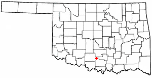
<span class="mw-page-title-main">Ratliff City, Oklahoma</span> Town in Oklahoma, United States

Ratliff City is a town in Carter County, Oklahoma, United States. The population was 120 at the 2010 census. Ratliff City was named for Ollie Ratliff, owner of a local garage. It is part of the Ardmore, Oklahoma Micropolitan Statistical Area.

<span class="mw-page-title-main">Springer, Oklahoma</span> Town in Oklahoma, United States

Springer is a town in Carter County, Oklahoma, United States. As of the 2020 census, the community had 685 residents. It is part of the Ardmore, Oklahoma Micropolitan Statistical Area.

<span class="mw-page-title-main">Butler, Oklahoma</span> Town in Oklahoma, United States

Butler is a town in Custer County, Oklahoma, United States. The population was 208 at the time of the 2020 census, down from 287 at the 2010 census.

<span class="mw-page-title-main">Covington, Oklahoma</span> Town in Oklahoma, United States

Covington is a town in Garfield County, Oklahoma, United States. The population was 477 at the 2020 census.
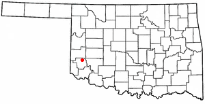
<span class="mw-page-title-main">Willow, Oklahoma</span> Town in Oklahoma, United States

Willow is a town in Greer County, Oklahoma, United States. The population was 119 as of the 2020 United States census. It is situated about 13 miles north of the county seat of Mangum, just west of the concurrent US Route 283 and Oklahoma State Highway 34.

<span class="mw-page-title-main">May, Oklahoma</span> Town in Oklahoma, United States

May is a town in Harper County, Oklahoma, United States. As of the 2020 census, the town’s population was 29.
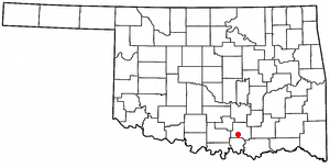
<span class="mw-page-title-main">Ravia, Oklahoma</span> Town in Oklahoma, United States

Ravia is a town in Johnston County, Oklahoma, United States. The population was 528 at the 2010 census, up from 459 in 2000.

<span class="mw-page-title-main">Tryon, Oklahoma</span> Town in Oklahoma, United States

Tryon is a town in Lincoln County, Oklahoma, United States. The population was 491 at the 2010 census. The community is named after early land owner Fred S. Tryon.

<span class="mw-page-title-main">Warwick, Oklahoma</span> Town in Oklahoma, United States

Warwick is a town in Lincoln County, Oklahoma, United States. The population was 184 at the 2020 census, up from 148 in 2010.

<span class="mw-page-title-main">Langley, Oklahoma</span> Town in Oklahoma, United States

Langley is a town in Mayes County, Oklahoma, United States. The population was 819 at the 2010 census.

<span class="mw-page-title-main">Byars, Oklahoma</span> Town in Oklahoma, United States

Byars is a town in McClain County, Oklahoma, United States. The population was 184 at the 2020 census, down from 255 at the 2010 census.

<span class="mw-page-title-main">Cole, Oklahoma</span> Town in Oklahoma, United States

Cole is a town in McClain County, Oklahoma, United States. The population was 624 at the 2020 census, up from 555 at the 2010 census.

<span class="mw-page-title-main">Rosedale, Oklahoma</span> Town in Oklahoma, United States

Rosedale is a town in McClain County, Oklahoma, United States. The population was 62 at the 2020 census, a 8.8% decrease from 2010.

<span class="mw-page-title-main">North Miami, Oklahoma</span> Town in Oklahoma, United States

North Miami is a town in Ottawa County, Oklahoma, United States. The population was 290 at the 2020 census. The town is primarily a bedroom community for several larger towns in the county.

St. Louis is a town in Pottawatomie County, Oklahoma, United States. The population was 121 by the 2020 United States census.

<span class="mw-page-title-main">Foyil, Oklahoma</span> Town in Oklahoma, United States

Foyil is a town in Rogers County, Oklahoma, United States. It was named for Alfred Foyil, a local landowner and the first postmaster of the town. The population was 344 at the 2010 census, a 47.0 percent increase over the figure of 234 recorded in 2000.
<span class="mw-page-title-main">Burns Flat, Oklahoma</span> Town in Oklahoma, United States

Burns Flat is a town in Washita County, Oklahoma, United States. The population was 2,057 at the 2010 census.
References

  1. "ArcGIS REST Services Directory". United States Census Bureau. Retrieved September 20, 2022.
  2. 1 2 U.S. Geological Survey Geographic Names Information System: Dill City, Oklahoma
  3. 1 2 "U.S. Census website". United States Census Bureau . Retrieved January 31, 2008.
  4. "Census of Population and Housing". Census.gov. Retrieved June 4, 2015.