Double Bayou | |
---|---|
Coordinates: 29°41′34″N94°37′45″W / 29.69278°N 94.62917°W | |
Country | United States |
State | Texas |
County | Chambers |
Elevation | 13 ft (4 m) |
Time zone | UTC-6 (Central (CST)) |
• Summer (DST) | UTC-5 (CDT) |
Area code | 409 |
GNIS feature ID | 1378220 [1] |
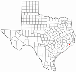
Double Bayou is an unincorporated community in Chambers County, Texas, United States. According to the Handbook of Texas, the community had a population of 400 in 2000. It is located within the Greater Houston metropolitan area.
In 1847, James Jackson established a 26,000 acres (11,000 ha) ranch in the region. The Jackson ranch was enclosed at an early period, even though the majority of operations of this kind operated on the open range. At Double Bayou, the local general store—founded by John Jackson before 1900—acted as the hub of the community. The region's widely dispersed residents also had gathering places in the form of a cotton gin and sugar cane mill. Post offices at Double Bayou were open from 1860 to 1866 and again from 1876 to 1919. Boats continued far into the twentieth century to serve as the area's principal mode of transportation, sailing on Trinity Bay and Double Bayou. Like with many other communities of Texas' higher coastal prairies, the people of Double Bayou suffered greatly from the floods that accompanied the hurricane of 1915. In the 1930s, the population of the remote rural area, which was predominantly black, was believed to be between 150 and 300. In the middle of the 1970s, the Double Bayou hamlet was identified on maps by several homes and churches. In 1981, 26,136 tons were handled by the Double Bayou port. 400 people were living in the community as of 1990 and 2000. [2]
James Jackson's grandson, Ralph Semmes Jackson, was born here in the early 1900s and was the author of Home on the Double Bayou. His brother, Guy Cade, became an early conservationist and county judge. Besides the Galveston Hurricane, several other storms struck Double Bayou, resulting in the loss of cattle one winter. It is also the home of a dance hall. [3]
Double Bayou is located between the two forks of the Double Bayou and just north of the intersection of Farm to Market Roads 1985 and 562, 50 mi (80 km) southwest of Beaumont in west-central Chambers County. [2]
Double Bayou had its own school in the 1970s. [2] Today, the Anahuac Independent School District operates schools in the area.
Chambers County is a county in the U.S. state of Texas. As of the 2020 census, its population was 46,571. The county seat is Anahuac. Chambers County is one of the nine counties that comprise Greater Houston, the Houston–The Woodlands–Sugar Land metropolitan statistical area.
Brewster County is a county located in the U.S. state of Texas. It is in West Texas and its county seat is Alpine. It is one of the nine counties that comprise the Trans-Pecos region, and borders Mexico. Brewster County is the largest county by area in the state - at 6,192 square miles (16,040 km2) it is over three times the size of the state of Delaware, and more than 500 square miles (1,300 km2) bigger than Connecticut.
Morgan's Point is located 30 miles southeast of Houston in southeastern Harris County, Texas, United States, located on the shores of Galveston Bay at the inlet to the Houston Ship Channel, near La Porte and Baytown. As of the 2020 census, it has 273 residents, and is located within the La Porte Independent School District.
Pasadena is a city in the U.S. state of Texas, located in Harris County. It is part of the Houston–The Woodlands–Sugar Land metropolitan area. As of the 2020 U.S. census, the city's population was 151,950, making it the 23rd most populous city in Texas and the second most populous in Harris County, after Houston. The area was founded in 1893 by John H. Burnett of Galveston, who named the area after Pasadena, California, because of the perceived lush vegetation.
Baytown is a city in the U.S. state of Texas, within Harris and Chambers counties. Located in the Houston–The Woodlands–Sugar Land metropolitan statistical area, it lies on the northern side of the Galveston Bay complex near the outlets of the San Jacinto River and Buffalo Bayou. It is the sixth-largest city within this metropolitan area and seventh largest community. Major highways serving the city include State Highway 99, State Highway 146 and Interstate 10. At the 2020 U.S. census, Baytown had a population of 83,701, and it had an estimated population of 84,324 in 2022.
Katy is a city in the U.S. state of Texas. It is in the Greater Katy area, itself forming the western part of the Greater Houston metropolitan area. Homes and businesses may have Katy postal addresses without being in the City of Katy. The city of Katy is approximately centered at the tripoint of Harris, Fort Bend, and Waller counties. The population was 21,894 at the 2020 census.
Clear Lake City is a master-planned community located in southeast Harris County, Texas, within the Bay Area of Greater Houston. It is the second-largest master-planned community in Houston – behind Kingwood. The majority of the community lies in the corporate limits of Houston, and a small eastern portion within the city limits of Taylor Lake Village.
The city of Houston in the U.S. state of Texas was founded in 1837 after Augustus and John Allen had acquired land to establish a new town at the junction of Buffalo and White Oak bayous in 1836. Houston served as the temporary capital of the Republic of Texas. Meanwhile, the town developed as a regional transportation and commercial hub. Houston was part of an independent nation until 1846 when the United States formally annexed Texas. Railroad development began in the late 1850s but ceased during the American Civil War. Houston served the Confederacy as a regional military logistics center. The population increased during the war and blockade runners used the town as a center for their operations.
High Island is an unincorporated community located in the Bolivar Peninsula census-designated place, Galveston County, Texas, United States. The community is located in the extreme eastern part of the county on Bolivar Peninsula, less than one mile from Chambers County and less than two miles from Jefferson County. As of 2000, 500 people resided in High Island. The 2010 census did not record a population for High Island.
Buffalo Bayou is a slow-moving body of water which flows through Houston in Harris County, Texas. Formed 18,000 years ago, it has its source in the prairie surrounding Katy, Fort Bend County, and flows approximately 53 miles (85 km) east through the Houston Ship Channel into Galveston Bay and the Gulf of Mexico. In addition to drainage water impounded and released by the Addicks and Barker reservoirs, the bayou is fed by natural springs, surface runoff, and several significant tributary bayous, including White Oak Bayou, Greens Bayou, and Brays Bayou. Additionally, Buffalo Bayou is considered a tidal river downstream of a point 440 yards (400 m) west of the Shepherd Drive bridge in west-central Houston.
Johnson Bayou is a small unincorporated community located on the Creole Nature Trail along the Gulf Coast in Cameron Parish, Louisiana, United States, and is named after Daniel Johnson, who came to the area circa 1790. The village is a barrier island spread across coastal chenieres which were formed by deltaic sedimentation by the shifting of the Mississippi River. This geologic formation, the coastal cheniere, is found only in a few locations across the globe. The population of the community was approximately 400 before Hurricanes Laura and Delta devastated the community in August and October of 2020. By September of 2021 the population had recovered to almost 300.
Crystal Beach is an unincorporated community in the Bolivar Peninsula census-designated place, in Galveston County, Texas, United States. Also known as Patton, Crystal Beach stretches 7 miles (10 km) along Texas State Highway 87 in the middle of Bolivar Peninsula.
North Shore is a community in east side of Harris County, Texas with a small portion inside the city of Houston, Texas. The area includes subdivisions such as Songwood, Holiday Forest, Wood Bayou, Cimarron, Home Owned Estates, Woodland Acres, Hidden Forest, Pine Trails, Woodforest, Woodforest North, New Forest, and New Forest West, as well as newer neighborhoods near Highway 90 and Beltway 8 North Sam Houston Parkway.
The Galveston Bay Area, also known as Bay Area Houston or simply the Bay Area, is a region that surrounds the Galveston Bay estuary of Southeast Texas in the United States, within Houston–The Woodlands–Sugar Land metropolitan area. Normally the term refers to the mainland communities around the bay and excludes Galveston as well as most of Houston.
Rosharon, is a census-designated place (CDP) in Brazoria County, Texas, United States, at the intersection of Farm to Market Road 521 and Farm to Market Road 1462. As of the 2010 census, it had a population of 1,152. There are areas outside of the CDP, with Rosharon postal addresses, in Fort Bend County.
Amsterdam is an unincorporated community in Brazoria County, Texas, United States. Amsterdam is on Chocolate Bayou, 10 mi (16 km) east of Angleton in east central Brazoria County.
Cedar Bayou is an area in east central Harris County, Texas, United States.
For a period of over 7000 years, humans have inhabited the Galveston Bay Area in what is now the United States. Through their history the communities in the region have been influenced by the once competing sister cities of Houston and Galveston, but still have their own distinct history. Though never truly a single, unified community, the histories of the Bay Area communities have had many common threads.
Pete Mayes was an American Texas blues singer, guitarist and songwriter. He was variously known as Texas Pete Mayes and T-Bone Man.
East Bay also known as East Galveston Bay, is the eastern extension of Galveston Bay found in Chambers County, Texas. The bay is oriented northeast to southwest, and is approximately five miles wide and twenty miles in length. It covers the area north of the entire Bolivar Peninsula, and south of mainland Texas, including the small community of Smith Point at the western extreme. The bay's one extension is Rollover Bay, which is found to the extreme east near the town of Gilchrist.