Uran is a coastal town in Raigad District's Navi Mumbai, Maharashtra state in Konkan division. It lies to the east of Mumbai across the Dharamtar Creek. Uran is primarily a fishing and agriculture village, which has developed into the special economic zone of Uran. The primary languages spoken are Agri and Koli which is a dialect of Marathi-Konkani.
Raigad district, previously Colaba district, is a district in the Konkan division of Maharashtra, India. The headquarters of the district is Alibag. Other major cities in the district are Panvel, Karjat, Navi Mumbai, Khopoli, Shrivardhan and Mahad.
Sarasgad fort is situated near village Pali in the Raigad district of Maharashtra. Pali lies about 10 kilometres East of Nagothane along the Nagothane-Khopoli road. This fort height from sea level is 490 meters

Karnala Fort is a hill fort in Raigad district, Maharashtra, India, about 10 km from Panvel city. Currently it is a protected place lying within the Karnala Bird Sanctuary. It was a place of strategic importance since it overlooked the Bor pass, which connected the Konkan coast to the interior of Maharashtra on the main trade route between these areas.

Korlai Fort is a colonial fort in the Raigad district of Maharashtra, India. Formerly a part of Chaul in Portuguese India, the structure is a specimen of Portuguese colonial architecture. It was built as a companion to the fort at Chaul, at this strategic position the Portuguese could use it to defend their province which stretched from Korlai to the Fort Bassein. Vestiges of the Portuguese occupation are manifested in the distinct dialect of the Korlai villages inhabitants which is a Luso-Indian creole called Korlai Portuguese Creole.

Shrivardhan Fort is one of the two hill forts that constitute the Rajmachi fortification, the other being Manaranjan Fort. It is located in Rajmachi village which 8.5 km from Lonavala in the Sahyadris mountain range. At 900 m(3000 feet) above sea level it was the taller of the two peaks and was named after Shrivardhan Ganpatrao Patwardhan. Other than a rampart there is no visible construction. It was probably used at a watchtower for the Sahyadri region. There are two water tanks at the top of the hill but one of them has an iron pillar in it.

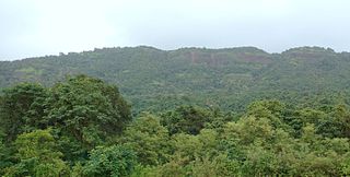
Madhe Ghat is located in Maharashtra state India around 62 km south west of Pune bordering Raigad district and in the vicinity of Torna Fort, Rajgad, Raigad Fort and backwaters of Bhatghar dam. The name of this waterfall is Laxmi Waterfall. It is about 850 meters above sea level and situated in dense forests behind Torna Fort. From this place, you can have a view of vast area such as Raigad fort, Lingana, Varandha ghat and Shivthar Ghal.
Ulwe is a node of Raigad District's Navi Mumbai situated beside Belapur and Nerul and home to Navi Mumbai International Airport officially named DB Patil International Airport. It is developed and maintained by CIDCO. It is soon going to come under the purview of the Panvel Municipal Corporation.

Kenjalgad Fort in Wai, Maharashtra is a fort eleven miles (18 km) north-west of Wai. It is located on the Mandhardev spur of the Mahadev hill range. The fort is visible from quite a long distance as a stone scarp 30–40 feet high rising as a cap on the irregular hill. The fort is rhomboid in shape with 388m long axis and 175m short axis.
Talgad fort is located 18 km south of the Roha town on Roha-Tala-Indapur road. This fort is at an altitude of 1000 feet. This fort is in form of a narrow strip 20 meters in width. This fort is situated on a narrow spur guarded by fortification. This fort served to keep watch on the enemy and the trade route from Maval to the sea ports around. Also this fort was used to keep check on the activity of Sidhhis of Janjira. Ghosalgad fort is also visible from this fort.

Vandan Fort is located in Satara District. This fort is situated on a hilly spur from the main ridge of Sahyadri. This fort is frequently visited by trekkers and pilgrims. The villages at the base are rich in sugarcane and other cultivation. The Chandan and Vandan are adjacent forts. The trek to both the fort can easily be completed in a day.
Mrugagad fort is a hill fort in Sudhagad taluka of Raigad district, Maharashtra, India. At a height of 1750 ft, the fort lies near Bheliv village, and is made of stone. The fort is very small in size and is in a form of spur radiating from the Western ghats. The fort is very close to the Lonavala, Khandala and Khopoli.

Vikatgad / Peb Fort is a fort located 19 km (12 mi) from Karjat, in Raigad district, of Maharashtra. This fort is in continuation with the Malang gad, Tauli Hill and Chanderi fort of the Matheran Hill Range. Vikatgad is a favourite destination for one-day trekkers. The trek path to Vikatgad is along deep ravines and cliffs. Its closeness to Matheran and Neral attracts many trekkers on weekends. The forest department and local villagers are doing plantation and some restoration works on the fort. The altitude of Vikatgad, also known as Peb fort is 640 meters above sea level.
Makrandgad Fort is a fort near Pratapgad Fort. It is located 156km from Pune, in Satara district, of Maharashtra. The fort is located in the midst of the famous Javli forest. The fort is accessible from the Hatlot and Ghonaspur village. The trek to this fort is an easy one day trek for visitors at Mahabaleshwar. The fort consists of two flattened humps with a ridge between them.

Pisola Fort is a fort located 125 km (78 mi) from Nashik, in the Nashik district of Maharashtra, India. This fort lies exactly on the borders of Dhule & Nashik District. One side is in Sakri Taluka & another is in Satana Taluka. Though this fort is an important fort in Nashik district, it is less visited by trekkers. In Satana taluka, there are four forts in a line on the Galna hill range, the Pisol fort, Dermal fort, Kankrala fort and Galna fort. This fort is easy to climb but requires one hour to reach the fort.
Chandragad Fort / Dhavalgad Fort is a fort located 182 km from Mumbai, in raigad district, of Maharashtra. This fort was an important fort in raigad district as a watch over for the Varandha Ghattrade routes from Bhor to kokan. The fort is surrounded by forest and hill slopes.