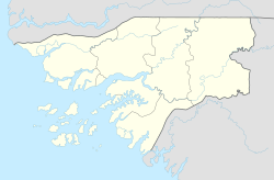
Guinea-Bissau, officially the Republic of Guinea-Bissau, is a country in West Africa that covers 36,125 square kilometres (13,948 sq mi) with an estimated population of 2,026,778. It borders Senegal to its north and Guinea to its southeast.
The region now known as Guinea-Bissau has been inhabited for thousands of years. In the 13th century, it became a province of the Mali Empire that later became independent as the Empire of Kaabu. The region was claimed by Portugal beginning in the 1450s. During most of this period, Portuguese control of the region was limited to a number of forts along the coast. Portugal gained full control of the mainland after the pacification campaigns of 1912–15. The offshore Bijago islands were not colonised until 1936. After independence in 1974, the country was controlled by a single-party system until 1991. The introduction of multi-party politics in 1991 brought the first multi-party elections in 1994. A civil war broke out from 1998 to 1999.

The economy of Guinea-Bissau comprises a mixture of state-owned and private companies. Guinea-Bissau is among the world's least developed nations and one of the 10 poorest countries in the world, and depends mainly on agriculture and fishing. Cashew crops have increased remarkably in recent years, and the country ranked ninth in cashew production for the year 2019.

The recorded history of Cape Verde begins with the Portuguese discovery of the island in 1458. Possible early references to Cape Verde date back at least 2,000 years.

Bissau is the capital and largest city of Guinea-Bissau. As of 2015, it had a population of 492,004. Bissau is located on the Geba River estuary, off the Atlantic Ocean, and is Guinea-Bissau's largest city, major port, its administrative and military center.

Portuguese Guinea, called the Overseas Province of Guinea from 1951 until 1972 and then State of Guinea from 1972 until 1974, was a West African colony of Portugal from 1588 until 10 September 1974, when it gained independence as Guinea-Bissau.
Articles related to Guinea-Bissau include:

Cacheu is a town in northwestern Guinea-Bissau lying on the Cacheu River, capital of the eponymous region. Its population was estimated to be 9,849 as of 2008.
The lançados were settlers and colonizers of Portuguese origin in Senegambia, Cabo Verde, Guinea, Sierra Leone, and other areas on the coast of West Africa. Many were Jews—often New Christians—escaping persecution from the Portuguese Inquisition. Lançados often took African wives from local ruling families, securing protection and advantageous trading ties. They established clandestine trading networks in weaponry, spices, and slaves. This black market angered the Portuguese Crown by disrupting its ability to collect taxes.

This article is a comprehensive list of all the actual possessions of the Portuguese Empire.

Portuguese maritime exploration resulted in the numerous territories and maritime routes recorded by the Portuguese as a result of their intensive maritime journeys during the 15th and 16th centuries. Portuguese sailors were at the vanguard of European exploration, chronicling and mapping the coasts of Africa and Asia, then known as the East Indies, and Canada and Brazil, in what came to be known as the Age of Discovery.
Papels, also known as Moium, Oium, Papei, Pepel or Pelels, are an ethnic group primarily located in Guinea-Bissau, though are also found in Casamance (Senegal) and Guinea. Their population in Guinea-Bissau is about 183,000, with 9,000 living outside of the country. They traditionally engaged in hunting and agriculture.
Bissau-Guinean Americans are Americans of Bissau-Guinean descent. As was the case with almost all current West African coastal countries, the first people in the United States from present-day Guinea-Bissau were imported as slaves. Thus, in the 21st century, there are many African Americans who have discovered, through DNA analysis, they descend mainly or at least partly, from Bissau-Guinean enslaved people.
Bibiana Vaz de França was a prominent nhara slave-trader in Cacheu, Guinea-Bissau.
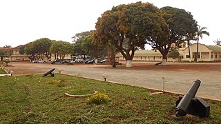
Fort São José of Amura, also known locally as Amura Fort, is a fortification located in the city of Bissau, region of Bissau, capital of Guinea-Bissau, in West Africa.
André Álvares de Almada was a Cape Verdean writer, trader and explorer of mestiço (mixed) descent. He was one of the first recorded Cape Verdean writers.
The Cacheu and Cape Verde Company was a chartered company created by Portugal which operated the colonies of Cacheu and Cape Verde in the late 17th and early 18th centuries. It was created as part of the economic reforms of Luís de Meneses, 3rd Count of Ericeira, under King Peter II.
Crispina Peres was an African "Senhora" slave trader, natural from Geba, nowadays Guinea-Bissau.
The Company of Cacheu and Rivers and Commerce of Guinea was a Portuguese colonial company. It succeeded the Guinea Coast Company and was intended to promote trade in manufactured fabrics, ivory, and slaves in the Guinea region of West Africa.