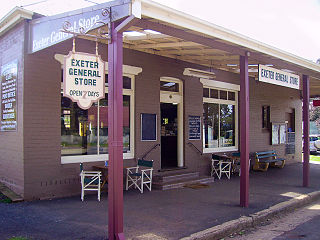
Exeter is a village in the Southern Highlands district of New South Wales, Australia, in Wingecarribee Shire. It has a station on the Main Southern railway line south of Sydney.

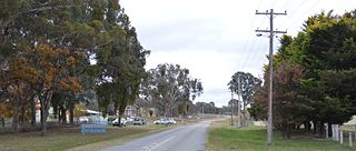
Aylmerton is a Northern Village of the Southern Highlands of New South Wales, Australia in Wingecarribee Shire. It is located north-east of Mittagong. The only buildings in Aylmerton are a fire station and houses, many of which are on farms.
Burradoo is a suburb of Bowral, in the Southern Highlands of New South Wales, Australia, in Wingecarribee Shire.
Colo is a small town located north-west of Sydney in New South Wales, Australia. It is home to the Colo River and parts of the Wollemi National Park. The main road through Colo is Putty Road. The locality of Colo is bounded in the south and the east by the Hawkesbury River.
Balaclava is a Northern Village of the Southern Highlands of New South Wales, Australia in Wingecarribee Shire. It is 1 km north-east of Mittagong. The village includes a service station, real estate, pre-school, nursery, doctor's surgery and antiques store. It is located in Wingecarribee Shire and is often considered part of Braemar along with its neighbour Willow Vale.
Kangaloon is a village in the Southern Highlands of New South Wales, Australia, in Wingecarribee Shire.

Fitzroy Falls is a village in the Wingecarribee Shire, located within the Southern Highlands region of New South Wales, Australia. The locality was known as Yarrunga, but was renamed after the 81-metre (266 ft) waterfall.
Braemar is a northern village of the Southern Highlands of New South Wales, Australia in Wingecarribee Shire. It is located two km north-east of Mittagong and is often considered to include the hamlet villages of Balaclava and Willow Vale.
Alpine is a Northern Village of the Southern Highlands of New South Wales, Australia, in the Wingecarribee Shire. It is located north-east of Aylmerton and south of Yerrinbool. The Main Southern Line passes through the locality, and the Hume Highway runs along the western boundary. The Old South Road, an early precursor to the Hume Highway, runs through the centre of the locality, separating the rural western side from the Upper Nepean Catchment Area which is heavily forested.
Canyonleigh is a locality in the Southern Highlands of New South Wales, Australia, in Wingecarribee Shire. Canyan Leigh was named by Mrs Jane Murray who took up a property between Paddys River and Long Swamp. The property overlooked the valley and this gave Mrs Murray the idea 'Canyan' or 'Canyon' being the name for a steep sided gully.
Glenquarry is a locality in the Southern Highlands of New South Wales, Australia, in Wingecarribee Shire. It is a scattered village on the banks of the Wingecarribee River.
Bullio is a small village in the Southern Highlands of New South Wales, Australia, in Wingecarribee Shire.
Belanglo is a locality around the Belanglo State Forest in the Southern Highlands of New South Wales, Australia, in Wingecarribee Shire.
Nubba is a locality and former railway station on the Main South railway line in New South Wales, Australia, located midway between Wallendbeen and Harden. The station was open between 1882 and 1975 and has now been demolished.
Rugby is a village in the Southern Tablelands region of New South Wales, Australia. The village is in the Hilltops Council local government area, 292 kilometres (181 mi) south west of the state capital, Sydney and 146 kilometres (91 mi) north of the national capital, Canberra.
New Auckland is an urban locality in Gladstone in the Gladstone Region, Queensland, Australia. In the 2016 census, New Auckland had a population of 5,085 people. It is on the outskirts of the Gladstone urban area, but, as at December 2020, is experiencing high levels of suburban development.
Rye Park is a town in the Southern Tablelands region of New South Wales, Australia. The town is in the Hilltops Council local government area, 305 kilometres (190 mi) south west of the state capital, Sydney and 107 kilometres (66 mi) north of the national capital, Canberra.

Monteagle is a locality in the South West Slopes region of New South Wales, Australia. The locality is in the Hilltops Council local government area, 366 kilometres (227 mi) south west of the state capital, Sydney.

Crowther is a locality in New South Wales, Australia. The locality is in the Hilltops Council local government area and on the Olympic Highway, 341 kilometres (212 mi) west of the state capital, Sydney.

Berremangra is a locality in the Hilltops Council, New South Wales, Australia. It is on both sides of the Hume Highway about 45 km west of Yass.
