
Richmond is a historic town in north-west of Sydney, New South Wales, Australia. Richmond is in local government area of City of Hawkesbury and comes under Sydney Metropolitan area. It is located 20 metres above sea level on the alluvial Hawkesbury River flats, at the foot of the Blue Mountains. It is about 65 km by road from Sydney, 22 km from Penrith, 26 km from Blacktown, 40 km from Parramatta, 78 km from Lithgow and 5 km from Windsor. Richmond Town is now part of Sydney urban area have all amenities including Shopping Malls, Service NSW, Schools, TAFE, University, Post Office, Restaurants, Railway Station, Cafe, Hotel and Supermarkets.

The City of Hawkesbury is a local government area of New South Wales, Australia, located on the northern and north-western fringe of the Greater Sydney area, about 50 kilometres (31 mi) north-west of the Sydney central business district. Hawkesbury City is named after the Hawkesbury River. Major towns in City of Hawkesbury are Windsor, Richmond and Pitt Town.
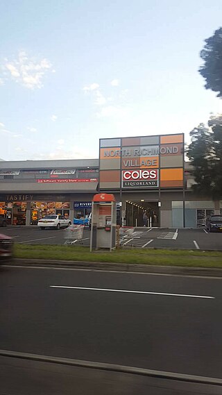
North Richmond is a town and also considered as suburb of Richmond, in the state of New South Wales, Australia. North Richmond is located 67 kilometres north-west of the Sydney central business district in the local government area of the City of Hawkesbury. It is separated from Richmond to the south-east by the Hawkesbury River. North Richmond is not part of Sydney metropolitan area as its border is Hawkesbury River, however North Richmond is considered as outskirts of Sydney region. Due to Redbank, a new land estate area in North Richmond, population increased gradually from 2020.

Mount Kuring-gai is an outer suburb of Northern Sydney, in the state of New South Wales, Australia. Mount Kuring-gai is located 31 kilometres north-west of the Sydney central business district, in the local government area of Hornsby Shire.
Bonner is a suburb in the district of Gungahlin in Canberra in the Australian Capital Territory, Australia.

Cattai is an historic suburb of Sydney, in the state of New South Wales, Australia. It is located 44 kilometres north-west of the Sydney central business district and 30 kilometres north-west of Parramatta. It is in the local government areas of The Hills Shire and City of Hawkesbury. Cattai's state electoral district is Hawkesbury, and its federal electoral divisions are Berowra and Macquarie.

Chatswood West is a suburb on the Lower North Shore of Sydney, in the state of New South Wales, Australia. Chatswood West is located 11 kilometres north-west of the Sydney central business district, in the local government areas of the City of Willoughby and City of Ryde. Chatswood is a separate suburb to the east. The locality of Chatswood located west of the Pacific Highway is informally known as West Chatswood, and should not be confused with the separate suburb of Chatswood West, nor should it be confused with the West Chatswood Post Office on Railway Street in the suburb of Chatswood. Chatswood West shares the same postcode as Chatswood which is 2067.

Cowan is a small outer suburb of Sydney, in the state of New South Wales, Australia, approximately 40 kilometres (25 mi) north of the Sydney central business district, in the local government area of Hornsby Shire. Cowan shares the postcode of 2081 with Berowra. Brooklyn, which lies 6 kilometres (3.7 mi) to the north-east of Cowan, is considered the northernmost suburb of the Greater Sydney Metropolitan Area.
Glossodia is a small town in the state of New South Wales, Australia. Glossodia is located 68 kilometres north-west of the Sydney central business district in the local government area of the City of Hawkesbury.

Kurrajong is a small town in New South Wales, Australia. Kurrajong is located 75 kilometres (47 mi) north-west of Sydney, in the local government area of the City of Hawkesbury.

Archerfield is a mixed-use southern suburb in the City of Brisbane, Queensland, Australia. In the 2021 census, Archerfield had a population of 533 people.
Hawkesbury Heights is a small town in the state of New South Wales, Australia in the City of Blue Mountains. It is located between the townships of Yarramundi and Winmalee. To the south is Yellow Rock. The only road link to the suburb is Hawkesbury Road, which becomes Springwood Road to the east.

Kurrajong Heights is a small town in the state of New South Wales, Australia. Kurrajong Heights is 79 kilometres (49 mi) north-west of Sydney, in the local government area of the City of Hawkesbury. It is stretched across the Bells Line of Road in the Blue Mountains, west of Kurrajong and east of Bilpin. At the 2016 census, Kurrajong Heights had a population of 1,342 people.
Kurrajong Hills is a locality in the state of New South Wales, Australia. It is 76 kilometres north-west of Sydney, in the local government area of the City of Hawkesbury. It is north of the Bells Line of Road in the Blue Mountains, west of Kurrajong and east of Bilpin.

Sackville (Doorumbolooa) is a suburb of Sydney, in the state of New South Wales, Australia. It is located in the City of Hawkesbury and at the 2016 census had a population of 298, thirteen of whom identified as Aboriginal and Torres Strait Islander.
Kurmond is a village 70.5 km west of Sydney, in the state of New South Wales, Australia. It is located in the City of Hawkesbury between Kurrajong and North Richmond on Bells Line of Road.

Grose Vale is a suburb of Sydney, in the state of New South Wales, Australia. It is located in the City of Hawkesbury. It was previously known as South Kurrajong. Many historic properties are located in Grose Vale including "Lemon Forest" originally owned by the Lamrock family as well as a number of homes owned by the Dunston and Ezzy families.
Wheeny Creek is a locality of Sydney, in the state of New South Wales, Australia. It is located in the City of Hawkesbury north-east of Kurrajong.
Blaxlands Ridge is a suburb near Richmond, in the state of New South Wales, Australia. It is located in the City of Hawkesbury north of East Kurrajong.

The Kurrajong railway line was a railway line in the distant rural western suburbs of Sydney, Australia. It was an extension of the branch off the Main Western line from Blacktown to Richmond and was operated by the New South Wales Government Railways.

