This article needs additional citations for verification .(January 2017) |
Edgbaston | |
---|---|
Ward | |
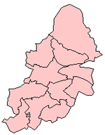
Edgbaston Ward shown within Birmingham | |
Location within the West Midlands | |
Population | 24,426 (2011) [1] |
OS grid reference | SP055845 |
Metropolitan borough | |
Metropolitan county | |
Region | |
Country | England |
Sovereign state | United Kingdom |
Post town | BIRMINGHAM |
Postcode district | B15 B16 |
Dialling code | 0121 |
Police | West Midlands |
Fire | West Midlands |
Ambulance | West Midlands |
UK Parliament | |
Councillors |
|
Edgbaston ward is a local government district, one of 40 wards that make up Birmingham City Council. Edgbaston lies to the south west of Birmingham city centre and is home to the University of Birmingham and the Queen Elizabeth hospital. The ward population at the 2011 census was 24,426. [2]
The ward covers an area of west Birmingham, including the districts of Edgbaston and parts of Ladywood. It also covers areas around the University Hospital.
The ward was created in 1838, and has been a ward ever since.
The boundary changes of 1950, transferred an area east of the railway line and north of Church Rd and Priory Rd, was transferred to Market Hall ward. To compensate for the loss of electorate, the ward was extended westwards to take in areas of north Harborne.
The boundary changes of 1962 were a reverse of the 1950 changes. The areas south of Lea Bank and Belgrave Roads from the Market Hall ward. Once again to balance the electorate, the area north of the Hagley Road close to the city boundary at Bearwood, and the area of northern Harborne which had been acquired in 1950 were transferred to Harborne ward.
The Edgbaston ward is currently represented by two Conservative Councillors; Deirdre Alden (1999-), and Matt Bennett (2015-).
The ward of Edgbaston forms part of the Parliamentary constituency of Birmingham Edgbaston along with Bartley Green, Harborne, and Quinton, which has been represented by Labour Party MP Preet Gill since 2017.
Party | Candidate | Votes | % | ±% | |
---|---|---|---|---|---|
Conservative | Deirdre Alden | 1,710 | 24.1 | ||
Conservative | Matt Bennett | 1,548 | 21.9 | ||
Labour | Baljit Kaur | 1,474 | 20.8 | ||
Labour | Marie Hill | 1,465 | 20.7 | ||
Green | Ashish Awasthi | 392 | 5.5 | ||
Liberal Democrats | Jamie Scott | 251 | 3.5 | ||
Liberal Democrats | James Bryant | 243 | 3.4 | ||
Majority | |||||
Turnout | 7,083 | ||||
Conservative hold | Swing | ||||
Conservative hold | Swing |
Party | Candidate | Votes | % | ±% | |
---|---|---|---|---|---|
Conservative | Deirdre Alden | 2,607 | 31.1 | ||
Conservative | Matt Bennett | 1,969 | 23.5 | ||
Labour | Jenny Nolan | 1,571 | 18.8 | ||
Labour | Marcus Bernasconi | 1,470 | 17.6 | ||
Green | Alexander Nettle | 279 | 3.3 | ||
Liberal Democrats | Daniel Chamberlain | 259 | 3.1 | ||
Liberal Democrats | Jamie Scott | 222 | 2.7 | ||
Majority | |||||
Turnout | 8,377 | ||||
Conservative hold | Swing | ||||
Conservative hold | Swing |
Party | Candidate | Votes | % | ±% | |
---|---|---|---|---|---|
Conservative | Deirdre Alden | 2,043 | 44.6 | 2.1 | |
Labour | Tom Keeley | 1,967 | 42.9 | 2.3 | |
Green | Joe Belcher | 222 | 4.8 | 3.2 | |
UKIP | Peter Hughes | 180 | 3.9 | 0.5 | |
Liberal Democrats | Lee Dargue | 174 | 3.8 | 0.7 | |
Majority | 76 | 1.7 | |||
Turnout | 4,586 | 32.3 | |||
Conservative hold | Swing |
Party | Candidate | Votes | % | ±% | |
---|---|---|---|---|---|
Conservative | Matt Bennett | 4,112 | 42.5 | 0.8 | |
Labour | Tom Keeley | 3,932 | 40.6 | 0.8 | |
Green | Tom Dalton | 777 | 8.0 | 1.3 | |
Liberal Democrats | Lee Dargue | 433 | 4.5 | 3.1 | |
UKIP | Laura Howard | 426 | 4.4 | 2.1 | |
Majority | 180 | 1.9 | |||
Turnout | 9,680 | ||||
Conservative hold | Swing | 0.6 |
Party | Candidate | Votes | % | ±% | |
---|---|---|---|---|---|
Conservative | Fergus Robinson | 2,235 | |||
Labour | Robbie Lea-Trengrouse | 2,061 | |||
UKIP | Keith Rowe | 470 | |||
Liberal Democrats | Kaneyalal Chudasama | 313 | |||
Majority | 174 | ||||
Turnout | |||||
Conservative hold | Swing |
Party | Candidate | Votes | % | ±% | |
---|---|---|---|---|---|
Conservative | Deirdre Alden | 2,240 | 46.1 | ||
Labour | D Minnis | 1999 | 41.1 | ||
Green | B Marle | 279 | 5.7 | ||
Liberal Democrats | Colin Green | 196 | 4.0 | ||
UKIP | D Bridges | 131 | 2.7 | ||
Majority | 241 | 5.0 | |||
Turnout | 26.6 | 7.3 | |||
Conservative hold | Swing |
Party | Candidate | Votes | % | ±% | |
---|---|---|---|---|---|
Conservative | James Hutchings | 2,555 | 41.7 | ||
Labour | D Minnis | 2534 | 41.4 | ||
Liberal Democrats | Colin Green | 472 | 7.7 | ||
Green | P Tinsley | 414 | 6.8 | ||
UKIP | G Houston | 145 | 2.4 | ||
Majority | 21 | 0.3 | |||
Turnout | 33.9 | ||||
Conservative hold | Swing |
Party | Candidate | Votes | % | ±% | |
---|---|---|---|---|---|
Conservative | Fergus Robinson | 3,832 | 40.4 | 18.4 | |
Labour | N Constantinou | 3,036 | 32.0 | 9.9 | |
Liberal Democrats | R Hunter | 2,053 | 21.7 | 12.6 | |
Green | E Moss | 378 | 4.0 | ||
BNP | E Wainwright | 181 | 1.9 | ||
Majority | 796 | 8.4 | |||
Conservative hold | Swing |
Party | Candidate | Votes | % | ±% | |
---|---|---|---|---|---|
Conservative | Deirdre Alden | 2,429 | 58.8 | ||
Labour | R Dungate | 912 | 22.1 | ||
Liberal Democrats | S Ritchie | 372 | 9.0 | ||
Majority | 1517 | 36.7 | |||
Conservative hold | Swing |
Party | Candidate | Votes | % | ±% | |
---|---|---|---|---|---|
Conservative | James Hutchings | 2,410 | 51.9 | ||
Labour | M Clee | 1196 | 25.7 | ||
Liberal Democrats | S Ritchie | 524 | 11.3 | ||
Green | B Smith | 322 | 6.9 | ||
BNP | T Shearer | 121 | 2.6 | ||
UKIP | F Jones | 75 | 1.6 | ||
Majority | 1214 | 26.1 | |||
Conservative hold | Swing |
Beckenham was a constituency in Greater London represented in the House of Commons of the UK Parliament from 2010 until its abolition for the 2024 general election by Bob Stewart, a member of the Conservative Party.
Birmingham City Council is the local authority for the city of Birmingham in the West Midlands, England. Birmingham has had an elected local authority since 1838, which has been reformed several times. Since 1974 the council has been a metropolitan borough council. It provides the majority of local government services in the city. It is the most populous local government district in England, serving over 1.1 million people. The council has been a member of the West Midlands Combined Authority since 2016.
Smethwick is an industrial town in Sandwell, West Midlands, England. It lies 4 miles (6 km) west of Birmingham city centre. Historically it was in Staffordshire and then Worcestershire before being placed into then West Midlands county.
Edgbaston is a suburb of Birmingham, West Midlands, England. It lies immediately south-west of Birmingham city centre, and was historically in Warwickshire. The wards of Edgbaston and North Edgbaston had a combined population of 42,295 at the 2021 census.
Harborne is an area of south-west Birmingham, England. It is located three miles southwest from Birmingham city centre. It is a Birmingham City Council ward in the formal district and in the parliamentary constituency of Birmingham Edgbaston.
Erdington is a suburb and ward of Birmingham in the West Midlands County, England. Historically part of Warwickshire, it is located 5 miles (8 km) northeast of central Birmingham, bordering Sutton Coldfield. It was also a council constituency, managed by its own district committee. The former council district consisted of the ward of Erdington as well as Tyburn, Stockland Green and Kingstanding, although all of Kingstanding and most of both Tyburn and Stockland Green wards lie outside the historical boundaries of Erdington. Stockland Green was formerly part of Aston, Kingstanding part of Perry Barr, and Tyburn partially split between Aston and Hodge Hill. Erdington (ward) was part of the Sutton Coldfield constituency before 1974.
Selly Oak is an industrial and residential area in south-west Birmingham, England. The area gives its name to Selly Oak ward and includes the neighbourhoods of: Bournbrook, Selly Park, and Ten Acres. The adjoining wards of Edgbaston and Harborne are to the north of the Bourn Brook, which was the former county boundary, and to the south are Weoley, and Bournville. A district committee serves the four wards of Selly Oak, Billesley, Bournville and Brandwood. The same wards form the Birmingham Selly Oak constituency, represented since 2010 by Steve McCabe (Labour). Selly Oak is connected to Birmingham by the Pershore Road (A441) and the Bristol Road (A38). The Worcester and Birmingham Canal and the Birmingham Cross-City Railway Line run across the Local District Centre.
Birmingham, a city and metropolitan borough in the West Midlands, England, is the second-largest city in the United Kingdom.
Quinton is a suburb and ward of Birmingham, England, 5 miles (8 km) west of the city centre. Formerly part of Halesowen parish, Quinton became part of Birmingham in 1909. Quinton was a village and the surrounding area was farmland until the 1930s when the first housing estates were developed. Most of the farmland had been built on by 1980 but some countryside remains in the form of Woodgate Valley Country Park. Along with Bartley Green, Harborne and Edgbaston, Quinton is within the Birmingham Edgbaston constituency.
West Heath is a residential area of Birmingham, England on the boundary with Worcestershire. Forming the larger part of the ward of Longbridge And West Heath it is situated between Kings Norton, Northfield, Longbridge and Cofton Hackett and lies on traditional heathland formed in the 13th century as part of the Kings Norton manorial lands, and was historically in Worcestershire.
Birmingham Edgbaston is a constituency, represented in the House of Commons of the UK Parliament since 2017 by Preet Gill, a Labour Co-op MP.
Birmingham Hall Green was a parliamentary constituency in the city of Birmingham, which has been represented in the House of Commons of the UK Parliament since 2019 by Tahir Ali of the Labour Party.
Birmingham Ladywood is a constituency in the city of Birmingham that was created in 1918. The seat has been represented in the House of Commons of the Parliament of the United Kingdom by Shabana Mahmood of the Labour Party since 2010. Mahmood currently serves as Lord Chancellor and Secretary of State for Justice under the government of Keir Starmer.
Bearwood is the southern part of Smethwick, in the metropolitan borough of Sandwell, West Midlands, England. It lies north of the A456 Hagley Road. Bearwood Hill was the original name of the High Street from Smethwick Council House to Windmill Lane. The border at the Shireland Brook where Portland Road, Edgbaston becomes Shireland Road, Smethwick is signed "Bearwood" as of February 2014.
Sharoe Green is a largely residential suburban area of Preston, Lancashire, England, and an electoral ward. It is nowadays usually considered to be a district of the larger suburb of Fulwood. Royal Preston Hospital, the largest hospital in Lancashire and sole main provider of NHS hospital treatment in Preston, is within the ward boundaries, as is Preston College, a number of secondary and primary schools, and Preston Golf Course.
Acocks Green ward is an electoral ward in south-east Birmingham, England, and following the boundary reorganisation of 1 December 2017 includes the areas of Acocks Green, Stockfield and Fox Hollies.
Harborne ward is a local government district, one of 40 wards that make up Birmingham City Council. Harborne lies to the south west of Birmingham city centre. It has a slightly older age profile than the city average. The percentage of ethnic minority residents is below the city average. Unemployment is below the city average. The ward population at the 2011 census was 23,001.
The Weoley local council ward is one of the 40 electoral wards for the City of Birmingham, England. It is also one of the four wards that make up the local council constituency of Birmingham Northfield, the other three being the wards of Northfield, Longbridge and King's Norton.
Market Hall was a ward of the County Borough of Birmingham. Named after Birmingham Market Hall, it covered an area of central Birmingham, including at times the districts of Lee Bank, Edgbaston around Carpenters Rd and Wellington Rd and the western part of Balsall Heath.
Summerfield is an area of Birmingham, England, two miles west of the city centre. It is also the name of an ecclesiastical parish. The area takes its name from Summerfield House, owned by members of the Chance family, local industrialists. Neighbouring areas are Cape Hill, Edgbaston, Ladywood, Rotton Park and Winson Green. Edgbaston Reservoir is immediately to the south.