Sun Prairie is a census-designated place (CDP) in Cascade County, Montana, United States. The population was 1,630 at the 2010 census. It is part of the Great Falls Metropolitan Statistical Area.
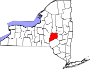
West End is an unincorporated suburban community in Otsego County, New York, United States. The population was 1,940 at the 2010 census.

Devon is a census-designated place (CDP) located in Tredyffrin and Easttown Township, Chester County, Pennsylvania, United States. The population was 1,515 at the 2010 census. The area is part of Philadelphia's Main Line suburbs.

Friendship is a census-designated place in western Nile Township, Scioto County, Ohio, United States. As of the 2010 census it had a population of 351. It has a post office with the ZIP code 45630. It lies along U.S. Route 52.

Cochranville is a census-designated place (CDP) in West Fallowfield Township, Chester County, Pennsylvania, United States. The population was 668 at the 2010 census. It is the hometown of Olympic swimmer Cierra Runge.

Chenango Bridge is a hamlet in the southern part of the Town of Chenango in Broome County, New York, United States. It lies where State Route 12A crosses the Chenango River. The population was 2,883 at the 2010 census, which lists the community as a census-designated place.

Eggertsville is a hamlet and census-designated place (CDP) within the town of Amherst in Erie County, New York, United States. The population of the CDP was 15,019 at the 2010 census.

Grandyle Village is a hamlet and census-designated place (CDP) in the town of Grand Island in Erie County, New York, United States. As of the 2010 census, it had a population of 4,629.

Wanakah is a hamlet in the town of Hamburg in Erie County, New York, United States. As of the 2010 census, it had a population of 3,199.
Hickory Hills is a census-designated place (CDP) in Foster Township, Luzerne County, Pennsylvania, southwest of the borough of White Haven. The CDP population was 562 at the 2010 census.
Hudson is a census-designated place (CDP) in Plains Township, Luzerne County, Pennsylvania, United States. The population was 1,443 at the 2010 census.

Falmouth is a census-designated place (CDP) within the town of Falmouth in Cumberland County, Maine, United States. The population was 1,855 at the 2010 census. It is part of the Portland–South Portland–Biddeford, Maine Metropolitan Statistical Area.

Gray is a census-designated place (CDP) within the town of Gray, in Cumberland County, Maine, United States. The population was 884 at the 2010 census., comprising 11.4% of the town's population of 7,761.
Hartwick is a census-designated place (CDP) forming the central settlement of the town of Hartwick in Otsego County, New York, United States. It is located at the corner of CR-11 and NY-205. The population of the CDP was 629 at the 2010 census.
Worcester is a census-designated place (CDP) forming the central settlement of the town of Worcester in Otsego County, New York, United States. The population of the CDP was 1,113 at the 2010 census.

Caln is a census-designated place (CDP) in Caln Township, Chester County, Pennsylvania, United States. The population was 1,519 at the 2010 census. It is located east of the city of Coatesville and lies west of Philadelphia.

Eagleview is a census-designated place (CDP) in Uwchlan Township, Chester County, Pennsylvania, United States. The population was 1,644 at the 2010 census. Conceptually, Eagleview was created as "... an old fashion town where you can work, live, shop, see your elders, and care for the young all in the same place." According to a Landsat imagery, the Eagleview shopping center represents a medium density development that generated 400 square feet more living space per acre per the source than lower density developments also shown in the same imagery. Stevens, in his book on a study of how to make communities safer in new urban developments uses Eagleview, along with Weatherstone, as sample data for comparing amount of green space for every acreage of development. The community was listed in volume 6 of the New Urban News as an example of this new type of housing development.

Pomeroy is a census-designated place (CDP) in Sadsbury Township, Chester County, Pennsylvania, United States. The population was 401 at the 2010 census.

Westwood is a census-designated place (CDP) in Valley Township, Chester County, Pennsylvania, United States. The population was 950 at the 2010 census.
Toyei is a census-designated place (CDP) in Apache County, Arizona, United States. The population was 13 at the 2010 census.


