Maryland, New York

Last updated
Maryland, New York
Otsego County outline map Maryland red.png
Otsego County map with the Town of Maryland in Red
Coordinates: 42°32′N74°52′W / 42.533°N 74.867°W / 42.533; -74.867
Country United States
State New York
County Otsego
Area
[1]
  Total52.54 sq mi (136.08 km2)
  Land52.41 sq mi (135.73 km2)
  Water0.14 sq mi (0.35 km2)
Elevation
1,276 ft (389 m)
Population
 (2010)
  Total1,897
  Estimate 
(2016) [2]
1,805
  Density34.44/sq mi (13.30/km2)
Time zone UTC-5 (Eastern (EST))
  Summer (DST) UTC-4 (EDT)
ZIP code
12116
Area code 607
FIPS code 36-45920
GNIS feature ID0979203
Website Early map and brief history of Maryland

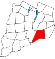
Maryland is a town in Otsego County, New York, United States. The population was 1,897 at the 2010 census. It was named for the U.S. state of the same name. [3] The Town of Maryland is on the county's southern border. It is northeast of the City of Oneonta.

Contents

History

The town was first settled around 1790 in the southwest part of the town. Maryland was erected from the Town of Worcester in 1808. About 1909 until 1912 an extensive lumber operation by Emmons L. Peck of Carbondale, Pennsylvania, utilizing a steam tramway straddled the county line on South Hill east of Mud Lake, shipping finished lumber from Burnsides Switch on the D&HRR. Peck's personal cabin was later dismantled and rebuilt in the hamlet of Maryland next to the present post office. During World War I, Porter Brothers contracted to build the third rail for the D&HRR "bridge line" through Maryland and Worcester to allow larger eastbound freight trains without extra locomotives to clear Richmondville Hill by an alternate route, much of which was later obliterated by I-88 construction. [ citation needed ]

Geography

According to the United States Census Bureau, the town has a total area of 51.9 square miles (134 km2), of which 51.8 square miles (134 km2) is land and 0.1 square miles (0.26 km2) (0.21%) is water. Interstate 88 and New York State Route 7 follows the east to west course of the Schenevus Creek. South Hill, an upland area, is partly in the southeastern quadrant of the town. The southern town line is the border of Delaware County.

Demographics

Historical population
CensusPop.Note
1820 1,439
1830 1,83427.4%
1840 2,08513.7%
1850 2,1523.2%
1860 2,2283.5%
1870 402−82.0%
1880 2,324478.1%
1890 2,199−5.4%
1900 1,998−9.1%
1910 1,852−7.3%
1920 1,529−17.4%
1930 1,5390.7%
1940 1,460−5.1%
1950 1,5566.6%
1960 1,386−10.9%
1970 1,4655.7%
1980 1,69015.4%
1990 1,7161.5%
2000 1,92011.9%
2010 1,897−1.2%
2016 (est.)1,805 [2] −4.8%
U.S. Decennial Census [4]

As of the census [5] of 2000, there were 1,920 people, 773 households, and 531 families residing in the town. The population density was 37.1 inhabitants per square mile (14.3/km2). There were 1,035 housing units at an average density of 20.0 units per square mile (7.7 units/km2). The racial makeup of the town was 98.80% White, 0.16% African American, 0.16% Asian, 0.05% from other races, and 0.83% from two or more races. Hispanic or Latino of any race were 1.09% of the population.

There were 773 households, out of which 29.9% had children under the age of 18 living with them, 55.1% were married couples living together, 10.1% had a female householder with no husband present, and 31.2% were non-families. 24.2% of all households were made up of individuals, and 10.5% had someone living alone who was 65 years of age or older. The average household size was 2.48 and the average family size was 2.93.

In the town, the population was spread out, with 23.7% under the age of 18, 7.6% from 18 to 24, 26.1% from 25 to 44, 27.7% from 45 to 64, and 15.0% who were 65 years of age or older. The median age was 40 years. For every 100 females, there were 99.6 males. For every 100 females age 18 and over, there were 97.2 males.

The median income for a household in the town was $33,821, and the median income for a family was $39,020. Males had a median income of $27,245 versus $20,898 for females. The per capita income for the town was $16,120. About 9.4% of families and 12.6% of the population were below the poverty line, including 16.0% of those under age 18 and 9.5% of those age 65 or over.

Communities and locations in Maryland

Related Research Articles

Alma is a town in Allegany County, New York, United States. The population was 785 at the 2020 census. The source of the town name is uncertain. One source credits it to Charles Wyvell's interest in the Battle of the Alma, while another attributes it to Stephen O. Alma, first manager of the Newbold Lumber Company of Shongo.

<span class="mw-page-title-main">Sanford, New York</span> Town in New York, United States

Sanford is a town in Broome County, New York, United States. The population was 2,407 at the 2010 census.

Hamden is a town in Delaware County, New York, United States. The population was 1,323 at the 2010 census.

<span class="mw-page-title-main">Exeter, New York</span> Town in New York, United States

Exeter is a town in Otsego County, New York, United States. The town is located in the northern part of the county. The population was 987 at the 2010 census. It is named after the county town and cathedral city of Exeter in England.

<span class="mw-page-title-main">Middlefield, New York</span> Town in New York, United States

Middlefield is a town in Otsego County, New York, United States. The population was 2,114 at the 2010 census.

<span class="mw-page-title-main">Otsego, New York</span> Town in New York, United States

Otsego is a town in the north-central part of Otsego County, New York, United States. The population was 3,900 at the 2010 census. The town is named after Lake Otsego, which forms part of the town's eastern border.

<span class="mw-page-title-main">Roseboom, New York</span> Town in New York, United States

Roseboom is a town in Otsego County, New York, United States. The population was 711 at the 2010 census. The name of the town is taken from those of early landowners and settlers Abram and John Roseboom.

<span class="mw-page-title-main">Westford, New York</span> Town in New York, United States

Westford is a town in Otsego County, New York, United States. The population was 868 at the 2010 census. It is southeast of Cooperstown.

Worcester is a town in Otsego County, New York, United States. The population was 2,220 at the 2010 census. Worcester is on the southeastern border of the county and is northeast of Oneonta. The Worcester Central School District presently has 369 students enrolled in grades K-12.

<span class="mw-page-title-main">De Kalb, New York</span> Town in New York, United States

DeKalb is a town in St. Lawrence County, New York, United States. The population was 2,434 at the 2010 census. The town is named after American general Baron de Kalb, a German officer serving under George Washington.

Tuscarora township is a township in Steuben County, New York, United States. The population was 1,388 at the 2020 census. The township is named after the Tuscarora tribe.

<span class="mw-page-title-main">Delaware, New York</span> Town in Sullivan County, New York, US

Delaware is a town in Sullivan County, New York, United States. The population was 2,203 at the 2020 census.

<span class="mw-page-title-main">Southport, New York</span> Town in New York, United States

Southport is a town in Chemung County, New York, United States. The population was 9,684 according to the 2020 census. The town is located in the southwestern corner of Chemung County and is southwest of the city of Elmira. It is part of the Elmira Metropolitan Statistical Area.

<span class="mw-page-title-main">Boonville, New York</span> Town in New York, United States

Boonville is a town in Oneida County, New York, United States. The town is in the northeastern section of the county. The population was 4,555 at the 2010 census. The town includes a village, also called Boonville. The town and village are named after Gerrit Boon, an agent of the Holland Land Company. The current mayor is Judith Dellerba.

<span class="mw-page-title-main">Laurens (town), New York</span> Town in New York, United States

Laurens is a town in Otsego County, New York, United States. The population was 2,424 at the 2010 census.

<span class="mw-page-title-main">Milford, New York</span> Town in New York, United States

Milford is a town in Otsego County, New York, United States. The population was 3,044 at the 2010 census. Within town is the village of Milford. The town is northeast of the City of Oneonta.

<span class="mw-page-title-main">Otego (town), New York</span> Town in New York, United States

Otego is a town in Otsego County, New York, United States. The population was 3,115 at the 2010 census. The name is a native word meaning "where there is fire."

<span class="mw-page-title-main">Unadilla, New York</span> Town in New York, United States

Unadilla is a town in Otsego County, New York, United States. As of the 2010 census, the town had a population of 4,392. The name is derived from an Iroquois word for "meeting place". Unadilla is located in the southwestern corner of the county, southwest of Oneonta. The village of Unadilla is located in the southern part of the town. The mayor of Unadilla is David Welch, as of January 13, 2020.

<span class="mw-page-title-main">Avoca, New York</span> Town in New York, United States

Avoca is a town in Steuben County, New York, United States. The population was 1,996 at the 2020 census.

Deposit is a town in Delaware County, New York, United States. As of the 2010 census, the town's population was 1,712.

References

  1. "2016 U.S. Gazetteer Files". United States Census Bureau. Retrieved Jul 5, 2017.
  2. 1 2 "Population and Housing Unit Estimates" . Retrieved June 9, 2017.
  3. "Towns named after states". Reading Eagle. Jul 2, 1897. p. 3. Retrieved 14 October 2015.
  4. "Census of Population and Housing". Census.gov. Retrieved June 4, 2015.
  5. "U.S. Census website". United States Census Bureau . Retrieved 2008-01-31.

42°32′N74°52′W / 42.533°N 74.867°W / 42.533; -74.867