Unadilla, New York

Last updated
Unadilla, New York
Unadilla, New York.jpg
A sign for the town of Unadilla, New York, on New York State Route 7.
Otsego County outline map Unadilla red.png
Unadilla, Otsego County, New York
Coordinates: 42°21′58″N75°19′40″W / 42.36611°N 75.32778°W / 42.36611; -75.32778
CountryUnited States
State New York
County Otsego
Settled1770
Established1792
Government
  SupervisorGeorge DeNys
Area
[1]
  Total46.67 sq mi (120.88 km2)
  Land46.27 sq mi (119.85 km2)
  Water0.40 sq mi (1.04 km2)  0.51%
Elevation
1,467 ft (447 m)
Population
 (2010)
  Total4,392
  Estimate 
(2016) [2]
4,186
  Density90.46/sq mi (34.93/km2)
Time zone UTC-5 (Eastern (EST))
  Summer (DST) UTC-4 (EDT)
ZIP code
13849
Area code 607
FIPS code 36-76012
GNIS feature ID0979571
Website Official website

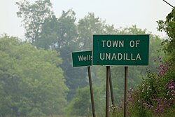
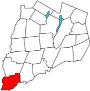
Unadilla is a town in Otsego County, New York, United States. As of the 2010 census, the town had a population of 4,392. The name is derived from an Iroquois word for "meeting place". Unadilla is located in the southwestern corner of the county, southwest of Oneonta. The village of Unadilla is located in the southern part of the town. The mayor of Unadilla is David Welch, as of January 13, 2020.

Contents

History

Depot in Unadilla, 1870 Railroad Station, So. Unadilla.jpg
Depot in Unadilla, 1870

The first settlement took place circa 1770 in the area of Sidney (in adjacent Delaware County), followed by Unadilla. Both Sidney and Unadilla were destroyed during the American Revolution and were re-established after the war. The town was formed from part of the Town of Otsego in 1792. Later the size of the town was reduced by the formation of new towns: Butternuts, Milford, and Oneonta in 1796, Otego (town), New York in 1822, and an addition to Butternuts in 1857. In 1827, the community of Unadilla set itself off from the town by incorporating as a village.

Perspective map of Unadilla and list of landmarks from 1887 by L.R. Burleigh Unadilla, N.Y. 1887. LOC 75694856.jpg
Perspective map of Unadilla and list of landmarks from 1887 by L.R. Burleigh

The Unadilla Waterworks, Russ-Johnsen Site, and Andrew Mann Inn are listed on the National Register of Historic Places. [3]

Geography

According to the United States Census Bureau, the town has a total area of 46.6 square miles (120.8 km2), of which 46.4 square miles (120.2 km2) is land and 0.2 square mile (0.6 km2) (0.51%) is water. This includes the artificially created Buck Horn Lake.

New York State Route 7 intersects New York State Route 8 by Riverside. Interstate 88 passes briefly through the town at Unadilla village. The Unadilla River flows into the Susquehanna River at the southwestern corner of the town, west of Riverside.

The Unadilla town lines

Communities and locations in the Town of Unadilla

Demographics

Historical population
CensusPop.Note
1820 2,194
1830 2,3135.4%
1840 2,272−1.8%
1850 2,4638.4%
1860 2,7029.7%
1870 2,555−5.4%
1880 2,523−1.3%
1890 2,7237.9%
1900 2,601−4.5%
1910 2,376−8.7%
1920 2,3950.8%
1930 2,276−5.0%
1940 2,2770.0%
1950 2,68918.1%
1960 3,64935.7%
1970 3,8635.9%
1980 4,0204.1%
1990 4,3438.0%
2000 4,5484.7%
2010 4,392−3.4%
2016 (est.)4,186 [2] −4.7%
U.S. Decennial Census [4]

As of the census [5] of 2000, there were 4,548 people, 1,810 households, and 1,272 families residing in the town. The population density was 98.0 inhabitants per square mile (37.8/km2). There were 2,101 housing units at an average density of 45.3 per square mile (17.5/km2). The racial makeup of the town was 97.14% White, 0.86% Black or African American, 0.24% Native American, 0.20% Asian, 0.02% Pacific Islander, 0.57% from other races, and 0.97% from two or more races. Hispanic or Latino of any race were 1.21% of the population.

There were 1,810 households, out of which 32.7% had children under the age of 18 living with them, 54.8% were married couples living together, 9.8% had a female householder with no husband present, and 29.7% were non-families. 23.6% of all households were made up of individuals, and 10.1% had someone living alone who was 65 years of age or older. The average household size was 2.51 and the average family size was 2.94.

In the town, the population was spread out, with 26.4% under the age of 18, 7.0% from 18 to 24, 27.1% from 25 to 44, 24.2% from 45 to 64, and 15.2% who were 65 years of age or older. The median age was 39 years. For every 100 females, there were 97.9 males. For every 100 females age 18 and over, there were 96.4 males.

The median income for a household in the town was $34,619, and the median income for a family was $40,556. Males had a median income of $29,817 versus $21,732 for females. The per capita income for the town was $16,908. About 9.6% of families and 12.8% of the population were below the poverty line, including 18.1% of those under age 18 and 6.6% of those age 65 or over.

Notable people and horse

Related Research Articles

<span class="mw-page-title-main">Columbus, New York</span> Town in New York, United States

Columbus is a town in Chenango County, New York, United States. The population was 975 at the 2010 census. Columbus is in the northeastern corner of the county and is northeast of Norwich.

<span class="mw-page-title-main">Guilford, New York</span> Town in New York, United States

Guilford is a town in Chenango County, New York, United States. The town is on the eastern border of the county. The population was 2,922 at the 2010 census.

<span class="mw-page-title-main">Pitcher, New York</span> Town in New York, United States

Pitcher is a town in Chenango County, New York, United States. The population was 803 at the 2010 census. The town is named after Nathaniel Pitcher, the eighth governor of New York. The town is on the western border of Chenango County, west of the city of Norwich.

<span class="mw-page-title-main">Columbia, New York</span> Town in New York, United States

Columbia is a town in Herkimer County, New York, United States. As of the 2010 census, the town population was 1,580. The town is at the southern border of the county and is southeast of Utica.

<span class="mw-page-title-main">Winfield (town), New York</span> Town in New York, United States

Winfield is a town in Herkimer County, New York, United States. The population was 2,086 at the 2010 census. The town is named after General Winfield Scott and is in the southwestern corner of the county, south of Utica. "The town has recently been certified a Clean Energy Community."

<span class="mw-page-title-main">Burlington, New York</span> Town in New York, United States

Burlington is a town in Otsego County, New York, United States. The population was 1,140 at the 2010 census.

<span class="mw-page-title-main">Butternuts, New York</span> Town in New York, United States

Butternuts is a town located in Otsego County, New York, United States. As of the 2010 census, the town had a population of 1,786. The Town of Butternuts is located in the southwestern part of the county, and is west of Oneonta.

<span class="mw-page-title-main">Edmeston, New York</span> Town in New York, United States

Edmeston is a town located in Otsego County, New York, United States. As of the 2010 census, the town had a total population of 1,826.

<span class="mw-page-title-main">New Lisbon, New York</span> Town in New York, United States

New Lisbon is a town in Otsego County, New York, United States. The population was 1,114 at the 2010 census.

<span class="mw-page-title-main">Pittsfield, New York</span> Town in New York, United States

Pittsfield is a town in Otsego County, New York, United States. The population was 1,366 at the 2010 census.

<span class="mw-page-title-main">Plainfield, New York</span> Town in New York, United States

Plainfield is a town in Otsego County, New York, United States. The population was 915 at the 2010 census.

New Berlin is a village in Chenango County, New York, United States. The population was 1,028 at the 2010 census. The village is by the eastern town line of the town of New Berlin and is northeast of Norwich.

<span class="mw-page-title-main">New Berlin, New York</span> Town in New York, United States

New Berlin is a town in Chenango County, central New York, United States. The population was 2,682 at the 2010 census. The town contains the village of New Berlin. The town is at the eastern border of the county and is northeast of Norwich.

<span class="mw-page-title-main">Norwich (town), New York</span> Town in New York, United States

Norwich is a town in Chenango County, New York, United States. The population was 3,998 at the 2010 census.

<span class="mw-page-title-main">Laurens (town), New York</span> Town in New York, United States

Laurens is a town in Otsego County, New York, United States. The population was 2,424 at the 2010 census.

<span class="mw-page-title-main">Milford, New York</span> Town in New York, United States

Milford is a town in Otsego County, New York, United States. The population was 3,044 at the 2010 census. Within town is the village of Milford. The town is northeast of the City of Oneonta.

<span class="mw-page-title-main">Morris (town), New York</span> Town in New York, United States

Morris is a town located in Otsego County, New York, United States. As of the 2010 census, the town had a population of 1,878. The town is named after General Jacob Morris.

<span class="mw-page-title-main">Oneonta (town), New York</span> Town in New York, United States

Oneonta is a town in Otsego County, New York, United States. The population was 5,065 at the 2020 census.,

<span class="mw-page-title-main">Otego (town), New York</span> Town in New York, United States

Otego is a town in Otsego County, New York, United States. The population was 3,115 at the 2010 census. The name is a native word meaning "where there is fire."

<span class="mw-page-title-main">Unadilla (village), New York</span> Village in New York, United States

Unadilla is a village located in the Town of Unadilla in Otsego County, New York, United States. The population was 1,128 at the 2010 census.

References

  1. "2016 U.S. Gazetteer Files". United States Census Bureau. Retrieved Jul 5, 2017.
  2. 1 2 "Population and Housing Unit Estimates" . Retrieved June 9, 2017.
  3. "National Register Information System". National Register of Historic Places . National Park Service. March 13, 2009.
  4. "Census of Population and Housing". Census.gov. Retrieved June 4, 2015.
  5. "U.S. Census website". United States Census Bureau . Retrieved 2008-01-31.