Einasleigh, Queensland

Last updated

Einasleigh
Queensland
Station Master's Residence, Einasleigh (former), from S (2008).jpg
Station master's residence, 2008
Australia Queensland location map.svg
Red pog.svg
Einasleigh
Coordinates 18°30′48″S144°05′37″E / 18.5133°S 144.0936°E / -18.5133; 144.0936 (Einasleigh (town centre))
Population87 (2021 census) [1]
 • Density0.02143/km2 (0.0555/sq mi)
Postcode(s) 4871
Area4,060.5 km2 (1,567.8 sq mi)
Time zone AEST (UTC+10:00)
Location
LGA(s) Shire of Etheridge
State electorate(s) Traeger
Federal division(s) Kennedy
Localities around Einasleigh:
Georgetown Talaroo Mount Surprise
Forsayth Einasleigh Conjuboy
Forsayth Lyndhurst Lyndhurst

Einasleigh is a town and a locality in the Shire of Etheridge, Queensland, Australia. [2] [3] In the 2021 census, the locality of Einasleigh had a population of 87 people. [1]

Contents

Geography

The town is located at the confluence of Einasleigh River with the Copperfield River. [4] The Einasleigh River has a catchment area of 24,366 square kilometres (9,408 sq mi). [5] Following its confluence with the Gilbert River, they spill into a vast estuarine delta approximately 100 kilometres (62 mi) wide [6] that largely consists of tidal flats and mangrove swamps across the Gulf Country. The Einasleigh River descends 730 metres (2,400 ft) over its 618-kilometre (384 mi) course. [4]

History

The indigenous people of Einasleigh were the Ewamin.[ citation needed ]

Einasleigh Provisional School opened on 29 October 1901. It closed in 1905 but reopened in 1906. On 1 January 1909, it became Einasleigh State School. It closed in 1955. [7] It was at 5-7 First Street ( 18°30′36″S144°05′36″E / 18.5101°S 144.0932°E / -18.5101; 144.0932 (Einasleigh State School (former)) ). [8] [4]

Einasleigh Post Office opened by May 1909 (a receiving office had been open from 1900) and closed in 1993. [9]

Wirra Wirra Provisional School opened on 1914. On 1 December 1914, it became Wirra Wirra State School. It closed circa 1918. [7]

The operators of the Lyndhurst pastoral station have their official address located in town.

Demographics

In the 2006 census, the locality of Einasleigh had a population of 202 people. [10]


In the 2016 census, the locality of Einasleigh had a population of 92 people. [11]

In the 2021 census, the locality of Einasleigh had a population of 87 people. [1]

Heritage listings

Einasleigh has a number of heritage-listed sites, including:

Related Research Articles

<span class="mw-page-title-main">Chillagoe, Queensland</span> Town in Queensland, Australia

Chillagoe is a rural town and locality in the Shire of Mareeba, Queensland, Australia. In the 2021 census, the locality of Chillagoe had a population of 214 people.

<span class="mw-page-title-main">Laura, Queensland</span> Town in Queensland, Australia

Laura is a rural town and locality in the Shire of Cook, Queensland, Australia. In the 2021 census, the locality of Laura had a population of 133 people.

<span class="mw-page-title-main">Daintree, Queensland</span> Town in Queensland, Australia

Daintree is a rural town and locality in the Shire of Douglas, Queensland, Australia. In the 2021 census, the locality of Daintree had a population of 93 people.

<span class="mw-page-title-main">Mount Molloy, Queensland</span> Town in Queensland, Australia

Mount Molloy is a rural town and locality in the Shire of Mareeba, Queensland, Australia. It is a historic mining and timber town, 55 kilometres (34 mi) north of Cairns. The dominant industry in the area is cattle grazing; the town itself consists of a few shops and an old hotel. In the 2021 census, the locality of Mount Molloy had a population of 266 people.

<span class="mw-page-title-main">Forsayth, Queensland</span> Town in Queensland, Australia

Forsayth is a rural town and locality in the Shire of Etheridge, Queensland, Australia. In the 2021 census, the locality of Forsayth had a population of 107 people.

<span class="mw-page-title-main">Inkerman, Queensland</span> Town in Australia

Inkerman is a rural town and locality in the Shire of Burdekin, Queensland, Australia. In the 2021 census, the locality of Inkerman had a population of 119 people.

<span class="mw-page-title-main">Hungerford, Queensland</span> Town in Queensland, Australia

Hungerford is an outback town in the Shire of Bulloo and a locality in the Shire of Bulloo and Shire of Paroo, South West Queensland, Australia. The locality is on the Queensland border with New South Wales.

<span class="mw-page-title-main">Irvinebank</span> Town in Queensland, Australia

Irvinebank is a rural town and locality in the Shire of Mareeba, Queensland, Australia. In the 2021 census, the locality of Irvinebank had a population of 113 people.
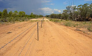
Gilbert River is a rural locality in the Shire of Etheridge, Queensland, Australia. In the 2021 census, Gilbert River had a population of 32 people.

Gilberton is a rural locality in the Shire of Etheridge, Queensland, Australia. In the 2021 census, the locality of Gilberton had a population of 26 people.

<span class="mw-page-title-main">Bloomfield, Queensland</span> Town in Queensland, Australia

Bloomfield is a rural town in the Shire of Cook and a coastal locality which is split between the Shire of Cook and the Shire of Douglas in Queensland, Australia. The neighbourhood of Ayton is within the locality. In the 2021 census, the locality of Bloomfield had a population of 228 people.

Strathmore is a locality split between the Shire of Mareeba and the Shire of Etheridge, in Queensland, Australia. In the 2021 census, Strathmore had "no people or a very low population".

<span class="mw-page-title-main">Cow Bay, Queensland</span> Suburb of Shire of Douglas, Queensland, Australia

Cow Bay is a coastal locality in the Shire of Douglas, Queensland, Australia. In the 2021 census, Cow Bay had a population of 220 people.

<span class="mw-page-title-main">Whyanbeel</span> Suburb of Shire of Douglas, Queensland, Australia

Whyanbeel is a rural locality in the Shire of Douglas, Queensland, Australia. In the 2021 census, Whyanbeel had a population of 172 people.

<span class="mw-page-title-main">Newell, Queensland</span> Town in Queensland, Australia

Newell is a coastal town and rural locality in the Shire of Douglas, Queensland, Australia. It is a sugarcane growing district.

<span class="mw-page-title-main">Lyndhurst, Queensland</span> Suburb of Shire of Etheridge, Queensland, Australia

Lyndhurst is a rural locality in the Shire of Etheridge, Queensland, Australia. In the 2021 census, Lyndhurst had a population of 11 people.

<span class="mw-page-title-main">Talaroo, Queensland</span> Suburb of Shire of Etheridge, Queensland, Australia

Talaroo is an outback locality in the Shire of Etheridge, Queensland, Australia. In the 2021 census, Talaroo had a population of 5 people.

<span class="mw-page-title-main">Lower Daintree, Queensland</span> Suburb of Shire of Douglas, Queensland, Australia

Lower Daintree is a coastal rural locality in the Shire of Douglas, Queensland, Australia. In the 2021 census, Lower Daintree had a population of 83 people.

<span class="mw-page-title-main">Kimberley, Queensland</span> Suburb of Shire of Douglas, Queensland, Australia

Kimberley is a coastal locality in the Shire of Douglas, Queensland, Australia. In the 2021 census, Kimberley had a population of 28 people.

<span class="mw-page-title-main">Forest Creek, Queensland</span> Suburb of Shire of Douglas, Queensland, Australia

Forest Creek is a locality in the Shire of Douglas, Queensland, Australia. In the 2021 census, Forest Creek had a population of 136 people.

References

  1. 1 2 3 Australian Bureau of Statistics (28 June 2022). "Einasleigh (SAL)". 2021 Census QuickStats. Retrieved 28 February 2023. OOjs UI icon edit-ltr-progressive.svg
  2. "Einasleigh – town in Shire of Etheridge (entry 11416)". Queensland Place Names. Queensland Government . Retrieved 22 December 2018.
  3. "Einasleigh – locality in Shire of Etheridge (entry 41671)". Queensland Place Names. Queensland Government . Retrieved 22 December 2018.
  4. 1 2 3 "Queensland Globe". State of Queensland . Retrieved 13 June 2022.
  5. "Einasleigh River drainage sub-basin — facts and maps". WetlandInfo. Department of Environment and Heritage Protection, Queensland Government. Archived from the original on 8 December 2015. Retrieved 27 November 2015.
  6. "Flood warning system for the Gilbert River". Bureau of Meteorology . Australian Government. Archived from the original on 8 December 2015. Retrieved 27 November 2015.
  7. 1 2 Queensland Family History Society (2010), Queensland schools past and present (Version 1.01 ed.), Queensland Family History Society, ISBN   978-1-921171-26-0
  8. "Town of Einasleigh" (Map). Queensland Government. 1973. Retrieved 13 June 2022.
  9. Premier Postal History. "Post Office List". Premier Postal Auctions. Archived from the original on 15 May 2014. Retrieved 10 May 2014.
  10. Australian Bureau of Statistics (25 October 2007). "Einasleigh (SSC)". 2006 Census QuickStats. Retrieved 26 June 2016.
  11. Australian Bureau of Statistics (27 June 2017). "Einasleigh (SSC)". 2016 Census QuickStats. Retrieved 20 October 2018. OOjs UI icon edit-ltr-progressive.svg
  12. "Einasleigh Copper Mine and Smelter (entry 602586)". Queensland Heritage Register . Queensland Heritage Council. Retrieved 7 July 2013.
  13. "Einasleigh Hotel (entry 602331)". Queensland Heritage Register . Queensland Heritage Council. Retrieved 7 July 2013.
  14. "Etheridge Railway (entry 601637)". Queensland Heritage Register . Queensland Heritage Council. Retrieved 1 August 2014.
  15. "Station Master's Residence, Einasleigh (former) (entry 600505)". Queensland Heritage Register . Queensland Heritage Council. Retrieved 7 July 2013.