Flats, West Virginia | |
---|---|
Unincorporated community | |
Coordinates: 39°11′37″N78°58′46″W / 39.19361°N 78.97944°W Coordinates: 39°11′37″N78°58′46″W / 39.19361°N 78.97944°W | |
Country | United States |
State | West Virginia |
County | Hardy |
Time zone | Eastern (EST) (UTC-5) |
• Summer (DST) | EDT (UTC-4) |
GNIS feature ID | 1539067 [1] |
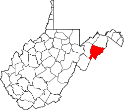
Flats is an unincorporated community in Hardy County, West Virginia, United States.
In law, an unincorporated area is a region of land that is not governed by a local municipal corporation; similarly an unincorporated community is a settlement that is not governed by its own local municipal corporation, but rather is administered as part of larger administrative divisions, such as a township, parish, borough, county, city, canton, state, province or country. Occasionally, municipalities dissolve or disincorporate, which may happen if they become fiscally insolvent, and services become the responsibility of a higher administration. Widespread unincorporated communities and areas are a distinguishing feature of the United States and Canada. In most other countries of the world, there are either no unincorporated areas at all, or these are very rare; typically remote, outlying, sparsely populated or uninhabited areas.
Hardy County is a county in the U.S. state of West Virginia. As of the 2010 census, the population was 14,025. Its county seat is Moorefield. The county was created from Hampshire County in 1786 and named for Samuel Hardy, a distinguished Virginian.
West Virginia is a state located in the Appalachian region in the Southern United States and is also considered to be a part of the Middle Atlantic States. It is bordered by Pennsylvania to the north, Maryland to the east and northeast, Virginia to the southeast, Kentucky to the southwest, and Ohio to the northwest. West Virginia is the 41st largest state by area, and is ranked 38th in population. The capital and largest city is Charleston.
Raleigh County is a county in the U.S. state of West Virginia. As of the 2010 United States Census, the population was 78,859. Its county seat is Beckley. The county was founded in 1850 and is named for Sir Walter Raleigh.
A bateau or batteau is a shallow-draft, flat-bottomed boat which was used extensively across North America, especially in the colonial period and in the fur trade. It was traditionally pointed at both ends but came in a wide variety of sizes. The name derives from the French word, bateau, which is simply the word for boat and the plural, bateaux, follows the French, an unusual construction for an English plural. In the southern United States, the term is still used to refer to flat-bottomed boats, including those elsewhere called jon boats.
Ghent is a census-designated place in Raleigh County in the U.S. state of West Virginia. As of the 2010 census, its population was 457.
Oak Flat is an unincorporated community on the South Fork South Branch Potomac River located in Pendleton County, West Virginia, United States. Oak Flat lies along U.S. Highway 33.
Audra State Park is a West Virginia state park located on 355 acres (1.44 km2) in southwestern Barbour County. It was established around the remnants of an early 19th-century gristmill and the tiny community of Audra. A gristmill spillway is still visible in the river.
North Bend State Park sits on 2,459 acres (995 ha) along the North Fork of the Hughes River in Ritchie County near Cairo, West Virginia. The park is named after the sharp bend in the river that the formed three sides of the original park boundary. The North Bend Rail Trail, a 72-mile (116 km) hiking and biking corridor, is also managed as a unit of the park. A new 305 acre (1.23 km²) lake was recently added to the park.
Grays Flat is an unincorporated community in Marion County, West Virginia, United States. It lies along the Paw Paw Creek, adjacent on the northeast of Grant Town.
Looneyville is an unincorporated community on Flat Creek of the Pocatalico River in Roane County, West Virginia, United States. It is on West Virginia Route 36. The community is named for Robert Looney, a pioneer settler. The post office was established in 1870.
Center Branch Wildlife Management Area is located on 975 acres (395 ha) in Harrison County near Stonewood, West Virginia. The WMA is located on a former strip mine site, and contains several flat benches and high walls. Second growth oak-hickory and mixed hardwoods forests cover much of the land.
Hillcrest Wildlife Management Area is located in Hancock County near New Cumberland, West Virginia. Located on 2,212 acres (895 ha) of former farmland, the flat bottoms and rolling hills provide open fields, old orchards and small forest lots.
This is a list of the National Register of Historic Places listings in McDowell County, West Virginia.
Mountview is an unincorporated community in Raleigh and Summers counties, West Virginia, United States. Mountview is west of Hinton and southeast of Beckley. County Routes 3/1, 3/12, and 19/22 are in Mountview. There are two ponds: one near Mt. View Road and another near Country Route 3/12. Spicelick Creek, Glade Creek, and Farley Creek run through the town. Features close to Mountview are Lake View Golf Course and the artificial Flat Top Lake.
Flat Top is an unincorporated community in Mercer County, West Virginia, United States. Flat Top is located on U.S. Route 19 19 miles (31 km) south of Beckley.
Flat or flats may refer to:
Jackson Flats is an unincorporated community in McDowell County, West Virginia.
Pisgah is an unincorporated community in Preston County, West Virginia.
Thorny Flat is the second highest peak in the U.S. state of West Virginia, after Spruce Knob. Thorny Flat is the high point of the ridge known as Cheat Mountain, which is the location of Snowshoe Mountain Resort.
Flatfork is an unincorporated community in Roane County, in the U.S. state of West Virginia.
This article about a location in Hardy County, West Virginia is a stub. You can help Wikipedia by expanding it. |