Fruitdale | |
---|---|
![]() Location in Santa Clara County and the state of California | |
Coordinates: 37°18′46″N121°56′9″W / 37.31278°N 121.93583°W | |
Country | United States |
State | California |
County | Santa Clara |
Area | |
• Total | 0.269 sq mi (0.697 km2) |
• Land | 0.269 sq mi (0.697 km2) |
• Water | 0 sq mi (0 km2) 0% |
Elevation | 144 ft (44 m) |
Population (2010) | |
• Total | 935 |
• Density | 3,500/sq mi (1,300/km2) |
Time zone | UTC-8 (PST) |
• Summer (DST) | UTC-7 (PDT) |
ZIP code | 95128 |
Area codes | 408/669 |
FIPS code | 06-27080 |
GNIS feature ID | 1877235 |
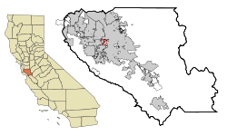
Fruitdale is a district of San Jose, California, though some portions are still unincorporated as a census-designated place. The population of the CDP was 935 at the 2010 census.
Fruitdale is located at 37°18′46″N121°56′9″W / 37.31278°N 121.93583°W (37.312743, -121.935837). [2] It is bordered on the north, west, and east by San Jose, California, and on the south by Campbell, California.
According to the United States Census Bureau, the CDP has a total area of 0.3 square miles (0.78 km2), all of it land.
Census | Pop. | Note | %± |
---|---|---|---|
U.S. Decennial Census [3] |
The 2010 United States Census [4] reported that Fruitdale had a population of 935. The population density was 3,475.3 inhabitants per square mile (1,341.8/km2). The racial makeup of Fruitdale was 633 (67.7%) White, 31 (3.3%) African American, 11 (1.2%) Native American, 110 (11.8%) Asian, 4 (0.4%) Pacific Islander, 88 (9.4%) from other races, and 58 (6.2%) from two or more races. Hispanic or Latino of any race were 244 persons (26.1%).
The Census reported that 861 people (92.1% of the population) lived in households, 26 (2.8%) lived in non-institutionalized group quarters, and 48 (5.1%) were institutionalized.
There were 361 households, out of which 92 (25.5%) had children under the age of 18 living in them, 135 (37.4%) were opposite-sex married couples living together, 39 (10.8%) had a female householder with no husband present, 25 (6.9%) had a male householder with no wife present. There were 24 (6.6%) unmarried opposite-sex partnerships, and 5 (1.4%) same-sex married couples or partnerships. 118 households (32.7%) were made up of individuals, and 29 (8.0%) had someone living alone who was 65 years of age or older. The average household size was 2.39. There were 199 families (55.1% of all households); the average family size was 3.11.
The population was spread out, with 171 people (18.3%) under the age of 18, 80 people (8.6%) aged 18 to 24, 271 people (29.0%) aged 25 to 44, 325 people (34.8%) aged 45 to 64, and 88 people (9.4%) who were 65 years of age or older. The median age was 41.7 years. For every 100 females, there were 100.2 males. For every 100 females age 18 and over, there were 97.9 males.
There were 379 housing units at an average density of 1,408.7 units per square mile (543.9 units/km2), of which 195 (54.0%) were owner-occupied, and 166 (46.0%) were occupied by renters. The homeowner vacancy rate was 1.0%; the rental vacancy rate was 2.9%. 507 people (54.2% of the population) lived in owner-occupied housing units and 354 people (37.9%) lived in rental housing units.
As of the census [5] of 2000, there were 895 people, 348 households, and 212 families residing in the CDP. The population density was 1,279.9 people/km2 (3,315 people/sq mi). There were 356 housing units at an average density of 509.1 units/km2 (1,319 units/sq mi). The racial makeup of the CDP was 76.54% White, 1.90% African American, 1.12% Native American, 5.47% Asian, 0.34% Pacific Islander, 7.15% from other races, and 7.49% from two or more races. Hispanic or Latino of any race were 16.76% of the population.
There were 348 households, out of which 30.7% had children under the age of 18 living with them, 46.8% were married couples living together, 10.6% had a female householder with no husband present, and 38.8% were non-families. 28.2% of all households were made up of individuals, and 7.2% had someone living alone who was 65 years of age or older. The average household size was 2.49 and the average family size was 3.07.
In the CDP, the population was spread out, with 21.8% under the age of 18, 6.6% from 18 to 24, 39.1% from 25 to 44, 22.7% from 45 to 64, and 9.8% who were 65 years of age or older. The median age was 37 years. For every 100 females, there were 95.4 males. For every 100 females age 18 and over, there were 94.4 males.
The median income for a household in the CDP was $58,750, and the median income for a family was $94,224. Males had a median income of $45,781 versus $37,031 for females. The per capita income for the CDP was $30,724. About 3.0% of families and 6.6% of the population were below the poverty line, including 4.2% of those under age 18 and 25.0% of those age 65 or over.
Dustin Acres is a census-designated place (CDP) in Kern County, California, United States. Dustin Acres is located 6.5 miles (10 km) north-northeast of Taft, at an elevation of 384 feet (117 m). The population was 652 at the 2010 census, up from 585 at the 2000 census.
Tamalpais-Homestead Valley is a census-designated place (CDP) in Marin County, California, United States. The population was 11,492 at the 2020 census.
Le Grand is an unincorporated community and census-designated place (CDP) in Merced County, California, United States. Le Grand is 14 miles (23 km) east-southeast of Merced, the county seat at an elevation of 253 feet (77 m). The population was 1,592 at the 2020 census, down from 1,659 at the 2010 census.
Hamilton Branch is a census-designated place (CDP) in Plumas County, California, United States. The population was 587 at the 2000 census.
Keddie is a census-designated place in Plumas County, California, United States. The population was 66 at the 2010 census.
Morada is a census-designated place (CDP) in San Joaquin County, California, United States. The population was 3,166 at the 2020 census, down from 3,828 at the 2010 census.
Taft Mosswood is a census-designated place (CDP) in San Joaquin County, California, United States. The population was 1,530 at the 2010 census, up from 1,388 at the 2000 census. It comprises an unincorporated "island" within the City of Stockton.
East Foothills is a census-designated place (CDP) in Santa Clara County, California, United States and a neighborhood of San Jose. The population was 8,269 at the 2010 census and it is located about 4 miles east of downtown San Jose.
Day Valley is a census-designated place (CDP) in Santa Cruz County, California, United States. The population was 3,409 at the 2010 census.
Richgrove is a census-designated place (CDP) in Tulare County, California, United States. The population was 2,358 at the 2020 United States census, down from 2,882 at the 2010 census.
Hillsmere Shores was a census-designated place (CDP) in Anne Arundel County, Maryland, United States. It is a suburb of Annapolis. The population was 2,977 at the 2000 census. It was included in the Annapolis Neck CDP at the 2010 census. Built in phases, beginning in 1960, the community has been home to The Key School, a non-sectarian private school, since the 1960s.
East Douglas is a census-designated place (CDP) in the town of Douglas in Worcester County, Massachusetts, United States. The population was 2,557 at the 2010 census.
Greentree is an unincorporated community and census-designated place (CDP) located within Cherry Hill Township, in Camden County, in the U.S. state of New Jersey. As of the 2010 United States Census, the CDP's population was 11,367.
Princeton Meadows is an unincorporated community and census-designated place (CDP) in Plainsboro Township, Middlesex County, New Jersey, United States. As of the 2020 census, the population was 14,776.
Yorketown is an unincorporated community and census-designated place (CDP) within Manalapan Township, in Monmouth County, in the U.S. state of New Jersey. As of the 2020 census, the CDP's population was 6,617.
Cherry Grove is a census-designated place (CDP) in Anderson Township, Hamilton County, Ohio, United States. The population was 4,419 at the 2020 census.
Mount Healthy Heights is a census-designated place (CDP) in Colerain Township, Hamilton County, Ohio, United States. The population was 2,918 at the 2020 census.
Harbeck-Fruitdale was formerly a census-designated place (CDP) in Josephine County, Oregon, United States, near Grants Pass. As of the 2000 census, the CDP population was 3,780. It includes the community of Fruitdale.
Fruitdale is a town in Butte County, South Dakota, United States. The population was 73 at the 2020 census.
Kingston is a census-designated place (CDP) in the town of Kingston in Plymouth County, Massachusetts, United States. The population was 5,591 at the 2010 census.