Galapagar

Last updated
Galapagar
Galapagar - Plaza de la Constitucion, Monumento a Jacinto Benavente 2.jpg
City centre of Galapagar
Bandera de Galapagar.svg
Escudo de Galapagar.svg
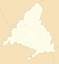
Spain Madrid location map.svg
Red pog.svg
Galapagar
Location in Spain
Spain location map with provinces.svg
Red pog.svg
Galapagar
Galapagar (Spain)
Coordinates: 40°34′35″N4°0′7″W / 40.57639°N 4.00194°W / 40.57639; -4.00194
Country Spain
Community Community of Madrid
Province Madrid
Comarca Guadarrama
Government
  MayorCarla Greciano (PP)
Area
  Total65 km2 (25 sq mi)
Elevation
881 m (2,890 ft)
Population
 (2018) [1]
  Total33,379
  Density510/km2 (1,300/sq mi)
Demonym Galapagueños
Time zone UTC+1 (CET)
  Summer (DST) UTC+2 (CEST)
Postal code
28260
Website Official website

Galapagar is a town and municipality northwest of Madrid, Spain, situated in the autonomous community of the Community of Madrid. Of all the towns in the area, it was experiencing the most growth, mostly because of immigration and the conversion of old livestock fields into terrain for construction.

Bordering with Collado Villalba, Colmenarejo, Torrelodones, Las Rozas de Madrid, El Escorial, San Lorenzo de El Escorial, Villanueva del Pardillo, Hoyo de Manzanares, Moralzarzal and Guadarrama.

The name Galapagar comes from the Spanish galápago, meaning turtle, as the town centre was settled near a lake full of turtles. The town first appears as a village in the eleventh century, its importance due to the frequent hunting expeditions by the Spanish royalty, and being a main stop on the road from the capital to the Royal Monastery of San Lorenzo de El Escorial. Sights in the town include the church of The Asunción (Assumption).

Galapagar is served by lines C-3, C-8 and C-10 of the Cercanías Madrid commuter rail service at its Galapagar-La Navata train station; and by 9 lines of Interurban Bus Service linking it to Moncloa district of Madrid.

Jacinto Benavente, one of the foremost Spanish dramatists of the 20th century and 1922 laurate of the Nobel Prize in Literature, is buried here. The British writer Malcolm Brocklehurst lived in the village between 1982 and 1983.

Bullfighting, stock-breeding, meadows and beef are the main features of Galapagar. The bullfighter José Tomás was born in this place.

See also

Related Research Articles

<span class="mw-page-title-main">El Escorial</span> Monastery and historical residence of the King of Spain

El Escorial, or the Royal Site of San Lorenzo de El Escorial, or Monasterio de El Escorial, is a historical residence of the King of Spain located in the town of San Lorenzo de El Escorial, 2.06 kilometres (1.28 mi) up the valley from the town of El Escorial and about 45 kilometres (28 mi) northwest of the Spanish capital Madrid. Built between 1563 and 1584 by order of King Philip II, El Escorial is the largest Renaissance building in the world. It is one of the Spanish royal sites and functions as a monastery, basilica, royal palace, pantheon, library, museum, university, school, and hospital.

<span class="mw-page-title-main">San Lorenzo de El Escorial</span> Municipality in Community of Madrid, Spain

San Lorenzo de El Escorial, also known as El Escorial de Arriba, is a town and municipality in the Community of Madrid, Spain, located to the northwest of the region in the southeastern side of the Sierra de Guadarrama, at the foot of Mount Abantos and Las Machotas, 47 kilometres (29 mi) from Madrid. It is head of the eponymous judicial party. The settlement is popularly called El Escorial de Arriba, to differentiate it from the neighbouring village of El Escorial, also known as El Escorial de Abajo.

<span class="mw-page-title-main">El Escorial, Madrid</span> Place in Community of Madrid, Spain

El Escorial is a municipality in the Autonomous Community of Madrid, located 45 km (28 mi) northwest of the Spanish capital Madrid. It belongs to the comarca of Cuenca del Guadarrama. Its population in 2009 was 14,979.

<span class="mw-page-title-main">Valdemorillo</span> Municipality in Community of Madrid, Spain

Valdemorillo is a Spanish town and municipality located in the Community of Madrid. The municipality, with a population of 13,453 inhabitants, includes, in addition to the town of Mojadillas, El Paraíso, Pino Alto Cazadero Real, Pino Alto Sector Sur, Jarabeltrán, Puentelasierra, La Esperanza, Montemorillo, Parque de las Infantas, La Pizarrera, Mirador del Romero, Los Barrancos and Cerro Alarcón shared with Navalagamella and Ampliación Cerro Alarcón. In the municipality is located part of the reservoir of Valmayor.

<span class="mw-page-title-main">Las Rozas de Madrid</span> Place in Community of Madrid, Spain

Las Rozas de Madrid is a municipality in the autonomous community of Madrid, Spain, with an area of 59 km².

<span class="mw-page-title-main">Villanueva de la Cañada</span> Municipality in Community of Madrid, Spain

Villanueva de la Cañada is a municipality in the Community of Madrid, Spain. Located 30 km north-west from Madrid, the municipality covers an area of 34.92 km2. Geographically, it sits on a large plain, in which there are several promontories, on one of which is found the castle of Aulencia, its main landmark. The ESA's European Space Astronomy Centre lies close to the former, on the Guadarrama riverfront. Villafranca del Castillo, a well-off urban area detached from the main nucleus, is located within the municipal bounds. Villanueva de la Cañada hosts the main campus of the Alfonso X El Sabio University as well as the Aquópolis waterpark.

<span class="mw-page-title-main">Cercanías Madrid</span> Commuter rail service serving Madrid, Spain

Cercanías Madrid is the commuter rail service that serves Madrid, the capital of Spain, and its metropolitan area. It is operated by Cercanías Renfe, the commuter rail division of Renfe, the former monopoly of rail services in Spain. Its total length is 370 km.

<span class="mw-page-title-main">Juan Bautista de Toledo</span> Spanish architect

Juan Bautista de Toledo was a Spanish architect. He was educated in Italy, in the Italian High Renaissance. As many Italian renaissance architects, he had experience in both architecture and military and civil public works. Born, either in Toledo or in Madrid around 1515. He died on 19 May 1567 in Madrid, and was buried in Madrid in the choir of the primitive “Convento de Santo Tomás, Iglesia de la Santa Cruz”.

<span class="mw-page-title-main">Collado Villalba</span> Place in Community of Madrid, Spain

Collado Villalba is a municipality of the Community of Madrid, in central Spain. It is located 40.3 kilometres north-west of the city of Madrid, at an altitude of 917 meters above sea level. It has a population of 64,263 (2022), with a population density of about 2,400 per km2. Collado Villalba has a hot summer Mediterranean climate.

<span class="mw-page-title-main">Patrimonio Nacional</span> Spanish state agency

Patrimonio Nacional is a Spanish autonomous agency, under the jurisdiction of the Ministry of the Presidency, that administers the sites owned by the Spanish State and used by the Monarch and the Spanish Royal Family as residences and for State Ceremonies. The Patrimonio Nacional includes palaces, gardens, monasteries and convents, called the Royal sites. When not in official use, the Royal sites are open to the public. It also manages the official and holiday residences of the Prime Minister.

<span class="mw-page-title-main">Colmenarejo</span> Place in Madrid, Spain

Colmenarejo is a Spanish town and municipality in the Community of Madrid, located in the northwest of the region, in the foothills of the Sierra de Guadarrama, 899 meters high and 37 kilometers away from the capital. It is bordered to the north by El Escorial, to the east by Galapagar, to the south by Villanueva del Pardillo and to the west by Valdemorillo. Its only road access is the M 510, from Galapagar or from Valdemorillo. It has in its municipality with the east bank of the reservoir of Valmayor, second in capacity of the Region of Madrid, with the third Campus of the University Carlos III of Madrid and with an attractive natural environment, where you can go for walks with a bicycle, within the Regional Park of the middle course of the Guadarrama River and its surroundings, in which stand out the holm oaks and pastures of cattle use dotted with junipers, ash trees and gall oaks.

<span class="mw-page-title-main">Husillos</span> Municipality in Castile and León, Spain

Husillos is a municipality located in the province of Palencia, Castile and León, Spain. According to the 2004 census (INE), the municipality had a population of 208 inhabitants.

<span class="mw-page-title-main">Herrerian style</span> Architectural style in Renaissance Spain

The Herrerian style of architecture was developed in Spain during the last third of the 16th century under the reign of Philip II (1556–1598), and continued in force in the 17th century, but transformed by the Baroque style of the time. It corresponds to the third and final stage of Spanish Renaissance architecture, whose dominant trend had been towards austerity and minimal decoration. The ornate Plateresque style had given way to classical Purism in the second third of the 16th century. Purism in turn had given way to the geometric simplicity of the Herrerian style.

<span class="mw-page-title-main">Torrelodones</span> Municipality in Community of Madrid, Spain

Torrelodones is a municipality in the northwest of the Autonomous Community of Madrid, Spain. It is situated 29 kilometers northwest from the city of Madrid. Because of its location between the Sierra de Guadarrama and the metropolitan area of the capital, it is linked to two districts in Madrid: the agricultural area of Guadarrama and the metropolitan area of Madrid.

<span class="mw-page-title-main">Villanueva del Pardillo</span> Municipality in Community of Madrid, Spain

Villanueva del Pardillo is a municipality and Spanish town of the Community of Madrid, situated 26 kilometers from the capital of Spain and nestled in the natural environment of the Cuenca del Guadarrama. It borders the municipalities of Majadahonda, Las Rozas de Madrid, Villanueva de la Cañada, Galapagar, Colmenarejo and Valdemorillo.

<span class="mw-page-title-main">Casita del Infante</span> Historic building in San Lorenzo de El Escorial, Spain

The Casita del Infante is a historic building in San Lorenzo de El Escorial, Spain. It was constructed as a private home for the Infante Gabriel of Spain, hence its name. The small residence was built in the late 18th century during the reign of his father, Charles III of Spain.

<span class="mw-page-title-main">Mount Abantos</span> Mountain in the country of Spain

Mount Abantos is a mountain in the Sierra de Guadarrama range in the Sistema Central of Spain, a chain that runs from east to west. For the most part, the mountain is located in the municipality of San Lorenzo de El Escorial in the Community of Madrid, with part of its west side in the province of Ávila.

<span class="mw-page-title-main">Casita del Príncipe (El Escorial)</span> Cultural property in El Escorial, Spain

The Casita del Príncipe is an eighteenth-century building located in San Lorenzo de El Escorial, Spain. It was designed by the neoclassical architect Juan de Villanueva for the private use of the heir to the Spanish throne Charles, Prince of Asturias, and his wife Maria Luisa. It was constructed in the 1770s and extended in the 1780s.

<span class="mw-page-title-main">Los Negrales</span>

Los Negrales is a residential zone in the municipal area of Collado Villalba, Alpedrete, San Lorenzo de El Escorial, Guadarrama and Galapagar, consisting mostly of detached houses. Although it was divided in three administrative zones, Los Negrales is a contiguous residential area. This residential zone was built gradually. The oldest houses date to the first half of the 20th century, and building has continued until contemporary times. A significant part of the houses are second residences of their owners, therefore, in summer and in holidays the population doubles.

<span class="mw-page-title-main">Imperial Route of the Community of Madrid</span> Spanish regional tourist itinerary

The Imperial Route of the Community of Madrid is the tourist itinerary promoted by the Ministry of Culture and Tourism of this Spanish region, which runs through several municipalities in the Sierra de Guadarrama. It partially follows the historical road that led to the Monastery of El Escorial, used in the 16th century by King Philip II in his travels from the city of Madrid to the Royal Site.

References

  1. Municipal Register of Spain 2018. National Statistics Institute.