Garwood, Texas

Last updated

Garwood, Texas
Relief map of Texas.png
Red pog.svg
Garwood, Texas
Location within the state of Texas
Usa edcp location map.svg
Red pog.svg
Garwood, Texas
Garwood, Texas (the United States)
Coordinates: 29°26′59″N96°23′49″W / 29.44972°N 96.39694°W / 29.44972; -96.39694
Country United States
State Texas
County Colorado
Elevation
154 ft (47 m)
Time zone UTC-6 (Central (CST))
  Summer (DST) UTC-5 (CDT)
ZIP code
77442
Area code 979
GNIS feature ID1336419 [1]

Garwood is an unincorporated community and census designated place (CDP) in Colorado County, Texas, United States. According to the Handbook of Texas, the community had a population of 975 in 2000.

Contents

History

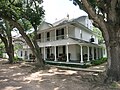
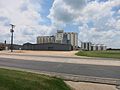
The Red Bluff Irrigation System was constructed in 1896 by Marcus H. Townsend, W. T. Burford, and T. A. Hill to draw rice farmers to the region. By 1901, several local farmers were cultivating rice. Ed R. Frnka moved the first building on the townsite in 1901 as well; Townsend offered Frnka the property for his building. In memory of Townsend's friend and Houston lawyer Hiram Morgan Garwood, the community was renamed Garwood. The first chapel and post office in the village were founded in 1901. An extra structure was relocated to Garwood in 1902 and put to use as a hotel. Garwood participated in a land advertising scam in 1906. Agents would give photos of crops, such as orange groves, to their victims that had been taken somewhere else but were purportedly from Colorado County. Unseen, the land was purchased, and most purchasers departed upon seeing Garwood and the surrounding acreage. 1909–1912 saw Garwood publish two newspapers. In 1910, there was a bank there, and 500 people were living in Garwood. The Gulf, Colorado and Santa Fe Railway served the town, which had 750 persons by 1915. The majority of the establishments on the east side of the main street were destroyed by fire in 1922. After these were restored, the town expanded gradually. Garwood recorded twelve establishments and a 975-person population estimate in 1990 and 2000, with 37 businesses. [2] It stayed at 975 in 2010 then went down to 510 in 2020. [3]

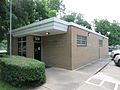
Although it is unincorporated, Garwood has a post office with the ZIP code 77442. [4]

Geography

Garwood is situated at the junction of Texas State Highway 71 and Farm to Market Road 950 in southern Colorado County, 13 mi (21 km) southwest of Eagle Lake, 20 mi (32 km) south of Columbus, and 17 mi (27 km) north of El Campo. [3]

There is a bridge on FM 950 that crosses the Colorado River.

Demographics

Historical population
CensusPop.Note
2020 510
U.S. Decennial Census [5]
1850–1900 [6] 1910 [7]
1920 [8] 1930 [9] 1940 [10]
1950 [11] 1960 [12] 1970 [13]
1980 [14] 1990 [15] 2000 [16]
2010 [17]

Climate

The climate in this area is characterized by hot, humid summers and generally mild to cool winters. According to the Köppen Climate Classification system, Garwood has a humid subtropical climate, abbreviated "Cfa" on climate maps. [18]

Education

Garwood's first school opened in 1904. [2] Public education in the community of Garwood is provided by the Rice Consolidated Independent School District. Zoned campuses include Garwood School (grades K-6; located in Garwood), Rice Junior High School (grades 7-8), and Rice High School (grades 9-12).

The designated community college for Rice CISD is Wharton County Junior College. [19]

Media

KPUY 97.3 FM

Notable people

Related Research Articles

<span class="mw-page-title-main">Eagle Lake, Texas</span> City in Colorado County, Texas, U.S.

Eagle Lake is a city in southeastern Colorado County, Texas, United States. The population was 3,442 at the 2020 census. It is home to a golf course, the largest private lake in Texas, and the Eagle Lake Regional Airport, which serves light aircraft.

<span class="mw-page-title-main">Cumings, Texas</span> Census-designated place in Texas, United States

Cumings is an unincorporated community and census-designated place (CDP) in Fort Bend County, Texas, United States. The population was 2,207 at the 2020 census, significantly up from 981 at the 2010 census.

<span class="mw-page-title-main">Kendleton, Texas</span> City in Texas, United States

Kendleton is a city in western Fort Bend County, Texas, United States, located southwest of Sugar Land. It was established by emancipated slaves after the Civil War. The population was 343 at the 2020 census. As of 2011, Darryl Humphrey was the mayor of the city.

<span class="mw-page-title-main">Pecan Grove, Texas</span> Census-designated place in Texas, United States

Pecan Grove is a census-designated place and master-planned community within the extraterritorial jurisdictions of Houston and Richmond in Fort Bend County, Texas, United States. The population was 22,782 at the 2020 census.

<span class="mw-page-title-main">Channelview, Texas</span> Census-designated place in Texas, United States

Channelview is a census-designated place (CDP) in the U.S. state of Texas on the east side of Houston in Harris County. Its population was 45,688 at the 2020 U.S. census.

<span class="mw-page-title-main">Markham, Texas</span> CDP in Texas, United States

Markham is a census-designated place (CDP) in Matagorda County, Texas, United States. Named in 1903 for Charles H. Markham, a railroad engineer for Southern Pacific, the town was founded in 1901 as Cortes. In 1914, it was a designated stop on the Texas and New Orleans Railroad. As of the 2020 census, the population was 908.

<span class="mw-page-title-main">Mirando City, Texas</span> CDP in Texas, United States

Mirando City is a census-designated place (CDP) in Webb County, Texas, United States. It is approximately 30 miles east of Laredo and 130 miles southwest of Corpus Christi. The population was 166 at the 2010 census. The town gets its name from Nicolás Mirando, a Spanish land grantee. The population of Mirando City was highest in 1929, at an estimated 1500.

<span class="mw-page-title-main">Hungerford, Texas</span> CDP in Texas, United States

Hungerford is a census-designated place (CDP) in northeastern Wharton County, Texas, United States. U.S. Route 59, Texas State Highway 60, and Farm to Market Road 1161 intersect in the community. The Kansas City Southern Railway Co. passes through Hungerford. The population was 390 at the 2020 census. It is located on what in the 1820s was part of colonist Alexander Jackson's land grant north of George E. Quinan's home. By the 1870s, the Quinan settlement grew up a short distance away, but its residents moved to the new town when the railroad came through Hungerford.

<span class="mw-page-title-main">Louise, Texas</span> CDP in Texas, United States

Louise is a census-designated place (CDP) in southwestern Wharton County, Texas, United States. Louise started as a station on a newly built railroad in 1881. The area soon proved especially suited for rice growing. Other crops were successful and oil and gas were produced in the area. The population peaked in 1960, then declined, then rose again. Louise operates its own school district. The population is currently 889 as of 2020.

<span class="mw-page-title-main">Wharton, Texas</span> City in Texas, United States

Wharton is a city in and the county seat of Wharton County, Texas, United States. This city is 60 mi (97 km) southwest of Houston. Its population was 8,832 at the 2010 census and 8,627 at the 2020 census. Wharton is located on the Colorado River of Texas. U.S. Highway 59 passes west of it.

Bledsoe is an unincorporated community and census designated place (CDP) in western Cochran County, Texas, United States, located near the New Mexico border. It is approximately 68 miles west of Lubbock. As of the 1990 US Census, the town had a population of 125.

<span class="mw-page-title-main">Montague, Texas</span> Census-designated place & Unincorporated Community in Texas, United States

Montague is a census-designated place and unincorporated community in Montague County, Texas, United States. It is the county seat of Montague County and had an estimated population of 400 in 2000, according to the Handbook of Texas. Its population was 304 as of the 2010 census.

<span class="mw-page-title-main">Kopperl, Texas</span> Place in Texas, United States

Kopperl is an unincorporated community and census designated place (CDP) in Bosque County, Texas, United States. It lies on the northwestern end of Lake Whitney, and has an estimated population of 225.

<span class="mw-page-title-main">Palo Pinto, Texas</span> CDP in Texas, United States

Palo Pinto is a census-designated place (CDP) and unincorporated community and county seat in Palo Pinto County, Texas, United States. This was a new CDP for the 2010 census with a population of 333.

Rochelle is an unincorporated community in McCulloch County, Texas, United States. According to the Handbook of Texas, the community had an estimated population of 163 in 2000.

<span class="mw-page-title-main">Cedar Creek, Texas</span> Unincorporated community in Texas, US

Cedar Creek is an unincorporated community in Bastrop County, Texas, United States. It is located about 11 miles (18 km) west of the city of Bastrop. The community takes its name from Cedar Creek, a tributary of the Colorado River that is close to the area. Cedar Creek is home to McKinney Roughs Nature Park, which features natural landscapes and an archaeological site.

<span class="mw-page-title-main">Midfield, Texas</span> Unincorporated community in Texas, US

Midfield is an unincorporated community and census-designated place in Matagorda County, Texas, United States. Midfield has a post office, with the ZIP code 77458. The population as of 2022 is 408 residents.

Nada is an unincorporated community and census designated place (CDP) in Colorado County, Texas, United States. It is located on State Highway 71 approximately midway between El Campo and Columbus. According to the Handbook of Texas, the community had an estimated population of 165 in 2000.

Altair is an unincorporated community in Colorado County, Texas, United States. It is located at the four-way stop sign junction of U.S. Route 90 Alternate and State Highway 71. The community had an estimated population of 30 in 2000.

Colorado Acres is a census-designated place in Webb County, Texas, United States. The population was 296 at the 2010 census. This was a new CDP, formed from parts of the Ranchitos Las Lomas CDP prior to the 2010 census.

References

  1. U.S. Geological Survey Geographic Names Information System: Garwood, Texas
  2. 1 2 Garwood, Texas from the Handbook of Texas Online
  3. 1 2 "Garwood, Texas". Texas Escapes Online Magazine. Retrieved October 22, 2009.
  4. USPS – Cities by ZIP Code
  5. "Decennial Census by Decade". US Census Bureau.
  6. "1900 Census of Population - Population of Texas By Counties And Minor Civil Divisions" (PDF). United States Census Bureau .
  7. "1910 Census of Population - Supplement for Texas" (PDF). United States Census Bureau .
  8. "1920 Census of Population - Number of Inhabitants - Texas" (PDF). United States Census Bureau .
  9. "1930 Census of Population - Number of Inhabitants - Texas" (PDF). United States Census Bureau .
  10. "1940 Census of Population - Number of Inhabitants - Texas" (PDF). United States Census Bureau .
  11. "1950 Census of Population - Number of Inhabitants - Texas" (PDF). United States Census Bureau .
  12. "1960 Census of Population - Number of Inhabitants - Texas" (PDF). United States Census Bureau .
  13. "1970 Census of Population - Number of Inhabitants - Texas" (PDF). United States Census Bureau .
  14. "1980 Census of Population - Number of Inhabitants - Texas" (PDF). United States Census Bureau .
  15. "1990 Census of Population - Population and Housing Unit Counts - Texas" (PDF). United States Census Bureau .
  16. "2000 Census of Population - Population and Housing Unit Counts - Texas" (PDF). United States Census Bureau .
  17. "2010 Census of Population - Population and Housing Unit Counts - Texas" (PDF). United States Census Bureau .
  18. Climate Summary for Garwood, Texas
  19. Texas Education Code Sec. 130.211. WHARTON COUNTY JUNIOR COLLEGE DISTRICT SERVICE AREA.