Geology of Argentina

Last updated

The geology of Argentina includes ancient Precambrian basement rock affected by the Grenville orogeny, sediment filled basins from the Mesozoic and Cenozoic as well as newly uplifted areas in the Andes.

Contents

Geologic history, stratigraphy and tectonics

The oldest rocks in Argentina date to the Precambrian. Strontium, oxygen and carbon isotope data from carbonate rocks in the Sierra de Pie de Palo are part of an ophiolite unit related to the Grenville orogeny, formed as cover rock in the Appalachian margin of the continent Laurentia around 720 million years ago. These Neoproterozoic age rocks are believed to have formed above much older Archean craton rock. [1] Throughout the late Proterozoic, sections of Argentina were part of a metamorphic mobile belt adjacent to the Brazilian Shield. Regional metamorphism produced scheelite belts and wolframite in parts of San Luis and Cordoba Provinces. [2]

To the north, along the Bolivian border in the Altiplano, drilling has revealed Precambrian Hornblende Granoblastite and biotite Granoblastite formed from magma during the Grenville orogeny 1.05 billion years ago metamorphosed around 530 million years ago. [3] Granitoid and metamorphic rocks elsewhere in the El Cristo area in the southern Tandilia Range experienced intense folding more than two billion years ago and then metamorphosed to almandine grade on the sequence of metamorphic facies 1.8 billion years ago. Brittle deformation, granite emplacement and chloritization occurred in the formation 900 million years ago. [4]

Extremely ancient trace fossils have been found in the Puncoviscana Formation in the northwest, which grades into gneiss, schist and migmatite, as well as conglomerates, pelagic clay and volcanic rocks. [5] Large areas of Argentina were part of the supercontinent Gondwana, inferred from detrital zircon grains. [6]

Paleozoic (539-251 million years ago)

In the Paleozoic, Argentina was located at a point in western Gondwana where the current African and South American cratons joined. Graywacke samples from the Puncoviscana Formation have zircon age patterns that suggest the crystals eroded out of active-margin mountain belts in the Brazilian Shield. [7]

Ice ages occurred in the Carboniferous and Early Permian in two main glacial periods. Carboniferous glacial deposits are well preserved in the San Eduardo Group in the western side of the Precordillera. The discovery of glacial deposits and marine sediments far east of the main deposits suggests that global changes in climate and latitude played a bigger role than altitude in the ice ages. [8]

The Rio Blanco Basin and Paganzo Basin in western Argentina include sedimentary sequences that from bottom to top include marine sediments, an erosional surface with conglomerate, fluvial and shallow marine deposits, shale and diamictite, as well as shallow marine and glacial outwash deposits. [9]

Mesozoic (251-66 million years ago)

During the Mesozoic, basins formed in what would become the Andean foothills, due to strike-slip movement and continental extension. The Choiyoi Group is a remnant of bimodal magmatism along a Paleozoic terrane suture. As the breakup of Gondwana began, narrow half-grabens filled with volcaniclastic rocks and the Pampa de Agnia Basin formed along the Gastre fault system. The Magallenes Basin experienced rifting and the Chon Aike province witnessed intraplate volcanism during the acceleration of the breakup around 180 to 165 million years ago, as the Weddell Sea opened. Explosive volcanism occurred in back arc basins through the Jurassic and low oxygen conditions prevailed in the Neuquen Basin sedimentary environment. [10] [11]

Compressional tectonic forces were the norm in Argentine Tierra del Fuego. The volcanite and breccia of the Lemaire Formation, deep marine andesite turbidite of the Yahgan Formation, and slope mudstones of the Beauvoir Formation were metamorphosed in the Rocas Verdes Marginal Basin. The Malvinas and Austral basins originated during uplift of the region in the Campanian. [12]

Cenozoic (66 million years ago-present)

Tilted strata of the Yacoraite Formation at Serrania de Hornocal in northernmost Argentina. The Andean orogeny caused the tilting of these originally horizontal strata. Serrania de Hornocal up close near Humahuaca.jpg
Tilted strata of the Yacoraite Formation at Serranía de Hornocal in northernmost Argentina. The Andean orogeny caused the tilting of these originally horizontal strata.

The Andean orogeny has been a dominant process through the Cenozoic in Argentina. Rifting and strike-slip faulting in weak Cretaceous magmatic arc rocks was reactivated with the subduction of the Nazca Plate under South America around nine million years ago. [13] Uplift began around seven million years ago in the Sierra Pampeanas, a group of reverse fault-bounded Precambrian and Paleozoic rocks in the central Andes foreland basin. [14] To the south, in Tierra del Fuego, turbidites accumulated in the basins formed in the late Cretaceous, producing the Paleocene Río Claro Group, the Eocene La Despedida Group and the Oligocene Cabo Domingo Group. Outside of Antarctica, the chronology of the Patagonian glaciers is the best documented in the Southern Hemisphere. Glaciation began around seven million years ago in the Miocene and Pliocene. A sequence of eight glaciations peaked with the Great Patagonian Glaciations in the early Pleistocene. Paleosols and loess formed in the Pampas, very similar to sediments in northern China although less well preserved. [15]

Related Research Articles

<span class="mw-page-title-main">Geology of the Appalachians</span> Geologic description of the Appalachian Mountains

The geology of the Appalachians dates back more than 1.2 billion years to the Mesoproterozoic era when two continental cratons collided to form the supercontinent Rodinia, 500 million years prior to the development of the range during the formation of Pangea. The rocks exposed in today's Appalachian Mountains reveal elongate belts of folded and thrust faulted marine sedimentary rocks, volcanic rocks and slivers of ancient ocean floor—strong evidences that these rocks were deformed during plate collision. The birth of the Appalachian ranges marks the first of several mountain building plate collisions that culminated in the construction of Pangea with the Appalachians and neighboring Anti-Atlas mountains near the center. These mountain ranges likely once reached elevations similar to those of the Alps and the Rocky Mountains before they were eroded.

<span class="mw-page-title-main">Geology of the Rocky Mountains</span> Discontinuous series of North American mountain ranges with distinct geological origin

The geology of the Rocky Mountains is that of a discontinuous series of mountain ranges with distinct geological origins. Collectively these make up the Rocky Mountains, a mountain system that stretches from Northern British Columbia through central New Mexico and which is part of the great mountain system known as the North American Cordillera.
<span class="mw-page-title-main">Laurentia</span> Craton forming the geological core of North America

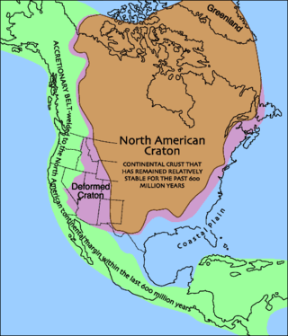
Laurentia or the North American Craton is a large continental craton that forms the ancient geological core of North America. Many times in its past, Laurentia has been a separate continent, as it is now in the form of North America, although originally it also included the cratonic areas of Greenland and also the northwestern part of Scotland, known as the Hebridean Terrane. During other times in its past, Laurentia has been part of larger continents and supercontinents and consists of many smaller terranes assembled on a network of early Proterozoic orogenic belts. Small microcontinents and oceanic islands collided with and sutured onto the ever-growing Laurentia, and together formed the stable Precambrian craton seen today.

<span class="mw-page-title-main">Andean orogeny</span> Ongoing mountain-forming process in South America

The Andean orogeny is an ongoing process of orogeny that began in the Early Jurassic and is responsible for the rise of the Andes mountains. The orogeny is driven by a reactivation of a long-lived subduction system along the western margin of South America. On a continental scale the Cretaceous and Oligocene were periods of re-arrangements in the orogeny. The details of the orogeny vary depending on the segment and the geological period considered.

<span class="mw-page-title-main">Geology of Bolivia</span>

The geology of Bolivia comprises a variety of different lithologies as well as tectonic and sedimentary environments. On a synoptic scale, geological units coincide with topographical units. The country is divided into a mountainous western area affected by the subduction processes in the Pacific and an eastern lowlands of stable platforms and shields. The Bolivian Andes is divided into three main ranges; these are from west to east: the Cordillera Occidental that makes up the border to Chile and host several active volcanoes and geothermal areas, Cordillera Central once extensively mined for silver and tin and the relatively low Cordillera Oriental that rather than being a range by its own is the eastern continuation of the Central Cordillera as a fold and thrust belt. Between the Occidental and Central Cordillera the approximately 3,750-meter-high Altiplano high plateau extends. This basin hosts several freshwater lakes, including Lake Titicaca as well as salt-covered dry lakes that bring testimony of past climate changes and lake cycles. The eastern lowlands and sub-Andean zone in Santa Cruz, Chuquisaca, and Tarija Departments was once an old Paleozoic sedimentary basin that hosts valuable hydrocarbon reserves. Further east close to the border with Brazil lies the Guaporé Shield, made up of stable Precambrian crystalline rock.

<span class="mw-page-title-main">Geology of Uruguay</span>

The geology of Uruguay combines areas of Precambrian-aged shield units with a region of volcanic rock erupted during the Cretaceous and copious sedimentary facies the oldest of which date from the Devonian. Big events that have shaped the geology of Uruguay include the Transamazonian orogeny, the breakup of Rodinia and the opening of the South Atlantic.

Arequipa-Antofalla is a basement unit underlying the central Andes in northwestern Argentina, western Bolivia, northern Chile and southern Peru. Geologically, it corresponds to a craton, terrane or block of continental crust. Arequipa-Antofalla collided and amalgamated with the Amazonian craton about 1000 Ma ago during the Sunsás orogeny. As a terrane Arequipa-Antofalla was ribbon-shaped during the Paleozoic, a time when it was bounded by the west by the Iapetus Ocean and by the east by the Puncoviscana Ocean.

<span class="mw-page-title-main">Lhasa terrane</span> Fragment of crustal material that forms present-day southern Tibet

The Lhasa terrane is a terrane, or fragment of crustal material, sutured to the Eurasian Plate during the Cretaceous that forms present-day southern Tibet. It takes its name from the city of Lhasa in the Tibet Autonomous Region, China. The northern part may have originated in the East African Orogeny, while the southern part appears to have once been part of Australia. The two parts joined, were later attached to Asia, and then were impacted by the collision of the Indian Plate that formed the Himalayas.

<span class="mw-page-title-main">Famatinian orogeny</span> Paleozoic geological event in South America

The Famatinian orogeny is an orogeny that predates the rise of the Andes and that took place in what is now western South America during the Paleozoic, leading to the formation of the Famatinian orogen also known as the Famatinian belt. The Famatinian orogeny lasted from the Late Cambrian to at least the Late Devonian and possibly the Early Carboniferous, with orogenic activity peaking about 490 to 460 million years ago. The orogeny involved metamorphism and deformation in the crust and the eruption and intrusion of magma along a Famatinian magmatic arc that formed a chain of volcanoes. The igneous rocks of the Famatinian magmatic arc are of calc-alkaline character and include gabbros, tonalites, granodiorites and trondhjemites. The youngest igneous rocks of the arc are granites.

<span class="mw-page-title-main">Pampean orogeny</span>

The Pampean orogeny was an orogeny active in the Cambrian in the western margin of the ancient landmass of Gondwana. The orogen's remains can now be observed in central Argentina, in particular at the Sierras de Córdoba and other parts of the eastern Sierras Pampeanas. It is uncertain if the orogeny involved at some point a continental collision. The Pampean orogen can be considered both part of the larger Terra Australis orogen and of the Brasiliano orogeny. The Pampean orogeny was succeeded by the Famatinian orogeny further west.

Puncoviscana Formation is a formation of sedimentary and metasedimentary rocks Late Ediacaran and Lower Cambrian age, estimated at between 700 and 535 Ma, that crop out in the Argentine Northwest. Most of the formation lies in Jujuy, Salta and Tucumán Province albeit some authors extend the formation further south to the Sierras Pampeanas near Córdoba.

<span class="mw-page-title-main">Gondwanide orogeny</span> Permian mountain forming tectonic event

The Gondwanide orogeny was an orogeny active in the Permian that affected parts of Gondwana that are by current geography now located in southern South America, South Africa, Antarctica, Australia and New Guinea. The zone of deformation in Argentina extends as a belt south and west of the cratonic nucleus of Río de la Plata–Pampia. The deformation of the orogeny is visible in the Sierra de la Ventana mountains in Argentina and the Cape Fold Belt in South Africa. The Gondwanide orogeny might have been linked with the roughly contemporary San Rafael orogeny of western Argentina.

<span class="mw-page-title-main">Geology of Germany</span> Overview of the geology of Germany

The geology of Germany is heavily influenced by several phases of orogeny in the Paleozoic and the Cenozoic, by sedimentation in shelf seas and epicontinental seas and on plains in the Permian and Mesozoic as well as by the Quaternary glaciations.

<span class="mw-page-title-main">Tectonic evolution of Patagonia</span>

Patagonia comprises the southernmost region of South America, portions of which lie on either side of the Argentina-Chile border. It has traditionally been described as the region south of the Rio, Colorado, although the physiographic border has more recently been moved southward to the Huincul fault. The region's geologic border to the north is composed of the Rio de la Plata craton and several accreted terranes comprising the La Pampa province. The underlying basement rocks of the Patagonian region can be subdivided into two large massifs: the North Patagonian Massif and the Deseado Massif. These massifs are surrounded by sedimentary basins formed in the Mesozoic that underwent subsequent deformation during the Andean orogeny. Patagonia is known for its vast earthquakes and the damage they cause.

The geology of Mozambique is primarily extremely old Precambrian metamorphic and igneous crystalline basement rock, formed in the Archean and Proterozoic, in some cases more than two billion years ago. Mozambique contains greenstone belts and spans the Zimbabwe Craton, a section of ancient stable crust. The region was impacted by major tectonic events, such as the mountain building Irumide orogeny, Pan-African orogeny and the Snowball Earth glaciation. Large basins that formed in the last half-billion years have filled with extensive continental and marine sedimentary rocks, including rocks of the extensive Karoo Supergroup which exist across Southern Africa. In some cases these units are capped by volcanic rocks. As a result of its complex and ancient geology, Mozambique has deposits of iron, coal, gold, mineral sands, bauxite, copper and other natural resources.

<span class="mw-page-title-main">Geology of Sweden</span>

The geology of Sweden is the regional study of rocks, minerals, tectonics, natural resources and groundwater in the country. The oldest rocks in Sweden date to more than 2.5 billion years ago in the Precambrian. Complex orogeny mountain building events and other tectonic occurrences built up extensive metamorphic crystalline basement rock that often contains valuable metal deposits throughout much of the country. Metamorphism continued into the Paleozoic after the Snowball Earth glaciation as the continent Baltica collided with an island arc and then the continent Laurentia. Sedimentary rocks are most common in southern Sweden with thick sequences from the last 250 million years underlying Malmö and older marine sedimentary rocks forming the surface of Gotland.

The geology of Venezuela includes ancient Precambrian igneous and metamorphic basement rocks, layered with sedimentary rocks from the Paleozoic and Mesozoic and thick geologically recent Cenozoic sediments with extensive oil and gas.

The geology of Brazil includes very ancient craton basement rock from the Precambrian overlain by sedimentary rocks and intruded by igneous activity, as well as impacted by the rifting of the Atlantic Ocean.

<span class="mw-page-title-main">Geology of Peru</span>

The geology of Peru includes ancient Proterozoic rocks, Paleozoic and Mesozoic volcanic and sedimentary rocks, and numerous basins and the Andes Mountains formed in the Cenozoic.

The geology of Newfoundland and Labrador includes basement rocks formed as part of the Grenville Province in the west and Labrador and the Avalonian microcontinent in the east. Extensive tectonic changes, metamorphism and volcanic activity have formed the region throughout Earth history.

References

  1. Galindo, C.; Casquet, C.; Rapela, C.; Pankhurst, R.J.; Baldo, E.; Saavedra, J. (2004). "Sr, C and O isotope geochemistry and stratigraphy of Precambrian and lower Paleozoic carbonate sequences from the Western Sierras Pampeanas of Argentina: Tectonic implications" (PDF). Precambrian Research. 131 (1–2): 55–71. Bibcode:2004PreR..131...55G. doi:10.1016/j.precamres.2003.12.007.
  2. De Brodtkorb, M. K.; Brodtkorb, A. (1977). "Strata-Bound Scheelite Deposits in the Precambrian Basement of San Luis (Argentina)". Time- and Strata-Bound Ore Deposits. pp. 141–149. doi:10.1007/978-3-642-66806-7_9. ISBN   978-3-642-66808-1.
  3. Lehmann, Bernd (1978). "A Precambrian core sample from the Altiplano/Bolivia". Geologische Rundschau. 67 (1): 270–278. Bibcode:1978GeoRu..67..270L. doi:10.1007/BF01803266. S2CID   129763740.
  4. Salda, Luis Dalla (1981). "The Precambrian geology of el Cristo, southern Tandilia Region, Argentina". Geologische Rundschau. 70 (3): 1030–1042. Bibcode:1981GeoRu..70.1030S. doi:10.1007/BF01820179. S2CID   129368161.
  5. Aceñolaza, Florencio Gilberto; Miller, Hubert; Toselli, Alejandro José (1988). "The Puncoviscana Formation (Late Precambrian — Early Cambrian). - sedimentology, tectonometamorphic history and age of the oldest rocks of NW Argentina". The Southern Central Andes. Lecture Notes in Earth Sciences. Vol. 17. pp. 25–37. doi:10.1007/BFb0045172. ISBN   978-3-540-50032-2.
  6. Schwartz, Joshua J.; Gromet, L.Peter (2004). "Provenance of a late Proterozoic–early Cambrian basin, Sierras de Córdoba, Argentina". Precambrian Research. 129 (1–2): 1–21. Bibcode:2004PreR..129....1S. doi:10.1016/j.precamres.2003.08.011.
  7. Adams, C.J.; Miller, H.; Aceñolaza, F.G.; Toselli, A.J.; Griffin, W.L. (2011). "The Pacific Gondwana margin in the late Neoproterozoic–early Paleozoic: Detrital zircon U–Pb ages from metasediments in northwest Argentina reveal their maximum age, provenance and tectonic setting". Gondwana Research. 19 (1): 71–83. Bibcode:2011GondR..19...71A. doi:10.1016/j.gr.2010.05.002. hdl: 11336/89605 .
  8. González, Carlos Roberto (1990). "Development of the Late Paleozoic glaciations of the South American Gondwana in western Argentina". Palaeogeography, Palaeoclimatology, Palaeoecology. 79 (3–4): 275–287. Bibcode:1990PPP....79..275G. doi:10.1016/0031-0182(90)90022-Y.
  9. Limarino, Carlos; Tripaldi, Alfonsina; Marenssi, Sergio; Fauqué, Luis (2006). "Tectonic, sea-level, and climatic controls on Late Paleozoic sedimentation in the western basins of Argentina". Journal of South American Earth Sciences. 22 (3–4): 205–226. Bibcode:2006JSAES..22..205L. doi:10.1016/j.jsames.2006.09.009.
  10. Franzese, Juan; Spalletti, Luis; Pérez, Irene Gómez; MacDonald, David (2003). "Tectonic and paleoenvironmental evolution of Mesozoic sedimentary basins along the Andean foothills of Argentina (32°–54°S)". Journal of South American Earth Sciences. 16 (1): 81–90. Bibcode:2003JSAES..16...81F. doi:10.1016/S0895-9811(03)00020-8. hdl: 11336/72577 .
  11. Pángaro, Francisco; Ramos, Víctor A. (2012). "Paleozoic crustal blocks of onshore and offshore central Argentina: New pieces of the southwestern Gondwana collage and their role in the accretion of Patagonia and the evolution of Mesozoic south Atlantic sedimentary basins". Marine and Petroleum Geology. 37 (1): 162–183. Bibcode:2012MarPG..37..162P. doi:10.1016/j.marpetgeo.2012.05.010. hdl: 11336/84682 .
  12. Olivero, Eduardo Bernardo; Malumián, Norberto (2008). "Mesozoic-Cenozoic stratigraphy of the Fuegian Andes, Argentina". Geologica Acta. 6: 5–18. doi:10.1344/104.000000238.
  13. Cladouhos, T.T.; Allmendinger, R.W.; Coira, B.; Farrar, E. (1994). "Late cenozoic deformation in the Central Andes: Fault kinematics from the northern Puna, northwestern Argentina and southwestern Bolivia". Journal of South American Earth Sciences. 7 (2): 209–228. Bibcode:1994JSAES...7..209C. doi: 10.1016/0895-9811(94)90008-6 .
  14. Strecker, M. R.; Cerveny, P.; Bloom, A. L.; Malizia, D. (1989). "Late Cenozoic tectonism and landscape development in the foreland of the Andes: Northern Sierras Pampeanas (26°-28°S), Argentina". Tectonics. 8 (3): 517–534. Bibcode:1989Tecto...8..517S. doi:10.1029/TC008i003p00517.
  15. Rabassa, Jorge; Coronato, Andrea M.; Salemme, Mónica (2005). "Chronology of the Late Cenozoic Patagonian glaciations and their correlation with biostratigraphic units of the Pampean region (Argentina)". Journal of South American Earth Sciences. 20 (1–2): 81–103. Bibcode:2005JSAES..20...81R. doi:10.1016/j.jsames.2005.07.004. hdl: 11336/150967 .