Related Research Articles
The geology of Shropshire is very diverse with a large number of periods being represented at outcrop. The bedrock consists principally of sedimentary rocks of Palaeozoic and Mesozoic age, surrounding restricted areas of Precambrian metasedimentary and metavolcanic rocks. The county hosts in its Quaternary deposits and landforms, a significant record of recent glaciation. The exploitation of the Coal Measures and other Carboniferous age strata in the Ironbridge area made it one of the birthplaces of the Industrial Revolution. There is also a large amount of mineral wealth in the county, including lead and baryte. Quarrying is still active, with limestone for cement manufacture and concrete aggregate, sandstone, greywacke and dolerite for road aggregate, and sand and gravel for aggregate and drainage filters. Groundwater is an equally important economic resource.

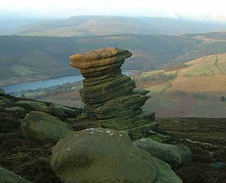
Millstone Grit is the name given to any of a number of coarse-grained sandstones of Carboniferous age which occur in the British Isles. The name derives from its use in earlier times as a source of millstones for use principally in watermills. Geologists refer to the whole suite of rocks that encompass the individual limestone beds and the intervening mudstones as the Millstone Grit Group. The term Millstone Grit Series was formerly used to refer to the rocks now included within the Millstone Grit Group together with the underlying Edale Shale Group.

One of the classic locations for the study of Triassic sandstones in the UK is at Alderley Edge in Cheshire. Numerous scientists from the early 19th century up to the present day have studied the area and it is a popular field site for universities around the UK.
The geology of Cheshire in England consists mainly of Triassic sandstones and mudstones. To the north west of Cheshire, these rocks are heavily faulted and the underlying Carboniferous Coal Measures are thrown up. Around the areas of Poynton and Macclesfield, the coal is close to the surface and was easily mined. Below the Coal Measures is the Millstone Grit, which appears towards the Derbyshire border on the flanks of the Peak District dome.

The geology of Wales is complex and varied; its study has been of considerable historical significance in the development of geology as a science. All geological periods from the Cryogenian to the Jurassic are represented at outcrop, whilst younger sedimentary rocks occur beneath the seas immediately off the Welsh coast. The effects of two mountain-building episodes have left their mark in the faulting and folding of much of the Palaeozoic rock sequence. Superficial deposits and landforms created during the present Quaternary period by water and ice are also plentiful and contribute to a remarkably diverse landscape of mountains, hills and coastal plains.

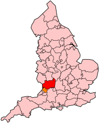
Gloucestershire is one of the most geologically and scenically diverse counties in England, with rocks from the Precambrian through to the Jurassic represented. These varying rock-types are responsible for the three major areas of the county, each with its own distinctive scenery and land-use - the Forest of Dean in the west, bordering Wales, the Cotswolds in the east, and in between, the Severn Vale.

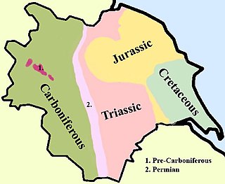
The Geology of Yorkshire in northern England shows a very close relationship between the major topographical areas and the geological period in which their rocks were formed. The rocks of the Pennine chain of hills in the west are of Carboniferous origin whilst those of the central vale are Permo-Triassic. The North York Moors in the north-east of the county are Jurassic in age while the Yorkshire Wolds to the south east are Cretaceous chalk uplands. The plain of Holderness and the Humberhead levels both owe their present form to the Quaternary ice ages. The strata become gradually younger from west to east.

The Marros Group is the name given to a suite of rocks of Namurian age laid down during the Carboniferous Period in South Wales. These rocks were formerly known as the Millstone Grit Series but are now distinguished from the similar but geographically separate rock sequences of the Pennines and Peak District of northern England and northeast Wales by this new name.

The Mercia Mudstone Group is an early Triassic lithostratigraphic group which is widespread in Britain, especially in the English Midlands—the name is derived from the ancient kingdom of Mercia which corresponds to that area. It is frequently encountered in older literature as the Keuper Marl or Keuper Marl Series.
The geology of Monmouthshire in southeast Wales largely consists of a thick series of sedimentary rocks of different types originating in the Silurian, Devonian, Carboniferous, Triassic and Jurassic periods.

The Sherwood Sandstone Group is a Triassic lithostratigraphic group which is widespread in Britain, especially in the English Midlands. The name is derived from Sherwood Forest in Nottinghamshire which is underlain by rocks of this age. It has economic importance as the reservoir of the Morecambe Bay gas field, the second largest gas field in the UK.
The geology of Lancashire in northwest England consists in the main of Carboniferous age rocks but with Triassic sandstones and mudstones at or near the surface of the lowlands bordering the Irish Sea though these are largely obscured by Quaternary deposits.
The Pennine Coal Measures Group is a lithostratigraphical term referring to the coal-bearing succession of rock strata which occur in the United Kingdom within the Westphalian Stage of the Carboniferous Period. In formal use, the term replaces the Coal Measures Group as applied to the succession of coal-bearing strata within the Pennine Basin which includes all of the coalfields of northern England and the English Midlands. It includes the largely concealed Canonbie Coalfield of southern Scotland and the coalfields of northeast Wales and the minor Anglesey coalfield. The sequence consists in the main of mudstones and siltstones together with numerous sandstones, the more significant ones of which are individually named. Some are laterally extensive, others are more restricted in their range. There are numerous coal seams, again with some being more laterally continuous than others. Those which were economically valuable were named though any individual seam may have attracted different names in different pits and different districts. Marine bands preserving distinctive and dateable marine fossils such as goniatites and brachiopods are widespread within the sequence and enable correlation to be made between sequences in one part of the basin and another and with other basins
The geology of County Durham in northeast England consists of a basement of Lower Palaeozoic rocks overlain by a varying thickness of Carboniferous and Permo-Triassic sedimentary rocks which dip generally eastwards towards the North Sea. These have been intruded by a pluton, sills and dykes at various times from the Devonian Period to the Palaeogene. The whole is overlain by a suite of unconsolidated deposits of Quaternary age arising from glaciation and from other processes operating during the post-glacial period to the present. The geological interest of the west of the county was recognised by the designation in 2003 of the North Pennines Area of Outstanding Natural Beauty as a European Geopark.
The geology of Northumberland in northeast England includes a mix of sedimentary, intrusive and extrusive igneous rocks from the Palaeozoic and Cenozoic eras. Devonian age volcanic rocks and a granite pluton form the Cheviot massif. The geology of the rest of the county is characterised largely by a thick sequence of sedimentary rocks of Carboniferous age. These are intruded by both Permian and Palaeogene dykes and sills and the whole is overlain by unconsolidated sediments from the last ice age and the post-glacial period. The Whin Sill makes a significant impact on Northumberland's character and the former working of the Northumberland Coalfield significantly influenced the development of the county's economy. The county's geology contributes to a series of significant landscape features around which the Northumberland National Park was designated.
Mynydd Garnclochdy is a gentle summit on the long moorland ridge which extends south from Blorenge towards Pontypool and which defines the boundary between the modern county of Monmouthshire to the east and the county borough of Torfaen to the west though historically it was entirely within the traditional county of Monmouthshire. Its summit, at a height of 448 m (1407 ft), is marked by a small cairn. The summit and the eastern slopes of the hill fall within the Brecon Beacons National Park. A southern top of the hill, Mynydd Garn-wen achieves a height of 436m, and carries a trig point further south again at an elevation of 425m. To the north the broad moorland ridge runs via a poorly defined 425m top and a col at 404m elevation just south of a minor east–west road, into Mynydd y Garn-fawr, east of Blaenavon.
The geology of the Gower Peninsula in South Wales is central to the area's character and to its appeal to visitors. The peninsula is formed almost entirely from a faulted and folded sequence of Carboniferous rocks though both the earlier Old Red Sandstone and later New Red Sandstone are also present. Gower lay on the southern margin of the last ice sheet and has been a focus of interest for researchers and students in that respect too. Cave development and the use of some for early human occupation is a further significant aspect of the peninsula's scientific and cultural interest.
The geology of the Yorkshire Dales National Park in northern England largely consists of a sequence of sedimentary rocks of Ordovician to Permian age. The core area of the Yorkshire Dales is formed from a layer-cake of limestones, sandstones and mudstones laid down during the Carboniferous period. It is noted for its karst landscape which includes extensive areas of limestone pavement and large numbers of caves including Britain's longest cave network.
The geology of the Peak District National Park in England is dominated by a thick succession of faulted and folded sedimentary rocks of Carboniferous age. The Peak District is often divided into a southerly White Peak where Carboniferous Limestone outcrops and a northerly Dark Peak where the overlying succession of sandstones and mudstones dominate the landscape. The scarp and dip slope landscape which characterises the Dark Peak also extends along the eastern and western margins of the park. Although older rocks are present at depth, the oldest rocks which are to be found at the surface in the national park are dolomitic limestones of the Woo Dale Limestone Formation seen where Woo Dale enters Wye Dale east of Buxton.
The geology of Pembrokeshire in Wales inevitably includes the geology of the Pembrokeshire Coast National Park which extends around the larger part of the county's coastline and where the majority of rock outcrops are to be seen. Pembrokeshire's bedrock geology is largely formed from a sequence of sedimentary and igneous rocks originating during the late Precambrian and the Palaeozoic era, namely the Ediacaran, Cambrian, Ordovician, Silurian, Devonian and Carboniferous periods, i.e. between 635 and 299 Ma. The older rocks in the north of the county display patterns of faulting and folding associated with the Caledonian Orogeny. On the other hand, the late Palaeozoic rocks to the south owe their fold patterns and deformation to the later Variscan Orogeny.
References
- ↑ British Geological Survey 1:50,000 scale geological map series sheets (England and Wales) 74, 83, 84, 96 & 97 and accompanying memoirs
- ↑ Aitkenhead et al 2002 British regional geology: the Pennines and adjacent areas (4th edn). British Geological Survey, Nottingham
- ↑ Howard et al 2007 geology of the Liverpool District - a brief explanation of the geological map Sheet explanation of the British Geological Survey 1:50,000 sheet 96 Liverpool (England and Wales), pp13-14
- ↑ Howard et al 2007 geology of the Liverpool District - a brief explanation of the geological map Sheet explanation of the British Geological Survey 1:50,000 sheet 96 Liverpool (England and Wales)
- ↑ Howard et al 2007 geology of the Liverpool District - a brief explanation of the geological map Sheet explanation of the British Geological Survey 1:50,000 sheet 96 Liverpool (England and Wales), pp21-22
- ↑ British Geological Survey 1:625,000 scale geological map Quaternary Map of the United Kingdom South 1st Edn. 1977