Omagh is the county town of County Tyrone, Northern Ireland. It is situated where the rivers Drumragh and Camowen meet to form the Strule. Northern Ireland's capital city, Belfast, is 68 miles (109.5 km) to the east of Omagh, and Derry is 34 miles (55 km) to the north.

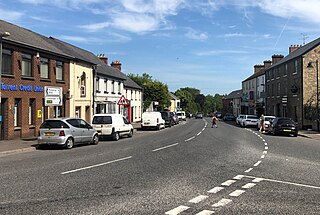
Donemana or Dunnamanagh is a village in County Tyrone, Northern Ireland. It is 7 miles or 11 kilometres north-east of Strabane, on the banks of the Burn Dennett and at the foothills of the Sperrins. In 2001, it was the largest of the thirteen villages in the former Strabane District Council area and it had a population of 586 in the Census that year.

Coagh is a small village in County Tyrone, Northern Ireland, five miles (8 km) east of Cookstown. Part of the village also extends into County Londonderry. It had a population of 545 people in the 2001 Census. It owes its existence to George Butle Conyngham of Springhill, and was founded in 1728 when King George II of Great Britain granted Conyngham a market charter allowing the village to host four fairs yearly. It is situated within Mid-Ulster District.
Donaghmore is a village, townland and civil parish in County Tyrone, Northern Ireland, about five kilometres (3 mi) north-west of Dungannon. In the 2011 Census it had a population of 1,122 people. The village is beside the River Torrent, formerly known as the Torrent Flow.

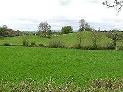
Caledon is a small village and townland in County Tyrone, Northern Ireland. It is in the Clogher Valley on the banks of the River Blackwater, 10 km from Armagh. It lies in the southeast of Tyrone and near the borders of County Armagh and County Monaghan. It is situated in the historic barony of Dungannon Lower and the civil parish of Aghaloo. In the 2001 Census it had a population of 387 people. It is a designated conservation area. It was historically known as Kinnaird.

Killyman is a small village and a civil parish in Northern Ireland, situated on the eastern boundary of County Tyrone and extending into County Armagh. The majority of townlands are in the historic barony of Dungannon Middle in County Tyrone, the rest being in the barony of Oneilland West in County Armagh.

Galbally Pearses' is a Gaelic Athletic Association club based in the village of Galbally in County Tyrone, Northern Ireland. The club is named after the 1916 Easter Rising martyr, Patrick Pearse.
Killeeshil St Mary's is a Gaelic Athletic Association club based in the village of Killeeshil in County Tyrone, Northern Ireland.
Derrytresk Fir An Chnoic is a Gaelic Athletic Association club in Tyrone. The club is based in the townland of Derrytresk near Clonoe in County Tyrone, Northern Ireland.
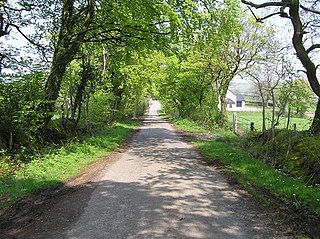
Altishane or Altishahane is a small settlement and townland in County Tyrone, Northern Ireland. It lies near Strabane, between Plumbridge and Donemana. It is situated in the historic barony of Strabane Lower and the civil parish of Donaghedy and covers an area of 744 acres. There is one primary school, Altishane Primary School.
Killeeshil is a townland and civil parish in County Tyrone, Northern Ireland. It is situated in the historic barony of Dungannon Lower. Killeeshil is home to their local community centre which helps the local community throughout killeeshil parish. They work with trustees but mainly volunteer work.

Bockets is a townland in County Tyrone, Northern Ireland. It is situated in the historic barony of Dungannon Lower and the civil parish of Killeeshil and covers an area of 667 acres (270 ha).
Cranlome is a townland in County Tyrone, Northern Ireland. It is situated in the historic barony of Dungannon Lower and the civil parish of Killeeshil and covers an area of 1,259 acres (509 ha).
Farriter is a townland in County Tyrone, Northern Ireland. It is situated in the historic barony of Dungannon Lower and the civil parish of Killeeshil and covers an area of 271 acres (110 ha).
Lurgacullion is a townland in County Tyrone, Northern Ireland. It is situated in the historic barony of Dungannon Lower and the civil parish of Killeeshil and covers an area of 289 acres (117 ha).
Tullyvannon is a townland in County Tyrone, Northern Ireland. It is situated in the historic barony of Dungannon Lower and the civil parish of Killeeshil and covers an area of 448 acres.

Mullyroddan is a townland in County Tyrone, Northern Ireland. It is situated in the historic barony of Dungannon Lower and the civil parish of Killeeshil and covers an area of 308 acres (125 ha).

Dergenagh is a townland in County Tyrone, Northern Ireland. It is situated in the historic barony of Dungannon Lower and the civil parish of Killeeshil and covers an area of 437 acres (177 ha).

Aghaginduff is a townland in County Tyrone, Northern Ireland. It is situated in the historic barony of Dungannon Lower and the civil parish of Killeeshil and covers an area of 512 acres (207 ha). Aghaginduff is located approximately 12 km (7 mi) west of Dungannon, close to Cabragh.

Cabragh is a townland in County Tyrone, Northern Ireland. It is in the historic barony of Dungannon Lower, the civil parish of Killeeshil and the poor law union of Dunngannon, and covers an area of 347 acres (140 ha) in the province of Ulster. Cabragh is located approximately 12 km (7 mi) west of Dungannon, close to Aghaginduff and Fasglashagh.