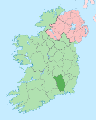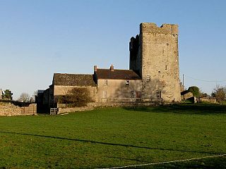
County Kilkenny is a county in Ireland. It is in the province of Leinster and is part of the Southern Region. It is named after the city of Kilkenny. Kilkenny County Council is the local authority for the county. At the 2022 census the population of the county was 103,685. The county was based on the historic Gaelic kingdom of Ossory (Osraighe), which was coterminous with the Diocese of Ossory.

Thomastown, historically known as Grennan, is a town in County Kilkenny in the province of Leinster in the south-east of Ireland. It is a market town along a stretch of the River Nore which is known for its salmon and trout, with a number of historical landmarks in the vicinity. Visitor attractions include Jerpoint Abbey, Kilfane Glen gardens, and Mount Juliet Golf Course. The town is in a civil parish of the same name.

Gowran is a town located on the eastern side of County Kilkenny, Ireland. The historic St. Mary's Collegiate Church is located in the centre of Gowran close to Gowran Castle. Gowran Park race course and Golf Course are located one km from the centre of Gowran. Gowran is located on the R448 regional road where it is crossed by the R702 regional road. The town is in a townland and civil parish and barony of the same name.
South Kilkenny was a UK Parliament constituency in Ireland.

Ballyhale is a village in the south east of Ireland. Located in the south of County Kilkenny, south of the city of Kilkenny and roughly halfway to Waterford city.
The Castlecomer Plateau, or 'South Leinster Coalfield', is an upland area in the North of County Kilkenny, Ireland, extending into County Laois and County Carlow at its northern edge. The plateau is bounded on the east and south by the R448 regional road, on the west by the N77. The River Nore flows southward past the plateau's western flank, the River Barrow past its eastern flank and it is dissected by the River Dinin, which flows through Castlecomer itself.
Flagmount is a combination of two townlands located within the barony of Gowran and on the R712 National primary road, in County Kilkenny, Ireland. It is located in Gowran civil parish.

Goresbridge is a small village located in the east of County Kilkenny, in the province of Leinster, Ireland. Goresbridge is named after a 1756 bridge, built by Colonel Ralph Gore, which provides a crossing of the River Barrow between County Kilkenny and County Carlow in the South-East region.

Ida is a barony in the south-east of County Kilkenny, Ireland. Ida is made up of 16 civil parishes containing 191 townlands, it is one of 12 baronies in the County. The barony is 249.8 square kilometres (96.4 sq mi) in size, with highest point at Tory Hill. The chief town is Slieveroe. The N25 crosses the barony.

Kilfane is a combination of two townlands located outside of Thomastown in County Kilkenny, Ireland. It is made up of the townlands of Kilfane East and West with a total area of 75 acres (0.30 km2). Located in the barony of Gowran, Kilfane gives its name to the wider civil parish which contains 16 townlands. It is in the Roman Catholic parish of Tullaherin.

Galmoy is a barony in the north western part of County Kilkenny, Ireland. It is one of 12 baronies in County Kilkenny. The size of the barony is 162.7 square kilometres (62.8 sq mi). There are 12 civil parishes in Galmoy. While it is named after the village of Galmoy, today the chief town of the barony is Urlingford. Galmoy barony lies at the north-western corner of the county between Fassadinin to the east, and Crannagh to the south. It is surrounded on two sides by counties Tipperary to the west and Laois to the north. The M8 Dublin/Cork motorway bisects the barony. It is situated 121 kilometres (75 mi) from Dublin city and 131 kilometres (81 mi) from Cork city. Galmoy is currently administered by Kilkenny County Council. The barony was part of in the historic kingdom of Osraige (Ossory).

Kilbline Castle is a fortified 16th century tower house in County Kilkenny in Ireland. It is set on the Kilbline Estate in the parish of Tullaherin, within the historical barony Gowran, approximately 1 mile southeast of Bennettsbridge. It is recorded as a protected (listed) structure by Kilkenny County Council.

Crannagh, sometimes written Cranagh or Granagh, is a barony in the north western part of County Kilkenny, Ireland. It is one of 12 baronies in County Kilkenny. The size of the barony is 210.8 square kilometres (81.4 sq mi). There are 19 civil parishes in Crannagh, made up of 182 townlands. The chief town Freshford, with highest point at Clomantagh Hill. Crannagh lies at the north west of the county, with the baronies of Galmoy and Fassadinin to the north, and the barony of the Kilkenny to the east and Shillelogher to the south. It is buffers County Tipperary on the west. The R693 road crosses the barony.

The barony of Callan is a barony in the west of County Kilkenny, Ireland. The barony is 22.9 square kilometres (8.8 sq mi) in size. It is one of 12 baronies in County Kilkenny. Unusually for a barony, it contains only two civil parishes which together comprise 65 townlands. The chief town is Callan. The barony is bordered by the baronies of Shillelogher to the north and by Kells to the south. The N76 road bisects the barony. Notable features include Callan Motte and Callan Augustinian Friary.

Iverk is a barony in the south-west of County Kilkenny, Ireland. The size of the barony is 167.3 square kilometres (64.6 sq mi). There are 15 civil parishes in Iverk. The chief town today is Piltown. The N24 crosses the barony.

Kells is a barony in the south-west of County Kilkenny, Ireland. It is one of 12 baronies in County Kilkenny. The size of the barony is 155.6 square kilometres (60.1 sq mi). There are 10 civil parishes in Kells, made up of 167 townlands. The chief town is Kells.

The barony of Knocktopher is a barony in the west of County Kilkenny, Ireland. The barony is 46,765 acres (189.25 km2) in size. There are 16 civil parishes made up of 125 townlands. It is one of 12 baronies in the county. The chief town is Mullinavat and it contains the settlements of Stonyford, Ballyhale, Hugginstown, Knocktopher, and Dunnamaggan. The M9 motorway bisects the barony.

Fassadinin, sometimes written Fassadining, is a barony in the north of County Kilkenny, Ireland. It is one of 12 baronies in County Kilkenny. The size of the barony is 276.2 square kilometres (106.6 sq mi). There are 19 civil parishes in Fassadinin. The chief town today is Castlecomer. The N78 Kilkenny/Athy road bisects the barony. Fassadinin is currently administered by Kilkenny County Council.

The barony of Shillelogher is a barony in the west of County Kilkenny, Ireland. The barony is 36,684 acres (148.45 km2) in size. It is one of 12 baronies in County Kilkenny. There are 19 civil parishes in Shillelogher, made up of 109 townlands. The chief town is Bennettsbridge. Shillelogher lies at the centre of the county, with the baronies of Crannagh and Kilkenny to the north (whose chief towns are Freshford and Kilkenny, and the barony of Gowran to the east. It is borders County Tipperary to the west. The N76 road bisects the barony. The river Nore flows through the barony. Danesfort Church is located in Shillelogher.

Cantwell's Castle is a tower house located in the townland of Sandfortscourt in County Kilkenny, Ireland. It served as the main residence for the head of the Cantwell family, While debated of who owned it in its final days the facts point to the Cantwell Family. Before a siege of the Cantwell castle from Oliver Cromwells army which led to Cromwells army being forced away with the Cantwells taking control even though two of the tree castles were significantly damaged.


