List of buildings
| Name | Location | Type | Completed [note 1] | Date designated | Grid ref. [note 2] Geo-coordinates | Entry number [note 3] | Image |
|---|---|---|---|---|---|---|---|
| Althorp, Gardeners House | Althorp | Estate cottage | Mid-18th century | 2 November 1954 | SP6820564502 52°16′28″N1°00′06″W / 52.274448°N 1.001803°W | 1356630 |  Upload Photo |
| Althorp, Stables | Althorp | Stables | c.1730 | 2 November 1954 | SP6813165040 52°16′45″N1°00′10″W / 52.279293°N 1.002779°W | 1054034 |  |
| Church of St Andrew | Arthingworth | Church | 12th century | 2 November 1954 | SP7547381421 52°25′32″N0°53′29″W / 52.425576°N 0.891506°W | 1067030 | 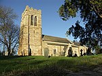 |
| Manor House | Ashby St. Ledgers | House | 16th century | 18 September 1953 | SP5733668289 52°18′35″N1°09′38″W / 52.309729°N 1.160436°W | 1367130 |  |
| Timber-framed house attached to north side of Manor House | Ashby St. Ledgers | House | 1903 | 18 January 1968 | SP5733368308 52°18′36″N1°09′38″W / 52.3099°N 1.160477°W | 1342976 |  Upload Photo |
| Church of St Mary the Virgin | Badby | Church | 14th century | 18 January 1968 | SP5597058737 52°13′26″N1°10′55″W / 52.224003°N 1.182051°W | 1075276 |  |
| Church of St Mary | Barby | Church | 13th century | 18 January 1968 | SP5433270295 52°19′41″N1°12′15″W / 52.328066°N 1.20417°W | 1076479 |  |
| Church of St Peter and St Paul | Brockhall | Church | 13th century | 18 January 1968 | SP6328062684 52°15′31″N1°04′28″W / 52.258694°N 1.074314°W | 1075243 |  |
| Manor Farmhouse | Brockhall | Farmhouse | 1677 | 18 September 1953 | SP6339462685 52°15′31″N1°04′22″W / 52.25869°N 1.072644°W | 1075246 | 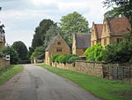 |
| The Hall | Brockhall | Country house | Early 17th century | 18 January 1968 | SP6326262662 52°15′31″N1°04′28″W / 52.258498°N 1.074582°W | 1075245 | 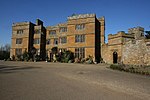 |
| Manor House | Byfield | Manor house | Early 18th century | 18 January 1968 | SP5175853425 52°10′36″N1°14′40″W / 52.176662°N 1.244517°W | 1075339 |  |
| Canons Ashby House, gates and gatepiers to Green Court | Canons Ashby | Gate | Early 18th century | 18 January 1968 | SP5767050691 52°09′05″N1°09′31″W / 52.151499°N 1.158534°W | 1367449 |  |
| Canons Ashby House, South Lion Gates and gatepiers to garden | Canons Ashby | Gate | Early 18th century | 18 January 1968 | SP5761650523 52°09′00″N1°09′34″W / 52.149995°N 1.159351°W | 1187120 |  Upload Photo |
| Packhorse bridge over River Cherwell | River Cherwell, Charwelton | Bridge | 15th century | 18 January 1968 | SP5349956078 52°12′01″N1°13′07″W / 52.200345°N 1.218641°W | 1075316 |  |
| Church of St Botolph | Church Brampton | Church | 14th century | 2 November 1954 | SP7180465712 52°17′06″N0°56′56″W / 52.284867°N 0.948808°W | 1067098 |  |
| Church of St Andrew | Clay Coton | Church | 14th century | 18 January 1968 | SP5938476967 52°23′15″N1°07′44″W / 52.387519°N 1.128869°W | 1287640 |  |
| The Chestnuts | Clipston | House | Mid-18th century | 2 November 1954 | SP7095981590 52°25′40″N0°57′28″W / 52.427698°N 0.957842°W | 1067034 |  Upload Photo |
| Church of St Denys | Cold Ashby | Church | 12th century to 14th century | 2 November 1954 | SP6561076269 52°22′50″N1°02′15″W / 52.380536°N 1.037537°W | 1216470 |  |
| Church of St Michael | Creaton | Church | Late 12th century | 2 November 1954 | SP7063271847 52°20′25″N0°57′53″W / 52.340164°N 0.9647°W | 1067105 |  |
| Moot Hall | Daventry | House | Mid-18th century | 4 December 1953 | SP5739562618 52°15′31″N1°09′38″W / 52.258745°N 1.160535°W | 1067667 |  |
| Saracen's Head Inn | Daventry | Public house | Mid-18th century | 4 December 1953 | SP5712062503 52°15′28″N1°09′52″W / 52.257739°N 1.164583°W | 1067693 |  |
| Wheatsheaf Hotel | Daventry | Care home | Early 17th century | 4 December 1953 | SP5721862341 52°15′23″N1°09′47″W / 52.256273°N 1.163175°W | 1298930 |  |
| 36 High Street | Daventry | House | Late 17th or early 18th century | 4 December 1953 | SP5728562543 52°15′29″N1°09′44″W / 52.258082°N 1.162159°W | 1054690 |  |
| 27 High Street | Daventry | House | Late 17th century | 4 December 1953 | SP5732462503 52°15′28″N1°09′42″W / 52.257718°N 1.161594°W | 1054700 |  |
| 57 and 59 High Street | Daventry | House | Mid-18th century | 4 December 1953 | SP5720362491 52°15′27″N1°09′48″W / 52.257623°N 1.163369°W | 1067663 |  Upload Photo |
| 2 Sheaf Street | Daventry | House | 17th century | 4 December 1953 | SP5711662468 52°15′27″N1°09′53″W / 52.257425°N 1.164647°W | 1067679 |  |
| 20 & 22 Sheaf Street | Daventry | House | 16th or early 17th century | 4 December 1953 | SP5717162421 52°15′25″N1°09′50″W / 52.256997°N 1.16385°W | 1067680 |  |
| 29 High Street | Daventry | House | 18th century | 4 December 1953 | SP5729662511 52°15′28″N1°09′43″W / 52.257793°N 1.162003°W | 1356578 |  |
| 1 Tavern Street | Daventry | House | 17th century | 4 December 1953 | SP5713662479 52°15′27″N1°09′52″W / 52.257522°N 1.164352°W | 1067682 |  |
| 7 New Street | Daventry | Grammar school | 1600 | 4 December 1953 | SP5743462502 52°15′28″N1°09′36″W / 52.257698°N 1.159983°W | 1054755 |  |
| Church of St Catherine | Draughton | Church | Late 12th century | 2 November 1954 | SP7619276814 52°23′03″N0°52′55″W / 52.384067°N 0.881982°W | 1067038 |  |
| Church of St Mary | East Haddon | Church | 12th–14th century | 2 November 1954 | SP6673068166 52°18′27″N1°01′22″W / 52.307564°N 1.022693°W | 1356896 |  |
| Church of St Mary | Farthingstone | Church | Late 13th century | 18 January 1968 | SP6132055007 52°11′24″N1°06′16″W / 52.189905°N 1.104415°W | 1054931 |  |
| Fawsley Farm, well house to south-west | Fawsley | Well house | Early 16th century | 24 February 1987 | SP5533056554 52°12′16″N1°11′30″W / 52.204444°N 1.191776°W | 1343553 |  Upload Photo |
| Church of All Saints | Flore | Church | 13th century | 18 January 1968 | SP6419359847 52°13′59″N1°03′41″W / 52.233086°N 1.061478°W | 1055753 |  |
| Church of St Helen | Great Oxendon | Church | 13th–14th century | 2 November 1954 | SP7355783938 52°26′54″N0°55′09″W / 52.44846°N 0.919124°W | 1367480 |  |
| Church of St Ethelreda | Guilsborough | Church | 14th century | 2 November 1954 | SP6760672681 52°20′53″N1°00′32″W / 52.348042°N 1.00894°W | 1067072 |  |
| Stables of Harlestone House | Lower Harlestone, Harlestone | House | Early 19th century | 2 November 1954 | SP7006364558 52°16′29″N0°58′28″W / 52.274718°N 0.974565°W | 1067077 | 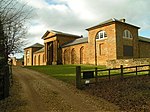 |
| Church of St Michael | Haselbech | Church | 13th century | 2 November 1954 | SP7117777309 52°23′21″N0°57′20″W / 52.38919°N 0.955545°W | 1067001 |  |
| Church of St John the Baptist | Hellidon | Church | Medieval | 18 January 1968 | SP5157358192 52°13′10″N1°14′47″W / 52.219532°N 1.246498°W | 1075284 | 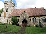 |
| The Grange | Hellidon | House | 1850 | 24 February 1987 | SP5158558021 52°13′05″N1°14′47″W / 52.217994°N 1.246348°W | 1075290 |  Upload Photo |
| Church of All Saints | Holdenby | Church | 14th century | 2 November 1954 | SP6918767599 52°18′08″N0°59′12″W / 52.302164°N 0.986778°W | 1281660 | 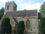 |
| Holdenby House | Holdenby | Country house | c.1583 | 2 November 1954 | SP6927767774 52°18′13″N0°59′08″W / 52.303726°N 0.985423°W | 1067053 |  |
| The Old Stone House | Teeton, Hollowell | Farmhouse | Early 17th century | 2 November 1954 | SP6949070326 52°19′36″N0°58′54″W / 52.326638°N 0.981773°W | 1067058 |  |
| Church of St Denys | Kelmarsh | Church | 14th century | 2 November 1954 | SP7352279220 52°24′22″N0°55′14″W / 52.406058°N 0.920675°W | 1370062 |  |
| Church of St Faith | Kilsby | Church | 13th century | 18 January 1968 | SP5631671137 52°20′08″N1°10′30″W / 52.335436°N 1.17492°W | 1031370 |  |
| North entrance to Kilsby Railway Tunnel | London to Birmingham Railway, Kilsby | Railway tunnel portal | c.1838 | 11 March 1987 | SP5647671459 52°20′18″N1°10′21″W / 52.338314°N 1.172518°W | 1076405 |  |
| North ventilation shaft, Kilsby Tunnel | London to Birmingham Railway, Kilsby | Ventilation shaft | c.1838 | 11 March 1987 | SP5694270876 52°19′59″N1°09′57″W / 52.333025°N 1.165778°W | 1076406 |  |
| South entrance to Kilsby Tunnel | London to Birmingham Railway, Kilsby | Railway tunnel portal | c.1838 | 11 March 1987 | SP5786369733 52°19′22″N1°09′09″W / 52.322654°N 1.15246°W | 1354762 |  |
| South ventilation shaft, Kilsby Tunnel | London to Birmingham Railway, Kilsby | Ventilation shaft | c.1838 | 11 March 1987 | SP5740870300 52°19′40″N1°09′33″W / 52.327799°N 1.159038°W | 1343043 |  |
| The Old Rectory | Lamport | House | c.1727–30 | 2 November 1954 | SP7586074610 52°21′51″N0°53′14″W / 52.364303°N 0.887356°W | 1356930 |  |
| Church of St Lawrence | Long Buckby | Church | Medieval | 18 January 1968 | SP6272467744 52°18′15″N1°04′53″W / 52.304242°N 1.081519°W | 1203352 |  |
| Holly House | Long Buckby | House | 17th century | 11 March 1987 | SP6292267549 52°18′09″N1°04′43″W / 52.302467°N 1.078652°W | 1077036 |  Upload Photo |
| Church of St Mary the Virgin | Maidwell | Church | 12th, 13th century | 2 November 1954 | SP7491676936 52°23′07″N0°54′03″W / 52.385339°N 0.900698°W | 1067857 |  |
| Church of All Saints | Naseby | Church | Early 13th century | 2 November 1954 | SP6889278133 52°23′49″N0°59′20″W / 52.396889°N 0.988946°W | 1343441 |  |
| Church Farmhouse | Newnham | House | 17th century | 29 April 1987 | SP5804459627 52°13′54″N1°09′06″W / 52.23179°N 1.15154°W | 1076540 |  Upload Photo |
| Church of All Saints | Pitsford | Church | 12th century | 2 November 1954 | SP7542768193 52°18′24″N0°53′43″W / 52.306683°N 0.895152°W | 1067059 |  |
| Church of St Peter and St Paul | Preston Capes | Church | 13th century | 18 January 1968 | SP5742554900 52°11′22″N1°09′41″W / 52.189361°N 1.161403°W | 1075292 |  |
| Church of St Denys | Ravensthorpe | Church | 13th century | 2 November 1954 | SP6700070346 52°19′38″N1°01′06″W / 52.327127°N 1.0183°W | 1227982 |  |
| Church of St Peter and St Paul | Scaldwell | Church | 12th–14th century | 2 November 1954 | SP7686872574 52°20′45″N0°52′23″W / 52.345862°N 0.873022°W | 1343570 |  |
| Church of St Helen | Sibbertoft | Church | 13th century | 2 November 1954 | SP6814682768 52°26′19″N0°59′56″W / 52.438644°N 0.998965°W | 1228308 |  |
| Church of St Helen | Thornby | Church | 13th century | 2 November 1954 | SP6696275636 52°22′29″N1°01′04″W / 52.374683°N 1.017804°W | 1228640 |  |
| Church of St Peter and St Paul | Lower Weedon, Weedon Bec | Church | Late 12th century | 18 January 1968 | SP6333659283 52°13′41″N1°04′27″W / 52.228115°N 1.07413°W | 1076520 |  |
| Former Weedon Barracks: canal enclosure wall to north | Lower Weedon, Weedon Bec | Wall | Early 19th century | 1 August 1982 | SP6258059563 52°13′51″N1°05′07″W / 52.230718°N 1.085145°W | 1076513 |  Upload Photo |
| Former Weedon Barracks: canal enclosure wall to south | Lower Weedon, Weedon Bec | Wall | Early 19th century | 1 August 1982 | SP6257459550 52°13′50″N1°05′07″W / 52.230602°N 1.085235°W | 1281680 |  |
| Former Weedon Barracks: east blast house of series of four in magazine enclosure | Lower Weedon, Weedon Bec | Powder magazine | 1807–11 | 29 April 1987 | SP6229759567 52°13′51″N1°05′21″W / 52.230786°N 1.089287°W | 1342985 |  Upload Photo |
| Former Weedon Barracks: East Lodge | Lower Weedon, Weedon Bec | Footbridge | 1811–14 | 29 April 1987 | SP6293359587 52°13′51″N1°04′48″W / 52.230894°N 1.079973°W | 1076511 |  |
| Former Weedon Barracks: east magazine of series of four in magazine enclosure | Lower Weedon, Weedon Bec | Magazine | Early–mid-19th century | 29 April 1987 | SP6227759565 52°13′51″N1°05′22″W / 52.230771°N 1.089581°W | 1203530 |  Upload Photo |
| Former Weedon Barracks: inner east of series of four blast houses in magazine enclosure | Lower Weedon, Weedon Bec | Powder magazine | Early–mid-19th century | 29 April 1987 | SP6225659560 52°13′51″N1°05′24″W / 52.230728°N 1.089889°W | 1281642 |  Upload Photo |
| Former Weedon Barracks: inner east of series of four magazines n magazine enclosure | Lower Weedon, Weedon Bec | Magazine | 1807–11 | 29 April 1987 | SP6223459563 52°13′51″N1°05′25″W / 52.230757°N 1.09021°W | 1076518 |  Upload Photo |
| Former Weedon Barracks: inner west of series of four blast houses in magazine enclosure | Lower Weedon, Weedon Bec | Powder magazine | 1807–11 | 29 April 1987 | SP6221259559 52°13′51″N1°05′26″W / 52.230724°N 1.090533°W | 1076519 |  Upload Photo |
| Former Weedon Barracks: inner west of series of four blast houses in magazine enclosure | Lower Weedon, Weedon Bec | Magazine | 1807–11 | 29 April 1987 | SP6219259559 52°13′51″N1°05′27″W / 52.230726°N 1.090826°W | 1281632 |  Upload Photo |
| Former Weedon Barracks: large magazine to west of the series of four magazines in magazine enclosure | Lower Weedon, Weedon Bec | Magazine | c.1857 | 29 April 1987 | SP6209959552 52°13′50″N1°05′32″W / 52.230674°N 1.092189°W | 1203528 |  Upload Photo |
| Former Weedon Barracks: outer wall and north-west bastion | Lower Weedon, Weedon Bec | Boundary wall | 1804–10 | 6 August 1982 | SP6253459617 52°13′52″N1°05′09″W / 52.231209°N 1.085809°W | 1076512 |  Upload Photo |
| Former Weedon Barracks: outer wall, south-east and south-west bastions and gate piers to south-east | Lower Weedon, Weedon Bec | Gate | 1804–10 | 1 August 1982 | SP6271359476 52°13′48″N1°05′00″W / 52.229921°N 1.083214°W | 1342980 |  Upload Photo |
| Former Weedon Barracks: outer walls and north-east bastion | Lower Weedon, Weedon Bec | Gate | 1804–10 | 6 August 1982 | SP6292759648 52°13′53″N1°04′48″W / 52.231443°N 1.080049°W | 1281700 |  Upload Photo |
| Former Weedon Barracks: outer walls to magazine enclosure | Lower Weedon, Weedon Bec | Boundary wall | 1807–11 | 6 August 1982 | SP6225259510 52°13′49″N1°05′24″W / 52.230279°N 1.089957°W | 1342983 |  Upload Photo |
| Former Weedon Barracks: Storehouse Number 1 | Lower Weedon, Weedon Bec | Warehouse | 1804–10 | 29 April 1987 | SP6286159602 52°13′52″N1°04′52″W / 52.231037°N 1.081024°W | 1342981 |  Upload Photo |
| Former Weedon Barracks: Storehouse Number 17 | Lower Weedon, Weedon Bec | Warehouse | 1902 | 6 August 1982 | SP6249159565 52°13′51″N1°05′11″W / 52.230746°N 1.086448°W | 1281668 |  Upload Photo |
| Former Weedon Barracks: Storehouse Number 2 | Lower Weedon, Weedon Bec | Warehouse | 1804–10 | 29 April 1987 | SP6286359548 52°13′50″N1°04′52″W / 52.230551°N 1.081005°W | 1076515 |  |
| Former Weedon Barracks: Storehouse Number 3 | Lower Weedon, Weedon Bec | Warehouse | 1804–10 | 29 April 1987 | SP6278659598 52°13′52″N1°04′56″W / 52.23101°N 1.082123°W | 1203495 |  Upload Photo |
| Former Weedon Barracks: Storehouse Number 4 | Lower Weedon, Weedon Bec | Warehouse | 1804–10 | 29 April 1987 | SP6279559544 52°13′50″N1°04′55″W / 52.230523°N 1.082001°W | 1342982 |  |
| Former Weedon Barracks: Storehouse Number 5 | Lower Weedon, Weedon Bec | Warehouse | 1804–10 | 29 April 1987 | SP6268059589 52°13′51″N1°05′01″W / 52.230941°N 1.083676°W | 1076514 |  Upload Photo |
| Former Weedon Barracks: Storehouse Number 6 | Lower Weedon, Weedon Bec | Warehouse | 1804–10 | 29 April 1987 | SP6269459536 52°13′50″N1°05′01″W / 52.230463°N 1.083481°W | 1203512 |  |
| Former Weedon Barracks: Storehouse Number 7 | Lower Weedon, Weedon Bec | Workshop | 1804–10 | 29 April 1987 | SP6260859586 52°13′51″N1°05′05″W / 52.230922°N 1.084731°W | 1203504 |  Upload Photo |
| Former Weedon Barracks: Storehouse Number 8 | Lower Weedon, Weedon Bec | Warehouse | 1804–10 | 29 April 1987 | SP6261059530 52°13′50″N1°05′05″W / 52.230418°N 1.084712°W | 1076516 |  |
| Former Weedon Barracks: west blast house of series of four in magazine enclosure | Lower Weedon, Weedon Bec | Powder magazine | 1807–11 | 29 April 1987 | SP6217159558 52°13′51″N1°05′28″W / 52.23072°N 1.091134°W | 1342984 |  Upload Photo |
| Former Weedon Barracks: West Lodge | Lower Weedon, Weedon Bec | Gate | Early 19th century | 29 April 1987 | SP6254159548 52°13′50″N1°05′09″W / 52.230588°N 1.085719°W | 1203443 |  |
| Former Weedon Barracks: west magazine of series of four in magazine enclosure | Lower Weedon, Weedon Bec | Magazine | 1807–11 | 29 April 1987 | SP6214959558 52°13′51″N1°05′29″W / 52.230722°N 1.091456°W | 1076517 |  Upload Photo |
| Church of St Mary | Welford | Church | 13th–15th century | 2 November 1954 | SP6412380336 52°25′02″N1°03′31″W / 52.417269°N 1.058602°W | 1228655 |  |
| Church of St Martin | Welton | Church | 14th century | 18 January 1968 | SP5810966026 52°17′21″N1°08′58″W / 52.289305°N 1.149489°W | 1077025 |  |
| Church of St Michael | Winwick | Church | 13th century | 18 January 1985 | SP6256973864 52°21′33″N1°04′58″W / 52.359273°N 1.082655°W | 1229677 | 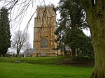 |
| Gate arch approx. 30m south of south front of Manor House | Winwick | Manor house | Early 17th century | 18 September 1953 | SP6256173931 52°21′36″N1°04′58″W / 52.359876°N 1.08276°W | 1278961 |  |
| Winwick Manor | Winwick | House | 16th century | 18 September 1953 | SP6260173953 52°21′36″N1°04′56″W / 52.360069°N 1.082168°W | 1229787 |  |
| Church of St Mary the Virgin | Woodford Halse, Woodford cum Membris | Church | 13th century | 18 January 1968 | SP5431252881 52°10′17″N1°12′26″W / 52.171526°N 1.207258°W | 1203286 | 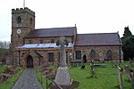 |
| Manor House | Hinton, Woodford cum Membris | Manor house | Late 17th century | 18 September 1953 | SP5383652543 52°10′07″N1°12′51″W / 52.168534°N 1.214271°W | 1355036 |  Upload Photo |