Teignbridge
| Name | Location | Type | Completed [note 1] | Date designated | Grid ref. [note 2] Geo-coordinates | Entry number [note 3] | Image |
|---|---|---|---|---|---|---|---|
| Church of St Andrew | Ashburton, Teignbridge | Tower | before 1449 | 7 August 1951 | SX7552669760 50°30′52″N3°45′25″W / 50.514357°N 3.756997°W | 1201040 |  |
| Parish Church of St Nectan | Ashcombe, Teignbridge | Parish Church | 13th century | 30 June 1961 | SX9121879559 50°36′20″N3°32′19″W / 50.605577°N 3.538627°W | 1308702 |  |
| Church of St John the Baptist | Higher Ashton, Ashton, Teignbridge | Parish Church | Early 15th century | 30 June 1961 | SX8561484684 50°39′02″N3°37′10″W / 50.650574°N 3.61937°W | 1097856 |  |
| Church of St Mary the Virgin | Bickington, Teignbridge | Church | late 19th century or early C20 | 23 August 1955 | SX7997072679 50°32′29″N3°41′43″W / 50.541525°N 3.695287°W | 1097150 | 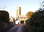 |
| Church of St John the Baptist | Bishopsteignton, Teignbridge | Parish Church | 12th century | 23 August 1955 | SX9109773502 50°33′04″N3°32′19″W / 50.551104°N 3.538561°W | 1147247 | 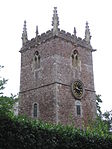 |
| Church of St Peter and St Paul and St Thomas of Canterbury | Bovey Tracey, Teignbridge | Tower | 14th century | 23 August 1955 | SX8207278611 50°35′43″N3°40′03″W / 50.595276°N 3.667518°W | 1334077 |  |
| Bridford Barton | Bridford, Teignbridge | Farmhouse | Circa early-mid 14th century | 9 March 1988 | SX8162286423 50°39′55″N3°40′35″W / 50.665407°N 3.676369°W | 1318200 |  |
| Church of St Thomas a Becket | Bridford, Teignbridge | Gate | 19th century | 30 June 1961 | SX8160186381 50°39′54″N3°40′36″W / 50.665025°N 3.676653°W | 1097825 |  |
| Church of St Peter and St Paul | Broadhempston, Teignbridge | Parish Church | 13th century | 17 July 1987 | SX8011866276 50°29′02″N3°41′28″W / 50.483998°N 3.691141°W | 1317828 | 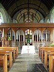 |
| Canonteign Barton | Christow, Teignbridge | Manor House | Circa late 16th century | 11 November 1952 | SX8379183124 50°38′10″N3°38′41″W / 50.636189°N 3.644656°W | 1097834 |  |
| Church of Saint James the Apostle | Christow, Teignbridge | Parish Church | 15th century | 30 June 1961 | SX8361385039 50°39′12″N3°38′52″W / 50.653368°N 3.647774°W | 1163790 |  |
| Hill | Christow, Teignbridge | Farmhouse | Former | 9 October 1980 | SX8353184246 50°38′46″N3°38′55″W / 50.646223°N 3.648684°W | 1097796 |  Upload Photo |
| Church of St Mary and St Martin | Chudleigh, Teignbridge | Church | At least 1225 | 23 August 1955 | SX8671479407 50°36′12″N3°36′08″W / 50.603352°N 3.602204°W | 1164590 | 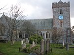 |
| Ugbrooke Park | Chudleigh, Teignbridge | Country House | Late 16th century | 23 August 1955 | SX8756978053 50°35′29″N3°35′23″W / 50.591346°N 3.589716°W | 1097135 | 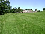 |
| Church of St Barthelomew | Coffinswell, Teignbridge | Parish Church | Probably 13th century | 23 August 1955 | SX8912068430 50°30′18″N3°33′54″W / 50.505136°N 3.564946°W | 1164557 |  |
| Chapel of St Alban, Luscombe Castle, Including Attached Stables and Other Outbuildings | Dawlish, Teignbridge | Castle | 1800 | 17 July 1951 | SX9429576811 50°34′53″N3°29′40″W / 50.581439°N 3.494377°W | 1164298 |  |
| Church of St Mary the Virgin | Denbury, Denbury and Torbryan, Teignbridge | Parish Church | Early 14th century | 15 October 1984 | SX8237668853 50°30′27″N3°39′37″W / 50.507622°N 3.66014°W | 1170197 |  |
| Church of the Holy Trinity | Torbryan Hamlet, Denbury and Torbryan, Teignbridge | Parish Church | Early 15th century | 23 August 1955 | SX8198466832 50°29′22″N3°39′54″W / 50.489376°N 3.665026°W | 1249658 |  |
| Church of St Michael | Doddiscombsleigh, Teignbridge | Parish Church | 15th century | 30 June 1961 | SX8575786556 50°40′03″N3°37′05″W / 50.667429°N 3.617927°W | 1333908 | 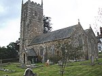 |
| Church of St Michael | Dunchideock, Teignbridge | Parish Church | 13th century | 30 June 1961 | SX8761287675 50°40′40″N3°35′31″W / 50.67785°N 3.592029°W | 1334285 | 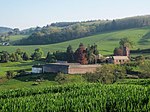 |
| Church of St Mary | Dunsford, Teignbridge | Church | early 19th century or earlier | 30 June 1961 | SX8130389204 50°41′25″N3°40′54″W / 50.69034°N 3.681774°W | 1215069 |  |
| Great Fulford House | Dunsford, Teignbridge | Kitchen | 16th century | 11 November 1952 | SX7907291710 50°42′45″N3°42′51″W / 50.712406°N 3.714165°W | 1214302 |  |
| Church of St Martin | Exminster, Teignbridge | Parish Church | Late 14th century | 30 June 1961 | SX9455787708 50°40′46″N3°29′38″W / 50.679448°N 3.49378°W | 1334270 | 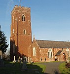 |
| Church of St Blaise | Haccombe, Haccombe with Combe, Teignbridge | Collegiate Church | 13th century | 23 August 1955 | SX8980670198 50°31′16″N3°33′21″W / 50.52116°N 3.555799°W | 1168193 | 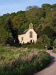 |
| Church of St Mary | Hennock, Teignbridge | Parish Church | 15th century | 23 August 1955 | SX8301680923 50°36′58″N3°39′18″W / 50.616249°N 3.654915°W | 1166001 |  |
| Church of St Michael | Ilsington, Teignbridge | Parish Church | Late 13th century or early 14th century | 23 August 1955 | SX7853476144 50°34′21″N3°43′00″W / 50.572375°N 3.716674°W | 1240794 |  |
| Church of St Andrew | Ipplepen, Teignbridge | Church | 1713 | 23 August 1955 | SX8340866554 50°29′14″N3°38′42″W / 50.487162°N 3.644874°W | 1334135 |  |
| Church of St Andrew | Kenn, Teignbridge | Parish Church | Early 14th century | 30 June 1961 | SX9219785696 50°39′39″N3°31′36″W / 50.660928°N 3.526584°W | 1097721 | 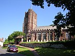 |
| Church of All Saints | Kenton, Teignbridge | Parish Church | Circa 1360-70 | 30 June 1961 | SX9579783311 50°38′25″N3°28′30″W / 50.640143°N 3.474997°W | 1169255 | 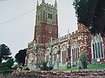 |
| Church of St John the Baptist | Lustleigh, Teignbridge | Parish Church | 13th century | 23 August 1955 | SX7850081274 50°37′07″N3°43′08″W / 50.61848°N 3.718833°W | 1334119 |  |
| Uphill, the Great Hall, and Oaknuve | Mapstone, Lustleigh, Teignbridge | Cruck House | Late medieval | 23 August 1955 | SX7824581652 50°37′19″N3°43′21″W / 50.621825°N 3.72256°W | 1334122 |  Upload Photo |
| Mamhead House | Mamhead, Teignbridge | Country House | 1827-1833 | 11 November 1952 | SX9304081092 50°37′11″N3°30′48″W / 50.619695°N 3.513331°W | 1170130 | 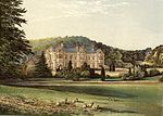 |
| Church of St Winifrid | Manaton, Teignbridge | Parish Church | 15th century | 23 August 1955 | SX7493581280 50°37′04″N3°46′09″W / 50.61778°N 3.769203°W | 1097224 | 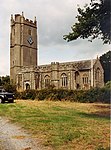 |
| Neadon Upper Hall | Manaton, Teignbridge | House | 1982-1983 | 23 August 1955 | SX7504982433 50°37′41″N3°46′05″W / 50.628168°N 3.767982°W | 1097260 |  Upload Photo |
| Almshouses | Moretonhampstead, Teignbridge | Cruck House | Late Medieval | 23 August 1955 | SX7554586031 50°39′38″N3°45′44″W / 50.660615°N 3.762182°W | 1334200 | 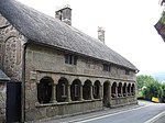 |
| Church of St Andrew | Moretonhampstead, Teignbridge | Church | 15th century | 23 August 1955 | SX7553286092 50°39′40″N3°45′45″W / 50.661161°N 3.762387°W | 1334222 |  |
| Bradley Manor | Newton Abbot, Teignbridge | First Floor Hall House | Early 13th century | 16 July 1949 | SX8485070859 50°31′34″N3°37′33″W / 50.526147°N 3.625885°W | 1256765 |  |
| Forde House | Newton Abbot, Teignbridge | Lobby Entry House | c. 1550 | 16 July 1949 | SX8699670940 50°31′38″N3°35′44″W / 50.527294°N 3.595647°W | 1256796 | 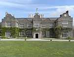 |
| Parish Church of All Saints | Highweek, Newton Abbot, Teignbridge | Chapel of Ease | 15th century | 16 July 1949 | SX8514572092 50°32′14″N3°37′20″W / 50.537289°N 3.622105°W | 1257209 | 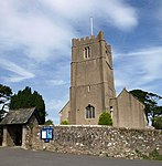 |
| Parish Church of St Mary the Virgin | Newton Abbot, Teignbridge | Parish Church | Before 15th century | 16 July 1949 | SX8549270375 50°31′19″N3°37′00″W / 50.521922°N 3.616683°W | 1256897 |  |
| Church of St John the Baptist | North Bovey, Teignbridge | Parish Church | 13th century | 23 August 1955 | SX7393583832 50°38′26″N3°47′03″W / 50.640503°N 3.7842°W | 1097172 |  |
| Sanders | Lettaford, North Bovey, Teignbridge | Cross Passage House | Early 16th century | 6 November 1972 | SX7019184058 50°38′30″N3°50′14″W / 50.641712°N 3.837199°W | 1307005 | 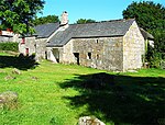 |
| Church of St Bartholomew | East Ogwell, Ogwell, Teignbridge | Boiler House | C20 | 23 August 1955 | SX8381170054 50°31′07″N3°38′25″W / 50.518705°N 3.640286°W | 1096697 | 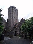 |
| West Ogwell Church | West Ogwell, Ogwell, Teignbridge | Parish Church | Late 13th century | 23 August 1955 | SX8186770046 50°31′06″N3°40′04″W / 50.518243°N 3.667693°W | 1334475 | 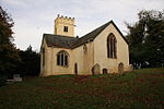 |
| Powderham Castle | Powderham, Teignbridge | Fortified Manor House | Medieval | 11 November 1952 | SX9682483604 50°38′35″N3°27′38″W / 50.64296°N 3.46056°W | 1097666 | 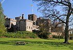 |
| Church of St Peter | Shaldon, Teignbridge | Church | 1932 | 30 June 1949 | SX9315272451 50°32′31″N3°30′33″W / 50.542035°N 3.509263°W | 1269235 |  |
| The Starcross Pumping House | Starcross, Teignbridge | Railway Engine House | 1845 | 11 November 1952 | SX9774181752 50°37′35″N3°26′50″W / 50.626473°N 3.447084°W | 1097684 | 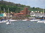 |
| Church of St Catherine of Alexandria | Church Town, Whitestone, Teignbridge | Parish Church | Medieval | 4 September 1986 | SX8687294355 50°44′16″N3°36′16″W / 50.737754°N 3.604547°W | 1216459 |  |
| Church of St Pancras | Widecombe in the Moor, Teignbridge | Parish Church | 15th century | 23 August 1955 | SX7187976791 50°34′36″N3°48′39″W / 50.576767°N 3.810829°W | 1242571 | 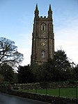 |
| Higher Uppacott, Uppacott | Widecombe in the Moor, Teignbridge | House | Medieval | 23 August 1955 | SX7013172879 50°32′28″N3°50′03″W / 50.541219°N 3.834137°W | 1241837 |  |
| Church of St John the Baptist | Woodland Hamlet, Woodland, Teignbridge | Parish Church | 15th century | 23 August 1955 | SX7912868758 50°30′22″N3°42′21″W / 50.506106°N 3.705892°W | 1263572 | 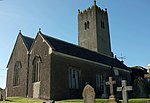 |

