Grandview Plaza, Kansas

Last updated

Grandview Plaza, Kansas
Geary County Kansas Incorporated and Unincorporated areas Grandview Plaza Highlighted.svg
Location within Geary County and Kansas
Map of Geary Co, Ks, USA.png
Coordinates: 39°1′52″N96°47′41″W / 39.03111°N 96.79472°W / 39.03111; -96.79472 [1]
Country United States
State Kansas
County Geary
Area
[2]
  Total0.86 sq mi (2.23 km2)
  Land0.85 sq mi (2.19 km2)
  Water0.01 sq mi (0.04 km2)
Elevation
[1]
1,135 ft (346 m)
Population
 (2020) [3]
  Total1,697
  Density2,000/sq mi (760/km2)
Time zone UTC-6 (CST)
  Summer (DST) UTC-5 (CDT)
ZIP code
66441
Area code 785
FIPS code 20-27425 [1]
GNIS ID 484915 [1]
Website grandviewplaza.org

Grandview Plaza is a city in Geary County, Kansas, United States. [1] As of the 2020 census, the population of the city was 1,697. [3]

Contents

History

Grandview Plaza was founded in 1963. [4]

Geography

Grandview Plaza is located at 39°1′52″N96°47′41″W / 39.03111°N 96.79472°W / 39.03111; -96.79472 (39.031249, -96.794751). [5] According to the United States Census Bureau, the city has a total area of 0.86 square miles (2.23 km2), of which, 0.84 square miles (2.18 km2) is land and 0.02 square miles (0.05 km2) is water. [6]

Climate

The climate in this area is characterized by hot, humid summers and generally mild to cool winters. According to the Köppen Climate Classification system, Grandview Plaza has a humid subtropical climate, abbreviated "Cfa" on climate maps. [7]

Demographics

Historical population
CensusPop.Note
1970 734
1980 1,18962.0%
1990 1,2333.7%
2000 1,184−4.0%
2010 1,56031.8%
2020 1,6978.8%
U.S. Decennial Census

Grandview Plaza is part of the Manhattan, Kansas Metropolitan Statistical Area.

2020 census

The 2020 United States census counted 1,697 people, 789 households, and 426 families in Grandview Plaza. [8] [9] The population density was 2,003.5 per square mile (773.6/km2). There were 987 housing units at an average density of 1,165.3 per square mile (449.9/km2). [9] [10] The racial makeup was 57.63% (978) white or European American (52.5% non-Hispanic white), 17.32% (294) black or African-American, 1.3% (22) Native American or Alaska Native, 3.01% (51) Asian, 2.42% (41) Pacific Islander or Native Hawaiian, 4.36% (74) from other races, and 13.97% (237) from two or more races. [11] Hispanic or Latino of any race was 15.2% (258) of the population. [12]

Of the 789 households, 27.1% had children under the age of 18; 39.8% were married couples living together; 21.4% had a female householder with no spouse or partner present. 38.4% of households consisted of individuals and 7.0% had someone living alone who was 65 years of age or older. [9] The average household size was 2.2 and the average family size was 2.8. [13] The percent of those with a bachelor’s degree or higher was estimated to be 16.8% of the population. [14]

21.0% of the population was under the age of 18, 20.3% from 18 to 24, 33.8% from 25 to 44, 16.7% from 45 to 64, and 8.2% who were 65 years of age or older. The median age was 27.5 years. For every 100 females, there were 84.5 males. [9] For every 100 females ages 18 and older, there were 82.7 males. [9]

The 2016-2020 5-year American Community Survey estimates show that the median household income was $44,054 (with a margin of error of +/- $6,677) and the median family income was $44,857 (+/- $15,039). [15] Males had a median income of $31,517 (+/- $4,790) versus $23,902 (+/- $2,928) for females. The median income for those above 16 years old was $29,281 (+/- $5,458). [16] Approximately, 6.1% of families and 13.0% of the population were below the poverty line, including 14.2% of those under the age of 18 and 11.0% of those ages 65 or over. [17] [18]

2010 census

As of the census [19] of 2010, there were 1,560 people, 651 households, and 430 families residing in the city. The population density was 1,857.1 inhabitants per square mile (717.0/km2). There were 788 housing units at an average density of 938.1 per square mile (362.2/km2). The racial makeup of the city was 72.1% White, 11.4% African American, 1.2% Native American, 1.9% Asian, 0.8% Pacific Islander, 3.7% from other races, and 8.9% from two or more races. Hispanic or Latino of any race were 11.5% of the population.

There were 651 households, of which 37.8% had children under the age of 18 living with them, 48.2% were married couples living together, 13.1% had a female householder with no husband present, 4.8% had a male householder with no wife present, and 33.9% were non-families. 26.6% of all households were made up of individuals, and 4% had someone living alone who was 65 years of age or older. The average household size was 2.36 and the average family size was 2.85.

The median age in the city was 25.3 years. 25.8% of residents were under the age of 18; 23.5% were between the ages of 18 and 24; 27% were from 25 to 44; 17.4% were from 45 to 64; and 6.3% were 65 years of age or older. The gender makeup of the city was 51.6% male and 48.4% female.

2000 census

As of the census of 2000, there were 1,184 people, 458 households, and 333 families residing in the city. The population density was 1,406.4 inhabitants per square mile (543.0/km2). There were 528 housing units at an average density of 627.2 per square mile (242.2/km2). The racial makeup of the city was 78.12% White, 9.04% African American, 1.10% Native American, 3.46% Asian, 0.25% Pacific Islander, 3.46% from other races, and 4.56% from two or more races. Hispanic or Latino of any race were 6.08% of the population.

There were 458 households, out of which 38.6% had children under the age of 18 living with them, 52.0% were married couples living together, 17.0% had a female householder with no husband present, and 27.1% were non-families. 19.7% of all households were made up of individuals, and 3.5% had someone living alone who was 65 years of age or older. The average household size was 2.59 and the average family size was 2.92.

In the city, the population was spread out, with 29.3% under the age of 18, 12.6% from 18 to 24, 33.8% from 25 to 44, 18.0% from 45 to 64, and 6.3% who were 65 years of age or older. The median age was 30 years. For every 100 females, there were 96.4 males. For every 100 females age 18 and over, there were 95.6 males.

The median income for a household in the city was $31,033, and the median income for a family was $32,368. Males had a median income of $26,058 versus $17,344 for females. The per capita income for the city was $13,022. About 12.9% of families and 13.3% of the population were below the poverty line, including 17.4% of those under age 18 and none of those age 65 or over.

Education

The community is served by Geary County USD 475 public school district.

Related Research Articles

<span class="mw-page-title-main">Burlington, Kansas</span> City in Coffey County, Kansas, United States

Burlington is a city in and the county seat of Coffey County, Kansas, United States. As of the 2020 census, the population of the city was 2,634.

<span class="mw-page-title-main">Waverly, Kansas</span> City in Coffey County, Kansas

Waverly is a city in Coffey County, Kansas, United States. As of the 2020 census, the population of the city was 574.

<span class="mw-page-title-main">Hepler, Kansas</span> City in Crawford County, Kansas

Hepler is a city in Crawford County, Kansas, United States. As of the 2020 census, the population of the city was 90.

<span class="mw-page-title-main">Mulberry, Kansas</span> City in Crawford County, Kansas

Mulberry is a city in Crawford County, Kansas, United States. As of the 2020 census, the population of the city was 409.

<span class="mw-page-title-main">Jennings, Kansas</span> City in Decatur County, Kansas

Jennings is a city in Decatur County, Kansas, United States. As of the 2020 census, the population of the city was 81.
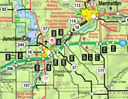
<span class="mw-page-title-main">Ottawa, Kansas</span> City in Franklin County, Kansas

Ottawa is a city in, and the county seat of, Franklin County, Kansas, United States. It is located on both banks of the Marais des Cygnes River near the center of Franklin County. As of the 2020 census, the population of the city was 12,625. It is the home of Ottawa University.

<span class="mw-page-title-main">Gove City, Kansas</span> City in Gove County, Kansas

Gove City, more commonly known as Gove, is a city in and the county seat of Gove County, Kansas, United States. As of the 2020 census, the population of the city was 80.

<span class="mw-page-title-main">Edgerton, Kansas</span> City in Kansas, United States

Edgerton is a city in Johnson County, Kansas, United States, and part of the Kansas City metropolitan area. As of the 2020 census, the population of the city was 1,748. It is home to a large BNSF intermodal train facility named Logistics Park Kansas City.

<span class="mw-page-title-main">Prairie Village, Kansas</span> City in Kansas, United States

Prairie Village is a city in Johnson County, Kansas, United States, and located within the Kansas City Metropolitan Area. As of the 2020 census, the population of the city was 22,957.

<span class="mw-page-title-main">Lansing, Kansas</span> City in Kansas, United States

Lansing is a city in Leavenworth County, Kansas, United States. It is situated along the west side of the Missouri River and Kansas-Missouri state border. As of the 2020 census, the population of the city was 11,239. It is the second most populous city of Leavenworth County and is a part of the Kansas City metropolitan area. The Lansing Correctional Facility, which includes the state's main maximum-security prison, is located in Lansing.

<span class="mw-page-title-main">Meade, Kansas</span> City in Meade County, Kansas

Meade is a city in and the county seat of Meade County, Kansas, United States. As of the 2020 census, the population of the city was 1,505.

<span class="mw-page-title-main">Ness City, Kansas</span> City in Ness County, Kansas

Ness City is a city in and the county seat of Ness County, Kansas, United States. As of the 2020 census, the population of the city was 1,329. Ness City is famous for its four-story Old Ness County Bank Building located downtown, and nicknamed Skyscraper of the Plains.

<span class="mw-page-title-main">Lyndon, Kansas</span> City in Osage County, Kansas

Lyndon is a city in, and the county seat of Osage County, Kansas, United States. As of the 2020 census, the population of the city was 1,037.

<span class="mw-page-title-main">Belleville, Kansas</span> City in Republic County, Kansas

Belleville is a city in and the county seat of Republic County, Kansas, United States. As of the 2020 census, the population of the city was 2,007.

<span class="mw-page-title-main">Andale, Kansas</span> City in Sedgwick County, Kansas

Andale is a city in Sedgwick County, Kansas, United States. As of the 2020 census, the population of the city was 941.

<span class="mw-page-title-main">Mount Hope, Kansas</span> City in Sedgwick County, Kansas

Mount Hope is a city in Sedgwick County, Kansas, United States. As of the 2020 census, the population of the city was 806.

<span class="mw-page-title-main">Argonia, Kansas</span> City in Sumner County, Kansas

Argonia is a city in Sumner County, Kansas, United States. As of the 2020 census, the population of the city was 456.

<span class="mw-page-title-main">Alma, Kansas</span> City in Wabaunsee County, Kansas

Alma is a city in and the county seat of Wabaunsee County, Kansas, United States. As of the 2020 census, the population of the city was 802.

<span class="mw-page-title-main">Grandview, Missouri</span> City in Missouri, United States

Grandview is a city in Jackson County, Missouri, United States. The population was 24,475 at the 2010 census. It is part of the Kansas City metropolitan area.

<span class="mw-page-title-main">Fort Dodge, Kansas</span> Unincorporated community in Ford County, Kansas

Fort Dodge is an unincorporated community in Grandview Township, Ford County, Kansas, United States. As of the 2020 census, the population of the community and nearby areas was 97. It is located on U.S. Route 400 5 miles (8 km) southeast of Dodge City. Fort Dodge has a post office with ZIP code 67843.

References

  1. 1 2 3 4 5 "Grandview Plaza, Kansas", Geographic Names Information System , United States Geological Survey, United States Department of the Interior
  2. "2019 U.S. Gazetteer Files". United States Census Bureau. Retrieved July 24, 2020.
  3. 1 2 "Profile of Grandview Plaza, Kansas in 2020". United States Census Bureau. Archived from the original on November 15, 2021. Retrieved November 15, 2021.
  4. "History of Grandview Plaza". City of Grandview Plaza, Kansas. Retrieved June 10, 2014.
  5. "US Gazetteer files: 2010, 2000, and 1990". United States Census Bureau. February 12, 2011. Retrieved April 23, 2011.
  6. "US Gazetteer files 2010". United States Census Bureau. Archived from the original on January 25, 2012. Retrieved July 6, 2012.
  7. Climate Summary for Grandview Plaza, Kansas
  8. "US Census Bureau, Table P16: HOUSEHOLD TYPE". data.census.gov. Retrieved January 3, 2024.
  9. 1 2 3 4 5 "US Census Bureau, Table DP1: PROFILE OF GENERAL POPULATION AND HOUSING CHARACTERISTICS". data.census.gov. Retrieved January 3, 2024.
  10. Bureau, US Census. "Gazetteer Files". Census.gov. Retrieved December 30, 2023.
  11. "US Census Bureau, Table P1: RACE". data.census.gov. Retrieved January 3, 2024.
  12. "US Census Bureau, Table P2: HISPANIC OR LATINO, AND NOT HISPANIC OR LATINO BY RACE". data.census.gov. Retrieved January 3, 2024.
  13. "US Census Bureau, Table S1101: HOUSEHOLDS AND FAMILIES". data.census.gov. Retrieved January 3, 2024.
  14. "US Census Bureau, Table S1501: EDUCATIONAL ATTAINMENT". data.census.gov. Retrieved January 3, 2024.
  15. "US Census Bureau, Table S1903: MEDIAN INCOME IN THE PAST 12 MONTHS (IN 2020 INFLATION-ADJUSTED DOLLARS)". data.census.gov. Retrieved January 3, 2024.
  16. "US Census Bureau, Table S2001: EARNINGS IN THE PAST 12 MONTHS (IN 2020 INFLATION-ADJUSTED DOLLARS)". data.census.gov. Retrieved January 3, 2024.
  17. "US Census Bureau, Table S1701: POVERTY STATUS IN THE PAST 12 MONTHS". data.census.gov. Retrieved January 3, 2024.
  18. "US Census Bureau, Table S1702: POVERTY STATUS IN THE PAST 12 MONTHS OF FAMILIES". data.census.gov. Retrieved January 3, 2024.
  19. "U.S. Census website". United States Census Bureau . Retrieved July 6, 2012.

Further reading