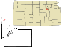
Demographics
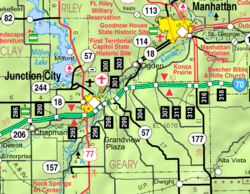
Milford is part of the Manhattan, Kansas Metropolitan Statistical Area.
2020 census
The 2020 United States census counted 408 people, 168 households, and 119 families in Milford. [9] [10] The population density was 713.3 per square mile (275.4/km2). There were 261 housing units at an average density of 456.3 per square mile (176.2/km2). [10] [11] The racial makeup was 82.84% (338) white or European American (78.43% non-Hispanic white), 5.15% (21) black or African-American, 0.25% (1) Native American or Alaska Native, 0.49% (2) Asian, 0.0% (0) Pacific Islander or Native Hawaiian, 1.23% (5) from other races, and 10.05% (41) from two or more races. [12] Hispanic or Latino of any race was 8.58% (35) of the population. [13]
Of the 168 households, 33.9% had children under the age of 18; 58.9% were married couples living together; 14.9% had a female householder with no spouse or partner present. 23.2% of households consisted of individuals and 6.5% had someone living alone who was 65 years of age or older. [10] The average household size was 2.0 and the average family size was 2.5. [14] The percent of those with a bachelor’s degree or higher was estimated to be 13.2% of the population. [15]
26.2% of the population was under the age of 18, 5.9% from 18 to 24, 27.9% from 25 to 44, 24.3% from 45 to 64, and 15.7% who were 65 years of age or older. The median age was 36.3 years. For every 100 females, there were 82.1 males. [10] For every 100 females ages 18 and older, there were 92.9 males. [10]
The 2016-2020 5-year American Community Survey estimates show that the median household income was $45,875 (with a margin of error of +/- $14,869) and the median family income was $72,917 (+/- $32,548). [16] Males had a median income of $44,250 (+/- $12,861). The median income for those above 16 years old was $38,750 (+/- $23,030). [17] Approximately, 5.3% of families and 8.9% of the population were below the poverty line, including 2.9% of those under the age of 18 and 19.1% of those ages 65 or over. [18] [19]
2010 census
As of the census [20] of 2010, there were 530 people, 203 households, and 133 families residing in the city. The population density was 898.3 inhabitants per square mile (346.8/km2). There were 272 housing units at an average density of 461.0 per square mile (178.0/km2). The racial makeup of the city was 83.4% White, 5.7% African American, 0.4% Native American, 0.9% Asian, 0.2% Pacific Islander, 1.3% from other races, and 8.1% from two or more races. Hispanic or Latino of any race were 5.7% of the population.
There were 203 households, of which 36.0% had children under the age of 18 living with them, 54.7% were married couples living together, 8.9% had a female householder with no husband present, 2.0% had a male householder with no wife present, and 34.5% were non-families. 25.1% of all households were made up of individuals, and 4% had someone living alone who was 65 years of age or older. The average household size was 2.61 and the average family size was 3.18.
The median age in the city was 32.8 years. 25.8% of residents were under the age of 18; 11.9% were between the ages of 18 and 24; 30.4% were from 25 to 44; 22.7% were from 45 to 64; and 9.2% were 65 years of age or older. The gender makeup of the city was 54.2% male and 45.8% female.
2000 census
As of the census of 2000, there were 502 people, 183 households, and 133 families residing in the city. The population density was 3,217.2 inhabitants per square mile (1,242.2/km2). There were 245 housing units at an average density of 1,570.1 per square mile (606.2/km2). The racial makeup of the city was 84.66% White, 3.19% African American, 0.40% Native American, 0.80% Asian, 1.00% Pacific Islander, 3.59% from other races, and 6.37% from two or more races. Hispanic or Latino of any race were 6.37% of the population.
There were 183 households, out of which 41.5% had children under the age of 18 living with them, 63.4% were married couples living together, 6.6% had a female householder with no husband present, and 26.8% were non-families. 22.4% of all households were made up of individuals, and 6.0% had someone living alone who was 65 years of age or older. The average household size was 2.74 and the average family size was 3.27.
In the city, the population was spread out, with 34.1% under the age of 18, 11.6% from 18 to 24, 32.7% from 25 to 44, 15.9% from 45 to 64, and 5.8% who were 65 years of age or older. The median age was 28 years. For every 100 females, there were 110.0 males. For every 100 females age 18 and over, there were 110.8 males.
The median income for a household in the city was $33,750, and the median income for a family was $40,000. Males had a median income of $29,583 versus $16,250 for females. The per capita income for the city was $14,246. About 10.3% of families and 8.1% of the population were below the poverty line, including 7.7% of those under age 18 and 8.8% of those age 65 or over.
This page is based on this
Wikipedia article Text is available under the
CC BY-SA 4.0 license; additional terms may apply.
Images, videos and audio are available under their respective licenses.