Hadley Falls Company Housing District

Last updated

Hadley Falls Company Housing District
HolyokeMA CompanyHousing.jpg
USA Holyoke location map.svg
Red pog.svg
USA Massachusetts location map.svg
Red pog.svg
Usa edcp location map.svg
Red pog.svg
LocationCenter, N. Canal, Grover, and Lyman Sts., Holyoke, Massachusetts
Coordinates 42°12′27″N72°35′55″W / 42.20750°N 72.59861°W / 42.20750; -72.59861
Area2.1 acres (0.85 ha)
Built1848 (1848)
ArchitectChase, John; McClallan, Charles
NRHP reference No. 72000133 [1]
Added to NRHPNovember 9, 1972

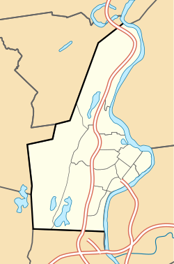
The Hadley Falls Company Housing District is a residential historic district encompassing a compact tract of factory worker housing in Holyoke, Massachusetts. Built in 1847-48, it is one of the earliest and largest surviving examples of company-built worker housing in the state. It includes five rowhouses facing Center, Lyman, Grover, and Canal Streets. The district was listed on the National Register of Historic Places in 1972. [1]

Contents

Description and history

The Hadley Falls Company Housing District is located on the north side of Holyoke's former industrial core. It consists of five brick rowhouses, two of which face each other on Center Street between Canal and Lyman Streets. The other three are adjacent to those two, and face Canal Street, Lyman Street and Grove Street. Each rowhouse has between eight and ten units, and is 2-1/2 stories in height, with a gabled roof. Four of the five buildings have a series of pedimented gable dormers in the roof. Chimneys are set at the ends and at every other party wall, and the unit entrances are grouped in pairs at the other party walls. [2]

The rowhouses were built by the Hadley Falls Mill Company, which was established in 1847 in a bid to recreate the success at Holyoke of the industrialization effort at Lowell, Massachusetts. They were built by engineer John Chase and contractor Charles McClallan. The exteriors were rehabilitated in 1974-75. The buildings were at the time one of the largest concentrations of company-built worker housing anywhere in the state, and were of a notably higher quality than other such housing built in the 1840s and 1850s. [2]

See also

Related Research Articles

<span class="mw-page-title-main">Chicopee, Massachusetts</span> City in Massachusetts, United States

Chicopee is a city located on the Connecticut River in Hampden County, Massachusetts, United States. At the 2020 census, the city had a population of 55,560, making it the second-largest city in Western Massachusetts after Springfield. Chicopee is part of the Springfield, Massachusetts Metropolitan Statistical Area. The communities of Chicopee Center (Cabotville), Chicopee Falls, Willimansett, Fairview, Aldenville, Burnett Road, Smith Highlands and Westover are located within the city.

<span class="mw-page-title-main">Holyoke, Massachusetts</span> City in Massachusetts, United States

Holyoke is a city in Hampden County, Massachusetts, United States, that lies between the western bank of the Connecticut River and the Mount Tom Range. As of the 2020 census, the city had a population of 38,238. Located 8 miles (13 km) north of Springfield, Holyoke is part of the Springfield Metropolitan Area, one of the two distinct metropolitan areas in Massachusetts.

<span class="mw-page-title-main">South Hadley Canal</span> United States historic place

The South Hadley Canal was a canal along the Connecticut River in South Hadley, Massachusetts. It was the earliest navigable canal in the United States, with operation commencing in 1795. It has been listed on the National Register of Historic Places as the South Hadley Canal Historic District.

<span class="mw-page-title-main">Holyoke Canal System</span> Historic power canals in Holyoke, Massachusetts, US

The Holyoke Canal System is a system of power canals in Holyoke, Massachusetts. It is split into three canals based on elevation and distance from the inlet at the Holyoke Dam- the First Level Canal, Second Level Canal, and Third Level Canal. Constructed over a period between 1847 and 1892, the Canal System, along with the Dam, is recognized as a Historic Mechanical Engineering Landmark by the American Society of Mechanical Engineers for its use in the development of the Venturi meter by Clemens Herschel, the first means of measuring large-scale flows, and the McCormick-Holyoke Turbine by John B. McCormick, which doubled the efficiency of turbines to more than 80% in its time.

<span class="mw-page-title-main">North High Street Historic District (Holyoke, Massachusetts)</span> Historic district in Massachusetts, United States

The North High Street Historic District is a historic district encompassing part of the downtown area of Holyoke, Massachusetts. When first added to the National Register of Historic Places in 1986, the district encompassed North High Street, between Dwight and Lyman Streets. This part of High Street was built between 1850 and 1885, and is lined with masonry buildings in Italianate and Second Empire styles. In 1992 the district was extended southward, adding three blocks of High Street between Dwight and Essex Streets. This expansions encompasses the growth of Holyoke during the height of its commercial success, between 1880 and 1930; it also includes the separately-listed Holyoke City Hall. The district was extended a third time, in 2008, adding a complex of three buildings at Dwight and Maple Streets that now houses the Holyoke Health Center.

<span class="mw-page-title-main">Mechanics Block Historic District</span> Historic district in Massachusetts, United States

The Mechanics Block Historic District is a historic district at 107–139 Garden St. and 6–38 Orchard Street in Lawrence, Massachusetts. It encompasses two segments of brick rowhouses that are back-to-back. The rowhouses are 2+12-story brick buildings, organized into mirror-image pairs, with a single gable-roof dormer piercing the side-gable roofs for each unit. They were built in 1847 by the Essex Company as worker housing.

<span class="mw-page-title-main">North Canal Historic District</span> Historic district in Massachusetts, United States

The North Canal Historic District of Lawrence, Massachusetts, encompasses the historic industrial heart of the city. It is centered on the North Canal and the Great Stone Dam, which provided the waterpower for its many mill complexes. The canal was listed on the National Register of Historic Places in 1975, while the district was first listed in 1984, and then expanded slightly in 2009.

<span class="mw-page-title-main">Building at 38–48 Richardson Avenue</span> United States historic place

The building at 38–48 Richardson Avenue is a historic residential rowhouse in Wakefield, Massachusetts. Built c. 1912, is believed to be one of the oldest rowhouses in the town. They were built by Solon O. Richardson, Jr., on a portion of his family's estate. The building was listed on the National Register of Historic Places in 1989.

<span class="mw-page-title-main">Olmstead Street Historic District</span> Historic district in New York, United States

The Olmstead Street Historic District is located along two blocks of that street in Cohoes, New York, United States. It is a microcosm of the city's economy at its peak in the mid- to late 19th century, consisting of a former textile mill complex, a filled-in section of the original Erie Canal, and three long blocks of row houses built for the millworkers.

<span class="mw-page-title-main">Boston Manufacturing Company Housing</span> United States historic place

Boston Manufacturing Company Housing are historic residential housing blocks at 380-410 and 153-165 River Street in Waltham, Massachusetts. The housing was for the Boston Manufacturing Company (BMC), the earliest modern manufacturing facility in the United States. The housing was built in the nineteenth century and the two blocks of buildings were separately added to the National Register of Historic Places in 1989.

<span class="mw-page-title-main">Lawton Place Historic District</span> Historic district in Massachusetts, United States

The Lawton Place Historic District is a historic district on Lawton Place between Amory Road and Jackson Street in Waltham, Massachusetts. The district preserves some of the nation's oldest textile mill worker housing. The duplex houses located on the south side of Lawton Place were built c. 1815-17 by the Boston Manufacturing Company (BMC), the first mill to process textiles entirely under one roof. They were originally located at what is now the Waltham Common, and were moved to Lawton Place in 1889. On the north side stands a rowhouse that was built in 1889; it is the last instance of a type of row housing that was once commonly built for mill workers. The district was listed on the National Register of Historic Places in 1989.

<span class="mw-page-title-main">Saco–Lowell Shops Housing Historic District</span> Historic district in Massachusetts, United States

The Saco–Lowell Shops Housing Historic District encompasses the only 20th-century factory working housing enclave in the city of Newton, Massachusetts. It is located in Newton Upper Falls, near the Saco–Pettee Machine Shops, and was developed to provide housing for employees of the machinery manufacturers located there. It is roughly bounded by Oak, Williams, Butts, and Saco Streets, and includes eight small-scale brick houses with vernacular Colonial Revival styling. These houses were built in 1919 and 1920, adjoining a small number of worker houses built in the early 1890s. The district was listed on the National Register of Historic Places in 1990.

<span class="mw-page-title-main">District A</span> Historic district in New Hampshire, United States

District A is a historic worker housing district located in Manchester, New Hampshire, near the former Amoskeag Manufacturing Company millyard. It is bounded by Pleasant, State, Granite, and Bedford streets, and includes seven surviving tenement blocks built by Amoskeag between 1843 and 1852. The district was added to the National Register of Historic Places on November 12, 1982.

<span class="mw-page-title-main">District B</span> Historic district in New Hampshire, United States

District B is a historic worker housing district located in Manchester, New Hampshire, United States, near the former Amoskeag Manufacturing Company millyard. It is roughly bounded by Canal, Mechanic, Franklin, and Pleasant Streets, and was added to the National Register of Historic Places on November 12, 1982. It contains 32 contributing properties, including seventeen rowhouse tenement blocks built mainly between 1838 and 1850, in an area of approximately 170 acres (69 ha).

<span class="mw-page-title-main">District C</span> Historic district in New Hampshire, United States

District C is a historic worker housing district located in Manchester, New Hampshire, near the former Amoskeag Manufacturing Company millyard, and surrounding area. It is roughly bounded by N. Hampshire Lane, Hollis, Canal, and Bridge streets, and was added to the National Register of Historic Places on November 12, 1982. It originally contained nine rowhouses in an area of approximately 5 acres (2 ha); three have subsequently been demolished and replaced by an apartment complex.

<span class="mw-page-title-main">District D</span> Historic district in New Hampshire, United States

District D is a historic worker housing district located in Manchester, New Hampshire, near the former Amoskeag Manufacturing Company millyard. It is roughly bounded by Canal, Langdon, Elm, and West Brook streets, and was added to the National Register of Historic Places on November 12, 1982. It contains three residential buildings constructed in 1864 in an area of about 3 acres (1 ha).

<span class="mw-page-title-main">George C. Ewing</span> American politician

George Clinton Ewing was a salesman, wainwright, land agent, superintendent, assessor, selectman, state representative, and most notably one of the chief founders of Holyoke, Massachusetts; he is credited as having first brought the idea of building a dam and industrial city at Hadley Falls to investors in Boston, New York, Hartford, and St. Johnsbury, Vermont in 1846.

<span class="mw-page-title-main">Holyoke Dam</span> Dam in Hampden County and Hampshire County Massachusetts

The Holyoke Dam, also referred to as the Hadley Falls Dam, or Hadley Falls Station is a granite dam built in tandem with the Holyoke Canal System at Hadley Falls on the Connecticut River, between Holyoke and South Hadley, Massachusetts. The water differential created by the dam produced mechanical hydropower for industrial uses in Holyoke, and later hydroelectric power.

<span class="mw-page-title-main">The Flats, Holyoke, Massachusetts</span> Neighborhood of Holyoke in Massachusetts, United States

The Flats is a neighborhood in Holyoke, Massachusetts located to the east of the city center, adjacent to the downtown. Although it lies at one of the lowest elevations in Holyoke, its name derives not from topography but from the brick tenement "flats" which characterized its architecture throughout much of its history. Historically the area has also been associated with the name Depot Hill, as it was the location of the city's first freight and passenger railway stations; passenger service was restored at Holyoke station in 2015, following a period of absence after 1967. A section of the neighborhood between Lyman and Appleton Street to north and south respectively, and between Race and Bowers Street to the east and west is also known as Depot Square. Today the area features the Holyoke Innovation District, Canal System, Hadley Falls Company Housing District, Marcella Kelly Elementary School, local Amtrak station and 275 acres (111 ha) of residential, commercial, and industrial zoning.

References

  1. 1 2 "National Register Information System". National Register of Historic Places . National Park Service. April 15, 2008.
  2. 1 2 "NRHP nomination for Hadley Falls Company Housing District". Commonwealth of Massachusetts. Retrieved December 24, 2016.