Hanikatsi laid

Last updated
Hanikatsi laid Hanikatsi laiu panoraam.jpg
Hanikatsi laid
Hanikatsi laid Hanikatsi laid.jpg
Hanikatsi laid

Hanikatsi laid (Swedish : Äpleö, meaning 'Apple Island') is an islet in Estonia, in the Baltic Sea, south east of Hiiumaa island. It has a surface area of 83 hectares and no permanent habitation. The islet belongs to Hiiu County, Pühalepa Parish and is part of Hiiumaa Islets Landscape Reserve, [1] which in turn is part of West Estonian Archipelago Biosphere Reserve.

Swedish language North Germanic language spoken in Sweden

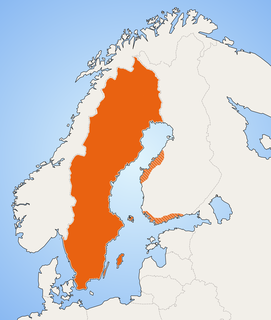
Swedish is a North Germanic language spoken natively by 10 million people, predominantly in Sweden, and in parts of Finland, where it has equal legal standing with Finnish. It is largely mutually intelligible with Norwegian and to some extent with Danish, although the degree of mutual intelligibility is largely dependent on the dialect and accent of the speaker. Both Norwegian and Danish are generally easier for Swedish speakers to read than to listen to because of difference in accent and tone when speaking. Swedish is a descendant of Old Norse, the common language of the Germanic peoples living in Scandinavia during the Viking Era. It has the most speakers of the North Germanic languages.

Estonia Republic in Northern Europe

Estonia, officially the Republic of Estonia, is a country in Northern Europe. It is bordered to the north by the Gulf of Finland with Finland on the other side, to the west by the Baltic Sea with Sweden on the other side, to the south by Latvia (343 km), and to the east by Lake Peipus and Russia (338.6 km). The territory of Estonia consists of a mainland and 2,222 islands in the Baltic Sea, covering a total area of 45,227 km2 (17,462 sq mi), water 2,839 km2 (1,096 sq mi), land area 42,388 km2 (16,366 sq mi), and is influenced by a humid continental climate. The official language of the country, Estonian, is the second most spoken Finnic language.

Baltic Sea A sea in Northern Europe bounded by the Scandinavian Peninsula, the mainland of Europe, and the Danish islands

The Baltic Sea is a marginal sea of the Atlantic Ocean, enclosed by Denmark, Estonia, Finland, Latvia, Lithuania, Sweden, northeast Germany, Poland, Russia and the North and Central European Plain.

Contents

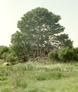
The flora of Hanikatsi is rich, and over 400 species have been found. There are also records of 117 species of lichens. In the northern part of the islet there lies the 12-hectare Lepana broad-leaved forest, rich in species. In the southern part there are mostly birch, poplar and juniper forests.

Birch genus of plants

A birch is a thin-leaved deciduous hardwood tree of the genus Betula, in the family Betulaceae, which also includes alders, hazels, and hornbeams. It is closely related to the beech-oak family Fagaceae. The genus Betula contains 30 to 60 known taxa of which 11 are on the IUCN 2011 Red List of Threatened Species. They are a typically rather short-lived pioneer species widespread in the Northern Hemisphere, particularly in northern areas of temperate climates and in boreal climates.

<i>Populus</i> genus of plants

Populus is a genus of 25–35 species of deciduous flowering plants in the family Salicaceae, native to most of the Northern Hemisphere. English names variously applied to different species include poplar, aspen, and cottonwood.

Juniper genus of plants

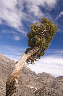
Junipers are coniferous plants in the genus Juniperus of the cypress family Cupressaceae. Depending on taxonomic viewpoint, between 50 and 67 species of junipers are widely distributed throughout the Northern Hemisphere, from the Arctic, south to tropical Africa, from Ziarat, Pakistan, east to eastern Tibet in the Old World, and in the mountains of Central America. The highest-known juniper forest occurs at an altitude of 16,000 ft (4,900 m) in southeastern Tibet and the northern Himalayas, creating one of the highest tree-lines on earth.

There are records of habitation of the islet from 1623. The last inhabitant left the islet in 1964. There are still some buildings on the islet which have been renovated by the Landscape Reserve and are now used by scientists.

Many people originating from the islet have the family name Hanikat.

See also

Related Research Articles

Hiiu County County of Estonia

Hiiu County, or Hiiumaa, is one of 15 counties of Estonia, being the smallest county both in terms of area and population. It consists of Hiiumaa, the second largest island of Estonia, and several smaller islands near it. The county borders Lääne County to the east and Saare County to the south.

Hanerahu is an uninhabited Estonian islet with surface area of 1.2 hectares. It lies south-east of Hiiumaa island and is part of Pühalepa Municipality. The islet belongs to Hiiumaa Islets Landscape Reserve.

Kõrgelaid island in Estonia (Väinameri)

Kõrgelaid is a small, uninhabited, moraine-based island in the Baltic Sea, belonging to the country of Estonia. Its coordinates 58°45′09″N23°05′35″E.

Saarnaki laid island

Saarnaki laid is an uninhabited, moraine-based island in the Baltic Sea belonging to the country of Estonia. Its coordinates are 58°48′38″N22°59′37″E.

Kõverlaid island in Estonia

Kõverlaid is a small, moraine-based Baltic Sea island belonging to the country of Estonia. Its coordinates are 58°49′01″N23°04′46″E.

Hülgerahu is a small, uninhabited, moraine-based Baltic Sea island belonging to the country of Estonia.

Langekare is a small, uninhabited Baltic Sea island belonging to the country of Estonia. Its coordinates are 58°48′21″N23°09′03″E

Luigerahu is a small, moraine-based Baltic Sea island that belongs to the country of Estonia.

Ahelaid island in Estonia

Ahelaid is a small uninhabited islet in Estonia. It lies in the Baltic Sea, south-east of Hiiumaa island. It has a surface area of 25 hectares. It is part of the Hiiumaa Islets Landscape Reserve.

Öakse is an island in the Baltic Sea belonging to the country of Estonia.

Rukkirahu island

Rukkirahu is a small, uninhabited island in the Baltic Sea belonging to the country of Estonia.

Uuemererahu is a small Baltic Sea islet comprising 2.3 hectares in area, belonging to the country of Estonia.

Uuemaarahu is a small, Baltic Sea islet comprising 0.0234 hectares belonging to the country of Estonia.

Pöörilaid

Pöörilaid is an islet in the Baltic Sea belonging to the country of Estonia.

Ooslamaa is a small islet in the Baltic Sea belonging to the country of Estonia.

Reigilaid is a small islet in the Baltic Sea belonging to the country of Estonia.

Liivanuka ots is an Estonian islet with surface area of 0.0059 hectares. It is a sandy, oval-shaped islet, stretching in a north-south direction. It lies southeast of the island of Hiiumaa in the Jausa rand, next to the islet of Hanerahu. Liivanuka ots is part of Emmaste Parish, Hiiu County. The islet belongs to Hiiumaa Islets Landscape Reserve.

Võrkrahu is a small islet belonging to the country of Estonia off the west coast of the larger island of Saaremaa in the Kuusnõmme Gulf of the Baltic Sea. It is administered by Lääne-Saare Parish. Võrkrahu lies in an oblong North-South direction and is covered in pine and junipers. It covers an area of 6.07618 hectares and a circumference of 1.32628 kilometers and is part of Vilsandi National Park.

Piiukaarelaid is a small, uninhabited islet in the Baltic Sea belonging to the country of Estonia. Piiukaarelaid has an approximate area of 8.5 hectares and a circumference of 1.8 kilometers and is administered by the village of Mereäärse, Varbla Parish, Pärnu County. The islet is fully protected as part of the Varbla Islets Landscape reserve, and is an important breeding site for 54 species of birds, including: the velvet scoter, the little tern, the red-backed shrike, the curlew, the common tern, the Arctic tern, the redshank, the northern shoveler, the gadwall, the black-tailed godwit, the Greylag goose the tufted duck, the mute swan, the common gull, the goosander, the common eider, the lapwing, and others.

West Estonian Archipelago Biosphere Reserve Biosphere reserve in Estonia | designated in 1990

The West Estonian Archipelago Biosphere Reserve is a UNESCO Biosphere Reserve in Estonia, located in the West Estonian archipelago in the eastern Baltic Sea. The 15,600 square kilometres (6,000 sq mi) reserve comprises the islands of Saaremaa, Hiiumaa, Vormsi and Muhu, as well as numerous islets and marine parts. The islands are in the transition zone between temperate needle-leaf and broadleaf forest.

References

Coordinates: 58°47′N23°04′E / 58.783°N 23.067°E / 58.783; 23.067

Geographic coordinate system Coordinate system

A geographic coordinate system is a coordinate system that enables every location on Earth to be specified by a set of numbers, letters or symbols. The coordinates are often chosen such that one of the numbers represents a vertical position and two or three of the numbers represent a horizontal position; alternatively, a geographic position may be expressed in a combined three-dimensional Cartesian vector. A common choice of coordinates is latitude, longitude and elevation. To specify a location on a plane requires a map projection.