Related Research Articles

Saare County is one of 15 counties of Estonia. It consists of Saaremaa, the largest island of Estonia, and several smaller islands near it, most notably Muhu, Ruhnu, Abruka and Vilsandi. The county borders Lääne County to the east, Hiiu County to the north, and Latvia to the south. In January 2013 Saare County had a population of 30,966, which was 2.4% of the population of Estonia.
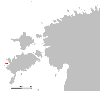
The island of Vilsandi, Saaremaa Parish, Saare County, Estonia is located in the Baltic Sea. It covers an area of some 9 square km and is the westernmost populated island in Estonia. The surrounding waters are shallow and rocky and many ships travelling the Baltic have perished nearby. The island of Vilsandi can be reached by boat, by truck having suitable clearance or on foot by wading from Saaremaa. Much of the island is now part of Vilsandi National Park, which grew from a bird reserve founded in 1910. It is a highly sensitive ecosystem due to the use of the area by many migratory birds as a breeding and nesting ground. Hunting is absolutely prohibited. This park is a popular tourist destination not only for local Estonians, but also people of Finland who are visiting Estonia in greater and greater numbers.
This is a list of the extreme points on land of Estonia: the points that are farther north, south, east or west than any other location.

Kihelkonna Parish was a municipality in Saare County, Estonia.

West Estonian archipelago is a group of Estonian islands located in the Baltic Sea around Väinameri. The total area is about 4,000 km2 (1,500 sq mi). The archipelago is composed of the islands Saaremaa, Hiiumaa, Muhu, Vormsi and about 900 other smaller islands.

Vesiloo is a small, uninhabited Estonian island in the Baltic Sea. Its coordinates are 58°23′45″N21°50′35″E.

Vilsandi National Park is a national park in Saare County, Estonia. It includes part of the island of Vilsandi, a number of smaller islands, adjacent parts of western Saaremaa and the Harilaid peninsula on Saaremaa, all in Kihelkonna Parish and Lääne-Saare Parish.

Loonalaid is a small island in the Baltic Sea belonging to the country of Estonia. Its coordinates are 58°19′42″N21°48′19″E. Loonalaid lies just off the NW coast of the island of Saaremaa, is administered by Kihelkonna Parish, Saare County and is also part of Vilsandi National Park.

Harilaid Peninsula is a peninsula on the northwest coast of the island of Saaremaa in Estonia. It should not be confused with the islet of Harilaid which lies between the islands of Vormsi and Hiiumaa.

Nootamaa is a small, uninhabited island in the Baltic Sea belonging to the country of Estonia. It marks the westernmost part of Estonia's territorial boundary.

Viki is a village in Saaremaa Parish, Saare County, on the western part of Saaremaa Island, Estonia.

Loona is a village in Saaremaa Parish, Saare County in western Estonia.
Innarahu is a small, uninhabited Baltic Sea islet belonging to the country of Estonia.

Vaika islands is a group of islands belonging to the country of Estonia. They lie next to Vilsandi. The Vaika islands are referenced in a book titled Islands of Estonia.
Ooslamaa is a small islet in the Baltic Sea belonging to the country of Estonia.

Peeter All (1829–1898) was an Estonian fisherman, farmer, ship captain, shipowner, rescuer of mariners in distress and a salvage diver who became one of the wealthiest Estonians of his time.

Kiipsaare Lighthouse is located on the tip of the Harilaid peninsula on the island of Saaremaa, Estonia, in the territory of Vilsandi National Park.
Tõõdilaid is a small Estonian islet within Saastna Bay off the south-east coast of the island of Saaremaa in the Baltic Sea. The island covers 0.0136 hectares and has a perimeter of 0.6 kilometers and lies in an oblong Southwest-Northeast position. Tõõdilaid is administered by Saaremaa Parish, Saare County and is part of the Kahtla-Kübassaare hoiuala Limited-conservation area.

Vilsandi Lighthouse is a lighthouse located on the island of Vilsandi, in Estonia. The lighthouse was built in 1809, making it the oldest lighthouse on the coastline of the Baltic Sea in Saare County. In 1907 the lighthouse keeper became Artur Toom, which founded the first protected area in the small island of Vaika. Artur Toom ended his service of lighthouse keeper in 1941. In 1957 the lighthouse was renovated.
Pitkasääremaa is a small islet in the Baltic Sea belonging to the country of Estonia.