Transport in Estonia relies mainly on road and rail networks.

Saaremaa is the largest island in Estonia, measuring 2,673 km2 (1,032 sq mi). The main island of Saare County, it is located in the Baltic Sea, south of Hiiumaa island and west of Muhu island, and belongs to the West Estonian Archipelago. The capital of the island is Kuressaare, which in January 2018 had 13,276 inhabitants. The whole island had a recorded population in January 2020 of 31,435.

Hiiumaa is the second largest island in Estonia and is part of the West Estonian archipelago, in the Baltic Sea. It has an area of 989 km2 and is 22 km from the Estonian mainland. Its largest town is Kärdla. It is located within Hiiu County.

Kihnu is an island in the Baltic Sea. With an area of 16.4 km2 (6.3 sq mi), it is the largest island in the Gulf of Riga and the seventh largest island of Estonia. With a length of 7 km (4.3 mi) and width of 3.3 km (2.1 mi), the island's highest point is 8.9 metres (29.2 ft) above sea level.

Osmussaar is an Estonian island situated in the mouth of the Gulf of Finland in the Baltic Sea, 7.5 km off the Estonian mainland. Administratively the island is part of Lääne-Nigula Parish in Lääne County. Its area is 4.8 km2.
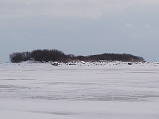
Hanerahu is an uninhabited Estonian islet with surface area of 1.2 hectares. It lies south-east of Hiiumaa island and is part of Pühalepa Municipality. The islet belongs to Hiiumaa Islets Landscape Reserve.
Kesselaid is a 1.7 km2 (0.66 sq mi) Estonian islet located between the mainland and the island of Muhu in the Suur Strait which connects the Väinameri strait and the Gulf of Riga. There's only one village on the island Kesse, which is administratively part of Muhu Parish, Saare County.

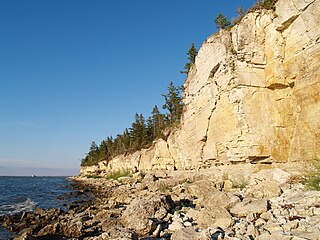
Harilaid Peninsula is a peninsula on the northwest coast of the island of Saaremaa in Estonia. It should not be confused with the islet of Harilaid which lies between the islands of Vormsi and Hiiumaa.

Kõrgelaid is a small, uninhabited, moraine-based island in the Baltic Sea, belonging to the country of Estonia. Its coordinates 58°45′09″N23°05′35″E.
Hobulaid is a Baltic Sea island belonging to the country of Estonia.

Kõverlaid is a small, moraine-based Baltic Sea island belonging to the country of Estonia. Its coordinates are 58°49′01″N23°04′46″E.

Hülgerahu is a small, uninhabited, moraine-based Baltic Sea island belonging to the country of Estonia.

Langekare is a small, uninhabited Baltic Sea island belonging to the country of Estonia. Its coordinates are 58°48′21″N23°09′03″E
Luigerahu is a small, moraine-based Baltic Sea island that belongs to the country of Estonia.

Hanikatsi laid is an islet in Estonia, in the Baltic Sea, south east of Hiiumaa island. It has a surface area of 83 hectares and no permanent habitation. The islet belongs to Hiiu County, Pühalepa Parish and is part of Hiiumaa Islets Landscape Reserve, which in turn is part of West Estonian Archipelago Biosphere Reserve.

Rohuküla is a village in Haapsalu municipality, Lääne County, in western Estonia. It is a seaport connecting the mainland with the islands of Hiiumaa and Vormsi. During winter there are two ice roads from the village to the two islands, the one to Hiiumaa being Europe's longest, at 26.5 km. Prior to the 2017 administrative reform of local governments, Rohuküla was located in Ridala Parish.
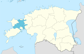
The Väinameri or Väinameri Sea is a strait and sub-bay of the Baltic Sea, located between the West Estonian Archipelago and the Estonian mainland, within western Estonia.
Kuivarahu may refer to several geographical objects in Estonia:
Uuemaarahu is a small, Baltic Sea islet comprising 0.0234 hectares belonging to the country of Estonia.

TS Laevad is an Estonian ferry company which operates two routes between the Estonian mainland and the islands of Hiiumaa and Muhu in the Baltic Sea. Muhu is connected by a causeway to Estonia's largest island, Saaremaa.
