Hiiu County is one of 15 counties of Estonia, being the smallest county both in terms of area and population. It consists of Hiiumaa, the second largest island of Estonia, and several smaller islands near it. The county borders Lääne County to the east and Saare County to the south.
Sala or SALA may refer to:

Ruhnu is an Estonian island in the Gulf of Riga in the Baltic Sea. Its territory of 11.9 square kilometres (4.6 sq mi) is administratively part of Saare maakond (county). Ruhnu lies geographically closer to the coast of Courland on the mainland of Latvia than it is to any point in the rest of Estonia. With less than 150 official residents, the Ruhnu vald (parish) has the smallest population of Estonia's 79 municipalities. Before 1944, it was for centuries populated by ethnic Swedes and traditional Swedish law was used.

Isla Salas y Gómez, also known as Isla Sala y Gómez, is a small uninhabited Chilean island in the Pacific Ocean. It is sometimes considered the easternmost point in the Polynesian Triangle.

Linnusitamaa is a 5.07 ha uninhabited Estonian islet in the Gulf of Riga. It's located about 300 m (980 ft) south of the island of Abruka. Administratively Linnusitamaa belongs to the Abruka village in Saaremaa Parish, Saare County. The island is part of the Abruka Nature Reserve.

Vahase is a 65.52 ha Estonian islet in the Gulf of Riga. It's located about 200 m (660 ft) west of the island of Abruka. Administratively Vahase belongs to the Abruka village in Lääne-Saare Parish, Saare County.
Aherahu is about 0.1 ha small islet in the Väinameri Sea in Estonia.
Anulaid is an uninhabited island belonging to the country of Estonia.
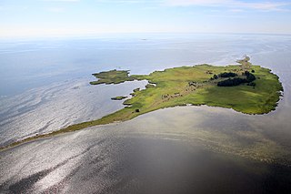
Kasselaid is a 49.92 ha uninhabited Estonian islet in the Gulf of Riga, about 300 m (980 ft) east of the island of Abruka. Administratively, it belongs to the Abruka village in Saaremaa Parish, Saare County. The island is part of the Abruka Nature Reserve.

Kumbli is a 0.023 ha uninhabited islet in the Gulf of Finland, near Tallinn, Estonia. It is located 270 m (890 ft) north of the Viimsi Peninsula and 150 m (490 ft) east of the Kräsuli islet. Administratively Kumbli belongs to the Rohuneeme village in Viimsi Parish, Harju County.
Mõndelaid is a 0.2694 ha islet on the western coast of Saaremaa island, Estonia. Administratively it belongs to Jõgela village, Lääne-Saare Parish, Saare County.
Öörahu is an island belonging to the country of Estonia.
Pitkasääremaa is a small islet in the Baltic Sea belonging to the country of Estonia.
Tagarahu is a small island in the Baltic Sea belonging to the country of Estonia.
Paljarahu is a small island in the Baltic Sea belonging to the country of Estonia.
Siimurahu is a small uninhabited island in the Baltic Sea belonging to the country of Estonia.
Väike Siimurahu is a small uninhabited island in the Baltic Sea belonging to the country of Estonia.

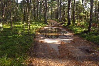
Aegna Landscape Conservation Area is a nature park covering the island of Aegna belonging to the city of Tallinn in Harju County, Estonia.

Naissaar Landscape Conservation Area is a nature park that comprises the island of Naissaar in Harju County, Estonia.
Prangli Landscape Conservation Area is a nature park which is located in Harju County, Estonia.
This page is based on this
Wikipedia article Text is available under the
CC BY-SA 4.0 license; additional terms may apply.
Images, videos and audio are available under their respective licenses.